Auchendryne

Settlement in Aberdeenshire

Scotland

Auchendryne

Approaching the Morrone summit plateau The five cairns, reported here about 15 years ago, are still in place, at the point where the slope eases.
Approaching the Morrone summit plateau Credit: Aleks Scholz

Auchendryne is a small village located in Aberdeenshire, Scotland. Situated in the heart of the Cairngorms National Park, this picturesque village offers a tranquil and scenic environment. The village is surrounded by stunning natural landscapes, including rolling hills, dense forests, and the beautiful River Dee.

Despite its small size, Auchendryne is known for its rich history and cultural heritage. The village features several historic buildings, including a charming 18th-century church and a traditional Scottish stone bridge. These architectural gems provide a glimpse into the village's past.

The village is also a popular destination for outdoor enthusiasts. It serves as a gateway to numerous hiking trails, including the famous Lairig Ghru, a challenging route that attracts experienced hikers from around the world. The nearby River Dee is renowned for its salmon fishing, attracting anglers looking for a rewarding catch.

Auchendryne is a close-knit community where residents enjoy a peaceful way of life. The village has a friendly and welcoming atmosphere, and its inhabitants take pride in preserving their heritage and natural surroundings.

While Auchendryne may not have a wide range of amenities, it is conveniently located near larger towns such as Braemar and Ballater, where visitors can find shops, restaurants, and other services. Additionally, the village is a popular tourist destination, with visitors coming to enjoy the stunning scenery and engage in outdoor activities.

Overall, Auchendryne offers a serene and idyllic setting for those seeking a peaceful retreat in the heart of the Scottish Highlands.

If you have any feedback on the listing, please let us know in the comments section below.
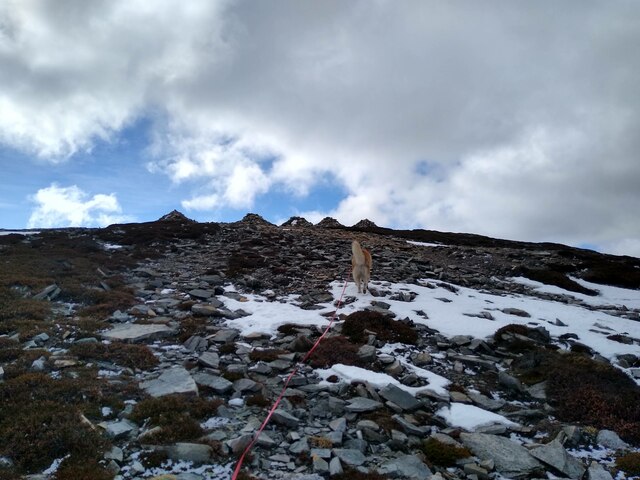
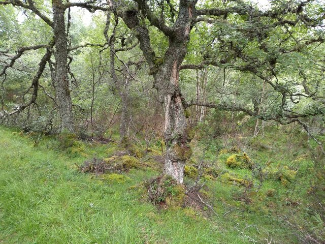
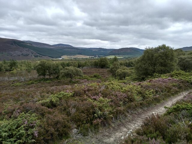
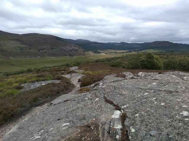
Auchendryne Images

Images are sourced within 2km of 57.005548/-3.4071863 or Grid Reference NO1491. Thanks to Geograph Open Source API. All images are credited.

Approaching the Morrone summit plateau The five cairns, reported here about 15 years ago, are still in place, at the point where the slope eases.
Approaching the Morrone summit plateau
The five cairns, reported here about 15 years ago, are still in place, at the point where the slope eases.
Path heading down Morrone The path heading down Morrone towards Braemar in the valley below
Path heading down Morrone
The path heading down Morrone towards Braemar in the valley below
Path to Morrone From the lower slopes of Morrone above Braemar, looking out to the Cairngorms.
Path to Morrone
From the lower slopes of Morrone above Braemar, looking out to the Cairngorms.
Morrone Birkwood Besides its birch trees, Morrone birkwood is also notable for underlying swathes of juniper bushes.
Morrone Birkwood
Besides its birch trees, Morrone birkwood is also notable for underlying swathes of juniper bushes.
Morrone Birkwood and Strathdee
Rock Outcrop in Morrone Birkwood A granite outcrop pushes its way through the peaty soil.
Rock Outcrop in Morrone Birkwood
A granite outcrop pushes its way through the peaty soil.
Braemar Duck Pond A haven for voracious ducks on the outskirts of Braemar.
Braemar Duck Pond
A haven for voracious ducks on the outskirts of Braemar.
Creag Choinnich Woods
Drystane Dyke, Creag Choinnich Woodland
Corrie Feragie Lochan
Signpost in Creag Choinnich Woods The track on the left is Queen's Drive, named after a favourite carriage route of Queen Victoria.
Signpost in Creag Choinnich Woods
The track on the left is Queen's Drive, named after a favourite carriage route of Queen Victoria.
Braemar and Strathdee
Rustic Staircase, Creag Choinnich
Cromlins Viewpoint, Creag Choinnich An ancient Scots pine stands over the viewpoint, said to be 300 years old.
Cromlins Viewpoint, Creag Choinnich
An ancient Scots pine stands over the viewpoint, said to be 300 years old.
So near and yet so far Gazing across the Dee from the left bank towards Braemar where there is beer and cakes, but the walk towards the Linn of Dee must carry on despite thirst and aching limbs.
So near and yet so far
Gazing across the Dee from the left bank towards Braemar where there is beer and cakes, but the walk towards the Linn of Dee must carry on despite thirst and aching limbs.
Clunie Water This picture was taken from a rock platform next to the military road, slightly north from the 90 degree bend in the river. At that bend a path branches off to the right which leads straight up towards the Morrone ascent, avoiding the village.
Clunie Water
This picture was taken from a rock platform next to the military road, slightly north from the 90 degree bend in the river. At that bend a path branches off to the right which leads straight up towards the Morrone ascent, avoiding the village.
Bird watching hide This bird watching hide in the woods behind Braemar is very well adjusted to its environment.
Bird watching hide
This bird watching hide in the woods behind Braemar is very well adjusted to its environment.
Ruined Balnagower cottage This is Balnagower cottage without a roof. Shown here in its original intact state: <a href="https://www.geograph.org.uk/photo/6362417">NO1593 : Balnagower Cottage</a>
Ruined Balnagower cottage
This is Balnagower cottage without a roof. Shown here in its original intact state: NO1593 : Balnagower Cottage
Show me another place!

Auchendryne is located at Grid Ref: NO1491 (Lat: 57.005548, Lng: -3.4071863)

Unitary Authority: Aberdeenshire

Police Authority: North East

What 3 Words

///eased.tickling.cocktail. Near Inverey, Aberdeenshire

Nearby Locations

Braemar Auchendryne

Related Wikis

Braemar

Braemar is a village in Aberdeenshire, Scotland, around 58 miles (93 km) west of Aberdeen in the Highlands. It is the closest significantly-sized settlement...
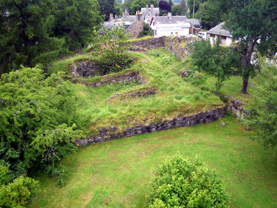
Kindrochit Castle

Kindrochit Castle () is a ruined 14th-century fortification in Aberdeenshire, Scotland. It is located at Braemar, in a strategic position on the banks...
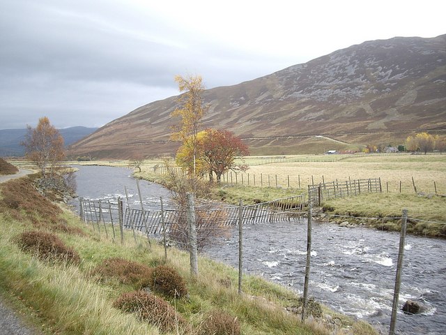
Clunie Water

Clunie Water is a river of Aberdeenshire, Scotland. It is a tributary of the River Dee, joining the river at Braemar, among grey stone buildings. Callater...
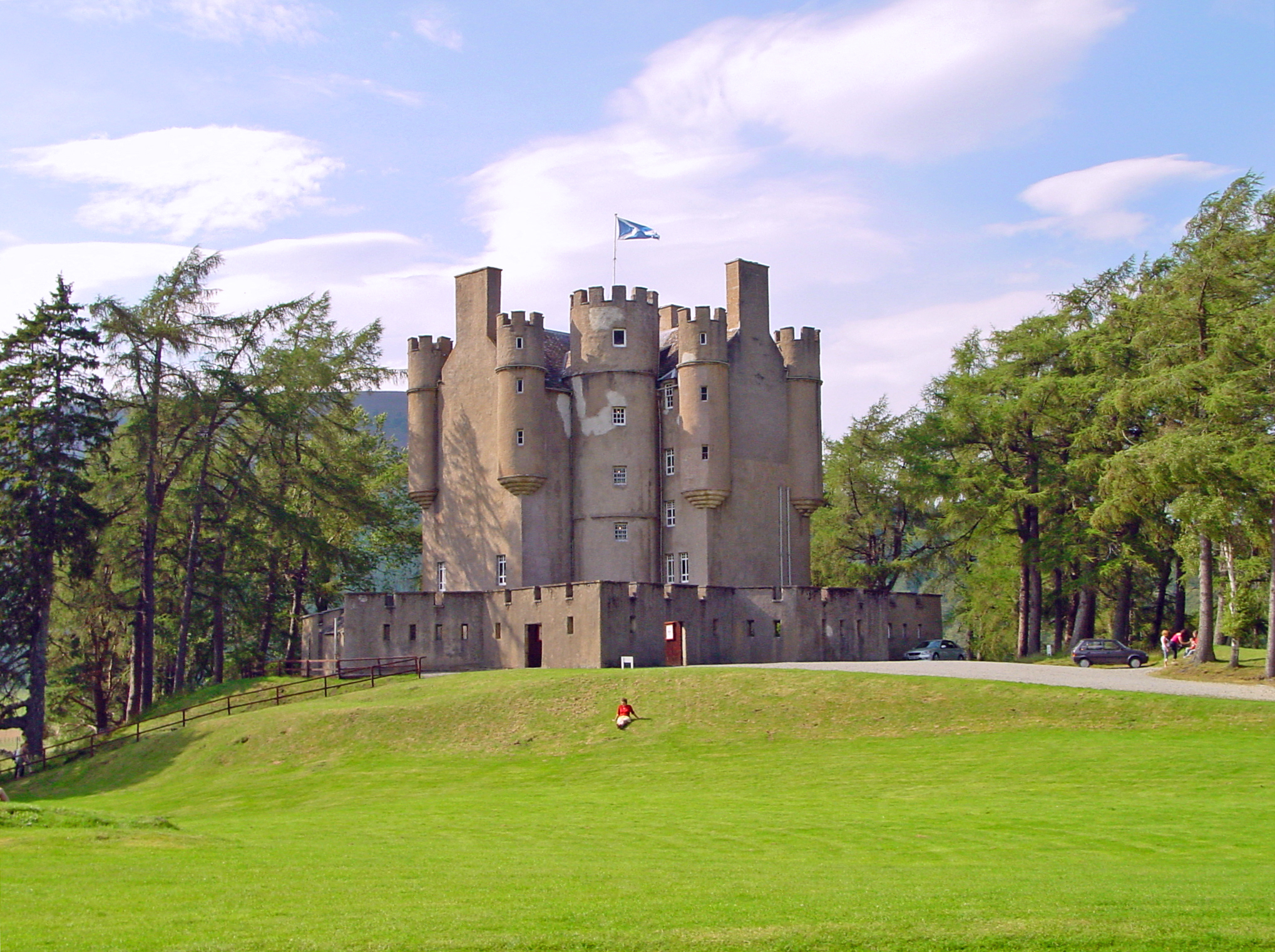
Braemar Castle

Braemar Castle is situated near the village of Braemar in Aberdeenshire, Scotland. It is a possession of the chief of Clan Farquharson and is leased to...

Nearby Amenities

Located within 500m of 57.005548,-3.4071863
Braemar
Ele: 339
Name Be: Брэймар
Name Bg: Бреймар
Name En: Braemar
Name Gd: Bràigh Mhàrr
Name Ru: Бреймар
Name Uk: Бреймар
Old Name En: Kindrochit
Old Name Gd: Cinn Drochaid
Place: village
Population: 491
Wikidata: Q897175
Wikipedia: en:Braemar
Lat/Long: 57.0058223/-3.399713
Post Office
Braemar Post Office
Addr Postcode: AB35 5YL
Branch: Braemar
Brand: Post Office
Brand Wikidata: Q1783168
Check Date: 2020-02-20
Contact Website: https://www.postoffice.co.uk/branch-finder/2774585/braemar
Note: inside the supermarket
Ref Pol Id: 119861
Lat/Long: 57.006125/-3.4006961
Pharmacy
Braemar Pharmacy & Newsagents
Healthcare: pharmacy
Source: survey
Lat/Long: 57.0060584/-3.4014266
Post Box
Brand: Royal Mail
Brand Wikidata: Q638098
Collection Times: Mo-Fr 14:30; Sa 12:00
Operator: Royal Mail
Operator Wikidata: Q638098
Post Box Design: type_c
Post Box Type: wall
Ref: AB35 249
Royal Cypher: GR
Royal Cypher Wikidata: Q33102273
Source: survey
Lat/Long: 57.0061459/-3.4052905
Cafe
Gordon's Tea Room & Restaurant
Internet Access: wlan
Internet Access Fee: no
Source: survey
Lat/Long: 57.006204/-3.4009716
Cafe
The Old Bakery
Source: survey
Lat/Long: 57.0061878/-3.4009134
Telephone
Booth: K6
Covered: booth
Source: survey
Lat/Long: 57.0057798/-3.4007937
Telephone
Booth: K6
Covered: booth
Source: survey
Lat/Long: 57.0057549/-3.4008148
Bus Stop
Auchendryne Square
Bench: yes
Bus: yes
Naptan AtcoCode: 630041681
Naptan Bearing: E
Naptan BusStopType: CUS
Naptan CommonName: Auchendryne Square
Naptan Indicator: at
Naptan NaptanCode: 23623239
Naptan Street: Auchendryne Square
Naptan Verified: no
Public Transport: platform
Shelter: no
Source: naptan;bing;naptan_compare_tool
Lat/Long: 57.0066332/-3.4037507
The Braemar Gallery
Shop: art
Lat/Long: 57.0067481/-3.4026779
Cafe
taste..
Website: http://www.taste-braemar.co.uk/
Lat/Long: 57.0064112/-3.4043028
Braemar Highland Heritage Centre
Tourism: museum
Lat/Long: 57.0057082/-3.4006012
Braes O Mar
Shop: gift
Lat/Long: 57.005594/-3.4004178
Vickers Wellington R1656
Historic: monument
Lat/Long: 57.0055705/-3.3997009
Bench
Backrest: yes
Lat/Long: 57.0054824/-3.3996842
Bench
Backrest: yes
Lat/Long: 57.0054828/-3.3997503
Waste Basket
Check Date: 2023-05-25
Lat/Long: 57.0055548/-3.400546
Bench
Backrest: yes
Lat/Long: 57.005565/-3.4005804
Barrier: entrance
Foot: yes
Lat/Long: 57.0055802/-3.4009103
War Memorial
Historic: monument
Lat/Long: 57.0056141/-3.3996942
Bicycle Parking
Bicycle Parking: stands
Capacity: 14
Covered: no
Lat/Long: 57.0056927/-3.400054
Waste Basket
Lat/Long: 57.0057322/-3.4002702
Bench
Lat/Long: 57.0057435/-3.4003426
Atm
Operator: Bank of Scotland
Source: survey
Lat/Long: 57.0056584/-3.4002362
Tourism: information
Lat/Long: 57.0056854/-3.400354
Post Box
Brand: Royal Mail
Brand Wikidata: Q638098
Collection Times: Mo-Fr 14:45; Sa 12:30
Operator: Royal Mail
Operator Wikidata: Q638098
Post Box Design: ludlow
Post Box Type: wall
Ref: AB35 436
Royal Cypher: scottish_crown
Lat/Long: 57.0060512/-3.4007517
Source: survey
Waterway: waterfall
Lat/Long: 57.0061069/-3.3992477
Auchendryne
Name Gd: Ach an Droighinn
Place: neighbourhood
Lat/Long: 57.0058709/-3.4036956
Barrier: height_restrictor
Maxheight: 2
Source: survey
Lat/Long: 57.0030508/-3.4124565
Power: transformer
Source: survey
Lat/Long: 57.0030001/-3.413019
Bench
Backrest: yes
Colour: black
Source: survey
Lat/Long: 57.0064232/-3.4036992
Atm
Operator: Coop
Lat/Long: 57.0061915/-3.4006259
Defibrillator
Defibrillator Location: in covered walkway
Emergency: defibrillator
Opening Hours: 24/7
Ref GB The Circuit: 8479CC9F-7328-44AF-B2BE-AE9A00C9740A
Lat/Long: 57.0057468/-3.4005089
Power: pole
Lat/Long: 57.0091152/-3.4033048
Power: pole
Lat/Long: 57.0089662/-3.4045547
Power: pole
Lat/Long: 57.0088209/-3.4060136
Power: pole
Lat/Long: 57.0086637/-3.4073987
Power: pole
Lat/Long: 57.0086067/-3.4079381
Power: pole
Lat/Long: 57.0083645/-3.4098119
Power: pole
Lat/Long: 57.008049/-3.4121937
Power: pole
Lat/Long: 57.0079293/-3.4135991
Cafe
The Duke of Rothesay Highland Games Pavilion
Lat/Long: 57.0050055/-3.4048317
Entrance: main
Lat/Long: 57.0067131/-3.4027207
Bench
Backrest: yes
Colour: brown
Material: wood
Lat/Long: 57.0066542/-3.4035328
Shelter
Bench: yes
Shelter Type: public_transport
Lat/Long: 57.0066633/-3.4037722
The Highlander
Shop: gift
Lat/Long: 57.006319/-3.4012918
Bench
Lat/Long: 57.0029909/-3.4127884
Barrier: chain
Lat/Long: 57.0029726/-3.4090461
Bench
Lat/Long: 57.0034977/-3.4134056
Lochcarron
Shop: clothes
Lat/Long: 57.0057398/-3.4006689
Power: pole
Lat/Long: 57.0030246/-3.4130309
Power: pole
Lat/Long: 57.0033357/-3.4135481
Power: pole
Lat/Long: 57.0037608/-3.4142335
Power: pole
Lat/Long: 57.0041954/-3.4149268
Power: pole
Lat/Long: 57.0044606/-3.4148475
Power: pole
Lat/Long: 57.0047846/-3.4147697
Power: pole
Lat/Long: 57.0051354/-3.414692
Power: pole
Lat/Long: 57.0054369/-3.4135529
Power: pole
Lat/Long: 57.00576/-3.4123296
Power: pole
Lat/Long: 57.0058896/-3.4108938
Power: pole
Lat/Long: 57.0062654/-3.4101815
Power: pole
Lat/Long: 57.0067674/-3.40922
Power: pole
Lat/Long: 57.0072495/-3.4083347
Power: pole
Lat/Long: 57.0077393/-3.4074225
Power: pole
Lat/Long: 57.0080935/-3.4067498
Power: pole
Lat/Long: 57.0086041/-3.4073336
Power: pole
Lat/Long: 57.0075354/-3.4060977
Power: pole
Lat/Long: 57.0070344/-3.4055297
Power: pole
Lat/Long: 57.0066041/-3.4051283
Power: pole
Lat/Long: 57.0085214/-3.4085979
Bus Stop
Post Office
Bench: no
Bin: yes
Bus: yes
Lit: yes
Naptan AtcoCode: 630041671
Naptan Bearing: SE
Naptan CommonName: Post Office
Naptan Indicator: at
Naptan NaptanCode: 23623243
Naptan Street: Mar Road
Naptan Verified: no
Public Transport: platform
Shelter: no
Source: naptan;bing;naptan_compare_tool
Tactile Paving: no
Lat/Long: 57.0059901/-3.4006595
Bus Stop
Post Office
Bench: no
Bin: no
Bus: yes
Lit: yes
Naptan AtcoCode: 630041672
Naptan Bearing: NW
Naptan CommonName: Post Office
Naptan Indicator: opp
Naptan NaptanCode: 23623242
Naptan Street: Mar Road
Naptan Verified: no
Public Transport: platform
Shelter: no
Source: naptan;bing;naptan_compare_tool
Tactile Paving: no
Lat/Long: 57.0060063/-3.4009943
Bicycle Parking
Bicycle Parking: stands
Capacity: 14
Covered: no
Note: n frames
Lat/Long: 57.0057383/-3.3999737
Bench
Backrest: yes
Lat/Long: 57.0065081/-3.4035435
Bench
Backrest: yes
Lat/Long: 57.0065198/-3.4034631
Fountain
Jubilee Fountain
Heritage Operator: Historic Environment Scotland
Heritage Website: https://portal.historicenvironment.scot/designation/LB6258
Inscription: ERECTED BY PUBLIC SUBSCRIPTION IN COMMEMORATION OF THE SIXTY YEARS REIGN OF HER MAJESTY QUEEN VICTORIA
Listed Status: Category C
Ref GB Hs: LB6258
Start Date: 1897
Wikidata: Q56616127
Lat/Long: 57.0065103/-3.4034993
Drinking Water
Fountain: bottle_refill
Lat/Long: 57.0057782/-3.4002047
The data included in this document is from www.openstreetmap.org. The data is made available under ODbL.

Have you been to Auchendryne?

Leave your review of Auchendryne below (or comments, questions and feedback).