Lodge Plantation

Wood, Forest in Norfolk Breckland

England

Lodge Plantation

The A11 west at Breckland Lodge island
The A11 west at Breckland Lodge island Credit: Roy Hughes

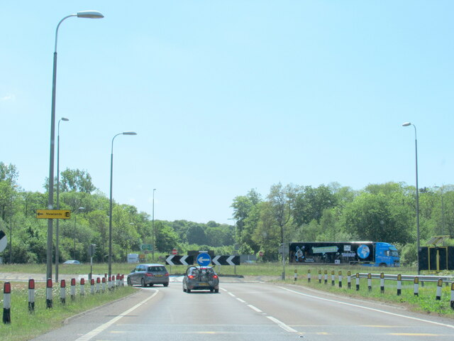
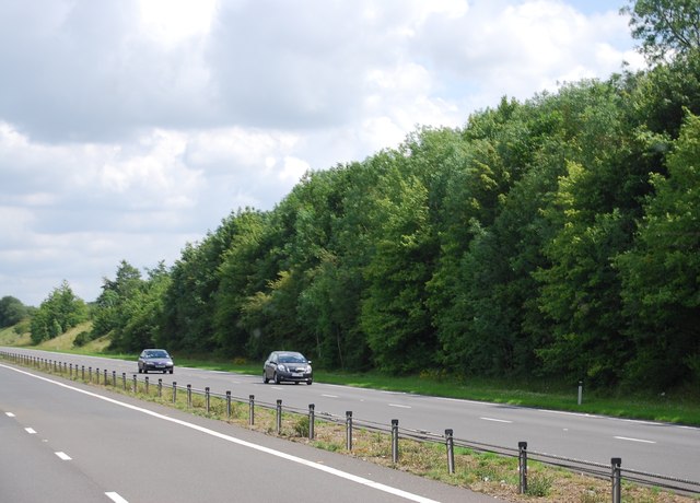
Lodge Plantation, located in Norfolk, England, is a picturesque woodland area renowned for its natural beauty and historical significance. Spanning over a vast expanse, this woodland is a part of the larger Norfolk Forest, making it an essential component of the region's ecosystem.

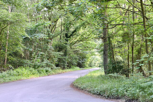
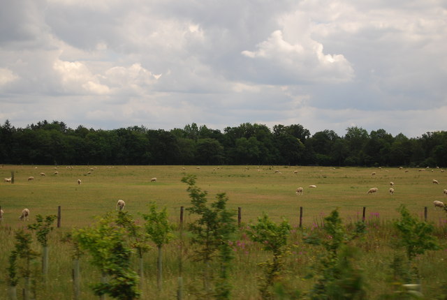
The plantation is characterized by its diverse range of tree species, including oak, beech, birch, and pine trees, creating a rich and vibrant landscape. The dense foliage provides a habitat for various wildlife, such as deer, foxes, and a wide array of bird species, making it a popular destination for nature enthusiasts and birdwatchers.

Historically, the Lodge Plantation has been used for timber extraction, with evidence of logging activities dating back several centuries. Today, the area is managed sustainably, allowing for the continued growth and preservation of the woodland. This approach ensures the maintenance of a healthy ecosystem, while also providing a sustainable supply of timber.

Visitors to Lodge Plantation can enjoy numerous walking trails that wind through the woodland, offering breathtaking views and the chance to immerse oneself in nature. The plantation is also home to a small educational center that provides information about the local flora and fauna, as well as the history of the area.

Overall, Lodge Plantation, Norfolk is a haven of natural beauty and historical significance, providing an opportunity for visitors to connect with nature while exploring the region's rich heritage. Whether it's a leisurely walk or an educational experience, this woodland offers something for everyone.

If you have any feedback on the listing, please let us know in the comments section below.

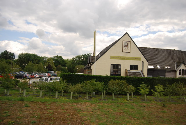
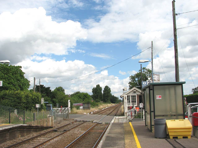
Lodge Plantation Images

Images are sourced within 2km of 52.487494/0.96844404 or Grid Reference TM0191. Thanks to Geograph Open Source API. All images are credited.

The A11 west at Breckland Lodge island
Hargham Level Crossing Hargham Road crosses the Breckland Line.
Hargham Level Crossing
Hargham Road crosses the Breckland Line.
Hargham Road heading west Towards the A11 and beyond, Shropham.
Hargham Road heading west
Towards the A11 and beyond, Shropham.
Snetterton Interchange bridge over A11 The junction appears to be mainly for access to industrial and business parks and racing circuit.
Snetterton Interchange bridge over A11
The junction appears to be mainly for access to industrial and business parks and racing circuit.
Quidenham: Road junction
Eccles Road crossing in the rain Looking towards Norwich the last class 40 in operation 40122 (D200) on the railway is seen approaching the station from Norwich with a special service to York.
Eccles Road crossing in the rain
Looking towards Norwich the last class 40 in operation 40122 (D200) on the railway is seen approaching the station from Norwich with a special service to York.
Preva Produce, Snetterton Part of an industrial estate by the A11.
Preva Produce, Snetterton
Part of an industrial estate by the A11.
Telecommunication mast, Snetterton
Farmland by the A11
Farmland by the A11
Church Rd
Church Rd
Church Rd turn off, A11 The A11 is a major road in Eastern England. It runs roughly north east for 111 miles from London to Norwich, With the M11 opening in the 1970s and then the A12 extension in 1999, a lengthy section has been downgraded between the suburbs of east London and the north-west corner of the county of Essex. It also overlaps with the A14 on the Newmarket bypass.
<span class="nowrap"><a title="http://www.sabre-roads.org.uk/wiki/index.php?title=A11" rel="nofollow ugc noopener" href="http://www.sabre-roads.org.uk/wiki/index.php?title=A11">Link</a><img style="margin-left:2px;" alt="External link" title="External link - shift click to open in new window" src="https://s1.geograph.org.uk/img/external.png" width="10" height="10"/></span>
Church Rd turn off, A11
The A11 is a major road in Eastern England. It runs roughly north east for 111 miles from London to Norwich, With the M11 opening in the 1970s and then the A12 extension in 1999, a lengthy section has been downgraded between the suburbs of east London and the north-west corner of the county of Essex. It also overlaps with the A14 on the Newmarket bypass. LinkExternal link
Field by the A11
Field by the A11
A11, London Rd The A11 is a major road in Eastern England. It runs roughly north east for 111 miles from London to Norwich, With the M11 opening in the 1970s and then the A12 extension in 1999, a lengthy section has been downgraded between the suburbs of east London and the north-west corner of the county of Essex. It also overlaps with the A14 on the Newmarket bypass.
<span class="nowrap"><a title="http://www.sabre-roads.org.uk/wiki/index.php?title=A11" rel="nofollow ugc noopener" href="http://www.sabre-roads.org.uk/wiki/index.php?title=A11">Link</a><img style="margin-left:2px;" alt="External link" title="External link - shift click to open in new window" src="https://s1.geograph.org.uk/img/external.png" width="10" height="10"/></span>
A11, London Rd
The A11 is a major road in Eastern England. It runs roughly north east for 111 miles from London to Norwich, With the M11 opening in the 1970s and then the A12 extension in 1999, a lengthy section has been downgraded between the suburbs of east London and the north-west corner of the county of Essex. It also overlaps with the A14 on the Newmarket bypass. LinkExternal link
Approaching a roundabout on the A11 The A11 is a major road in Eastern England. It runs roughly north east for 111 miles from London to Norwich, With the M11 opening in the 1970s and then the A12 extension in 1999, a lengthy section has been downgraded between the suburbs of east London and the north-west corner of the county of Essex. It also overlaps with the A14 on the Newmarket bypass.
<span class="nowrap"><a title="http://www.sabre-roads.org.uk/wiki/index.php?title=A11" rel="nofollow ugc noopener" href="http://www.sabre-roads.org.uk/wiki/index.php?title=A11">Link</a><img style="margin-left:2px;" alt="External link" title="External link - shift click to open in new window" src="https://s1.geograph.org.uk/img/external.png" width="10" height="10"/></span>
Approaching a roundabout on the A11
The A11 is a major road in Eastern England. It runs roughly north east for 111 miles from London to Norwich, With the M11 opening in the 1970s and then the A12 extension in 1999, a lengthy section has been downgraded between the suburbs of east London and the north-west corner of the county of Essex. It also overlaps with the A14 on the Newmarket bypass. LinkExternal link
Breckland Lodge
Breckland Lodge
Sheep grazing by London Rd
Church Rd off the A11
Vegetables by the A11
Show me another place!

Lodge Plantation is located at Grid Ref: TM0191 (Lat: 52.487494, Lng: 0.96844404)

Administrative County: Norfolk

District: Breckland

Police Authority: Norfolk

What 3 Words

///caskets.quench.newlywed. Near Attleborough, Norfolk

Related Wikis

Swangey Fen, Attleborough

Swangey Fen, Attleborough is a 48.4-hectare (120-acre) biological Site of Special Scientific Interest south-west of Attleborough in Norfolk. It is part...

Kenninghall Road Mill, East Harling

Kenninghall Road Mill is a Grade II listed tower mill at East Harling, Norfolk, England which has been converted to residential accommodation. == History... ==

Eccles Road railway station

Eccles Road railway station is on the Breckland line in the east of England, serving the villages of Eccles, Quidenham and Wilby in Norfolk. The line runs...

Snetterton

Snetterton is a village and civil parish in Norfolk, England. The village is about 9 miles (14 km) east-northeast of Thetford and 19 miles (31 km) southwest...

Kingdom of East Anglia

The Kingdom of the East Angles (Old English: Ēastengla Rīċe; Latin: Regnum Orientalium Anglorum), today known as the Kingdom of East Anglia, was a small...

East Anglia

East Anglia is an area in the East of England. It comprises the counties of Norfolk and Suffolk, with Cambridgeshire and Essex also included in some definitions...

Iceni

The Iceni ( eye-SEEN-eye, Classical Latin: [ɪˈkeːniː]) or Eceni were an ancient tribe of eastern Britain during the Iron Age and early Roman era. Their...

Wilby, Norfolk

Wilby is a village and former civil parish, 17 miles (27 km) south west of Norwich, now in the parish of Quidenham, in the Breckland district, in the county...

Nearby Amenities

Located within 500m of 52.487494,0.96844404
Motorway Junction
Lat/Long: 52.4859318/0.963754
Traffic Calming: island
Lat/Long: 52.4841586/0.9658233
Power: pole
Lat/Long: 52.491863/0.9675613
Power: pole
Lat/Long: 52.4903131/0.9663624
Power: pole
Lat/Long: 52.4910938/0.9669819
Power: pole
Lat/Long: 52.4894867/0.9657347
Material: wood
Power: pole
Lat/Long: 52.4886701/0.9650964
Material: wood
Power: pole
Lat/Long: 52.4880152/0.9649703
Material: wood
Power: pole
Transformer: yes
Lat/Long: 52.4875235/0.9645385
Material: wood
Power: pole
Lat/Long: 52.4869503/0.9640825
Material: wood
Power: pole
Lat/Long: 52.4862855/0.9635702
The data included in this document is from www.openstreetmap.org. The data is made available under ODbL.

Have you been to Lodge Plantation?

Leave your review of Lodge Plantation below (or comments, questions and feedback).