Friar's Grove

Wood, Forest in Essex Colchester

England

Friar's Grove

GreyFriars Hotel, Colchester The dinning terraces behind GreyFriars Hotel.
GreyFriars Hotel, Colchester Credit: Rebecca A Wills

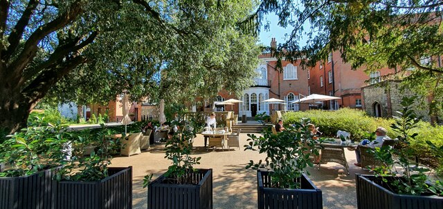
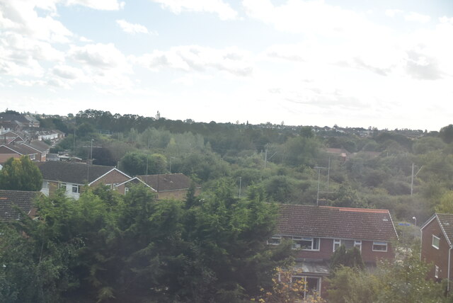
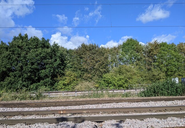
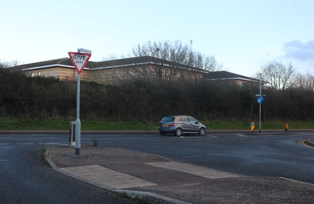
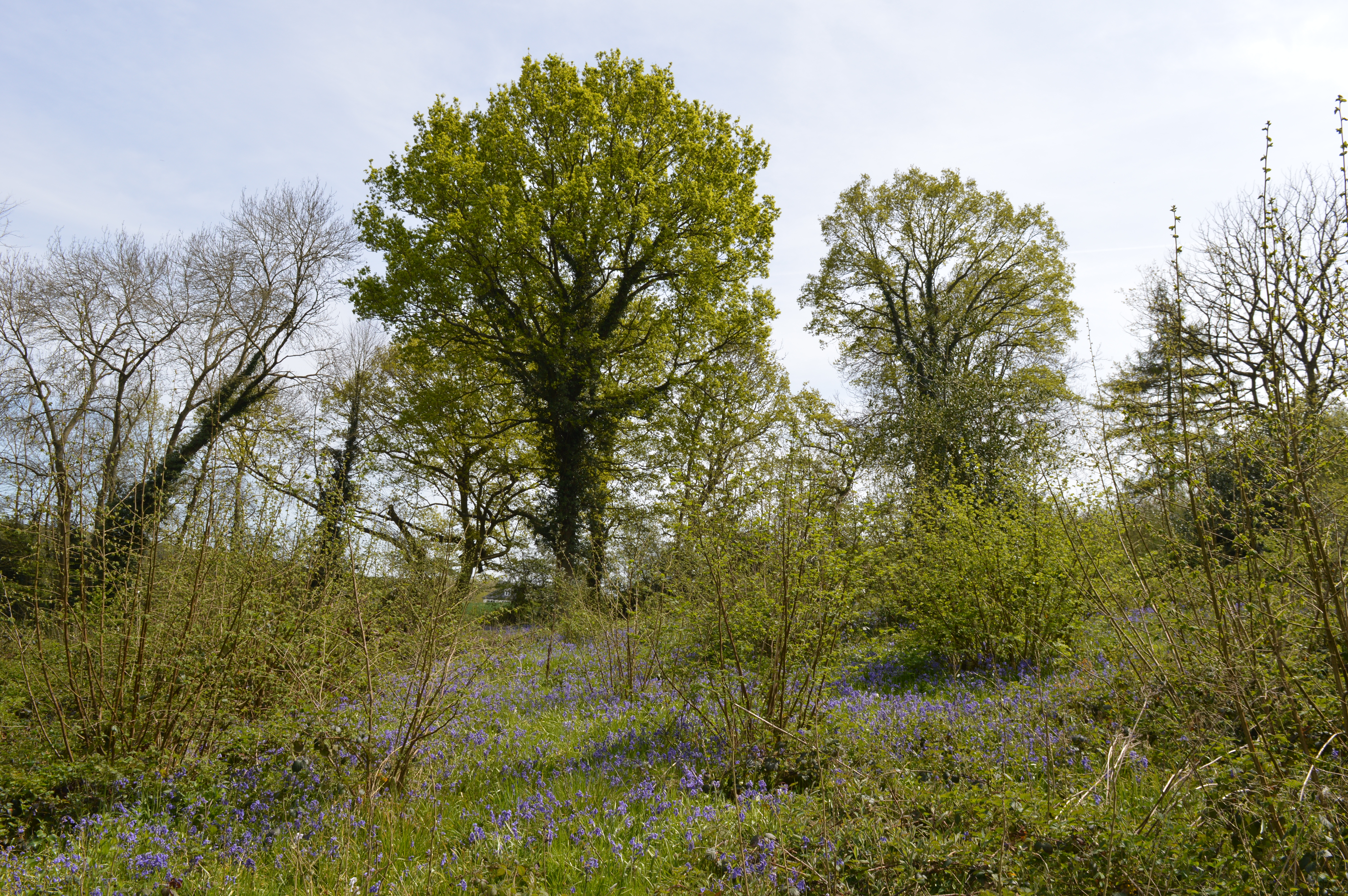
Friar's Grove is a picturesque woodland area located in Essex, England. Situated on the outskirts of the town of Brentwood, it covers a vast area of around 200 acres and is a popular destination for nature enthusiasts and locals alike. The grove is known for its dense forest and diverse range of flora and fauna.

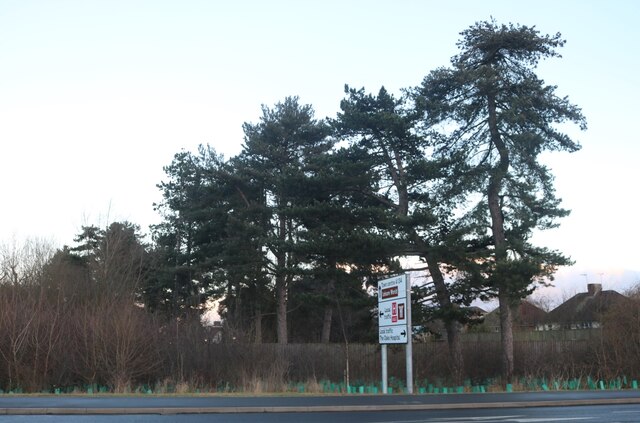
The woodland is primarily composed of native tree species, including oak, beech, and birch. These towering trees create a serene and tranquil atmosphere, providing a perfect escape from the hustle and bustle of urban life. The forest floor is carpeted with a variety of wildflowers and ferns, adding to the area's natural beauty.

Friar's Grove is home to a rich and diverse wildlife population. Visitors may spot a wide range of bird species, including woodpeckers, nuthatches, and various songbirds. Mammals such as deer, foxes, and rabbits are also commonly seen roaming through the woodland. The grove is a haven for nature photographers and birdwatchers, who can capture stunning images of the local wildlife in their natural habitat.

The woodland has a network of well-maintained walking trails, allowing visitors to explore the grove at their own pace. These trails meander through the forest, offering breathtaking views of the surrounding landscape. There are also designated picnic areas and benches where visitors can relax and immerse themselves in the tranquil setting.

Friar's Grove is not only a haven for nature lovers but also an important ecological site. It serves as a vital habitat for many species and contributes to the overall biodiversity of the region. Its natural beauty and peaceful ambiance make it a must-visit destination for anyone seeking a serene woodland experience in Essex.

If you have any feedback on the listing, please let us know in the comments section below.

Friar's Grove Images

Images are sourced within 2km of 51.903128/0.92110486 or Grid Reference TM0126. Thanks to Geograph Open Source API. All images are credited.

GreyFriars Hotel, Colchester The dinning terraces behind GreyFriars Hotel.
GreyFriars Hotel, Colchester
The dinning terraces behind GreyFriars Hotel.
Telephone Box, Highwoods
Outskirts of Colchester
Lots of vans, Colchester
Joining the main line from the Colchester Town chord
Train line entering Colchester
Joining train tracks entering Colchester
Steps up to Colchester Station
Asda Superstore on Turner Road, Colchester
House on Dickenson Road, Myland
Via Urbis Romanae at the junction of Dickenson Road
Conifers by Via Urbis Romanae, Mile End
Colchester Castle
Colchester Castle
North Station Road, Colchester – 1971 Looking north with the Globe Hotel behind the bus. By 2023, the Cooperative store building has been taken over by three separate retail units and the distinctive fascia has disappeared, although the earlier terracotta facings have remained. The Tramway Tavern on the right has long since become a shop.

Colchester Corporation's buses have also long since disappeared following the 1986 Transport Act. Bus 17 is an AEC Regent V with Massey body, new in 1957.

This is one of a series of views featuring buses in the 60s, 70s, and 80s. <a title="https://www.geograph.org.uk/search.php?i=137652761" href="https://www.geograph.org.uk/search.php?i=137652761">Link</a>
North Station Road, Colchester – 1971
Looking north with the Globe Hotel behind the bus. By 2023, the Cooperative store building has been taken over by three separate retail units and the distinctive fascia has disappeared, although the earlier terracotta facings have remained. The Tramway Tavern on the right has long since become a shop. Colchester Corporation's buses have also long since disappeared following the 1986 Transport Act. Bus 17 is an AEC Regent V with Massey body, new in 1957. This is one of a series of views featuring buses in the 60s, 70s, and 80s. Link
Flats, Colchester
Flats, Colchester
Colchester Station Colchester station (also known as Colchester North) is on the Great Eastern Main Line (GEML), and is the primary station serving the city of Colchester. The station opened in 1843.
Wikipedia: <span class="nowrap"><a title="https://en.wikipedia.org/wiki/Colchester_railway_station" rel="nofollow ugc noopener" href="https://en.wikipedia.org/wiki/Colchester_railway_station">Link</a><img style="margin-left:2px;" alt="External link" title="External link - shift click to open in new window" src="https://s1.geograph.org.uk/img/external.png" width="10" height="10"/></span>
Colchester Station
Colchester station (also known as Colchester North) is on the Great Eastern Main Line (GEML), and is the primary station serving the city of Colchester. The station opened in 1843. Wikipedia: LinkExternal link
Colchester Castle <span class="nowrap"><a title="https://historicengland.org.uk/listing/the-list/list-entry/1123674?section=official-list-entry" rel="nofollow ugc noopener" href="https://historicengland.org.uk/listing/the-list/list-entry/1123674?section=official-list-entry">Link</a><img style="margin-left:2px;" alt="External link" title="External link - shift click to open in new window" src="https://s1.geograph.org.uk/img/external.png" width="10" height="10"/></span>
Colchester Castle
Show me another place!

Friar's Grove is located at Grid Ref: TM0126 (Lat: 51.903128, Lng: 0.92110486)

Administrative County: Essex

District: Colchester

Police Authority: Essex

What 3 Words

///delay.wanted.penny. Near Colchester, Essex

Nearby Locations

Friar's Grove

Related Wikis

Ipswich Road, Colchester

Ipswich Road, formally the A1232, is a road in Colchester, Essex, England. It was the historic coaching route and main road to Ipswich from the Middle...

Bull Meadow

Bull Neadow is a 1.4 hectare Local Nature Reserve in Colchester in Essex, owned and managed by Colchester Borough Council.The meadow is unimproved damp...

St Aubyn Centre

The St Aubyn Centre is a mental health facility at 216 Turner Road, Colchester, Essex. It has two wards: (i) Longview Ward which is a General Adolescent...

Bullock Wood

Bullock Wood is a 23.3-hectare (58-acre) biological Site of Special Scientific Interest on the northern outskirts of Colchester in Essex.The site is mature...

The Gilberd School

The Gilberd School is a coeducational secondary school with academy status, in Colchester, Essex, England. == History == The school originally opened on...

Castle Park Cricket Ground

Castle Park Cricket Ground is an English cricket ground in Colchester. The ground is in Lower Castle Park, part of the land surrounding Colchester Castle...

Colchester Greyfriars

Colchester Greyfriars, otherwise the Franciscan Friary, Colchester, was a Franciscan friary in Colchester, Essex, England, situated to the north of the...

Welsh Wood

Welsh Wood is a 3.2 hectare Local Nature Reserve in Colchester in Essex. It is owned and managed by Colchester Borough Council.Trees in this site are managed...

Nearby Amenities

Located within 500m of 51.903128,0.92110486
Bench
Lat/Long: 51.9031009/0.9156529
Bench
Lat/Long: 51.9023795/0.9139969
Bench
Lat/Long: 51.9012498/0.9154937
Bench
Lat/Long: 51.9006687/0.9159077
Bus Stop
Myland Hall Chase
Bus: yes
Naptan AtcoCode: 150033016003
Naptan Bearing: N
Naptan CommonName: Myland Hall Chase
Naptan Crossing: Myland Hall Chase
Naptan Indicator: Opp
Naptan Landmark: Myland Hall Chase
Naptan NaptanCode: esxajwpm
Naptan PlusbusZoneRef: CLCHSTR
Naptan Street: Ipswich Road
Naptan Verified: no
Public Transport: platform
Source: naptan_import
Lat/Long: 51.9059059/0.9241894
Bus Stop
Myland Hall Chase
Bus: yes
Naptan AtcoCode: 150033016004
Naptan Bearing: S
Naptan CommonName: Myland Hall Chase
Naptan Crossing: Myland Hall Chase
Naptan Indicator: Adj
Naptan Landmark: Myland Hall Chase
Naptan NaptanCode: esxajwpt
Naptan PlusbusZoneRef: CLCHSTR
Naptan Street: Ipswich Road
Naptan Verified: no
Public Transport: platform
Source: naptan_import
Lat/Long: 51.9053075/0.9243414
Bus Stop
St. Johns Post Office
Bus: yes
Layby: yes
Naptan AtcoCode: 150033016005
Naptan Bearing: S
Naptan CommonName: Post Office
Naptan Crossing: Friars Close
Naptan Indicator: o/s
Naptan Landmark: Post Office
Naptan NaptanCode: esxajwpw
Naptan PlusbusZoneRef: CLCHSTR
Naptan Street: Ipswich Road
Public Transport: platform
Shelter: yes
Source: naptan_import
Lat/Long: 51.9031579/0.9239811
Bus Stop
St. Johns Post Office
Bus: yes
Layby: yes
Naptan AtcoCode: 150033016006
Naptan Bearing: N
Naptan CommonName: Post Office
Naptan Crossing: Friars Close
Naptan Indicator: Opp
Naptan Landmark: Post Office
Naptan NaptanCode: esxapgjt
Naptan PlusbusZoneRef: CLCHSTR
Naptan Street: Ipswich Road
Public Transport: platform
Source: naptan_import
Waste Basket: yes
Lat/Long: 51.9031954/0.9237465
Bus Stop
Upland Drive
Bus: yes
Naptan AtcoCode: 150033016007
Naptan Bearing: NE
Naptan CommonName: Upland Drive
Naptan Crossing: Upland Drive
Naptan Indicator: Opp
Naptan Landmark: Upland Drive
Naptan NaptanCode: esxajwta
Naptan PlusbusZoneRef: CLCHSTR
Naptan Street: Ipswich Road
Naptan Verified: no
Public Transport: platform
Source: naptan_import
Lat/Long: 51.9008835/0.9221665
Bus Stop
Goring Road West
Bus: yes
Naptan AtcoCode: 150033016009
Naptan Bearing: N
Naptan CommonName: Goring Road West
Naptan Crossing: Goring Road
Naptan Indicator: Opp
Naptan Landmark: Goring Road West
Naptan NaptanCode: esxajwtg
Naptan PlusbusZoneRef: CLCHSTR
Naptan Street: Ipswich Road
Naptan Verified: no
Public Transport: platform
Source: naptan_import
Lat/Long: 51.8986906/0.920431
Bus Stop
St. Columb Court
Bus: yes
Naptan AtcoCode: 150045001011
Naptan Bearing: N
Naptan BusStopType: CUS
Naptan CommonName: St. Columb Court
Naptan Indicator: Adj
Naptan Landmark: St. Columb Court
Naptan NaptanCode: esxjawmp
Naptan PlusbusZoneRef: CLCHSTR
Naptan Street: St. Cyrus Road
Public Transport: platform
Source: naptan_import
Lat/Long: 51.9037929/0.9278356
Bus Stop
St. Cyrus Road
Bus: yes
Naptan AtcoCode: 1500DGK082
Naptan Bearing: E
Naptan CommonName: St. Cyrus Road
Naptan Crossing: St. Cyrus Road
Naptan Indicator: Adj
Naptan Landmark: St. Cyrus Road
Naptan NaptanCode: esxgmgwp
Naptan PlusbusZoneRef: CLCHSTR
Naptan Street: St. Christopher Road
Naptan Verified: no
Public Transport: platform
Source: naptan_import
Lat/Long: 51.9029994/0.9283585
Bus Stop
Cloverlands
Bus: yes
Naptan AtcoCode: 1500DGK084
Naptan Bearing: S
Naptan CommonName: Cloverlands
Naptan Crossing: Cloverlands
Naptan Indicator: Adj
Naptan Landmark: Cloverlands
Naptan NaptanCode: esxgmjad
Naptan PlusbusZoneRef: CLCHSTR
Naptan Street: Upland Drive
Naptan Verified: no
Public Transport: platform
Source: naptan_import
Lat/Long: 51.9019627/0.9272507
Bus Stop
Mountain Ash Close
Bus: yes
Naptan AtcoCode: 1500DGK085
Naptan Bearing: NW
Naptan CommonName: Mountain Ash Close
Naptan Crossing: Mountain Ash Close
Naptan Indicator: Opp
Naptan Landmark: Mountain Ash Close
Naptan NaptanCode: esxgmjag
Naptan PlusbusZoneRef: CLCHSTR
Naptan Street: Upland Drive
Public Transport: platform
Source: naptan_import
Lat/Long: 51.9017318/0.9238604
Bus Stop
Mountain Ash Close
Bus: yes
Naptan AtcoCode: 1500PARSHTH5
Naptan Bearing: E
Naptan CommonName: Mountain Ash Close
Naptan Crossing: Mountain Ash Close
Naptan Indicator: Adj
Naptan Landmark: Mountain Ash Close
Naptan NaptanCode: esxjdawj
Naptan PlusbusZoneRef: CLCHSTR
Naptan Street: Upland Drive
Public Transport: platform
Source: naptan_import
Lat/Long: 51.901496/0.9255556
Post Box
Source: OS_opendata_streetview
Lat/Long: 51.9028737/0.9238853
Bus Stop
Upland Drive
Bus: yes
Naptan AtcoCode: 150033016008
Naptan NaptanCode: esxajwtd
Naptan Verified: no
Public Transport: platform
Source: naptan
Lat/Long: 51.9004865/0.9220299
Crossing
Crossing: traffic_signals
Lat/Long: 51.9055551/0.9242594
Cafe
Wild Bean Cafe
Lat/Long: 51.9069829/0.9242959
M&S Simply Food
Brand: M&S Simply Food
Brand Wikidata: Q714491
Contact Website: https://www.marksandspencer.com/stores/colchester-eastwood-bp-2051
Shop: convenience
Lat/Long: 51.9069928/0.9242222
Car Wash
Lat/Long: 51.9067164/0.9239191
Bench
Lat/Long: 51.9019538/0.9236737
Waste Basket
Lat/Long: 51.9019943/0.9236629
Post Office
St Johns Post Office
Addr Postcode: CO4 0HW
Branch: St Johns
Brand: Post Office
Brand Wikidata: Q1783168
Check Date: 2020-02-20
Contact Website: https://www.postoffice.co.uk/branch-finder/1071165/st-johns
Ref Pol Id: 1490
Lat/Long: 51.902816/0.9241323
Waste Basket
Lat/Long: 51.9017469/0.9238091
Waste Basket
Waste: dog_excrement
Lat/Long: 51.9053909/0.9268521
Generator Location: roof
Generator Method: photovoltaic
Generator Orientation: SSE
Generator Output Electricity: yes
Generator Source: solar
Generator Type: solar_photovoltaic_panel
Power: generator
Source: ESRI World Imagery
Lat/Long: 51.9041214/0.9236545
Generator Location: roof
Generator Method: photovoltaic
Generator Orientation: SSE
Generator Output Electricity: yes
Generator Source: solar
Generator Type: solar_photovoltaic_panel
Power: generator
Source: ESRI World Imagery
Lat/Long: 51.8989397/0.9221552
Generator Location: roof
Generator Method: photovoltaic
Generator Orientation: SSE
Generator Output Electricity: yes
Generator Source: solar
Generator Type: solar_photovoltaic_panel
Power: generator
Source: ESRI World Imagery
Lat/Long: 51.8989579/0.9222088
Generator Location: roof
Generator Method: photovoltaic
Generator Orientation: SSE
Generator Output Electricity: yes
Generator Source: solar
Generator Type: solar_photovoltaic_panel
Power: generator
Source: ESRI World Imagery
Lat/Long: 51.8988156/0.9230161
Tuition
Jacqui Robinson Education Centre
Operator: Jacqui Robinson
Website: https://www.jacquirobinsoneducation.co.uk/
Lat/Long: 51.906356/0.9238679
Speed Camera
Direction: 200
Maxspeed: 30 mph
Lat/Long: 51.9043641/0.9241553
Barrier: kissing_gate
Lat/Long: 51.9022663/0.9140587
Defibrillator
Access: yes
Defibrillator Location: on post to left of driveway gates when viewed from Uplands Drive
Emergency: defibrillator
Indoor: no
Ref GB The Circuit: 8AAF7EB8-A5FF-4E5A-942E-AE1900D8829E
Lat/Long: 51.9025135/0.9270841
The data included in this document is from www.openstreetmap.org. The data is made available under ODbL.

Have you been to Friar's Grove?

Leave your review of Friar's Grove below (or comments, questions and feedback).