Long Plantation

Wood, Forest in Suffolk Mid Suffolk

England

Long Plantation

Power Lines North of Badwell Ash
Power Lines Credit: John Myers

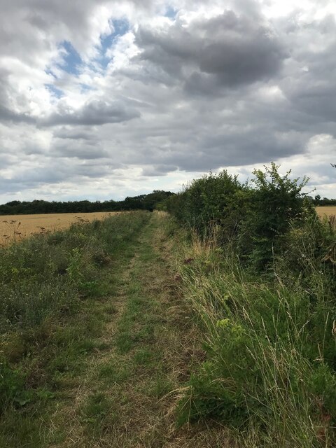
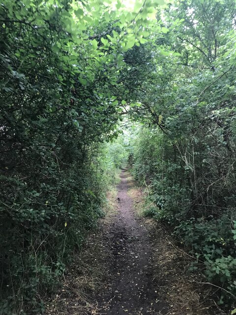
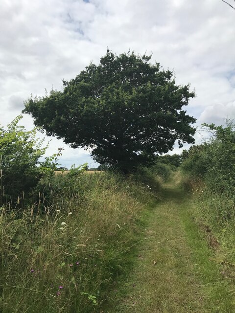
Long Plantation is a historic woodland located in Suffolk, England. Situated in the heart of the countryside, it covers an expansive area of lush forests and woodlands that provide a serene and picturesque setting. The plantation is known for its beautiful and diverse range of trees, including oak, beech, and pine, which create a rich and vibrant landscape.

With a history dating back centuries, Long Plantation has been carefully managed and preserved to maintain its natural beauty. It is a popular destination for nature enthusiasts, hikers, and photographers who are drawn to its tranquil atmosphere and stunning scenery. The old-growth trees tower overhead, creating a peaceful canopy that shelters a diverse array of wildlife, including birds, deer, and woodland creatures.

Visitors to Long Plantation can explore its extensive network of trails and footpaths, which wind their way through the woodland and offer breathtaking views at every turn. The plantation also features picnic areas and benches, providing the perfect spots to relax and enjoy the serenity of the surroundings. Additionally, educational programs and guided tours are available to learn more about the plantation's history, ecology, and conservation efforts.

Long Plantation is not only a haven for nature lovers but also a valuable ecological resource. Its untouched forests provide vital habitats for a wide range of flora and fauna, contributing to the overall biodiversity of the region. The plantation's commitment to sustainable management ensures that future generations can continue to appreciate and benefit from this natural treasure.

If you have any feedback on the listing, please let us know in the comments section below.

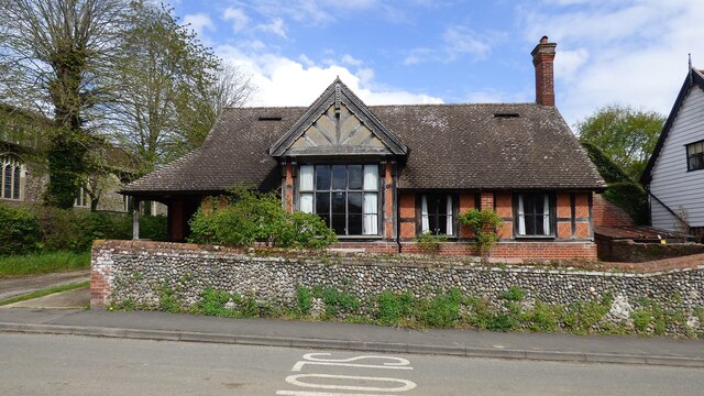
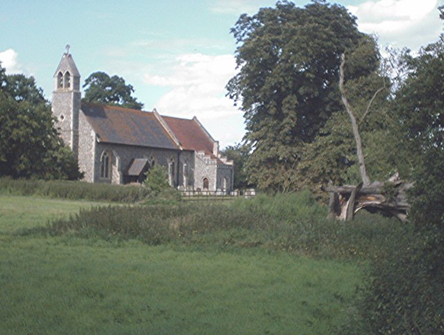
Long Plantation Images

Images are sourced within 2km of 52.298235/0.92331673 or Grid Reference TL9970. Thanks to Geograph Open Source API. All images are credited.

Power Lines North of Badwell Ash
Power Lines
North of Badwell Ash
Church of St Mary, Badwell Ash <span class="nowrap"><a title="https://historicengland.org.uk/listing/the-list/list-entry/1032210?section=official-list-entry" rel="nofollow ugc noopener" href="https://historicengland.org.uk/listing/the-list/list-entry/1032210?section=official-list-entry">Link</a><img style="margin-left:2px;" alt="External link" title="External link - shift click to open in new window" src="https://s1.geograph.org.uk/img/external.png" width="10" height="10"/></span>
Church of St Mary, Badwell Ash
Bridleway near Upthorpe
Bridleway towards Potash Farm
On Posters Lane
On Posters Lane
Church of St Mary, Walsham Le Willows <span class="nowrap"><a title="https://historicengland.org.uk/listing/the-list/list-entry/1182197?section=official-list-entry" rel="nofollow ugc noopener" href="https://historicengland.org.uk/listing/the-list/list-entry/1182197?section=official-list-entry">Link</a><img style="margin-left:2px;" alt="External link" title="External link - shift click to open in new window" src="https://s1.geograph.org.uk/img/external.png" width="10" height="10"/></span>
Church of St Mary, Walsham Le Willows
Font at Church of St Mary, Walsham Le Willows <span class="nowrap"><a title="https://historicengland.org.uk/listing/the-list/list-entry/1182197?section=official-list-entry" rel="nofollow ugc noopener" href="https://historicengland.org.uk/listing/the-list/list-entry/1182197?section=official-list-entry">Link</a><img style="margin-left:2px;" alt="External link" title="External link - shift click to open in new window" src="https://s1.geograph.org.uk/img/external.png" width="10" height="10"/></span>
Font at Church of St Mary, Walsham Le Willows
Interior of Church of St Mary, Walsham Le Willows <span class="nowrap"><a title="https://historicengland.org.uk/listing/the-list/list-entry/1182197?section=official-list-entry" rel="nofollow ugc noopener" href="https://historicengland.org.uk/listing/the-list/list-entry/1182197?section=official-list-entry">Link</a><img style="margin-left:2px;" alt="External link" title="External link - shift click to open in new window" src="https://s1.geograph.org.uk/img/external.png" width="10" height="10"/></span>
Interior of Church of St Mary, Walsham Le Willows
Rood Screen Dado at Church of St Mary, Walsham Le Willows <span class="nowrap"><a title="https://historicengland.org.uk/listing/the-list/list-entry/1182197?section=official-list-entry" rel="nofollow ugc noopener" href="https://historicengland.org.uk/listing/the-list/list-entry/1182197?section=official-list-entry">Link</a><img style="margin-left:2px;" alt="External link" title="External link - shift click to open in new window" src="https://s1.geograph.org.uk/img/external.png" width="10" height="10"/></span>
Rood Screen Dado at Church of St Mary, Walsham Le Willows
The Six Bells Public House, Walsham Le Willows <span class="nowrap"><a title="https://historicengland.org.uk/listing/the-list/list-entry/1182236?section=official-list-entry" rel="nofollow ugc noopener" href="https://historicengland.org.uk/listing/the-list/list-entry/1182236?section=official-list-entry">Link</a><img style="margin-left:2px;" alt="External link" title="External link - shift click to open in new window" src="https://s1.geograph.org.uk/img/external.png" width="10" height="10"/></span>
The Six Bells Public House, Walsham Le Willows
1,2 & 3 Guildhall, Walsham Le Willows <span class="nowrap"><a title="https://historicengland.org.uk/listing/the-list/list-entry/1032192?section=official-list-entry" rel="nofollow ugc noopener" href="https://historicengland.org.uk/listing/the-list/list-entry/1032192?section=official-list-entry">Link</a><img style="margin-left:2px;" alt="External link" title="External link - shift click to open in new window" src="https://s1.geograph.org.uk/img/external.png" width="10" height="10"/></span>
1,2 & 3 Guildhall, Walsham Le Willows
Sweetbriars, Walsham Le Willows <span class="nowrap"><a title="https://historicengland.org.uk/listing/the-list/list-entry/1032218?section=official-list-entry" rel="nofollow ugc noopener" href="https://historicengland.org.uk/listing/the-list/list-entry/1032218?section=official-list-entry">Link</a><img style="margin-left:2px;" alt="External link" title="External link - shift click to open in new window" src="https://s1.geograph.org.uk/img/external.png" width="10" height="10"/></span>
Sweetbriars, Walsham Le Willows
Walsham le Willows War Memorial <span class="nowrap"><a title="https://historicengland.org.uk/listing/the-list/list-entry/1470504?section=official-list-entry" rel="nofollow ugc noopener" href="https://historicengland.org.uk/listing/the-list/list-entry/1470504?section=official-list-entry">Link</a><img style="margin-left:2px;" alt="External link" title="External link - shift click to open in new window" src="https://s1.geograph.org.uk/img/external.png" width="10" height="10"/></span>
Walsham le Willows War Memorial
The Old Sunday School, Walsham Le Willows <span class="nowrap"><a title="https://historicengland.org.uk/listing/the-list/list-entry/1032217?section=official-list-entry" rel="nofollow ugc noopener" href="https://historicengland.org.uk/listing/the-list/list-entry/1032217?section=official-list-entry">Link</a><img style="margin-left:2px;" alt="External link" title="External link - shift click to open in new window" src="https://s1.geograph.org.uk/img/external.png" width="10" height="10"/></span>
The Old Sunday School, Walsham Le Willows
Roof at Church of St Mary, Walsham Le Willows <span class="nowrap"><a title="https://historicengland.org.uk/listing/the-list/list-entry/1182197?section=official-list-entry" rel="nofollow ugc noopener" href="https://historicengland.org.uk/listing/the-list/list-entry/1182197?section=official-list-entry">Link</a><img style="margin-left:2px;" alt="External link" title="External link - shift click to open in new window" src="https://s1.geograph.org.uk/img/external.png" width="10" height="10"/></span>
Roof at Church of St Mary, Walsham Le Willows
Farmland at Langham Looking north across a stubble field towards Hillwatering Farm.
Farmland at Langham
Looking north across a stubble field towards Hillwatering Farm.
Minor road and farmland near Badwell Ash This unfenced road leads across flat farmland, where a wide grassy margin has been retained, in keeping with Defra's Countryside Stewardship Scheme.
Minor road and farmland near Badwell Ash
This unfenced road leads across flat farmland, where a wide grassy margin has been retained, in keeping with Defra's Countryside Stewardship Scheme.
Show me another place!

Long Plantation is located at Grid Ref: TL9970 (Lat: 52.298235, Lng: 0.92331673)

Administrative County: Suffolk

District: Mid Suffolk

Police Authority: Suffolk

What 3 Words

///hiked.reds.kebab. Near Ixworth, Suffolk

Nearby Locations

Long Plantation

Related Wikis

Walsham le Willows

Walsham le Willows is a village and civil parish in the Mid Suffolk district, in Suffolk, England, located around 3 miles (4 km) south-east of Stanton...

Walsham-le-Willows F.C.

Walsham-le-Willows Football Club is a football club based in the village of Walsham le Willows in Suffolk, England. The club are currently members of the...

Badwell Ash

Badwell Ash is a village and civil parish in the Mid Suffolk district of Suffolk, England, near Bury St Edmunds and Stowmarket. According to Eilert Ekwall...

Langham, Suffolk

Langham is a village and civil parish in the Mid Suffolk district of Suffolk in eastern England. Located around seven miles north east of Bury St Edmunds...

RAF Shepherds Grove

Royal Air Force Shepherds Grove or more simply RAF Shepherds Grove is a former Royal Air Force station located in Suffolk, active from 1943–44 to 1966...

Hunston, Suffolk

Hunston is a small Suffolk village and civil parish set in a conservation area of Mid-Suffolk and lies between Stowlangtoft and Badwell Ash off the A1088...

Badwell Green

Badwell Green is a village in Suffolk, England. == External links == Media related to Badwell Green at Wikimedia Commons

The Gardens, Great Ashfield

The Gardens, Great Ashfield is a 3.8-hectare (9.4-acre) biological Site of Special Scientific Interest north of Great Ashfield in Suffolk.These ancient...

Nearby Amenities

Located within 500m of 52.298235,0.92331673
Fixme: Does a Public Footpath cross the road here?
Note: Definitive Statement and historic OS 1:25k suggest W-le-W FP 8 crosses road here.
Lat/Long: 52.3010784/0.9274929
Barrier: kissing_gate
Lat/Long: 52.3009605/0.9276907
Barrier: squeeze_stile
Lat/Long: 52.3021957/0.9243004
Barrier: stile
Lat/Long: 52.3021526/0.9242846
Barrier: kissing_gate
Lat/Long: 52.3020085/0.9242016
Barrier: squeeze_stile
Lat/Long: 52.3014278/0.9263285
Barrier: kissing_gate
Lat/Long: 52.3013197/0.9262799
The data included in this document is from www.openstreetmap.org. The data is made available under ODbL.

Have you been to Long Plantation?

Leave your review of Long Plantation below (or comments, questions and feedback).