The Carr

Wood, Forest in Norfolk Breckland

England

The Carr

The Crescent
The Crescent Credit: P Gaskell

The Carr, Norfolk, also known as the Wood or Forest, is a picturesque area located in the county of Norfolk, England. Spanning approximately 200 acres, this woodland is a haven for nature lovers and outdoor enthusiasts.

The Carr is characterized by its diverse flora and fauna, with a variety of tree species including oak, birch, and pine creating a dense and enchanting canopy. The forest floor is adorned with an array of wildflowers, mosses, and ferns, adding to its natural beauty.

This woodland is home to a wide range of wildlife, making it a popular spot for birdwatchers and animal enthusiasts. Visitors may spot native species such as deer, foxes, badgers, and a plethora of bird species including woodpeckers, owls, and thrushes.

The Carr offers a network of well-maintained walking trails, providing visitors with the opportunity to explore the forest and immerse themselves in its tranquil ambiance. These pathways offer breathtaking views of the surrounding countryside and are suitable for all levels of fitness.

In addition to its natural beauty, The Carr holds historical significance, with evidence of ancient settlements and archaeological sites dating back to the Bronze Age. This adds an element of intrigue and fascination to the area, attracting history enthusiasts and curious explorers.

Overall, The Carr, Norfolk, is a captivating woodland that offers a peaceful retreat from the hustle and bustle of everyday life. Its scenic beauty, diverse wildlife, and rich history make it a must-visit destination for nature enthusiasts and those seeking a tranquil escape in the heart of Norfolk.

If you have any feedback on the listing, please let us know in the comments section below.
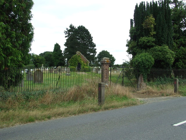
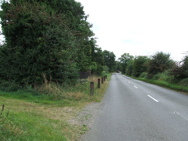
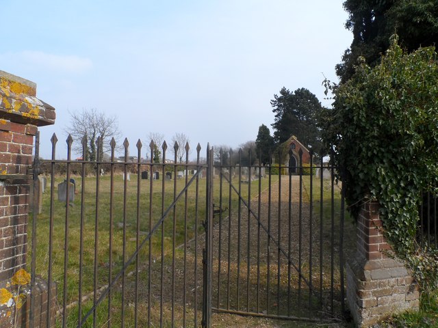
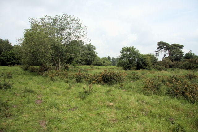
The Carr Images

Images are sourced within 2km of 52.445275/0.92501223 or Grid Reference TL9887. Thanks to Geograph Open Source API. All images are credited.

The Crescent
The Crescent
Overy Farm A view of the fields from the railway line near the racecourse.
A change of seasons from this view <a href="https://www.geograph.org.uk/photo/2009269">TL9988 : Overy Farm</a>
Overy Farm
A view of the fields from the railway line near the racecourse. A change of seasons from this view TL9988 : Overy Farm
St. Peter & St. Paul: the parish church of East Harling This beautiful church dates back to the 13th century.
St. Peter & St. Paul: the parish church of East Harling
This beautiful church dates back to the 13th century.
The village sign at East Harling
St Peter and St Paul East Harling The church of St Peter and St Paul East Harling, Norfolk. For info about the church see <span class="nowrap"><a title="http://www.norfolkchurches.co.uk/eastharling/eastharling.htm" rel="nofollow ugc noopener" href="http://www.norfolkchurches.co.uk/eastharling/eastharling.htm">Link</a><img style="margin-left:2px;" alt="External link" title="External link - shift click to open in new window" src="https://s1.geograph.org.uk/img/external.png" width="10" height="10"/></span>
St Peter and St Paul East Harling
The church of St Peter and St Paul East Harling, Norfolk. For info about the church see LinkExternal link
Village Sign The village sign at East Harling, Norfolk in the colours ready for London 2012 for close up view see <a title="https://www.geograph.org.uk/photo/3090931" href="https://www.geograph.org.uk/photo/3090931">Link</a>
Village Sign
The village sign at East Harling, Norfolk in the colours ready for London 2012 for close up view see Link
Village Sign The village sign at East Harling, Norfolk in the colours ready for London 2012 for overall view see <a title="https://www.geograph.org.uk/photo/3090926" href="https://www.geograph.org.uk/photo/3090926">Link</a>
Village Sign
The village sign at East Harling, Norfolk in the colours ready for London 2012 for overall view see Link
Lodge Marked on the 1:25:000 OS map as Lodge near to Middle Harling, Norfolk.
Lodge
Marked on the 1:25:000 OS map as Lodge near to Middle Harling, Norfolk.
Middle Farm Building at Middle Farm at Middle Harling, Norfolk.
Middle Farm
Building at Middle Farm at Middle Harling, Norfolk.
Cemetery Cemetery on the Garboldisham Road near to East Harling, Norfolk.
Cemetery
Cemetery on the Garboldisham Road near to East Harling, Norfolk.
Garboldisham Road Garboldisham Road with the cemetery on the left behind the railings near to East Harling, Norfolk. For view of the cemetery see <a title="https://www.geograph.org.uk/photo/3137647" href="https://www.geograph.org.uk/photo/3137647">Link</a>
Garboldisham Road
Garboldisham Road with the cemetery on the left behind the railings near to East Harling, Norfolk. For view of the cemetery see Link
Garboldisham Road cemetery
Market Street, East Harling
Fields on a frosty morning near East Harling The River Thet runs where the thicker band is in the centre of the image.
Fields on a frosty morning near East Harling
The River Thet runs where the thicker band is in the centre of the image.
East Harling Recreation Ground St Peter & St Paul's Church is behind.
East Harling Recreation Ground
St Peter & St Paul's Church is behind.
War memorial at East Harling
The Swan, East Harling One of two pubs in the village. This one is slightly more traditional. It sold a perfectly good Adnam's without sparkler.
The Swan, East Harling
One of two pubs in the village. This one is slightly more traditional. It sold a perfectly good Adnam's without sparkler.
School Lane, East Harling Showing some traditional stone walls near the site of the old school.
School Lane, East Harling
Showing some traditional stone walls near the site of the old school.
Show me another place!

The Carr is located at Grid Ref: TL9887 (Lat: 52.445275, Lng: 0.92501223)

Administrative County: Norfolk

District: Breckland

Police Authority: Norfolk

What 3 Words

///hillside.preheated.bounty. Near East Harling, Norfolk

Nearby Locations

The Carr

Related Wikis

St Peter and St Paul, East Harling

St Peter and St Paul is a Grade I listed Church of England parish church in East Harling, Norfolk. It is part of Harling United Benefice, a group of five...

East Harling

East Harling is a village in the English county of Norfolk. The village forms the principal settlement in the civil parish of Harling, and is located 13...

Harling, Norfolk

Harling is a civil parish in the English county of Norfolk. It covers an area of 23.19 km2 (8.95 sq mi) and had a population of 2,201 in 932 households...

St George's Distillery

St George's Distillery is a distillery based in Roudham, Norfolk. It is owned by the English Whisky Company who are a producer of single malt whisky and...

East Harling Common

East Harling Common is a 15.1-hectare (37-acre) biological Site of Special Scientific Interest east of Thetford in Norfolk.The importance of this site...

Harling Road railway station

Harling Road railway station is on the Breckland line in the east of England, serving the villages of Larling, Roudham and East Harling, Norfolk. The line...

Roudham and Larling

Roudham and Larling is a civil parish in the English county of Norfolk. It includes the villages of Roudham and Larling. It covers an area of 15.20 km2...

Middle Harling Fen

Middle Harling Fen is a 11.8-hectare (29-acre) biological Site of Special Scientific Interest south of East Harling in Norfolk.This calcareous valley fen...

Nearby Amenities

Located within 500m of 52.445275,0.92501223
Pipeline: marker
Ref: TL98020
Lat/Long: 52.4441821/0.9231425
Barrier: lych_gate
Foot: yes
Lat/Long: 52.4415873/0.9262367
Entrance: yes
Lat/Long: 52.4418289/0.9266453
Bench
Backrest: yes
Material: wood
Seats: 2
Lat/Long: 52.4420347/0.9261301
Bench
Backrest: yes
Material: metal
Seats: 3
Lat/Long: 52.4421475/0.9262134
Bench
Backrest: yes
Material: wood
Seats: 3
Lat/Long: 52.4422398/0.926822
Man Made: water_tap
Lat/Long: 52.4420335/0.926235
Recycling
Recycling Clothes: yes
Recycling Glass: yes
Recycling Paper: yes
Recycling Shoes: yes
Lat/Long: 52.4410653/0.9274966
Entrance: main
Lat/Long: 52.4417598/0.9263007
E. Harling
Alt Name: East Harling
Colour: yellow;white;red
Inscription: 30 / Please drive carefully
Material: metal
Traffic Sign: city_limit
Lat/Long: 52.442904/0.9241578
Power: pole
Lat/Long: 52.4472184/0.9227577
Location Transition: yes
Power: pole
Lat/Long: 52.4463086/0.9211296
Power: pole
Lat/Long: 52.4463765/0.9212637
Power: pole
Lat/Long: 52.4453858/0.9221461
Power: pole
Lat/Long: 52.4418993/0.9231573
Give Way
Lat/Long: 52.4442914/0.9232519
Power: pole
Lat/Long: 52.4432269/0.9238668
Power: pole
Lat/Long: 52.4441809/0.923266
Animal Boarding
Evergreen Boarding Kennels and Cattery
Addr City: Norwich
Addr Parentstreet: Hall Lane
Addr Place: Waterways Farm
Addr Postcode: NR16 2NB
Animal Boarding: dog;cat
Fixme: Check this is the right location
Website: https://www.evergreenboardingkennelsandcattery.co.uk/
Lat/Long: 52.4435612/0.928849
The data included in this document is from www.openstreetmap.org. The data is made available under ODbL.

Have you been to The Carr?

Leave your review of The Carr below (or comments, questions and feedback).