Arthy's Plantation

Wood, Forest in Suffolk Babergh

England

Arthy's Plantation

Gate on The Tendring Hall Farm Path To the left there was a harrowed field covered with plastic.
Gate on The Tendring Hall Farm Path Credit: Glyn Baker

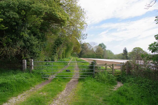
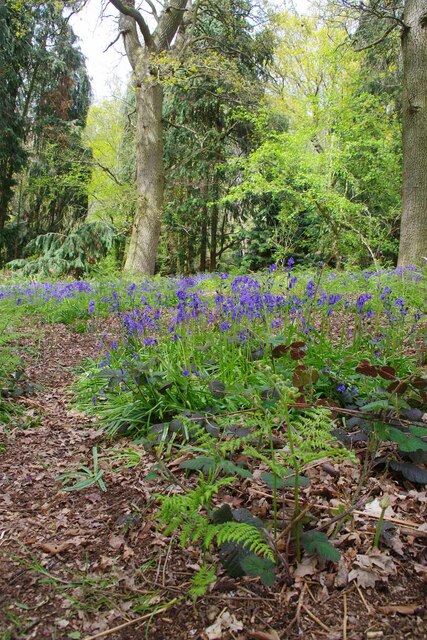
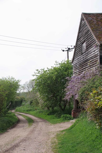
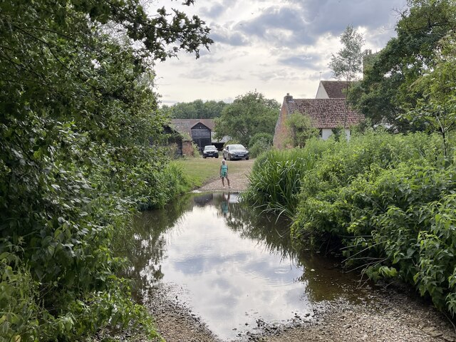
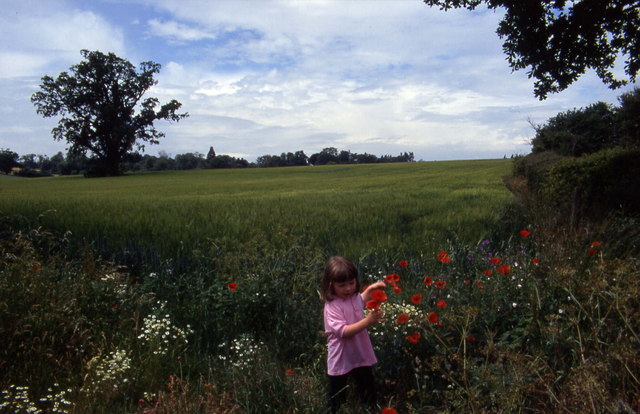
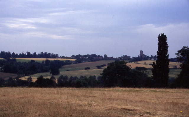
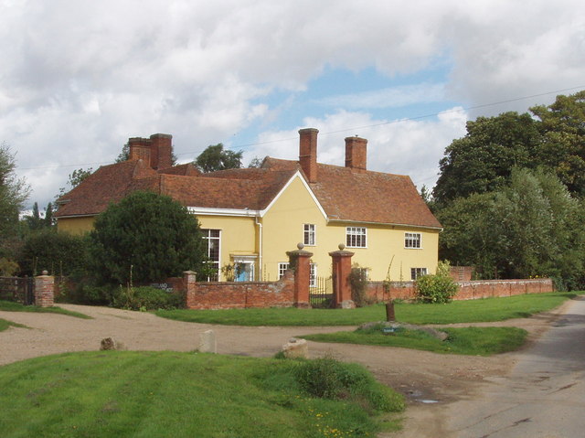
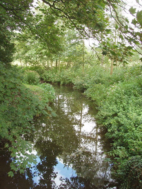
Arthy's Plantation, located in Suffolk, is a stunning woodland area known for its picturesque beauty and abundance of diverse plant life. Spanning over a vast area, the plantation is a haven for nature enthusiasts and those seeking tranquility in the heart of the countryside.

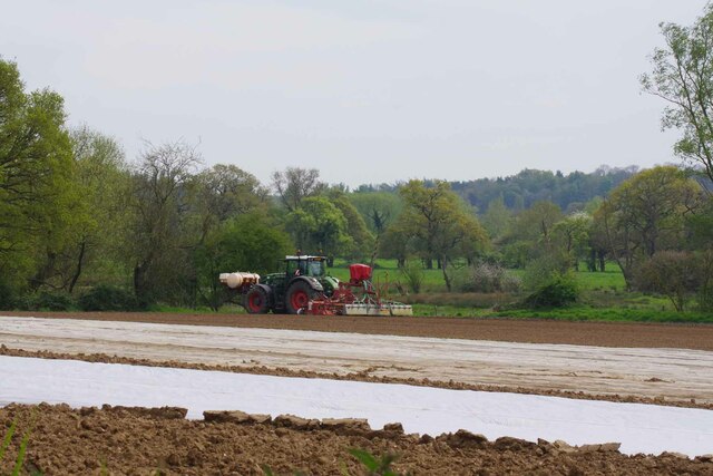
The plantation boasts a rich history, dating back several centuries. It was originally established as a timber plantation, primarily for the purpose of supplying wood to the local community. Over time, it has evolved into a protected forest area, attracting visitors from far and wide.

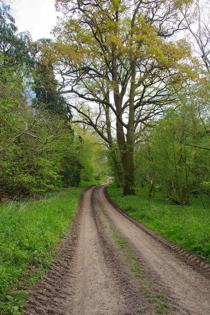
The woodland is characterized by its dense canopy of majestic oak, beech, and birch trees, providing a sheltered habitat for numerous species of wildlife. Visitors can expect to spot squirrels, deer, and a variety of bird species as they explore the plantation's winding trails.

Arthy's Plantation offers a range of activities for both nature lovers and adventure seekers. Walking and hiking trails crisscross the woodland, allowing visitors to immerse themselves in its natural splendor. The plantation also offers designated picnic areas, providing the perfect opportunity for visitors to relax and enjoy a meal amidst the serene surroundings.

For those interested in the plantation's history, informative signboards are strategically placed throughout the area, shedding light on its past and the importance of sustainable forestry.

Arthy's Plantation is a true gem in Suffolk, offering a peaceful retreat for individuals and families alike. Whether it's a leisurely stroll, a picnic, or a chance to reconnect with nature, this woodland oasis is sure to leave visitors with lasting memories of its beauty and tranquility.

If you have any feedback on the listing, please let us know in the comments section below.

Arthy's Plantation Images

Images are sourced within 2km of 51.986316/0.89426834 or Grid Reference TL9835. Thanks to Geograph Open Source API. All images are credited.

Gate on The Tendring Hall Farm Path To the left there was a harrowed field covered with plastic.
Gate on The Tendring Hall Farm Path
To the left there was a harrowed field covered with plastic.
Modern Farming at Tendring Hall Lots of agrichemicals and plastic.
Modern Farming at Tendring Hall
Lots of agrichemicals and plastic.
Path Through Pickess Grove A public footpath through the Tendring Hall Estate.
Path Through Pickess Grove
A public footpath through the Tendring Hall Estate.
Native Bluebells in Pickess Grove My nose alone told me these were <a href="https://www.geograph.org.uk/photo/422951">TM0722 : Hyacinthoides non-scripta</a> in a private wood (taken from the footpath).
Native Bluebells in Pickess Grove
My nose alone told me these were TM0722 : Hyacinthoides non-scripta in a private wood (taken from the footpath).
Old Barn at Grove Farm An ancient barn at the other end of the <a href="https://www.geograph.org.uk/photo/7476656">TL9835 : Footpath to Tendring Hall Farm</a>
Old Barn at Grove Farm
An ancient barn at the other end of the TL9835 : Footpath to Tendring Hall Farm
River Box Ford  This ford on the River Box is found beside Valley Farm. We were fortunate to come across a young badger as we ascended the bridleway beyond the pig farm at Rams Farm.
River Box Ford
This ford on the River Box is found beside Valley Farm. We were fortunate to come across a young badger as we ascended the bridleway beyond the pig farm at Rams Farm.
Stoke by Nayland Church The finest tower in Suffolk many think.
Stoke by Nayland Church
The finest tower in Suffolk many think.
Stoke-by-Nayland Lovely village in Suffolk's Constable Country
Stoke-by-Nayland
Lovely village in Suffolk's Constable Country
Floral delights in field at Mill Street The summer of 1996 will be forever remembered by me as the year of red poppies.  They seemed to be everywhere and lasted for many weeks.
Floral delights in field at Mill Street
The summer of 1996 will be forever remembered by me as the year of red poppies. They seemed to be everywhere and lasted for many weeks.
Narrow lane in Mill Street This shows a converted mill in the aptly named community of Mill Street
Narrow lane in Mill Street
This shows a converted mill in the aptly named community of Mill Street
Southern aspect from Bell's Corner Looks over a field towards some woods. These fall down into the Box Valley, with the distinctive landmark of Stoke-by-Nayland church in the distance on the opposite side
Southern aspect from Bell's Corner
Looks over a field towards some woods. These fall down into the Box Valley, with the distinctive landmark of Stoke-by-Nayland church in the distance on the opposite side
Converted barn, Scotland Street This is one of those Suffolk Black Barns - this one converted into a home.
Converted barn, Scotland Street
This is one of those Suffolk Black Barns - this one converted into a home.
Timber-framed house at Stoke-by-Nayland, Suffolk This 16th century building was once two houses and known as the Maltings. The tower of the parish church can be seen behind.
Timber-framed house at Stoke-by-Nayland, Suffolk
This 16th century building was once two houses and known as the Maltings. The tower of the parish church can be seen behind.
Cottage at Stoke Tye, Suffolk Stoke Tye is a small place northwest of Stoke-by-Nayland and has just a few houses like the one in this picture.
Cottage at Stoke Tye, Suffolk
Stoke Tye is a small place northwest of Stoke-by-Nayland and has just a few houses like the one in this picture.
Vicarage, Stoke by Nayland In Church Street
Vicarage, Stoke by Nayland
In Church Street
Roadside unattended jam stall, Stoke by Nayland Do retail outlets get any smaller? Outside a house in the narrow lane of Scotland Street, Stoke by Nayland, were two chairs holding homemade jam and chutney. We put our £2 in the honesty box for a jar of chutney, and found it excellent. The labels from "Jam Today!" gave us an email address and phone number for ordering more.
Roadside unattended jam stall, Stoke by Nayland
Do retail outlets get any smaller? Outside a house in the narrow lane of Scotland Street, Stoke by Nayland, were two chairs holding homemade jam and chutney. We put our £2 in the honesty box for a jar of chutney, and found it excellent. The labels from "Jam Today!" gave us an email address and phone number for ordering more.
Scotland Place, Stoke by Nayland View from Scotland Street
Scotland Place, Stoke by Nayland
View from Scotland Street
River Box, Stoke by Nayland View from Scotland Street bridge.
River Box, Stoke by Nayland
View from Scotland Street bridge.
Show me another place!

Arthy's Plantation is located at Grid Ref: TL9835 (Lat: 51.986316, Lng: 0.89426834)

Administrative County: Suffolk

District: Babergh

Police Authority: Suffolk

What 3 Words

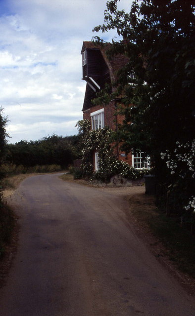
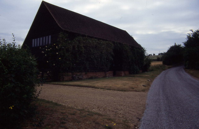
///conjured.flattens.coherent. Near Boxted, Essex

Related Wikis

Stoke-by-Nayland

Stoke-by-Nayland is a village and civil parish in the Babergh district, in the county of Suffolk, England, close to the border with Essex. The parish includes...

St Mary's Church, Stoke-by-Nayland

St Mary's Church is a Grade I listed parish church in the Church of England in Stoke-by-Nayland. == History == The earliest parts of the church date from...

South Suffolk (UK Parliament constituency)

South Suffolk is a constituency represented in the House of Commons of the UK Parliament since 2015 by James Cartlidge, a Conservative. == History == South...

Gospel Oak, Polstead

The Gospel Oak was a veteran tree in Polstead, Suffolk. The tree is associated with Saint Cedd, who reputedly planted it or preached beneath it. The...

Nearby Amenities

Located within 500m of 51.986316,0.89426834
Stoke by Nayland
Is In: Suffolk,England,UK
Place: village
Source Name: NPE
Wikidata: Q2042664
Lat/Long: 51.9892706/0.8966564
Bus Stop
Village Hall
Naptan AtcoCode: 390010108
Naptan Bearing: W
Naptan CommonName: Village Hall
Naptan Indicator: adj
Naptan Landmark: Village Hall
Naptan NaptanCode: sufadjdj
Naptan Street: Church Street
Naptan Verified: no
Public Transport: platform
Source: naptan_import
Lat/Long: 51.9892689/0.8937951
Bus Stop
Village Hall
Naptan AtcoCode: 390010109
Naptan Bearing: E
Naptan BusStopType: CUS
Naptan CommonName: Village Hall
Naptan Indicator: opp
Naptan Landmark: Village Hall
Naptan NaptanCode: sufadjdm
Naptan Street: Church Street
Naptan Verified: no
Public Transport: platform
Source: naptan_import
Lat/Long: 51.9893515/0.8937275
Bus Stop
The Angel
Naptan AtcoCode: 390010721
Naptan Bearing: NW
Naptan CommonName: The Angel
Naptan Indicator: adj
Naptan Landmark: The Angel
Naptan NaptanCode: sufjdmjp
Naptan Street: Polstead Street
Naptan Verified: no
Public Transport: platform
Source: naptan_import
Lat/Long: 51.9898487/0.8943569
Bus Stop
The Angel
Naptan AtcoCode: 390010722
Naptan Bearing: SE
Naptan BusStopType: CUS
Naptan CommonName: The Angel
Naptan Indicator: opp
Naptan Landmark: The Angel
Naptan NaptanCode: sufjdmjt
Naptan Street: Polstead Street
Naptan Verified: no
Public Transport: platform
Source: naptan_import
Lat/Long: 51.9898462/0.8944587
Post Office
Stoke By Nayland Post Office
Addr City: Colchester
Addr Hamlet: Stoke By Nayland
Addr Postcode: CO6 4SE
Addr Street: Park Street
Addr Village: Stoke
Brand: Post Office
Brand Wikidata: Q1783168
Contact Website: https://www.postoffice.co.uk/branch-finder/1111167/stoke-by-nayland
Opening Hours: Mo-Fr 09:00-17:30; Sa 09:00-12:30
Ref Pol Id: 1625
Source: OS_opendata_streetview
Source Addr: pol_branch_list_2018-02
Source Opening Hours: pol_branch_list_2018-02
Lat/Long: 51.9892366/0.8950104
Post Box
Collection Times: Mo-Fr 15:15; Sa 11:00
Operator: Royal Mail
Post Box Apertures: 1
Post Box Type: pillar
Ref: CO6 228
Royal Cypher: GVIR
Royal Cypher Wikidata: Q33102169
Lat/Long: 51.9892814/0.8950159
Defibrillator
Defibrillator Location: In the lobby at the right-hand side of the village hall.
Emergency: defibrillator
Indoor: no
Ref: CHT-10286
Ref GB The Circuit: C4B2B957-3C4C-4D65-BFAB-AF7F00F7463D
Lat/Long: 51.989176/0.8936977
Historic: memorial
Source: Bing
Lat/Long: 51.9893722/0.8924742
Fixme: incomplete
Note: Signed to "Rowley Wood"
Lat/Long: 51.9890073/0.8901467
The Open Road Books
Shop: books
Lat/Long: 51.9895424/0.8948815
The data included in this document is from www.openstreetmap.org. The data is made available under ODbL.

Have you been to Arthy's Plantation?

Leave your review of Arthy's Plantation below (or comments, questions and feedback).