Beetley Common

Wood, Forest in Norfolk Breckland

England

Beetley Common

The Kings Head pub, North Elmham
The Kings Head pub, North Elmham Credit: Bikeboy

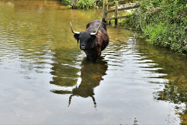
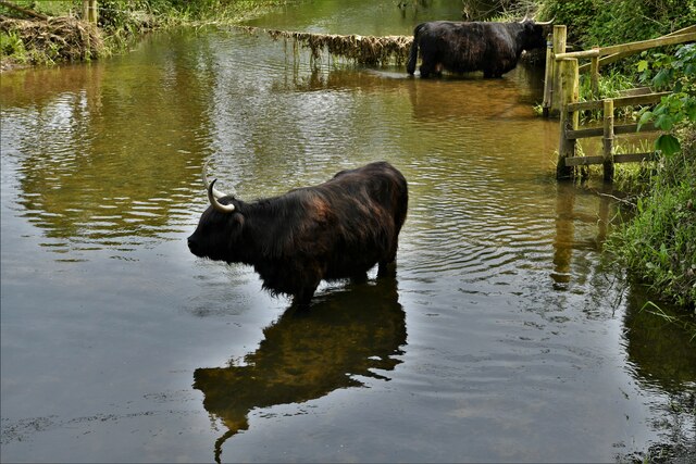
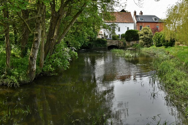
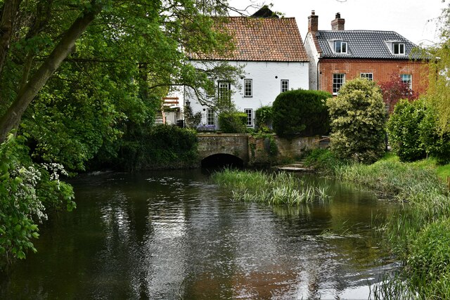
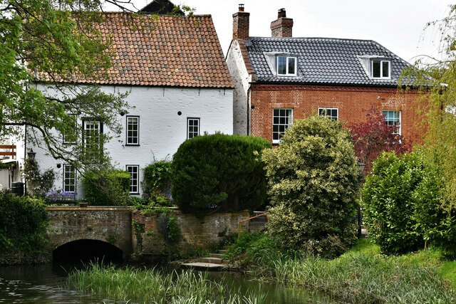
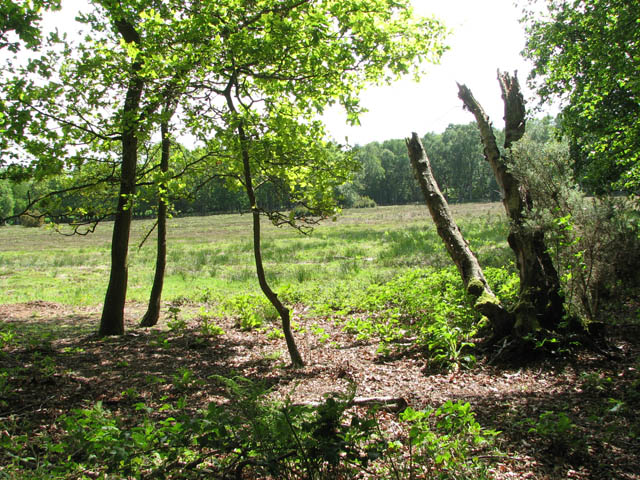
Beetley Common, located in the county of Norfolk, England, is a picturesque woodland area boasting an array of natural beauty and wildlife. Covering an extensive area, it stretches across approximately 300 acres and is a popular destination for nature enthusiasts and walkers.

The common is primarily composed of mixed broadleaf and coniferous trees, including oak, beech, pine, and birch, creating a diverse and vibrant woodland landscape. These trees provide a rich habitat for a variety of wildlife species, such as birds, mammals, and insects.

The common is crisscrossed by a network of well-maintained footpaths, allowing visitors to explore the area and immerse themselves in the tranquil surroundings. Along these paths, one can encounter enchanting sights, including wildflowers, ferns, and moss-covered tree trunks.

Beetley Common also features a number of small ponds and wetland areas, which attract a host of amphibians, dragonflies, and other water-dwelling creatures. These wetlands contribute to the overall biodiversity of the common, creating a fascinating ecosystem.

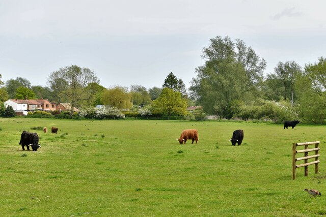
Furthermore, the common is home to several species of deer, such as roe deer and muntjac, which can often be spotted grazing or wandering through the woodland. Birdwatchers may also be delighted to observe a variety of avian species, including woodpeckers, owls, and thrushes.

Overall, Beetley Common offers a serene and captivating natural environment, where visitors can enjoy peaceful walks, observe wildlife, and appreciate the beauty of Norfolk's woodlands.

If you have any feedback on the listing, please let us know in the comments section below.

Beetley Common Images

Images are sourced within 2km of 52.732051/0.94197579 or Grid Reference TF9818. Thanks to Geograph Open Source API. All images are credited.

The Kings Head pub, North Elmham
The B1110 and B1145 Cross Roads at the Kings Head PH in North Elmham Looking southward.
The B1110 and B1145 Cross Roads at the Kings Head PH in North Elmham
Looking southward.
Ordnance Survey Flush Bracket S0182 This can be found on the roadside wall of the Kings Head in North Elmham.
For more detail see : <span class="nowrap"><a title="http://www.bench-marks.org.uk/bm11534" rel="nofollow ugc noopener" href="http://www.bench-marks.org.uk/bm11534">Link</a><img style="margin-left:2px;" alt="External link" title="External link - shift click to open in new window" src="https://s1.geograph.org.uk/img/external.png" width="10" height="10"/></span>
Ordnance Survey Flush Bracket S0182
This can be found on the roadside wall of the Kings Head in North Elmham. For more detail see : LinkExternal link
North Elmham: Water buffalo in Black Water
North Elmham: Mill house
North Elmham: Water buffalo grazing
North Elmham: The Worthing Road, Billingford Road junction
Bridge 1701 A small disused road/track bridge over the old freight line.
This section is under maintenance to prevent further decay, full restoration will take place after the Hoe extension is finished.
The trackbed here is private, I was on a supervised walking event.

* In August 2010 GWR 9466 along with a brake van 'explored' the northern frontier coming as far as bridge 1701, the first train to get this far since 1989.
Bridge 1701
A small disused road/track bridge over the old freight line. This section is under maintenance to prevent further decay, full restoration will take place after the Hoe extension is finished. The trackbed here is private, I was on a supervised walking event. * In August 2010 GWR 9466 along with a brake van 'explored' the northern frontier coming as far as bridge 1701, the first train to get this far since 1989.
Thelveton Mill Machinery Sadly the mill is long gone but this hurst frame and R&H diesel milling engine find themselves at Gressenhall museum. 
<a href="https://www.geograph.org.uk/photo/3064195">TF9717 : Hurst Frame - Gressenhall</a>
<a href="https://www.geograph.org.uk/photo/3064255">TF9717 : Gressenhall Workhouse - Diesel Engine</a>
Thelveton Mill Machinery
Sadly the mill is long gone but this hurst frame and R&H diesel milling engine find themselves at Gressenhall museum. TF9717 : Hurst Frame - Gressenhall TF9717 : Gressenhall Workhouse - Diesel Engine
Turning for Old Beetley
Old Milestone Old milestone on the B1110 near to Beetley, Norfolk. For overall view see <a title="https://www.geograph.org.uk/photo/3793161" href="https://www.geograph.org.uk/photo/3793161">Link</a>
Old Milestone
Old milestone on the B1110 near to Beetley, Norfolk. For overall view see Link
To Dereham 3 Old milestone on the B1110 near to Beetley, Norfolk. For close up view see <a title="https://www.geograph.org.uk/photo/3793158" href="https://www.geograph.org.uk/photo/3793158">Link</a>
To Dereham 3
Old milestone on the B1110 near to Beetley, Norfolk. For close up view see Link
Ordnance Survey Flush Bracket S9656 This can be found on the wall of a private dwelling - former barn - at Tarn Farm.
For more detail see : <span class="nowrap"><a title="http://www.bench-marks.org.uk/bm11557" rel="nofollow ugc noopener" href="http://www.bench-marks.org.uk/bm11557">Link</a><img style="margin-left:2px;" alt="External link" title="External link - shift click to open in new window" src="https://s1.geograph.org.uk/img/external.png" width="10" height="10"/></span>
Ordnance Survey Flush Bracket S9656
This can be found on the wall of a private dwelling - former barn - at Tarn Farm. For more detail see : LinkExternal link
Hall Road, Old Beetley
A field by Chapel Lane, Beetley
Show me another place!

Beetley Common is located at Grid Ref: TF9818 (Lat: 52.732051, Lng: 0.94197579)

Administrative County: Norfolk

District: Breckland

Police Authority: Norfolk

What 3 Words

///pass.than.comforted. Near North Elmham, Norfolk

Nearby Locations

Beetley Common

Related Wikis

Spong Hill

Spong Hill is an Anglo-Saxon cemetery site located south of North Elmham in Norfolk, England. It is the largest known Early Anglo-Saxon cremation site...

North Elmham railway station

North Elmham railway station is a railway station in the village of North Elmham in the English county of Norfolk. The station was part of the Wymondham...

Worthing, Norfolk

Worthing is a small village and former civil parish, now in the parish of Hoe and Worthing, in the Breckland district, in the county of Norfolk, England...

Robertson Barracks, Norfolk

Robertson Barracks is a military installation near Swanton Morley in Norfolk. It is home to 1st The Queen's Dragoon Guards. It is set to close in 2029...

RAF Swanton Morley

Royal Air Force Swanton Morley or more simply RAF Swanton Morley, is a former Royal Air Force station in Norfolk, England, located near to the village...

North Elmham

North Elmham is a village and civil parish in the English county of Norfolk. It covers an area of 7.41 sq mi (19.2 km2) and had a population of 1,428 in...

Beetley and Hoe Meadows

Beetley and Hoe Meadows is an 11.4-hectare (28-acre) biological Site of Special Scientific Interest north of Dereham in Norfolk, United Kingdom. The site...

Panford Beck

Panford Beck is a minor watercourse that is entirely in the county of Norfolk, eastern England. This small short beck rises within the Parish of North...

Nearby Amenities

Located within 500m of 52.732051,0.94197579
Worthing level crossing
Railway: level_crossing
Lat/Long: 52.7328045/0.9476007
Bridge Support: pier
Lat/Long: 52.7337612/0.9475472
Bridge Support: pier
Lat/Long: 52.7336824/0.9475485
Railway: milestone
Lat/Long: 52.7304904/0.9476717
The data included in this document is from www.openstreetmap.org. The data is made available under ODbL.

Have you been to Beetley Common?

Leave your review of Beetley Common below (or comments, questions and feedback).