King's Ford Grove

Wood, Forest in Essex Colchester

England

King's Ford Grove

Abberton Reservoir from a permissive path; Near Layer-De-La Haye This section of the path I only discovered last Saturday. I was soon to find out that it ended on a "private" section of Fields Farm Road!
Abberton Reservoir from a permissive path; Near Layer-De-La Haye Credit: Mr James D

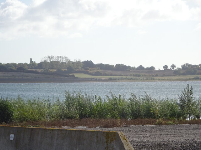
King's Ford Grove is a picturesque woodland located in the county of Essex, England. Situated in the heart of the county, it is known for its lush greenery, diverse flora and fauna, and tranquil atmosphere. Covering an area of approximately 100 hectares, the grove offers a serene escape from the bustling city life.

The woodland is primarily composed of a mix of deciduous and coniferous trees, creating a rich and diverse ecosystem. Oak, beech, and birch trees dominate the landscape, providing a vibrant display of colors throughout the seasons. The forest floor is adorned with bluebells, ferns, and other wildflowers, adding to the grove's natural charm.

King's Ford Grove is a haven for wildlife enthusiasts, as it is home to a variety of animal species. Squirrels, rabbits, and deer can often be spotted among the trees, while birds such as woodpeckers, owls, and thrushes inhabit the canopy. The grove also boasts a small pond, attracting ducks, frogs, and dragonflies.

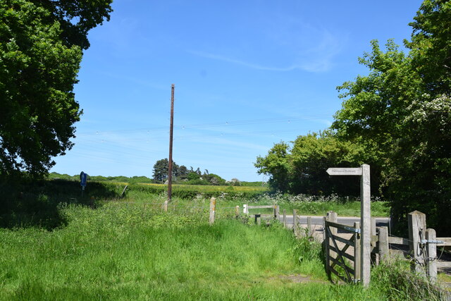
The woodland offers several walking trails, allowing visitors to explore its natural beauty at their own pace. These paths wind through the forest, offering breathtaking views and opportunities for nature photography. There are also designated picnic areas where visitors can enjoy a peaceful lunch amidst the tranquil surroundings.

Managed by the local council, King's Ford Grove is well-maintained, with informative signposts and occasional benches along the trails. It is a popular destination for families, nature lovers, and hikers seeking a peaceful retreat in the heart of Essex.

If you have any feedback on the listing, please let us know in the comments section below.

King's Ford Grove Images

Images are sourced within 2km of 51.855428/0.86806564 or Grid Reference TL9721. Thanks to Geograph Open Source API. All images are credited.

Abberton Reservoir from a permissive path; Near Layer-De-La Haye This section of the path I only discovered last Saturday. I was soon to find out that it ended on a "private" section of Fields Farm Road!
Abberton Reservoir from a permissive path; Near Layer-De-La Haye
This section of the path I only discovered last Saturday. I was soon to find out that it ended on a "private" section of Fields Farm Road!
Lidl Supermarket, Gosbecks Road, Colchester
Morris Minor parked in Oliver's lane I took this pic in black & white to make it appear as an old fashioned photo from the 50s, and not as a modern pic from 2022. The car in question is a Morris Minor MM, which thankfully, has its original reg no (issued in 1952 in East Sussex according to "Where's It From; When was It Issued" book on UK registration numbers I have in my possession); and not one of those "age related" plates you often see on vehicles of its age (which I don't like).
Morris Minor parked in Oliver's lane
I took this pic in black & white to make it appear as an old fashioned photo from the 50s, and not as a modern pic from 2022. The car in question is a Morris Minor MM, which thankfully, has its original reg no (issued in 1952 in East Sussex according to "Where's It From; When was It Issued" book on UK registration numbers I have in my possession); and not one of those "age related" plates you often see on vehicles of its age (which I don't like).
Junction of Church Road and Birch Road Layer de la Haye
Catholic Church of St. John the Baptist, Shrub End, Colchester The Catholic Church of St. John the Baptist in Shrub End, a suburb of Colchester in Essex.
Catholic Church of St. John the Baptist, Shrub End, Colchester
The Catholic Church of St. John the Baptist in Shrub End, a suburb of Colchester in Essex.
Block of flats on Iceni Way, Shrub End, Colchester A low rise block of flats on Iceni Way in Shrub End, a suburb of Colchester.
Block of flats on Iceni Way, Shrub End, Colchester
A low rise block of flats on Iceni Way in Shrub End, a suburb of Colchester.
Gloucester Avenue, Shrub End, Colchester Gloucester Avenue is a residential road in Shrub End, a suburb of Colchester in Essex.
Gloucester Avenue, Shrub End, Colchester
Gloucester Avenue is a residential road in Shrub End, a suburb of Colchester in Essex.
Alamein Road, Shrub End, Colchester Alamein Road is a residential road in Shrub End, a suburb of Colchester in Essex.
Alamein Road, Shrub End, Colchester
Alamein Road is a residential road in Shrub End, a suburb of Colchester in Essex.
Alamein Road, Shrub End, Colchester Alamein Road is a residential road in Shrub End, in the Essex town of Colchester.
Alamein Road, Shrub End, Colchester
Alamein Road is a residential road in Shrub End, in the Essex town of Colchester.
Glebe Road, Shrub End, Colchester Glebe Road is a residential road in Shrub End, a suburb of Colchester.
Glebe Road, Shrub End, Colchester
Glebe Road is a residential road in Shrub End, a suburb of Colchester.
Bishop Road, Shrub End, Colchester Bishop Road is a residential road in Shrub End, a suburb of Colchester in Essex.
Bishop Road, Shrub End, Colchester
Bishop Road is a residential road in Shrub End, a suburb of Colchester in Essex.
Shrub End Road, Shrub End, Colchester Shrub End Road is on the route of the B1022 road in the suburbs of Colchester in Essex.
Shrub End Road, Shrub End, Colchester
Shrub End Road is on the route of the B1022 road in the suburbs of Colchester in Essex.
Looking across Abberton Road  Taken from the permissive footpath which runs north of the dam of Abberton Reservoir.
Looking across Abberton Road
Taken from the permissive footpath which runs north of the dam of Abberton Reservoir.
Layer de la Haye: The Layer Fox P.H.
Layer de la Haye: 2 High Road
Layer de la Haye: Village Sign
Layer de la Haye: 11, 11a High Road
Pump House at Abberton Dam This is a photo of a small pump house just to the east of the Abberton Reservoir dam.
Pump House at Abberton Dam
This is a photo of a small pump house just to the east of the Abberton Reservoir dam.
Show me another place!

King's Ford Grove is located at Grid Ref: TL9721 (Lat: 51.855428, Lng: 0.86806564)

Administrative County: Essex

District: Colchester

Police Authority: Essex

What 3 Words

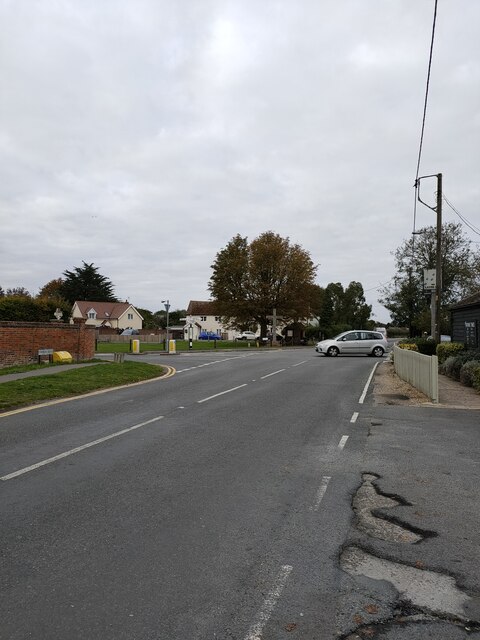
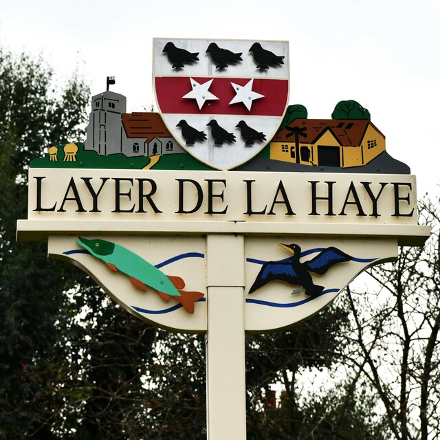
///petal.lamps.stand. Near Layer de la Haye, Essex

Nearby Locations

King's Ford Grove

Related Wikis

Roman River Valley

Roman River Valley is a 17.8-hectare (44-acre) nature reserve north of Layer de la Haye in Essex. It is managed by the Essex Wildlife Trust. This wetland...

Layer de la Haye

Layer de la Haye (often spelled Layer-de-la-Haye; locally known just as Layer) is a village and civil parish in the City of Colchester district of Essex...

St Michael's Church, Berechurch

St Michael's Church is a redundant Anglican church in the village of Berechurch, Essex, England. It is recorded in the National Heritage List for England...

Alderman Blaxill School

Alderman Blaxill School was a secondary school with academy status in Colchester, Essex, and was the town's smallest secondary school. It closed in 2014...

Nearby Amenities

Located within 500m of 51.855428,0.86806564
Kingsford Farm
Naptan AtcoCode: 150014011011
Naptan Bearing: S
Naptan BusStopType: CUS
Naptan CommonName: Kingsford Farm
Naptan Indicator: S-bound
Naptan Landmark: Kingsford Farm
Naptan NaptanCode: esxgjdtp
Naptan Street: B1026 Layer Road
Naptan Verified: no
Public Transport: platform
Source: naptan_import
Lat/Long: 51.8550134/0.8672019
Playing Fields
Naptan AtcoCode: 150014011012
Naptan BusStopType: CUS
Naptan NaptanCode: esxgjdtw
Naptan Verified: no
Public Transport: platform
Source: naptan_import
Lat/Long: 51.8584418/0.8671295
Kingsford Farm
Naptan AtcoCode: 1500140110Y1
Naptan Bearing: N
Naptan BusStopType: CUS
Naptan CommonName: Kingsford Farm
Naptan Indicator: N-bound
Naptan Landmark: Kingsford Farm
Naptan NaptanCode: esxgtjaj
Naptan Street: B1026 Layer Road
Naptan Verified: no
Public Transport: platform
Source: naptan_import
Lat/Long: 51.8550245/0.8671154
Playing Fields
Naptan AtcoCode: 1500140110Y2
Naptan BusStopType: CUS
Naptan NaptanCode: esxgtjdw
Naptan Verified: no
Public Transport: platform
Source: naptan_import
Lat/Long: 51.858444/0.8670424
Power: pole
Lat/Long: 51.8573707/0.8737926
Power: pole
Lat/Long: 51.8583679/0.8731212
Power: pole
Lat/Long: 51.8583918/0.8731231
Power: pole
Lat/Long: 51.8594155/0.870806
Power: pole
Lat/Long: 51.858796/0.8722326
Power: pole
Lat/Long: 51.8578617/0.8730802
Charging Station
Operator: Under construction.
Lat/Long: 51.8592925/0.8649533
The data included in this document is from www.openstreetmap.org. The data is made available under ODbL.

Have you been to King's Ford Grove?

Leave your review of King's Ford Grove below (or comments, questions and feedback).