Purchase Wood

Wood, Forest in Kent Ashford

England

Purchase Wood

Ashford Road (A28) in 1985 An evening photo with lengthening shadows.
Ashford Road (A28) in 1985 Credit: John Baker

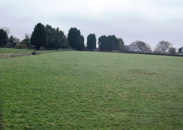
Purchase Wood, Kent, also known as Wood Forest, is a picturesque woodland located in the county of Kent in southeastern England. Covering an area of approximately 50 acres, it offers a tranquil and serene environment for nature lovers and outdoor enthusiasts.

The woodland is characterized by a dense canopy of trees, predominantly consisting of oak, beech, and birch. These towering trees create a sheltered and shaded ambiance, perfect for exploration and relaxation. The forest floor is adorned with a diverse range of flora, including bluebells, foxgloves, and ferns, adding to the beauty and enchantment of the woodland.

Purchase Wood is home to a variety of wildlife, making it an ideal spot for nature enthusiasts and birdwatchers. Visitors may catch glimpses of woodpeckers, owls, deer, squirrels, and a myriad of other creatures that inhabit the area.

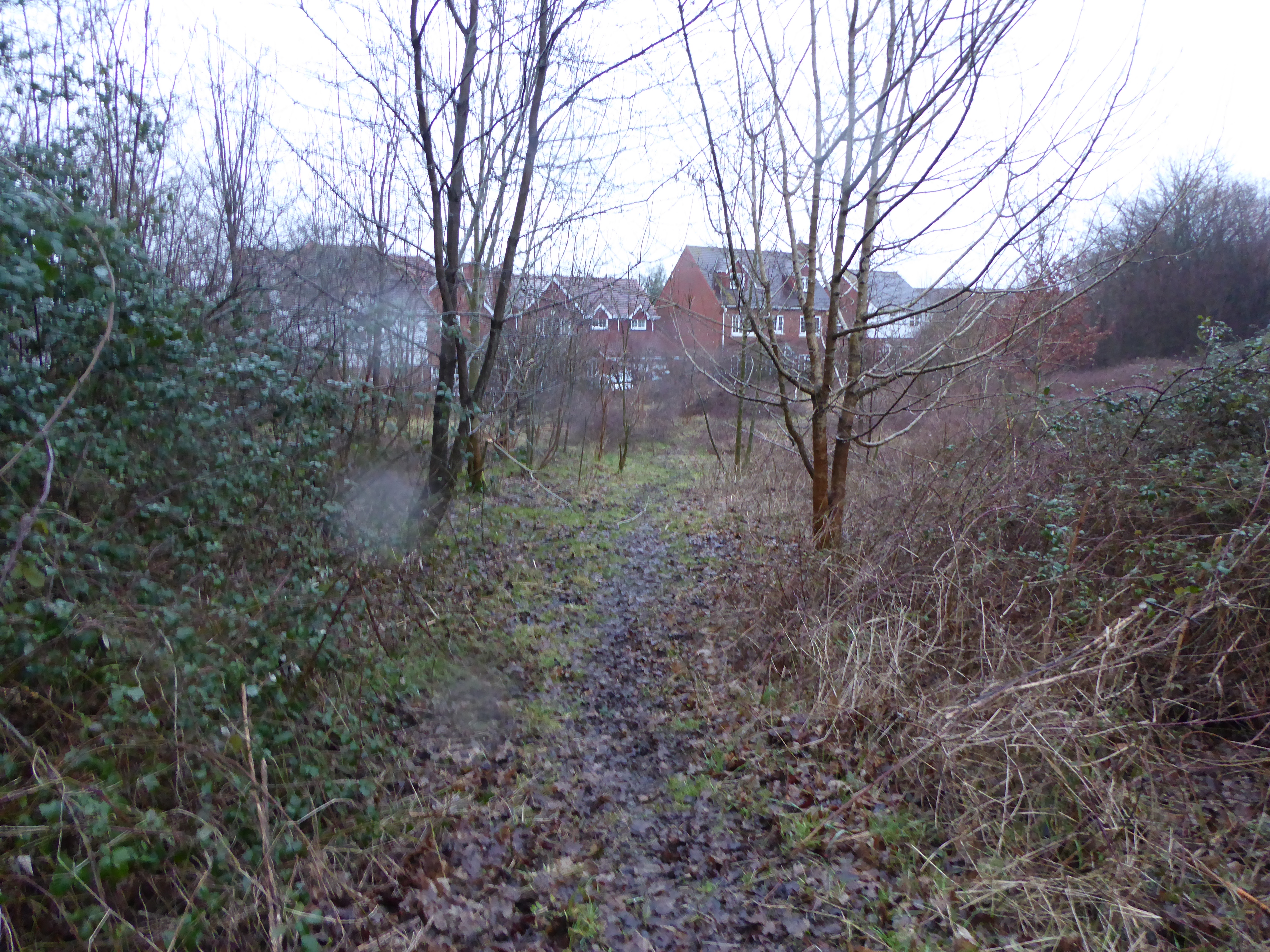
There are several walking trails within the woodland, allowing visitors to fully immerse themselves in the natural surroundings. These paths wind through the trees and offer stunning views of the surrounding countryside. Additionally, the wood is intersected by a small stream, further enhancing its scenic appeal.

With its peaceful atmosphere and abundance of natural beauty, Purchase Wood, Kent, provides a welcome escape from the hustle and bustle of everyday life. Whether it is for a leisurely stroll, a family picnic, or simply to connect with nature, this woodland is a hidden gem waiting to be discovered by nature enthusiasts and those seeking tranquility in the heart of Kent.

If you have any feedback on the listing, please let us know in the comments section below.

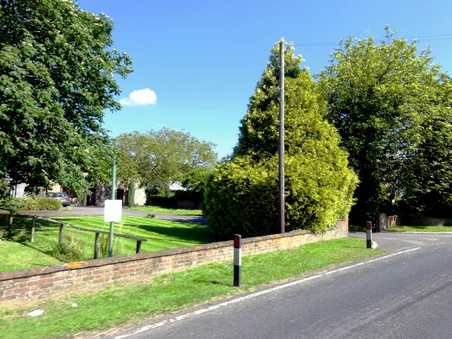
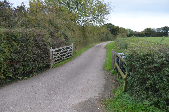
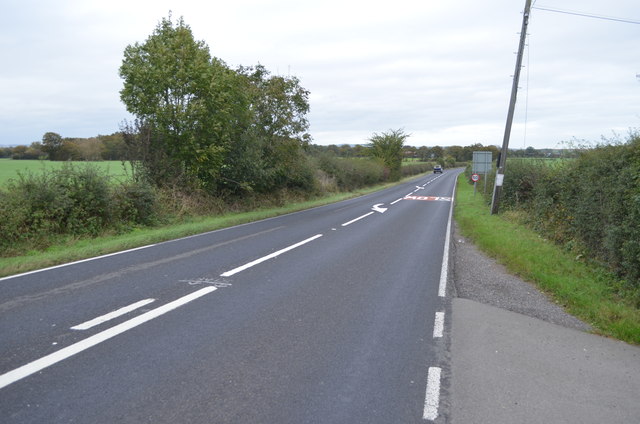
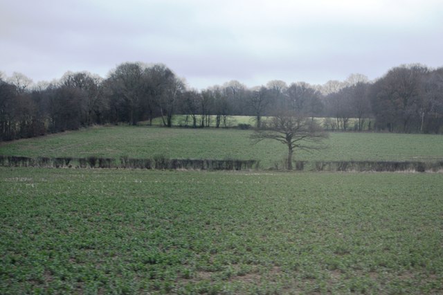
Purchase Wood Images

Images are sourced within 2km of 51.135279/0.80991135 or Grid Reference TQ9641. Thanks to Geograph Open Source API. All images are credited.

Ashford Road (A28) in 1985 An evening photo with lengthening shadows.
Ashford Road (A28) in 1985
An evening photo with lengthening shadows.
Bethersden, Spicer's Hill Bethersden, Spicer's Hill, Ashford Road, A28, Lodge Place.
Bethersden, Spicer's Hill
Bethersden, Spicer's Hill, Ashford Road, A28, Lodge Place.
Bethersden, Spicer's Hill Bethersden, Spicer's Hill, Ashford Road, A28, Lodge Place.
Bethersden, Spicer's Hill
Bethersden, Spicer's Hill, Ashford Road, A28, Lodge Place.
Bethersden, Spicer's Hill Bethersden, Spicer's Hill, Ashford Road, A28, Lodge Place.
Bethersden, Spicer's Hill
Bethersden, Spicer's Hill, Ashford Road, A28, Lodge Place.
Criol Road Towards Shadoxhurst.
Criol Road
Towards Shadoxhurst.
Entrance drive to Possingham Farm house Off the A28.
Entrance drive to Possingham Farm house
Off the A28.
A28 towards Ashford
A28 towards Ashford
Tree in a hedge
Tree in a hedge
Two trees in a hedge
Grazing by Ashford Rd
Bevenden House
Bevenden House
Barn Conversion, Lodge Place
Flat farmland by Ashford Rd
Farmland, Chilmington Green Road This will form part of a vast development, to be known as Chilmington Green, for which planning permission has been granted by Ashford Borough Council under application number 12/00400/AS. This is  an “outline application for a Comprehensive Mixed Use Development comprising: up to 5,750 residential units, in a mix of sizes, types and tenures; up to 10,000 m² (gross external floor space) of Class Bl use; up to 9,000 m² (gross external floor space) of Class Al to A5 uses; Education (including a secondary school of up to 8 ha and up to four primary schools of up to 2.1 ha each); Community Uses (class Dl) up to 7,000 m² (gross external floor space); Leisure Uses (class D2) up to 6,000 m² (gross external floor space); Provision of local recycling facilities; Provision of areas of formal and informal open space; Installation of appropriate utilities infrastructure as required to serve the development, including flood attenuation works, SUDS, water supply and wastewater infrastructure, gas supply, electricity supply (including substations), telecommunications infrastructure and renewable energy infrastructure (including CHP in the District Centre); Transport infrastructure, including provision of three accesses on to the A28, an access on to Coulter Road/Cuckoo Lane, other connections on to the local road network, and a network of internal roads, footpaths and cycle routes; New planting and landscaping, both within the Proposed Development and on its boundaries, and ecological enhancement works; and associated ground works where appearance, landscaping, layout and scale are reserved for future approval and where access is reserved for future approval with the exception of the three accesses on to the A28 and the access on to Coulter Road/Cuckoo Lane”.

Here, there is a footpath crossing a harvested field.
Farmland, Chilmington Green Road
This will form part of a vast development, to be known as Chilmington Green, for which planning permission has been granted by Ashford Borough Council under application number 12/00400/AS. This is an “outline application for a Comprehensive Mixed Use Development comprising: up to 5,750 residential units, in a mix of sizes, types and tenures; up to 10,000 m² (gross external floor space) of Class Bl use; up to 9,000 m² (gross external floor space) of Class Al to A5 uses; Education (including a secondary school of up to 8 ha and up to four primary schools of up to 2.1 ha each); Community Uses (class Dl) up to 7,000 m² (gross external floor space); Leisure Uses (class D2) up to 6,000 m² (gross external floor space); Provision of local recycling facilities; Provision of areas of formal and informal open space; Installation of appropriate utilities infrastructure as required to serve the development, including flood attenuation works, SUDS, water supply and wastewater infrastructure, gas supply, electricity supply (including substations), telecommunications infrastructure and renewable energy infrastructure (including CHP in the District Centre); Transport infrastructure, including provision of three accesses on to the A28, an access on to Coulter Road/Cuckoo Lane, other connections on to the local road network, and a network of internal roads, footpaths and cycle routes; New planting and landscaping, both within the Proposed Development and on its boundaries, and ecological enhancement works; and associated ground works where appearance, landscaping, layout and scale are reserved for future approval and where access is reserved for future approval with the exception of the three accesses on to the A28 and the access on to Coulter Road/Cuckoo Lane”. Here, there is a footpath crossing a harvested field.
Chilmington Green Road Opposite the row of trees another access/exit road into the Chilmington Green development has been created.

Planning permission has been granted by Ashford Borough Council under application number 12/00400/AS, for an “outline application for a Comprehensive Mixed Use Development comprising: up to 5,750 residential units, in a mix of sizes, types and tenures; up to 10,000 m² (gross external floor space) of Class Bl use; up to 9,000 m² (gross external floor space) of Class Al to A5 uses; Education (including a secondary school of up to 8 ha and up to four primary schools of up to 2.1 ha each); Community Uses (class Dl) up to 7,000 m² (gross external floor space); Leisure Uses (class D2) up to 6,000 m² (gross external floor space); Provision of local recycling facilities; Provision of areas of formal and informal open space; Installation of appropriate utilities infrastructure as required to serve the development, including flood attenuation works, SUDS, water supply and wastewater infrastructure, gas supply, electricity supply (including substations), telecommunications infrastructure and renewable energy infrastructure (including CHP in the District Centre); Transport infrastructure, including provision of three accesses on to the A28, an access on to Coulter Road/Cuckoo Lane, other connections on to the local road network, and a network of internal roads, footpaths and cycle routes; New planting and landscaping, both within the Proposed Development and on its boundaries, and ecological enhancement works; and associated ground works where appearance, landscaping, layout and scale are reserved for future approval and where access is reserved for future approval with the exception of the three accesses on to the A28 and the access on to Coulter Road/Cuckoo Lane”.
Chilmington Green Road
Opposite the row of trees another access/exit road into the Chilmington Green development has been created. Planning permission has been granted by Ashford Borough Council under application number 12/00400/AS, for an “outline application for a Comprehensive Mixed Use Development comprising: up to 5,750 residential units, in a mix of sizes, types and tenures; up to 10,000 m² (gross external floor space) of Class Bl use; up to 9,000 m² (gross external floor space) of Class Al to A5 uses; Education (including a secondary school of up to 8 ha and up to four primary schools of up to 2.1 ha each); Community Uses (class Dl) up to 7,000 m² (gross external floor space); Leisure Uses (class D2) up to 6,000 m² (gross external floor space); Provision of local recycling facilities; Provision of areas of formal and informal open space; Installation of appropriate utilities infrastructure as required to serve the development, including flood attenuation works, SUDS, water supply and wastewater infrastructure, gas supply, electricity supply (including substations), telecommunications infrastructure and renewable energy infrastructure (including CHP in the District Centre); Transport infrastructure, including provision of three accesses on to the A28, an access on to Coulter Road/Cuckoo Lane, other connections on to the local road network, and a network of internal roads, footpaths and cycle routes; New planting and landscaping, both within the Proposed Development and on its boundaries, and ecological enhancement works; and associated ground works where appearance, landscaping, layout and scale are reserved for future approval and where access is reserved for future approval with the exception of the three accesses on to the A28 and the access on to Coulter Road/Cuckoo Lane”.
Building site Viewed from near an access/exit road into the Chilmington Green development from <a href="https://www.geograph.org.uk/photo/6874543">TQ9739 : Chilmington Green Road</a>. 

Planning permission has been granted by Ashford Borough Council under application number 12/00400/AS, for an “outline application for a Comprehensive Mixed Use Development comprising: up to 5,750 residential units, in a mix of sizes, types and tenures; up to 10,000 m² (gross external floor space) of Class Bl use; up to 9,000 m² (gross external floor space) of Class Al to A5 uses; Education (including a secondary school of up to 8 ha and up to four primary schools of up to 2.1 ha each); Community Uses (class Dl) up to 7,000 m² (gross external floor space); Leisure Uses (class D2) up to 6,000 m² (gross external floor space); Provision of local recycling facilities; Provision of areas of formal and informal open space; Installation of appropriate utilities infrastructure as required to serve the development, including flood attenuation works, SUDS, water supply and wastewater infrastructure, gas supply, electricity supply (including substations), telecommunications infrastructure and renewable energy infrastructure (including CHP in the District Centre); Transport infrastructure, including provision of three accesses on to the A28, an access on to Coulter Road/Cuckoo Lane, other connections on to the local road network, and a network of internal roads, footpaths and cycle routes; New planting and landscaping, both within the Proposed Development and on its boundaries, and ecological enhancement works; and associated ground works where appearance, landscaping, layout and scale are reserved for future approval and where access is reserved for future approval with the exception of the three accesses on to the A28 and the access on to Coulter Road/Cuckoo Lane”.
Building site
Viewed from near an access/exit road into the Chilmington Green development from TQ9739 : Chilmington Green Road. Planning permission has been granted by Ashford Borough Council under application number 12/00400/AS, for an “outline application for a Comprehensive Mixed Use Development comprising: up to 5,750 residential units, in a mix of sizes, types and tenures; up to 10,000 m² (gross external floor space) of Class Bl use; up to 9,000 m² (gross external floor space) of Class Al to A5 uses; Education (including a secondary school of up to 8 ha and up to four primary schools of up to 2.1 ha each); Community Uses (class Dl) up to 7,000 m² (gross external floor space); Leisure Uses (class D2) up to 6,000 m² (gross external floor space); Provision of local recycling facilities; Provision of areas of formal and informal open space; Installation of appropriate utilities infrastructure as required to serve the development, including flood attenuation works, SUDS, water supply and wastewater infrastructure, gas supply, electricity supply (including substations), telecommunications infrastructure and renewable energy infrastructure (including CHP in the District Centre); Transport infrastructure, including provision of three accesses on to the A28, an access on to Coulter Road/Cuckoo Lane, other connections on to the local road network, and a network of internal roads, footpaths and cycle routes; New planting and landscaping, both within the Proposed Development and on its boundaries, and ecological enhancement works; and associated ground works where appearance, landscaping, layout and scale are reserved for future approval and where access is reserved for future approval with the exception of the three accesses on to the A28 and the access on to Coulter Road/Cuckoo Lane”.
Mock Lane The large building, behind the car, will open, upon completion, as the Chilmington Green Primary School.   

The photo of the <a href="https://www.geograph.org.uk/photo/5626559">TQ9740 : Contractor’s crossing, Mock Lane</a> shows the lane as it used to look, before the school was constructed.
Mock Lane
The large building, behind the car, will open, upon completion, as the Chilmington Green Primary School. The photo of the TQ9740 : Contractor’s crossing, Mock Lane shows the lane as it used to look, before the school was constructed.
Show me another place!

Purchase Wood is located at Grid Ref: TQ9641 (Lat: 51.135279, Lng: 0.80991135)

Administrative County: Kent

District: Ashford

Police Authority: Kent

What 3 Words

///committee.hosts.absorb. Near Shadoxhurst, Kent

Nearby Locations

Purchase Wood Fleeden

Related Wikis

RAF Ashford

Royal Air Force Ashford or more simply RAF Ashford is a former Royal Air Force Advanced Landing Ground in Kent, England. The landing ground is located...

Ashford Community Woodland

Ashford Community Woodland is a 13.8-hectare (34-acre) Local Nature Reserve on the western outskirts of Ashford in Kent. It is owned and managed by Ashford...

Chilmington Green

Chilmington Green was a hamlet on the edge of the Kentish Weald comprising 10 listed buildings. It is south-west of the town of Ashford. The population...

Hoad's Wood

Hoad's Wood is an 80.5-hectare (199-acre) biological Site of Special Scientific Interest west of Ashford in Kent. Natural England described the woodland...

Have you been to Purchase Wood?

Leave your review of Purchase Wood below (or comments, questions and feedback).