Old Gorse

Wood, Forest in Norfolk North Norfolk

England

Old Gorse

Post Office, Little Snoring See <a href="https://www.geograph.org.uk/photo/849761">TF9632 : Post Office and Village Store</a> for an earlier view.
Post Office, Little Snoring Credit: Hugh Venables

Old Gorse, located in Norfolk, England, is a picturesque woodland area known for its dense and ancient forest. Spread over a vast expanse of approximately 500 acres, it is a haven for nature lovers and outdoor enthusiasts. The woodland is situated in close proximity to the village of Old Gorse, which is a small rural community surrounded by scenic countryside.

The forest of Old Gorse is predominantly characterized by a diverse mix of broadleaf trees, including oak, beech, ash, and birch. These towering trees create a thick canopy that provides shelter and habitat for a wide array of wildlife. From rare bird species to elusive mammals, the forest is teeming with biodiversity.

Visitors to Old Gorse can explore a network of well-maintained walking trails that meander through the woods, allowing for an immersive experience in nature. The paths wind through ancient groves, past tranquil streams, and alongside vibrant wildflower meadows, providing a captivating and ever-changing vista throughout the seasons.

The woodland is managed by local conservation organizations, who strive to preserve its natural beauty and protect its delicate ecosystem. Conservation efforts include maintaining the integrity of the forest by preventing illegal logging and invasive species, as well as enhancing wildlife habitats through careful management practices.

Old Gorse, with its enchanting woodland and serene surroundings, offers a peaceful retreat for individuals seeking solace in nature or looking to engage in outdoor activities such as hiking, birdwatching, or photography. Its timeless beauty and ecological significance make it a cherished destination for locals and visitors alike.

If you have any feedback on the listing, please let us know in the comments section below.

Old Gorse Images

Images are sourced within 2km of 52.855151/0.91829933 or Grid Reference TF9632. Thanks to Geograph Open Source API. All images are credited.

Post Office, Little Snoring See <a href="https://www.geograph.org.uk/photo/849761">TF9632 : Post Office and Village Store</a> for an earlier view.
Post Office, Little Snoring
See TF9632 : Post Office and Village Store for an earlier view.
Little Snoring: St. Andrew's Church from the church car park 1
Little Snoring: St. Andrew's Church from the church car park 2
St Andrew's Church, Little Snoring A church with an intriguing history. The body of the church <span class="nowrap"><a title="https://historicengland.org.uk/listing/the-list/list-entry/1373753?section=official-list-entry" rel="nofollow ugc noopener" href="https://historicengland.org.uk/listing/the-list/list-entry/1373753?section=official-list-entry">Link</a><img style="margin-left:2px;" alt="External link" title="External link - shift click to open in new window" src="https://s1.geograph.org.uk/img/external.png" width="10" height="10"/></span> is quite distinct from the tower <span class="nowrap"><a title="https://historicengland.org.uk/listing/the-list/list-entry/1049264?section=official-list-entry" rel="nofollow ugc noopener" href="https://historicengland.org.uk/listing/the-list/list-entry/1049264?section=official-list-entry">Link</a><img style="margin-left:2px;" alt="External link" title="External link - shift click to open in new window" src="https://s1.geograph.org.uk/img/external.png" width="10" height="10"/></span> which appears to belong to another more or less contemporary building. Were there two churches here or did that belonging to the tower prove to be unstable and demolished (or never completed)?
St Andrew's Church, Little Snoring
A church with an intriguing history. The body of the church LinkExternal link is quite distinct from the tower LinkExternal link which appears to belong to another more or less contemporary building. Were there two churches here or did that belonging to the tower prove to be unstable and demolished (or never completed)?
Church of St Andrew and tower The round tower is not attached to the current church but belongs to an earlier church on this site
Church of St Andrew and tower
The round tower is not attached to the current church but belongs to an earlier church on this site
Old Milepost by Little Snoring Cast iron post by the UC road, in parish of Little Snoring (North Norfolk District), 70yds North of junction with Kettlestone Road, in the verge, on West side of road. Thos Brown (Burnham Market) iron casting, erected by the Wells to Fakenham turnpike trust in the 19th century. An earlier photograph can be found here <a title="https://www.geograph.org.uk/photo/6047918" href="https://www.geograph.org.uk/photo/6047918">Link</a>.

Inscription reads:-
 TO / WELLS / 8 / MILES : : LITTLE / SNORING : : TO / NORWICH / 24 / MILES 

Norfolk HER listed.
NHER Number: 56504 <span class="nowrap"><a title="https://www.heritagegateway.org.uk/Gateway/Results_Single.aspx?uid=MNF62913&resourceID=1002" rel="nofollow ugc noopener" href="https://www.heritagegateway.org.uk/Gateway/Results_Single.aspx?uid=MNF62913&resourceID=1002">Link</a><img style="margin-left:2px;" alt="External link" title="External link - shift click to open in new window" src="https://s1.geograph.org.uk/img/external.png" width="10" height="10"/></span>

Milestone Society National ID: NO_WF8b
Old Milepost by Little Snoring
Cast iron post by the UC road, in parish of Little Snoring (North Norfolk District), 70yds North of junction with Kettlestone Road, in the verge, on West side of road. Thos Brown (Burnham Market) iron casting, erected by the Wells to Fakenham turnpike trust in the 19th century. An earlier photograph can be found here Link. Inscription reads:- TO / WELLS / 8 / MILES : : LITTLE / SNORING : : TO / NORWICH / 24 / MILES Norfolk HER listed. NHER Number: 56504 LinkExternal link Milestone Society National ID: NO_WF8b
Fields beside Snoring Road, east of Kettlestone
View along dismantled railway line The line of trees at right denote the route of the single-track railway line that used to run between Langor Bridge and Thursford.
View along dismantled railway line
The line of trees at right denote the route of the single-track railway line that used to run between Langor Bridge and Thursford.
Approaching bridge PMY1 - 96 The bridge takes Snoring road over the dismantled single-track railway line that used to run between Langor Bridge and Thursford.
Approaching bridge PMY1 - 96
The bridge takes Snoring road over the dismantled single-track railway line that used to run between Langor Bridge and Thursford.
Straw bales beside the footpath to Barney
Footpath to Clipstone House A crop of maize can be seen at right.
Footpath to Clipstone House
A crop of maize can be seen at right.
Footpath to Kettlestone A crop of maize can be seen at left.
Footpath to Kettlestone
A crop of maize can be seen at left.
Poppies in sugar beet crop
Sugar beet crop by Croxton Mill
Fields east of Kettlestone
Farm track to Snoring Road, Kettlestone The track serves as a public footpath and leads to Clipstone House when followed in the opposite direction.
Farm track to Snoring Road, Kettlestone
The track serves as a public footpath and leads to Clipstone House when followed in the opposite direction.
A148 nears Little Snoring village boundary
Parish Church & Daffodils Little Snoring's round towered church of St Andrew in its isolated site north of the village.
Parish Church & Daffodils
Little Snoring's round towered church of St Andrew in its isolated site north of the village.
Show me another place!

Old Gorse is located at Grid Ref: TF9632 (Lat: 52.855151, Lng: 0.91829933)

Administrative County: Norfolk

District: North Norfolk

Police Authority: Norfolk

What 3 Words

///wide.threaded.removed. Near Fakenham, Norfolk

Related Wikis

RAF Little Snoring

Royal Air Force Little Snoring or more simply RAF Little Snoring is a former Royal Air Force station located north of the Norfolk village of Little Snoring...

Kettlestone

Kettlestone is a village and civil parish in the English county of Norfolk. It covers an area of 7.55 km2 (2.92 sq mi) and had a population of 177 in 85...
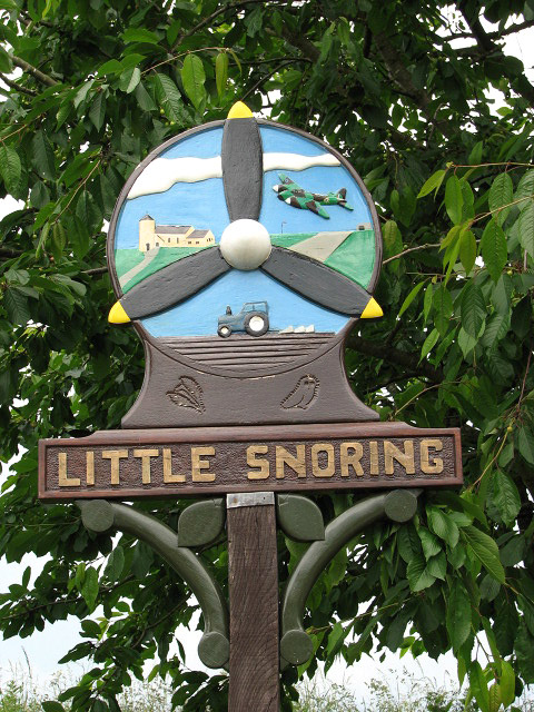
Little Snoring

Little Snoring is a village and a civil parish in Norfolk, England.The village is approximately 2 miles (3 km) east-north-east from the town of Fakenham...

Thursford Wood

Thursford Wood is a 10-hectare (25-acre) nature reserve north-east of Fakenham in Norfolk. It is managed by the Norfolk Wildlife Trust.The oak trees in...

Alethorpe

Alethorpe is a deserted medieval village site and former civil parish, now in the parish of Little Snoring, in the North Norfolk district, in the county...

Thursford Collection

The Thursford Collection is a museum located in Thursford, Norfolk. Founded by local man, the late George Cushing, it is now known for the scale of its...

Great Snoring

Great Snoring is a rural village in North Norfolk by the River Stiffkey, in the east of England. It is situated approximately 25 miles (40 km) north-west...

Thursford

Thursford is a village and civil parish in the county of Norfolk, eastern England. The village is 16.3 miles southwest of Cromer, 24.5 miles northwest...

Nearby Amenities

Located within 500m of 52.855151,0.91829933
Bus Stop
Green Man
Naptan AtcoCode: 2900S312
Naptan Bearing: SW
Naptan BusStopType: CUS
Naptan CommonName: Green Man
Naptan Indicator: adj
Naptan Landmark: public house
Naptan Latitude: 52.8517346
Naptan Locality: Little Snoring
Naptan Longitude: 0.9145307
Naptan NaptanCode: nfodtjwa
Naptan Street: A148 Holt Road
Source: naptan_import;survey
Lat/Long: 52.8519496/0.9148927
Bus Stop
Green Man
Kerb: raised
Naptan AtcoCode: 2900S316
Naptan Bearing: NE
Naptan BusStopType: CUS
Naptan CommonName: Green Man
Naptan Indicator: opp
Naptan Landmark: public house
Naptan Latitude: 52.8519605
Naptan Locality: Little Snoring
Naptan Longitude: 0.9144864
Naptan NaptanCode: nfodtjwm
Naptan Street: A148 Holt Road
Shelter: no
Source: naptan_import;survey
Tactile Paving: yes
Lat/Long: 52.8521294/0.9149919
The Green Man Camping
Phone: +44 1328879750
Tourism: camp_site
Lat/Long: 52.8515952/0.9147062
The data included in this document is from www.openstreetmap.org. The data is made available under ODbL.

Have you been to Old Gorse?

Leave your review of Old Gorse below (or comments, questions and feedback).