Butcher's Wood

Wood, Forest in Essex Colchester

England

Butcher's Wood

Lidl Supermarket, Gosbecks Road, Colchester
Lidl Supermarket, Gosbecks Road, Colchester Credit: Martin Tester

Butcher's Wood is a picturesque forest located in the county of Essex, England. Situated near the town of Saffron Walden, the wood covers an area of approximately 50 acres and is a popular destination for nature enthusiasts and outdoor lovers.

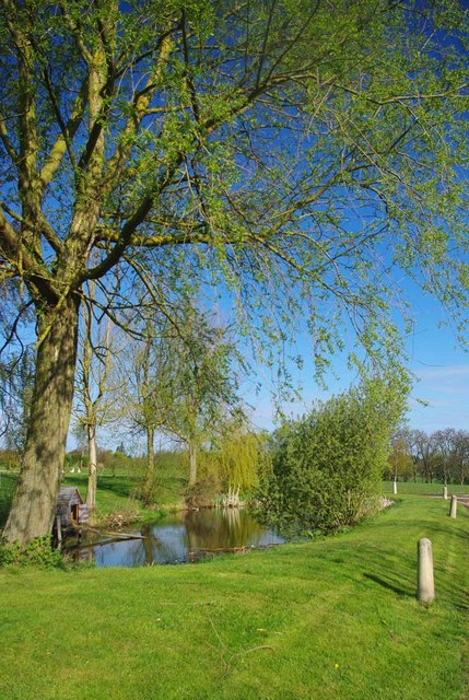
The wood is characterized by its diverse range of tree species, including oak, beech, and birch, which create a vibrant and colorful canopy throughout the year. The forest floor is covered in a thick carpet of moss and ferns, providing a lush and enchanting setting. Butcher's Wood is also home to a variety of wildlife, such as deer, foxes, and numerous bird species, making it a haven for wildlife enthusiasts and birdwatchers.

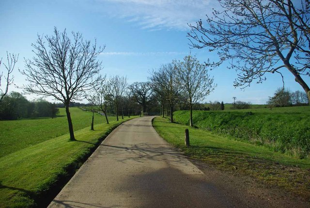
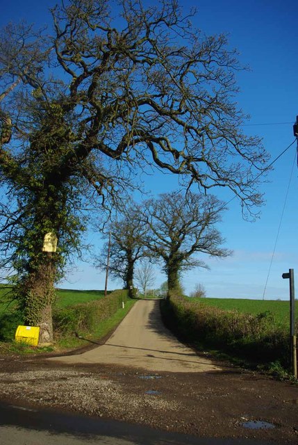
Visitors to Butcher's Wood can enjoy a network of well-maintained footpaths and trails, allowing them to explore the forest and discover its hidden treasures. The wood is also a popular spot for recreational activities such as walking, jogging, and cycling, providing a tranquil and peaceful environment for exercise and relaxation.

Butcher's Wood has a rich history, with evidence of human habitation dating back to the Iron Age. The wood has also played a role in local folklore and legends, adding an air of mystery and intrigue to its already enchanting atmosphere.

Overall, Butcher's Wood offers a serene and picturesque escape from the hustle and bustle of everyday life. Its natural beauty, diverse wildlife, and rich history make it a must-visit destination for nature lovers and those seeking a peaceful retreat in the heart of Essex.

If you have any feedback on the listing, please let us know in the comments section below.

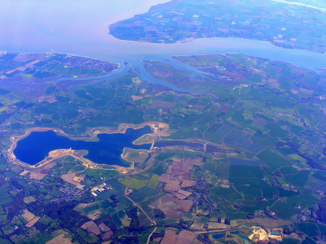
Butcher's Wood Images

Images are sourced within 2km of 51.861676/0.84374055 or Grid Reference TL9521. Thanks to Geograph Open Source API. All images are credited.

Lidl Supermarket, Gosbecks Road, Colchester
Morris Minor parked in Oliver's lane I took this pic in black & white to make it appear as an old fashioned photo from the 50s, and not as a modern pic from 2022. The car in question is a Morris Minor MM, which thankfully, has its original reg no (issued in 1952 in East Sussex according to "Where's It From; When was It Issued" book on UK registration numbers I have in my possession); and not one of those "age related" plates you often see on vehicles of its age (which I don't like).
Morris Minor parked in Oliver's lane
I took this pic in black & white to make it appear as an old fashioned photo from the 50s, and not as a modern pic from 2022. The car in question is a Morris Minor MM, which thankfully, has its original reg no (issued in 1952 in East Sussex according to "Where's It From; When was It Issued" book on UK registration numbers I have in my possession); and not one of those "age related" plates you often see on vehicles of its age (which I don't like).
Stoneleigh Park, Shrub End, Colchester Stoneleigh Park is a residential cul-de-sac in Shrub End, a suburb of Colchester in Essex.
Stoneleigh Park, Shrub End, Colchester
Stoneleigh Park is a residential cul-de-sac in Shrub End, a suburb of Colchester in Essex.
Bishop Road, Shrub End, Colchester Bishop Road is a residential road in Shrub End, a suburb of Colchester in Essex.
Bishop Road, Shrub End, Colchester
Bishop Road is a residential road in Shrub End, a suburb of Colchester in Essex.
The New Leather Bottle, Shrub End, Colchester The New Leather Bottle is a pub in Shrub End, a suburb of Colchester in Essex.
The New Leather Bottle, Shrub End, Colchester
The New Leather Bottle is a pub in Shrub End, a suburb of Colchester in Essex.
Shrub End Road, Shrub End, Colchester Shrub End Road is on the route of the B1022 road in the suburbs of Colchester in Essex.
Shrub End Road, Shrub End, Colchester
Shrub End Road is on the route of the B1022 road in the suburbs of Colchester in Essex.
Layer de la Haye and Abberton Reservoir from the air West Mersea on Mersea Island is to the right, Brightingsea is to the left, with the River Colne in between. Viewed from a Prague bound flight from Heathrow.
Layer de la Haye and Abberton Reservoir from the air
West Mersea on Mersea Island is to the right, Brightingsea is to the left, with the River Colne in between. Viewed from a Prague bound flight from Heathrow.
Layer de la Haye and Abberton Reservoir from the air Former RAF Bradwell <a href="https://www.geograph.org.uk/photo/2358320">TL9909 : Former RAF Bradwell Bay from the air</a> is visible in the distance. Viewed from a Prague bound flight from Heathrow.
Layer de la Haye and Abberton Reservoir from the air
Former RAF Bradwell TL9909 : Former RAF Bradwell Bay from the air is visible in the distance. Viewed from a Prague bound flight from Heathrow.
Gosbecks View
Gosbecks View
Upper Hill Farm Pond A small pond beside a footpath.
Upper Hill Farm Pond
A small pond beside a footpath.
Footpath to Fountain Lane The farm drive to Upper Hill Farm is a footpath that come out on Fountain Lane.
Footpath to Fountain Lane
The farm drive to Upper Hill Farm is a footpath that come out on Fountain Lane.
Footpath to Upper Hill farm Clear proof that Geographers think alike! I must have stood on Robert's wheel tracks however. I clearly got the better weather! see <a href="https://www.geograph.org.uk/photo/706823">TL9422 : The road to Upper Hill Farm</a>
Footpath to Upper Hill farm
Clear proof that Geographers think alike! I must have stood on Robert's wheel tracks however. I clearly got the better weather! see TL9422 : The road to Upper Hill Farm
Pedder's Close, Shrub End
All Saints Church, Shrub End
The Leather Bottle, Shrub End
Walking the Dogs Cheshunt Field
Walking the Dogs
Cheshunt Field
Roman River Valley Nature Reserve The Roman River running through the woodland in the Roman River Valley Nature Reserve, managed by the Essex Wildlife Trust <span class="nowrap"><a title="http://www.webcitation.org/6GRIiM1VU" rel="nofollow ugc noopener" href="http://www.webcitation.org/6GRIiM1VU">Link</a><img style="margin-left:2px;" alt="External link" title="External link - shift click to open in new window" src="https://s1.geograph.org.uk/img/external.png" width="10" height="10"/></span> .
Roman River Valley Nature Reserve
The Roman River running through the woodland in the Roman River Valley Nature Reserve, managed by the Essex Wildlife Trust LinkExternal link .
Needle Eye Wood, Roman River Valley Nature Reserve This woodland, on rising ground, is just south of the Roman River. 

For more info on the Roman River Valley Nature Reserve see <span class="nowrap"><a title="http://www.webcitation.org/6GRIiM1VU" rel="nofollow ugc noopener" href="http://www.webcitation.org/6GRIiM1VU">Link</a><img style="margin-left:2px;" alt="External link" title="External link - shift click to open in new window" src="https://s1.geograph.org.uk/img/external.png" width="10" height="10"/></span>
Needle Eye Wood, Roman River Valley Nature Reserve
This woodland, on rising ground, is just south of the Roman River. For more info on the Roman River Valley Nature Reserve see LinkExternal link
Show me another place!

Butcher's Wood is located at Grid Ref: TL9521 (Lat: 51.861676, Lng: 0.84374055)

Administrative County: Essex

District: Colchester

Police Authority: Essex

What 3 Words

///making.form.hammer. Near Layer de la Haye, Essex

Related Wikis

Colchester Zoo

Colchester Zoo is a zoological garden situated near Colchester, England. The zoo opened in 1963 and celebrated its 60th anniversary on 2 June 2023. It...

Heckfordbridge

Heckfordbridge or Heckford is a hamlet in the civil parish of Birch, in the county of Essex, England. The settlement is on the B1022 road, between Colchester...

Roman River Valley

Roman River Valley is a 17.8-hectare (44-acre) nature reserve north of Layer de la Haye in Essex. It is managed by the Essex Wildlife Trust.This wetland...

Alderman Blaxill School

Alderman Blaxill School was a secondary school with academy status in Colchester, Essex, and was the town's smallest secondary school. It closed in 2014...

Stanway Pegasus F.C.

Stanway Pegasus Football Club is a football club based in Stanway, England. They are currently members of the Eastern Counties League Division One North...

Layer de la Haye

Layer de la Haye (often spelled Layer-de-la-Haye; locally known just as Layer) is a village and civil parish in the City of Colchester district of Essex...

Birch, Essex

Birch is a village and civil parish in the City of Colchester district of Essex, England. It is located approximately 5 miles (8 km) south-west of Colchester...

The Stanway School

The Stanway School is a mixed secondary school located in Stanway in the English county of Essex.The school was converted to academy status in May 2013...

Nearby Amenities

Located within 500m of 51.861676,0.84374055
The data included in this document is from www.openstreetmap.org. The data is made available under ODbL.

Have you been to Butcher's Wood?

Leave your review of Butcher's Wood below (or comments, questions and feedback).