Holborn Dane Shaw

Wood, Forest in Kent Swale

England

Holborn Dane Shaw

Eastling: Frith farmhouse
Eastling: Frith farmhouse Credit: Michael Garlick

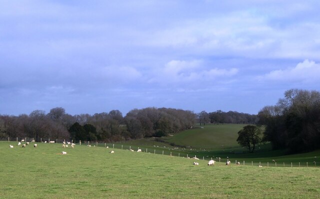
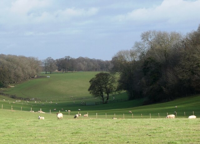
Holborn Dane Shaw is a small village located in the county of Kent, England. Situated amidst lush woodlands and serene forests, it offers a picturesque and tranquil environment for its residents. The village is nestled in the heart of the Kent Downs Area of Outstanding Natural Beauty, making it a haven for nature lovers and outdoor enthusiasts.

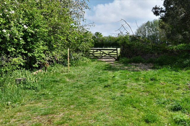
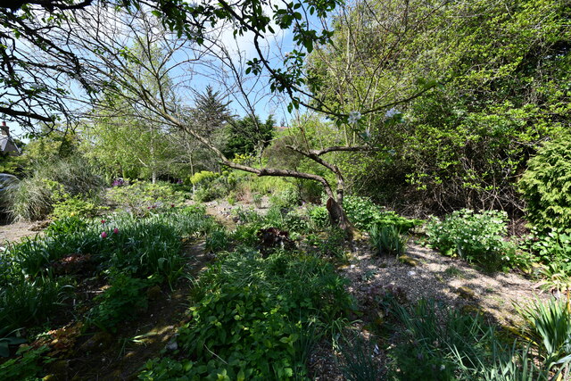
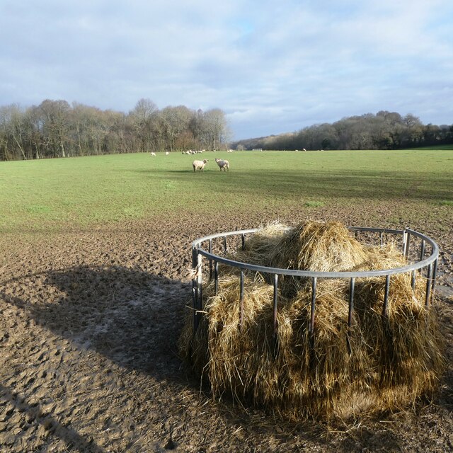
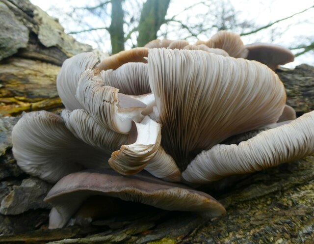
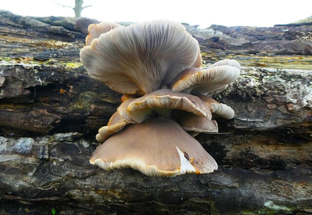
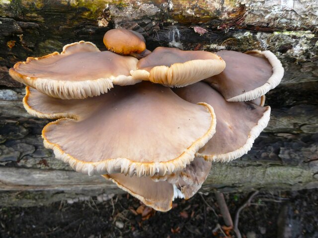
The woodlands surrounding Holborn Dane Shaw are home to a diverse range of flora and fauna, including ancient oak trees, wildflowers, and various bird species. This makes it an ideal destination for hiking, bird watching, and nature walks. The dense forests offer a sense of seclusion and provide a peaceful retreat from the hustle and bustle of city life.

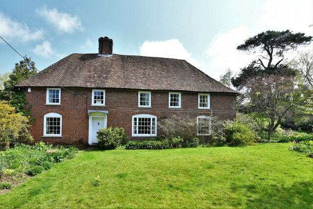
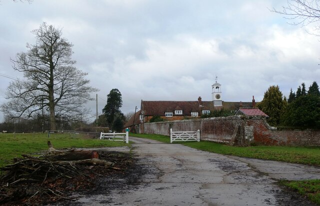
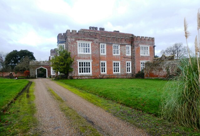
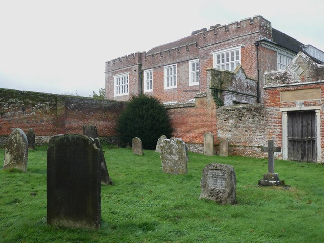
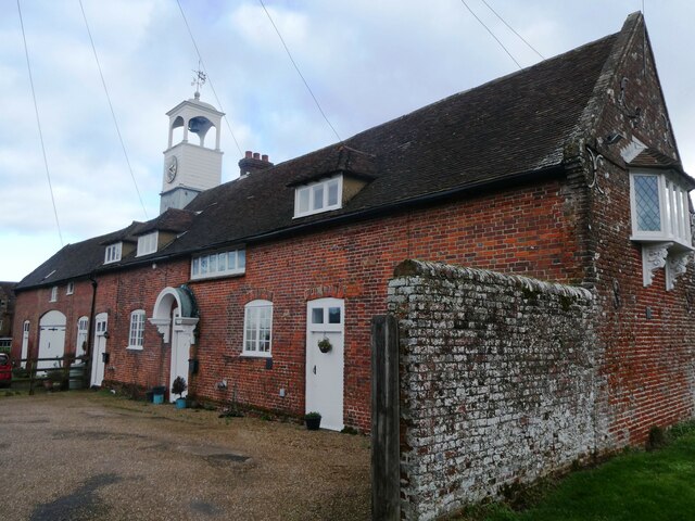
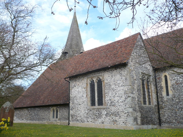
The village itself is a charming and close-knit community, with a population of around 300 residents. It boasts a rich history, with some buildings dating back to the 16th century. The traditional architecture and well-preserved cottages add to the village's rustic charm.

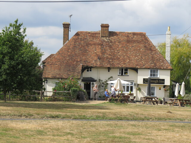
Although small, Holborn Dane Shaw offers basic amenities to its residents, including a local pub and a village hall used for community events. The village also has a primary school, ensuring that young families have access to education within the local area.

Overall, Holborn Dane Shaw, Kent (Wood, Forest) is a hidden gem in the English countryside. Its natural beauty, community spirit, and historical significance make it an attractive destination for those seeking a peaceful and idyllic rural lifestyle.

If you have any feedback on the listing, please let us know in the comments section below.

Holborn Dane Shaw Images

Images are sourced within 2km of 51.258633/0.80322486 or Grid Reference TQ9554. Thanks to Geograph Open Source API. All images are credited.

Eastling: Frith farmhouse
Eastling: Small field
Eastling: Frith farmhouse garden
The Plough at Stalisfield May take some finding but well worth the effort!
The Plough at Stalisfield
May take some finding but well worth the effort!
Valley Farm, Otterden From the lane running between Stalisfield Road and Rigshill Road.
Valley Farm, Otterden
From the lane running between Stalisfield Road and Rigshill Road.
Valley Farm, Otterden From the lane running between Stalisfield Road and Rigshill Road.
Valley Farm, Otterden
From the lane running between Stalisfield Road and Rigshill Road.
Valley Farm, Otterden The sheep looking back in the mid distance have just run away from the feeding bin.
Valley Farm, Otterden
The sheep looking back in the mid distance have just run away from the feeding bin.
Otterden Place The track through the gate leads to Hurstwood Road. Otterden Place is an early 17th-century estate with a house and parkland. The park was laid out during the mid-18th century.
Otterden Place
The track through the gate leads to Hurstwood Road. Otterden Place is an early 17th-century estate with a house and parkland. The park was laid out during the mid-18th century.
Fungus, Otterden Place On a rotting log near St. Lawrence's Cnurch. Otterden Place is an early 17th-century estate with a house and parkland. The park was laid out during the mid-18th century.
Fungus, Otterden Place
On a rotting log near St. Lawrence's Cnurch. Otterden Place is an early 17th-century estate with a house and parkland. The park was laid out during the mid-18th century.
Fungus, Otterden Place On a rotting log near St. Lawrence's Church. Otterden Place is an early 17th-century estate with a house and parkland. The park was laid out during the mid-18th century.
Fungus, Otterden Place
On a rotting log near St. Lawrence's Church. Otterden Place is an early 17th-century estate with a house and parkland. The park was laid out during the mid-18th century.
Otterden Place Otterden Place is an early 17th-century estate with a house and parkland. The park was laid out during the mid-18th century. The mansion, GV II* listed was built by Sir Anthony Aucher in mid 16th century, altered early 18th century and 1787-88. Altered and partly rebuilt by William Pilkington for Granville Hastings Wheler 1801-3.
Otterden Place
Otterden Place is an early 17th-century estate with a house and parkland. The park was laid out during the mid-18th century. The mansion, GV II* listed was built by Sir Anthony Aucher in mid 16th century, altered early 18th century and 1787-88. Altered and partly rebuilt by William Pilkington for Granville Hastings Wheler 1801-3.
Otterden Place Otterden Place is an early 17th-century estate with a house and parkland. The park was laid out during the mid-18th century. The mansion, GV II* listed, was built by Sir Anthony Aucher in the mid 16th century, altered early 18th century and 1787-88. Altered and partly rebuilt by William Pilkington for Granville Hastings Wheler 1801-3.Viewed from St. Lawrence's churchyard.
Otterden Place
Otterden Place is an early 17th-century estate with a house and parkland. The park was laid out during the mid-18th century. The mansion, GV II* listed, was built by Sir Anthony Aucher in the mid 16th century, altered early 18th century and 1787-88. Altered and partly rebuilt by William Pilkington for Granville Hastings Wheler 1801-3.Viewed from St. Lawrence's churchyard.
Stable Cottages, Otterden Place Otterden Place is an early 17th-century estate with a house and parkland. The park was laid out during the mid-18th century.
Stable Cottages, Otterden Place
Otterden Place is an early 17th-century estate with a house and parkland. The park was laid out during the mid-18th century.
Track leading to Bunce Court Road, Otterden Otterden Park, part of the Otterden estate. Otterden Place is an early 17th-century estate with a house and parkland. The park was laid out during the mid-18th century.
Track leading to Bunce Court Road, Otterden
Otterden Park, part of the Otterden estate. Otterden Place is an early 17th-century estate with a house and parkland. The park was laid out during the mid-18th century.
Gates and cattle grid, Otterden Place Leading into Bunce Court Road. Otterden Place is an early 17th-century estate with a house and parkland. The park was laid out during the mid-18th century.
Gates and cattle grid, Otterden Place
Leading into Bunce Court Road. Otterden Place is an early 17th-century estate with a house and parkland. The park was laid out during the mid-18th century.
Country lane, Otterden Can't find a name for this road but it might be part of Rigshill Road.
Country lane, Otterden
Can't find a name for this road but it might be part of Rigshill Road.
Otterden Road and Bunce Court Road junction Otterden Road continues to the left, and Bunce Court Road to the right.
Otterden Road and Bunce Court Road junction
Otterden Road continues to the left, and Bunce Court Road to the right.
Show me another place!

Holborn Dane Shaw is located at Grid Ref: TQ9554 (Lat: 51.258633, Lng: 0.80322486)

Administrative County: Kent

District: Swale

Police Authority: Kent

What 3 Words

///finds.cemented.stir. Near Charing, Kent

Related Wikis

Newnham, Kent

Newnham is a village and civil parish in the Syndale valley in Kent, England, in the administrative borough of Swale near the medieval market town of Faversham...

Faversham and Mid Kent (UK Parliament constituency)

Faversham and Mid Kent is a constituency represented in the House of Commons of the UK Parliament. Since 2015, the seat has been held by Helen Whately...

Eastling

Eastling is a small village 4½ miles to the southwest of Faversham, Kent in England. It is set in a designated Area of Outstanding Natural Beauty on the...

Otterden

Otterden is a civil parish and village on the Kent Downs in the borough of Maidstone in Kent, England. == History == Otterden is mentioned in the Domesday...

Stalisfield

Stalisfield is a village in the borough of Swale in Kent, England, located on a secondary road about 1½ miles (2.4 km) north of Charing and 5 miles south...

Bunce Court School

The Bunce Court School was an independent, private boarding school in the village of Otterden, in Kent, England. It was founded in 1933 by Anna Essinger...

Spuckles and Kennelling Woods

Spuckles and Kennelling Woods is a 20-hectare (49-acre) nature reserve north of Charing in Kent. It is managed by Kent Wildlife Trust. It is in the Kent...

Newnham Castle

Newnham Castle was a medieval castle in the village of Newnham, Kent, England. == History == Newnham Castle was built by the Normans, probably by Fulk...

Nearby Amenities

Located within 500m of 51.258633,0.80322486
The data included in this document is from www.openstreetmap.org. The data is made available under ODbL.

Have you been to Holborn Dane Shaw?

Leave your review of Holborn Dane Shaw below (or comments, questions and feedback).