Wingfield Shaw

Wood, Forest in Kent Swale

England

Wingfield Shaw

Cuckoo Wood Farm,  near Warren Street On Cold Harbour Road.
Cuckoo Wood Farm, near Warren Street Credit: pam fray

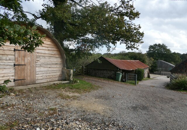
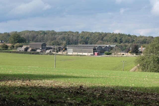
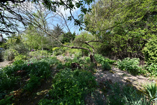
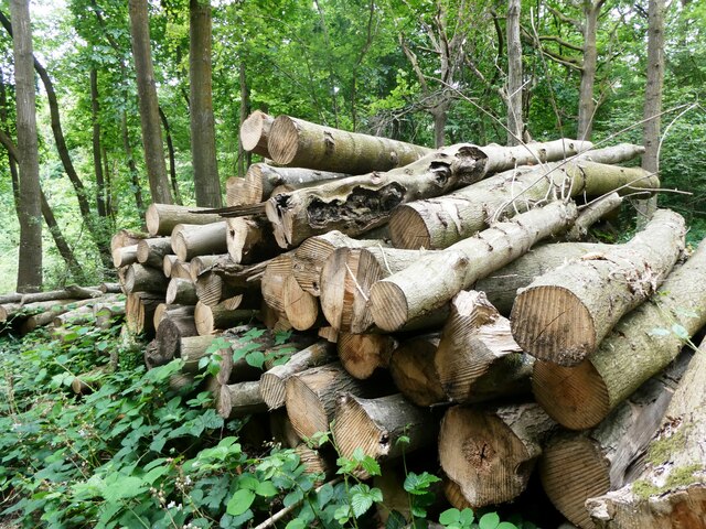
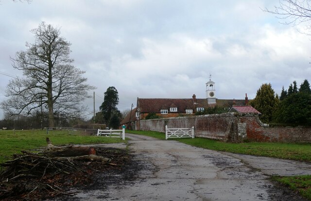
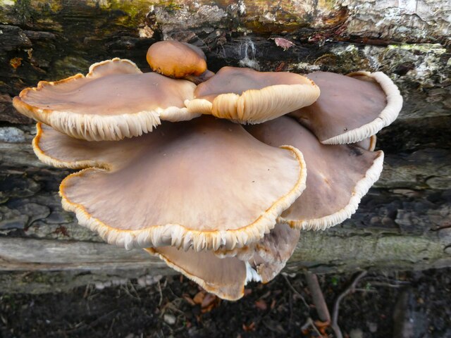
Wingfield Shaw is a small woodland area located in the county of Kent, England. Situated close to the village of Wingfield, it is a picturesque and tranquil spot that attracts nature enthusiasts and outdoor lovers. The woodland covers an area of approximately 50 acres and is characterized by its diverse range of tree species, including oak, birch, and beech.

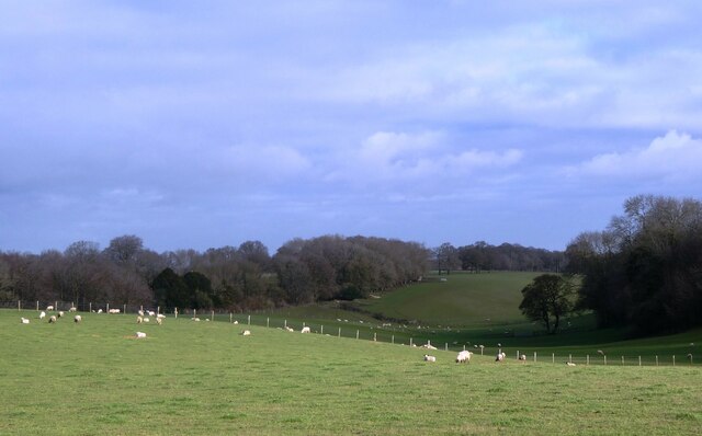
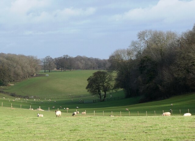
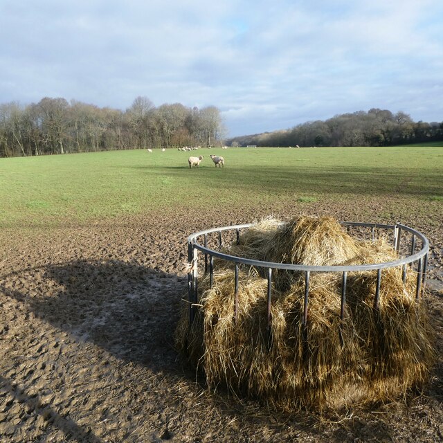
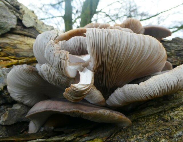
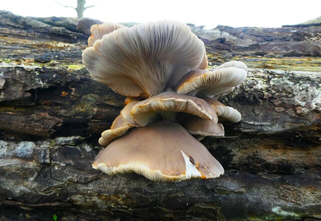
As part of the larger Blean Woods complex, Wingfield Shaw is an important habitat for wildlife. It provides a sanctuary for various bird species, such as woodpeckers, song thrushes, and tawny owls. Additionally, the woodland is home to a variety of small mammals, including foxes, badgers, and squirrels.

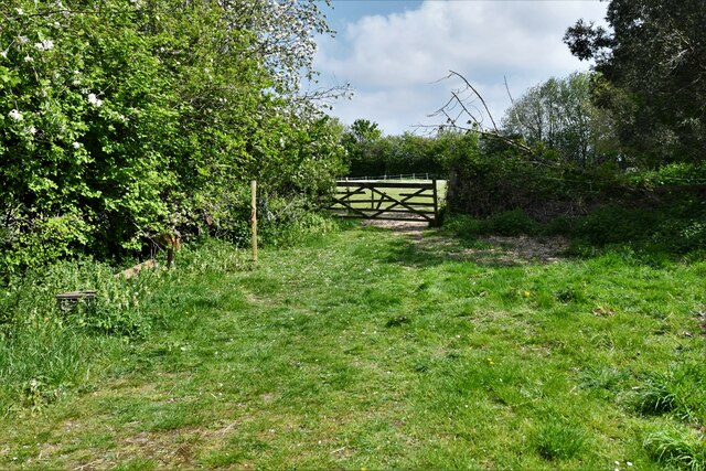
Wingfield Shaw offers visitors the opportunity to explore its peaceful surroundings through a network of well-maintained footpaths and trails. These paths wind their way through the woods, providing stunning views of the vibrant flora and fauna that thrive in the area. The woods are particularly popular during the spring, when they come alive with a carpet of bluebells and other wildflowers.

The woodland also serves as an educational resource, with local schools and conservation organizations using it as a site for nature studies and environmental workshops. It provides a valuable learning environment for children, allowing them to connect with nature and develop an appreciation for the natural world.

Overall, Wingfield Shaw is a delightful woodland retreat, offering visitors a chance to escape the hustle and bustle of everyday life and immerse themselves in the beauty of nature.

If you have any feedback on the listing, please let us know in the comments section below.

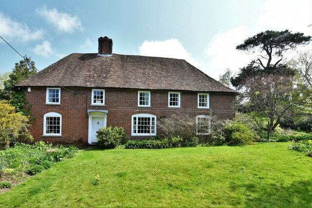
Wingfield Shaw Images

Images are sourced within 2km of 51.255332/0.7976203 or Grid Reference TQ9554. Thanks to Geograph Open Source API. All images are credited.

Cuckoo Wood Farm,  near Warren Street On Cold Harbour Road.
Cuckoo Wood Farm, near Warren Street
On Cold Harbour Road.
Hurst Farm, east of Warren Street Viewed from Bunce Court Road.
Hurst Farm, east of Warren Street
Viewed from Bunce Court Road.
Bunce Court Old House, near Warren Street On Bunce Court Road.
Bunce Court Old House, near Warren Street
On Bunce Court Road.
Plaque to Anna Essinger, Bunce Court Erected by the Association of Jewish Refugees. <span class="nowrap"><a title="https://en.wikipedia.org/wiki/Anna_Essinger" rel="nofollow ugc noopener" href="https://en.wikipedia.org/wiki/Anna_Essinger">Link</a><img style="margin-left:2px;" alt="External link" title="External link - shift click to open in new window" src="https://s1.geograph.org.uk/img/external.png" width="10" height="10"/></span>
Plaque to Anna Essinger, Bunce Court
Erected by the Association of Jewish Refugees. LinkExternal link
Eastling: Frith farmhouse
Eastling: Small field
Eastling: Frith farmhouse garden
Felled trees in Spuckles Wood, Stalisfield Kent Wildlife Trust is identifying ash trees affected by the ash die back fungal disease and managing the trees that present the greatest risk to public safety              in Spuckles, Kennelling and Bowls Woods.
Felled trees in Spuckles Wood, Stalisfield
Kent Wildlife Trust is identifying ash trees affected by the ash die back fungal disease and managing the trees that present the greatest risk to public safety in Spuckles, Kennelling and Bowls Woods.
The Plough at Stalisfield May take some finding but well worth the effort!
The Plough at Stalisfield
May take some finding but well worth the effort!
Muck spreading at Stalisfield Several tractor-trailers busy spreading much across the corn fields -  hard for walkers to keep boots clean!
Muck spreading at Stalisfield
Several tractor-trailers busy spreading much across the corn fields - hard for walkers to keep boots clean!
Valley Farm, Otterden From the lane running between Stalisfield Road and Rigshill Road.
Valley Farm, Otterden
From the lane running between Stalisfield Road and Rigshill Road.
Valley Farm, Otterden From the lane running between Stalisfield Road and Rigshill Road.
Valley Farm, Otterden
From the lane running between Stalisfield Road and Rigshill Road.
Valley Farm, Otterden The sheep looking back in the mid distance have just run away from the feeding bin.
Valley Farm, Otterden
The sheep looking back in the mid distance have just run away from the feeding bin.
Otterden Place The track through the gate leads to Hurstwood Road. Otterden Place is an early 17th-century estate with a house and parkland. The park was laid out during the mid-18th century.
Otterden Place
The track through the gate leads to Hurstwood Road. Otterden Place is an early 17th-century estate with a house and parkland. The park was laid out during the mid-18th century.
Fungus, Otterden Place On a rotting log near St. Lawrence's Cnurch. Otterden Place is an early 17th-century estate with a house and parkland. The park was laid out during the mid-18th century.
Fungus, Otterden Place
On a rotting log near St. Lawrence's Cnurch. Otterden Place is an early 17th-century estate with a house and parkland. The park was laid out during the mid-18th century.
Fungus, Otterden Place On a rotting log near St. Lawrence's Church. Otterden Place is an early 17th-century estate with a house and parkland. The park was laid out during the mid-18th century.
Fungus, Otterden Place
On a rotting log near St. Lawrence's Church. Otterden Place is an early 17th-century estate with a house and parkland. The park was laid out during the mid-18th century.
Otterden Place Otterden Place is an early 17th-century estate with a house and parkland. The park was laid out during the mid-18th century. The mansion, GV II* listed was built by Sir Anthony Aucher in mid 16th century, altered early 18th century and 1787-88. Altered and partly rebuilt by William Pilkington for Granville Hastings Wheler 1801-3.
Otterden Place
Otterden Place is an early 17th-century estate with a house and parkland. The park was laid out during the mid-18th century. The mansion, GV II* listed was built by Sir Anthony Aucher in mid 16th century, altered early 18th century and 1787-88. Altered and partly rebuilt by William Pilkington for Granville Hastings Wheler 1801-3.
Show me another place!

Wingfield Shaw is located at Grid Ref: TQ9554 (Lat: 51.255332, Lng: 0.7976203)

Administrative County: Kent

District: Swale

Police Authority: Kent

What 3 Words

///mimic.eclipses.deflated. Near Charing, Kent

Related Wikis

Faversham and Mid Kent (UK Parliament constituency)

Faversham and Mid Kent is a constituency represented in the House of Commons of the UK Parliament. Since 2015, the seat has been held by Helen Whately...

Otterden

Otterden is a civil parish and village on the Kent Downs in the borough of Maidstone in Kent, England. == History == Otterden is mentioned in the Domesday...

Newnham, Kent

Newnham is a village and civil parish in the Syndale valley in Kent, England, in the administrative borough of Swale near the medieval market town of Faversham...
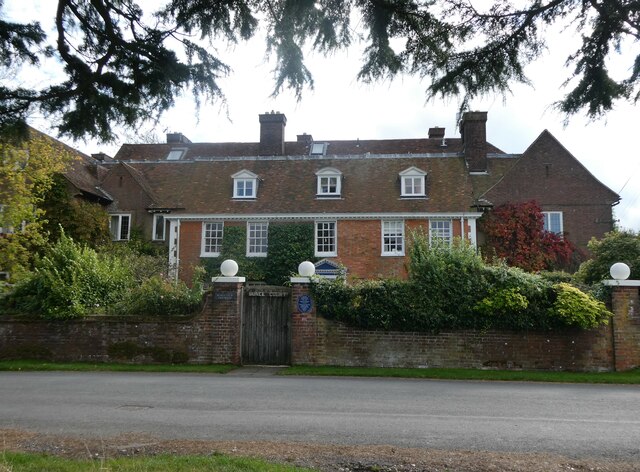
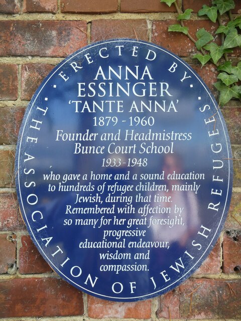
Bunce Court School

The Bunce Court School was an independent, private boarding school in the village of Otterden, in Kent, England. It was founded in 1933 by Anna Essinger...

Eastling

Eastling is a small village 4½ miles to the southwest of Faversham, Kent in England. It is set in a designated Area of Outstanding Natural Beauty on the...

Stalisfield

Stalisfield is a village in the borough of Swale in Kent, England, located on a secondary road about 1½ miles (2.4 km) north of Charing and 5 miles south...

Spuckles and Kennelling Woods

Spuckles and Kennelling Woods is a 20-hectare (49-acre) nature reserve north of Charing in Kent. It is managed by Kent Wildlife Trust. It is in the Kent...

Pines Garden

Pines Garden is a house and large garden, located on the winding beach road from St Margaret's at Cliffe village down to the beach at St Margeret's Bay...

Nearby Amenities

Located within 500m of 51.255332,0.7976203
Bus Stop
Otterden Corner House
Flag: no
Naptan AtcoCode: 2400A037950A
Naptan Bearing: S
Naptan BusStopType: CUS
Naptan CommonName: Otterden Corner House
Naptan Indicator: adj
Naptan Landmark: Corner Houses
Naptan NaptanCode: kntdpdjt
Naptan Street: Otterden Road
Naptan Verified: no
Public Transport: platform
Source: naptan_import
Lat/Long: 51.2588556/0.7945806
Post Box
Collection Plate: CP7D
Collection Times: Mo-Fr 09:00; Sa 07:00
Old Ref: ME13 11
Operator: Royal Mail
Operator Wikidata: Q638098
Ref: ME13 11D
Source: survey
Survey Date: 2023-10-09
Lat/Long: 51.2590153/0.7945398
The data included in this document is from www.openstreetmap.org. The data is made available under ODbL.

Have you been to Wingfield Shaw?

Leave your review of Wingfield Shaw below (or comments, questions and feedback).