Road Carr

Wood, Forest in Norfolk Breckland

England

Road Carr

Knettishall Heath
Knettishall Heath Credit: Dave Thompson

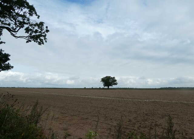
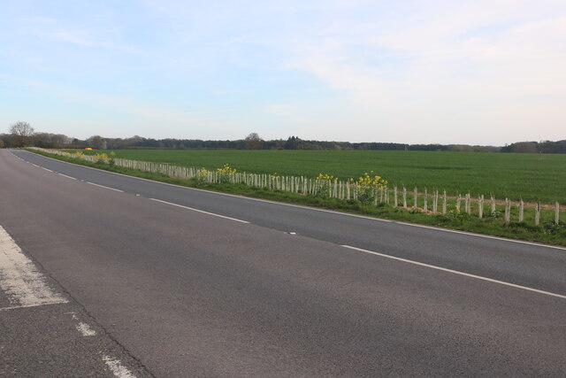
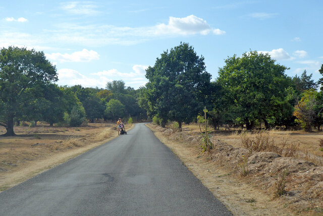
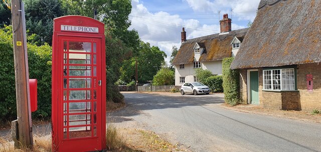
Road Carr is a small woodland area located in the picturesque county of Norfolk, England. The woodland is situated near the village of Wood, and is often referred to as the Road Carr Norfolk Wood or Road Carr Norfolk Forest. Spanning across approximately 50 acres, Road Carr offers a tranquil escape from the hustle and bustle of city life.

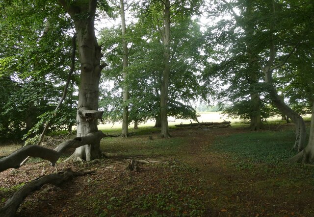
The woodland is home to a diverse range of flora and fauna, with a mixture of deciduous and coniferous trees creating a rich tapestry of colors throughout the seasons. Ancient oaks, beech, and birch trees dominate the landscape, providing a habitat for a variety of bird species, such as woodpeckers, owls, and thrushes. The forest floor is carpeted with bluebells, wild garlic, and ferns, adding to the enchanting atmosphere.

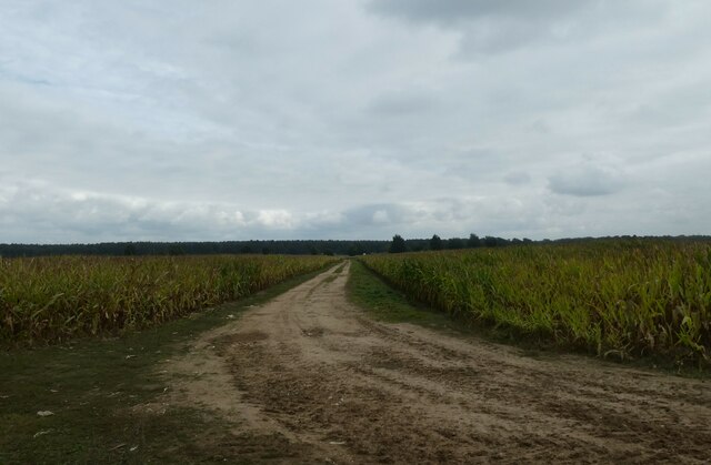
Road Carr is a popular destination for nature enthusiasts, walkers, and photographers, who are drawn to its natural beauty and peaceful surroundings. Several well-maintained paths and trails meander through the woodland, allowing visitors to explore its hidden gems and discover the abundant wildlife that calls Road Carr home.

The woodland is also a cherished location for educational visits, as it provides an opportunity for children and adults alike to learn about the importance of conservation and the delicate balance of ecosystems. Local schools often organize field trips to Road Carr, where students can participate in nature walks, learn about tree identification, and engage in hands-on activities related to environmental sustainability.

Overall, Road Carr in Norfolk is a haven for nature lovers, offering a serene escape into the heart of the woodland, teeming with life and natural beauty.

If you have any feedback on the listing, please let us know in the comments section below.

Road Carr Images

Images are sourced within 2km of 52.391272/0.87406235 or Grid Reference TL9580. Thanks to Geograph Open Source API. All images are credited.

Knettishall Heath
Knettishall Heath
On Heath Covert
On Heath Covert
Common Lizard
Common Lizard
Dog proof fence on the Peddars Way The Peddars Way is a long distance footpath in Norfolk. It is 46 miles long and follows the route of a Roman road. It has been suggested by more than one writer that it was not created by the Romans but was an ancient trackway, a branch or extension of the Icknield Way, used and remodelled by the Romans. The name is said to be derived from the Latin pedester – on foot.  It starts at Knettishall Heath in Suffolk (near the Norfolk-Suffolk border, about 4 miles east of Thetford), and it links with the Norfolk Coast Path at Holme-next-the-Sea.
Combined with the Norfolk Coast Path, it forms the Peddars Way & Norfolk Coast Path National Trail, one of 15 National Trails in England and Wales, and the two paths together run for 97 miles.
Wikipedia: <span class="nowrap"><a title="http://en.wikipedia.org/wiki/Peddars_Way" rel="nofollow ugc noopener" href="http://en.wikipedia.org/wiki/Peddars_Way">Link</a><img style="margin-left:2px;" alt="External link" title="External link - shift click to open in new window" src="https://s1.geograph.org.uk/img/external.png" width="10" height="10"/></span>
Dog proof fence on the Peddars Way
The Peddars Way is a long distance footpath in Norfolk. It is 46 miles long and follows the route of a Roman road. It has been suggested by more than one writer that it was not created by the Romans but was an ancient trackway, a branch or extension of the Icknield Way, used and remodelled by the Romans. The name is said to be derived from the Latin pedester – on foot. It starts at Knettishall Heath in Suffolk (near the Norfolk-Suffolk border, about 4 miles east of Thetford), and it links with the Norfolk Coast Path at Holme-next-the-Sea. Combined with the Norfolk Coast Path, it forms the Peddars Way & Norfolk Coast Path National Trail, one of 15 National Trails in England and Wales, and the two paths together run for 97 miles. Wikipedia: LinkExternal link
Gnarled old tree on the Peddars Way The Peddars Way is a long distance footpath in Norfolk. It is 46 miles long and follows the route of a Roman road. It has been suggested by more than one writer that it was not created by the Romans but was an ancient trackway, a branch or extension of the Icknield Way, used and remodelled by the Romans. The name is said to be derived from the Latin pedester – on foot.  It starts at Knettishall Heath in Suffolk (near the Norfolk-Suffolk border, about 4 miles east of Thetford), and it links with the Norfolk Coast Path at Holme-next-the-Sea.
Combined with the Norfolk Coast Path, it forms the Peddars Way & Norfolk Coast Path National Trail, one of 15 National Trails in England and Wales, and the two paths together run for 97 miles.
Wikipedia: <span class="nowrap"><a title="http://en.wikipedia.org/wiki/Peddars_Way" rel="nofollow ugc noopener" href="http://en.wikipedia.org/wiki/Peddars_Way">Link</a><img style="margin-left:2px;" alt="External link" title="External link - shift click to open in new window" src="https://s1.geograph.org.uk/img/external.png" width="10" height="10"/></span>
Gnarled old tree on the Peddars Way
The Peddars Way is a long distance footpath in Norfolk. It is 46 miles long and follows the route of a Roman road. It has been suggested by more than one writer that it was not created by the Romans but was an ancient trackway, a branch or extension of the Icknield Way, used and remodelled by the Romans. The name is said to be derived from the Latin pedester – on foot. It starts at Knettishall Heath in Suffolk (near the Norfolk-Suffolk border, about 4 miles east of Thetford), and it links with the Norfolk Coast Path at Holme-next-the-Sea. Combined with the Norfolk Coast Path, it forms the Peddars Way & Norfolk Coast Path National Trail, one of 15 National Trails in England and Wales, and the two paths together run for 97 miles. Wikipedia: LinkExternal link
Distant tree seen from the Peddars Way The Peddars Way is a long distance footpath in Norfolk. It is 46 miles long and follows the route of a Roman road. It has been suggested by more than one writer that it was not created by the Romans but was an ancient trackway, a branch or extension of the Icknield Way, used and remodelled by the Romans. The name is said to be derived from the Latin pedester – on foot.  It starts at Knettishall Heath in Suffolk (near the Norfolk-Suffolk border, about 4 miles east of Thetford), and it links with the Norfolk Coast Path at Holme-next-the-Sea.
Combined with the Norfolk Coast Path, it forms the Peddars Way & Norfolk Coast Path National Trail, one of 15 National Trails in England and Wales, and the two paths together run for 97 miles.
Wikipedia: <span class="nowrap"><a title="http://en.wikipedia.org/wiki/Peddars_Way" rel="nofollow ugc noopener" href="http://en.wikipedia.org/wiki/Peddars_Way">Link</a><img style="margin-left:2px;" alt="External link" title="External link - shift click to open in new window" src="https://s1.geograph.org.uk/img/external.png" width="10" height="10"/></span>
Distant tree seen from the Peddars Way
The Peddars Way is a long distance footpath in Norfolk. It is 46 miles long and follows the route of a Roman road. It has been suggested by more than one writer that it was not created by the Romans but was an ancient trackway, a branch or extension of the Icknield Way, used and remodelled by the Romans. The name is said to be derived from the Latin pedester – on foot. It starts at Knettishall Heath in Suffolk (near the Norfolk-Suffolk border, about 4 miles east of Thetford), and it links with the Norfolk Coast Path at Holme-next-the-Sea. Combined with the Norfolk Coast Path, it forms the Peddars Way & Norfolk Coast Path National Trail, one of 15 National Trails in England and Wales, and the two paths together run for 97 miles. Wikipedia: LinkExternal link
Small copse on the Peddars Way The Peddars Way is a long distance footpath in Norfolk. It is 46 miles long and follows the route of a Roman road. It has been suggested by more than one writer that it was not created by the Romans but was an ancient trackway, a branch or extension of the Icknield Way, used and remodelled by the Romans. The name is said to be derived from the Latin pedester – on foot.  It starts at Knettishall Heath in Suffolk (near the Norfolk-Suffolk border, about 4 miles east of Thetford), and it links with the Norfolk Coast Path at Holme-next-the-Sea.
Combined with the Norfolk Coast Path, it forms the Peddars Way & Norfolk Coast Path National Trail, one of 15 National Trails in England and Wales, and the two paths together run for 97 miles.
Wikipedia: <span class="nowrap"><a title="http://en.wikipedia.org/wiki/Peddars_Way" rel="nofollow ugc noopener" href="http://en.wikipedia.org/wiki/Peddars_Way">Link</a><img style="margin-left:2px;" alt="External link" title="External link - shift click to open in new window" src="https://s1.geograph.org.uk/img/external.png" width="10" height="10"/></span>
Small copse on the Peddars Way
The Peddars Way is a long distance footpath in Norfolk. It is 46 miles long and follows the route of a Roman road. It has been suggested by more than one writer that it was not created by the Romans but was an ancient trackway, a branch or extension of the Icknield Way, used and remodelled by the Romans. The name is said to be derived from the Latin pedester – on foot. It starts at Knettishall Heath in Suffolk (near the Norfolk-Suffolk border, about 4 miles east of Thetford), and it links with the Norfolk Coast Path at Holme-next-the-Sea. Combined with the Norfolk Coast Path, it forms the Peddars Way & Norfolk Coast Path National Trail, one of 15 National Trails in England and Wales, and the two paths together run for 97 miles. Wikipedia: LinkExternal link
Pathway through a field seen from the Peddars Way
Pavilion at School Plantation
Dolphin Business Park on Thetford Road
Thetford Road between Shadwell and Riddlesworth
Home Farm, Riddlesworth
Road across Knettishall Heath Nature Reserve
Lane towards Rushford from the east
Red telephone box on The Street, Gasthorpe
Hall Farm, Knettishall
Show me another place!

Road Carr is located at Grid Ref: TL9580 (Lat: 52.391272, Lng: 0.87406235)

Administrative County: Norfolk

District: Breckland

Police Authority: Norfolk

What 3 Words

///trump.comb.headliner. Near East Harling, Norfolk

Related Wikis

Knettishall Heath

Knettishall Heath is a 91.7-hectare (227-acre) biological Site of Special Scientific Interest west of Knettishall in Suffolk. A larger area of 176 hectares...

Iceni Way

The Iceni Way is a collective name for several long-distance footpaths running from Knettishall Heath to Hunstanton via the Little Ouse and Great Ouse...

Riddlesworth Hall

Riddlesworth Hall is a country house, and was formerly used as a boarding school. It is located in Riddlesworth, Norfolk, England. == History == It was...

Riddlesworth

Riddlesworth is a civil parish in the English county of Norfolk. It covers an area of 8.26 km2 (3.19 sq mi) and had a population of 147 in 48 households...

Knettishall

Knettishall is a village and civil parish in the West Suffolk district of Suffolk in eastern England. Located on the south bank of the River Little Ouse...

RAF Knettishall

RAF Knettishall is a former World War II airfield in Suffolk. During the conflict, it was numbered as Station 136 by the United States Army Air Forces...

Roman Catholic Diocese of East Anglia

The Diocese of East Anglia (Latin: Dioecesis Angliae Orientalis) is a Latin diocese of the Catholic Church covering the counties of Cambridgeshire, Norfolk...

Coney Weston

Coney Weston is a village and civil parish in Suffolk, England, within the West Suffolk district. It is a primarily rural residential town that has dormitory...

Nearby Amenities

Located within 500m of 52.391272,0.87406235
Knettishall Heath Country Park
Local Ref: IN
Naptan AtcoCode: 390050015
Naptan Bearing: W
Naptan BusStopType: CUS
Naptan CommonName: Country Park
Naptan Indicator: in
Naptan Landmark: Country Park
Naptan NaptanCode: sufgdamp
Naptan Street: On Site
Naptan Verified: no
Source: naptan_import
Lat/Long: 52.3894538/0.8712766
Disused: yes
Disused Highway: bus_stop
Lat/Long: 52.3930841/0.8717436
Disused: yes
Disused Highway: bus_stop
Lat/Long: 52.3930674/0.8716052
Barrier: teeth
Note: sprung teeth to allow exit only
Lat/Long: 52.3891499/0.8733035
Barrier: cattle_grid
Lat/Long: 52.3886339/0.8711399
Barrier: bar
Colour: brown
Foot: yes
Material: wood
Lat/Long: 52.3883245/0.8795263
Bench
Backrest: no
Colour: light_brown
Inscription: no
Material: wood
Seats: 3
Lat/Long: 52.3903272/0.8687643
Fixme: incomplete
Lat/Long: 52.3883405/0.8730126
Information: board
Tourism: information
Lat/Long: 52.3893216/0.8721708
Covered: yes
Leisure: picnic_table
Material: wood
Lat/Long: 52.3894188/0.8718609
Drinking Water
Indoor: yes
Lat/Long: 52.3896122/0.8712133
Leisure: picnic_table
Lat/Long: 52.3896699/0.8720017
Leisure: picnic_table
Lat/Long: 52.3896815/0.8718033
Leisure: picnic_table
Lat/Long: 52.3891391/0.868384
Bench
Lat/Long: 52.3894452/0.8682257
Bench
Lat/Long: 52.3895653/0.8695277
Barrier: kissing_gate
Lat/Long: 52.3894598/0.870635
Waste Basket
Colour: green
Material: metal
Waste: dog_excrement
Lat/Long: 52.3895342/0.8711133
Barrier: bollard
Lat/Long: 52.3892296/0.8681317
Barrier: cattle_grid
Horse: no
Lat/Long: 52.3880435/0.8741043
Picnic Bench
Covered: no
Inscription: High Fire Risk / No BBQs or fires anywhere on the nature reserve / Thank you
Leisure: picnic_table
Material: wood
Operator: Suffolk Wildlife Trust
Lat/Long: 52.3888704/0.8730911
Covered: yes
Leisure: picnic_table
Material: wood
Lat/Long: 52.3893402/0.8724359
Covered: yes
Leisure: picnic_table
Material: wood
Lat/Long: 52.3893517/0.8726961
Barrier: kissing_gate
Lat/Long: 52.3896443/0.8706346
Polish Memorial
Historic: memorial
Inscription: After the Second World War Polish Soldiers of the 3rd Carpathian Division arrived at Riddlesworth Camp from Italy and lived here with their families.
Lat/Long: 52.3942571/0.8712726
Waterway: weir
Lat/Long: 52.3900033/0.8726259
Leisure: picnic_table
Lat/Long: 52.388975/0.8711795
Barrier: kissing_gate
Lat/Long: 52.3880812/0.872152
Leisure: playground
Lat/Long: 52.3895852/0.8719277
Waste Basket
Waste: dog_excrement
Lat/Long: 52.3880397/0.8721002
Dog Poo Post
Note: Post for temporarily hanging dog poo bags
Lat/Long: 52.3893249/0.8696057
Barrier: kissing_gate
Colour: brown
Material: wood
Lat/Long: 52.3878545/0.8729812
Life Ring
Emergency: life_ring
Lat/Long: 52.3899908/0.872131
Vending Machine
Colour: dark_green
Inscription: Flowbird
Payment Cash: no
Payment Contactless: yes
Payment Mastercard: yes
Payment Visa: yes
Ref: 4868
Vending: parking_tickets
Lat/Long: 52.3894563/0.8716589
High Fire Risk
Board Type: notice
Description: No BBQs or fires anywhere on the nature reserve. Thank you
Information: board
Inscription: Please help us to protect this sensitive habiat. Do no river dip or swim here. / This platform is for learning activities and quiet appreciation only.
Operator: Suffolk Wildlife Trust
Tourism: information
Lat/Long: 52.390311/0.8680601
Blue Arrow
Description: Blue arrow, wheelchair and water symbols
Direction: W
Hiking: yes
Information: route_marker
Material: wood
Tourism: information
Lat/Long: 52.3903104/0.868221
Dogs should be on a short lead all year.
Board Type: notice
Description: Dogs are not permitted to swim in the river.
Information: board
Inscription: Please help us to protect the Little Ouse, which is a vitally important habitat for the red-list endangered water vole.
Material: wood
Operator: Suffolk Wildlife Trust
Tourism: information
Lat/Long: 52.3901334/0.8706477
Blue Arrow
Description: Blue arrow, wheelchair and water symbols
Direction: WNW
Hiking: yes
Information: route_marker
Material: wood
Tourism: information
Lat/Long: 52.3901281/0.8706839
Blue Arrow
Description: Blue arrow, wheelchair and water symbols
Direction: N
Hiking: yes
Information: route_marker
Material: wood
Tourism: information
Lat/Long: 52.3896908/0.8706725
Knettishall Heath
Boundary: marker
Direction: 343
Inscription: Welcome
Material: wood
Operator: Suffolk Wildlife Trust
Lat/Long: 52.3896667/0.8731636
Barrier: kissing_gate
Material: wood
Lat/Long: 52.3895631/0.8732309
Knettishall Heath Nature Reserve Car Park
Board Type: notice
Brand: RingGo
Description: Terms and conditions upon entry to this private land.
Information: board
Operator: Suffolk Wildlife Trust
Ref: 4868
Tourism: information
Lat/Long: 52.3894582/0.8716841
Covered: yes
Leisure: picnic_table
Material: wood
Lat/Long: 52.389328/0.872133
Covered: no
Leisure: picnic_table
Material: wood
Lat/Long: 52.3895005/0.8727144
Covered: yes
Leisure: picnic_table
Material: wood
Lat/Long: 52.389453/0.8720291
Heathland and Woodland Trails
Hiking: yes
Information: guidepost
Inscription: [Red rabbit] Heathland Trail 1.5 miles / [Yellow tree] Woodland Trail 2.5 miles / [Green rabbit] Heathland trail 2.5 miles
Material: wood
Tourism: information
Lat/Long: 52.3890757/0.8722852
Pay and stay
Board Type: notice
Description: Monday - Sunday, 10:00 – 21:00 / Free Parking between 05:00 - 10:00 AM / No parking allowed after 21:00
Information: board
Operator: Minster Baywatch Ltd
Tourism: information
Lat/Long: 52.3892627/0.8724059
ANPR
Camera Mount: pole
Camera Type: fixed
Direction: 245
Man Made: surveillance
Surveillance: public
Surveillance Type: camera
Surveillance Zone: parking
Lat/Long: 52.3891617/0.8732957
Man Made: traffic_sign
Traffic Sign: directions
Lat/Long: 52.3884013/0.8739884
Parking
Fee: no
Informal: yes
Parking: surface
Surface: ground
Lat/Long: 52.3884782/0.873224
Yellow Tree
Direction: NE
Hiking: yes
Information: route_marker
Material: wood
Tourism: information
Lat/Long: 52.3884643/0.872996
Yellow Tree
Direction: WNW
Hiking: yes
Information: route_marker
Material: wood
Tourism: information
Lat/Long: 52.3880107/0.8730637
Yellow Tree
Direction: NNE
Hiking: yes
Information: route_marker
Material: wood
Tourism: information
Lat/Long: 52.387248/0.872646
Power: pole
Lat/Long: 52.3951786/0.8775973
Power: pole
Lat/Long: 52.3941082/0.877828
Power: pole
Lat/Long: 52.3931769/0.8780211
Power: pole
Lat/Long: 52.3922406/0.8782303
Power: pole
Lat/Long: 52.3913445/0.8784275
Power: pole
Lat/Long: 52.3906905/0.8785602
Power: pole
Lat/Long: 52.3899228/0.8787279
Power: pole
Lat/Long: 52.3892206/0.8788714
Power: pole
Ref: 139882
Lat/Long: 52.3884038/0.8790538
Give Way
Lat/Long: 52.3884852/0.8738474
Give Way
Lat/Long: 52.3884431/0.87386
The data included in this document is from www.openstreetmap.org. The data is made available under ODbL.

Have you been to Road Carr?

Leave your review of Road Carr below (or comments, questions and feedback).