Brownmill Spinney

Wood, Forest in Kent Ashford

England

Brownmill Spinney

Pluckley Road Pluckley Road is seen here from the junction with Surrenden Road.
Pluckley Road Credit: Marathon

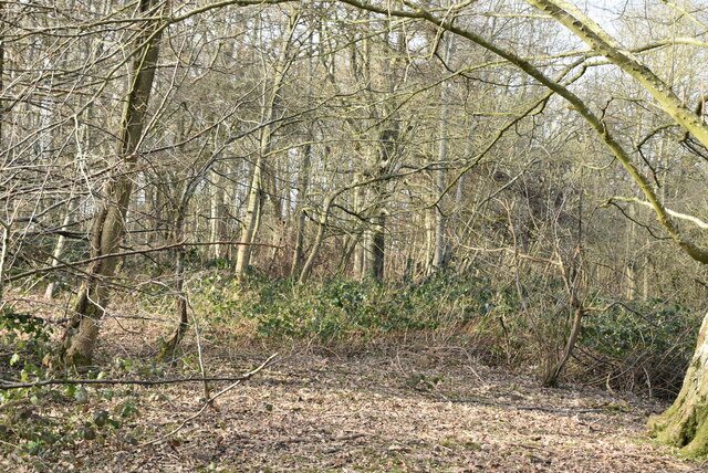
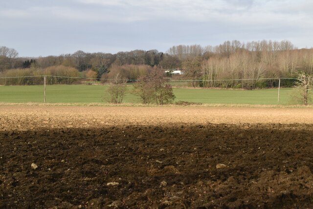
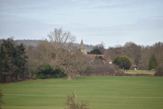
Brownmill Spinney is a small woodland area located in the county of Kent, England. Situated near the village of Brownmill, the spinney covers an area of approximately 10 acres. It is nestled amidst the picturesque countryside, surrounded by rolling hills and meadows.

The spinney is primarily composed of native deciduous trees, including oak, beech, and birch, providing a rich habitat for a diverse range of flora and fauna. The woodland floor is adorned with wildflowers in the spring and summer, creating a colorful and vibrant setting. The canopy of the trees offers a cool and shaded environment, making it an ideal spot for leisurely walks or picnics during the warmer months.

The spinney is a popular destination for nature enthusiasts and birdwatchers alike. It is home to a variety of bird species, including woodpeckers, owls, and thrushes. The tranquil atmosphere and abundance of wildlife make it a haven for those seeking a peaceful retreat from the bustle of everyday life.

Access to Brownmill Spinney is provided via a network of well-maintained footpaths and trails, ensuring visitors can explore the area easily. The spinney is open to the public year-round and is free to enter. It is managed by the local council, who work to preserve the natural beauty and integrity of the woodland.

Overall, Brownmill Spinney offers a serene and idyllic setting for nature lovers to immerse themselves in the beauty of the Kentish countryside. Whether it's a leisurely stroll or a birdwatching adventure, this small woodland is a hidden gem waiting to be discovered.

If you have any feedback on the listing, please let us know in the comments section below.

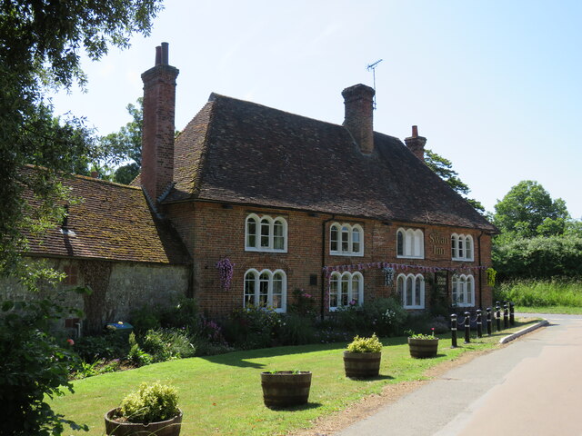
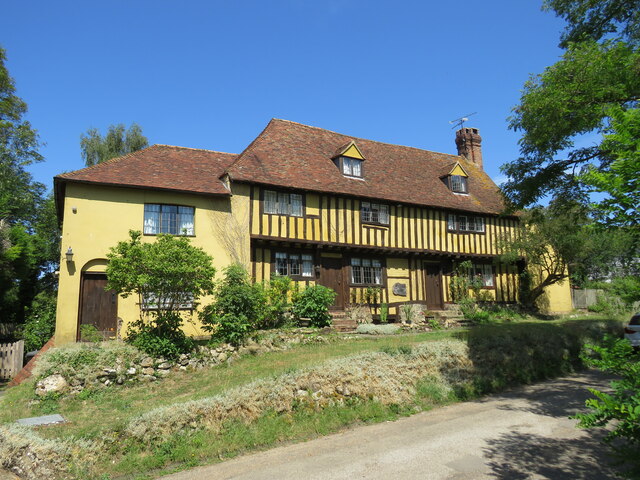
Brownmill Spinney Images

Images are sourced within 2km of 51.17137/0.79728345 or Grid Reference TQ9545. Thanks to Geograph Open Source API. All images are credited.

Pluckley Road Pluckley Road is seen here from the junction with Surrenden Road.
Pluckley Road
Pluckley Road is seen here from the junction with Surrenden Road.
Saracen's Cottage Saracen's Cottage on Surrenden Road  has the Dering windows. Dering windows are found in Pluckley and surrounding areas, and named after the Dering family. They are identified by their round tops above each casement. It is said that during the Civil War (1642-1652) one of the Royalist members of the Dering family escaped through one of these windows. Considering them lucky, Sir Edward Cholmeley Dering had all the windows on the estate (which included much of the village) replaced with the same style windows. The photograph was taken on 30th April when the Wisteria was fully out.
Saracen's Cottage
Saracen's Cottage on Surrenden Road has the Dering windows. Dering windows are found in Pluckley and surrounding areas, and named after the Dering family. They are identified by their round tops above each casement. It is said that during the Civil War (1642-1652) one of the Royalist members of the Dering family escaped through one of these windows. Considering them lucky, Sir Edward Cholmeley Dering had all the windows on the estate (which included much of the village) replaced with the same style windows. The photograph was taken on 30th April when the Wisteria was fully out.
Swan Inn at Little Chart Distinctive 'Dering' windows which are characteristic of this area. There's a large mill nearby.
Swan Inn at Little Chart
Distinctive 'Dering' windows which are characteristic of this area. There's a large mill nearby.
Bank House at Little Chart Imposing house on the village green.
Bank House at Little Chart
Imposing house on the village green.
Flood alleviation embankment
Worten Wood
Worten Wood
Worten Wood
Worten Wood
Stour Valley Walk, Worten Wood The Stour Valley Walk is a 58 mile (93km) route through the Low Weald and North Downs, giving you access to some the most attractive parts of East Kent. Rolling grassland, woods, marshes, peat bog, orchards and picturesque villages make this a memorable journey which can be completed over a long weekend or in shorter sections. The symbol of the Stour Valley Walk is the heron.
See <span class="nowrap"><a title="http://www.kent.gov.uk/leisure-and-culture/explore-kent/walking/stour-valley-walk.htm" rel="nofollow ugc noopener" href="http://www.kent.gov.uk/leisure-and-culture/explore-kent/walking/stour-valley-walk.htm">Link</a><img style="margin-left:2px;" alt="External link" title="External link - shift click to open in new window" src="https://s1.geograph.org.uk/img/external.png" width="10" height="10"/></span> for more details.
Stour Valley Walk, Worten Wood
The Stour Valley Walk is a 58 mile (93km) route through the Low Weald and North Downs, giving you access to some the most attractive parts of East Kent. Rolling grassland, woods, marshes, peat bog, orchards and picturesque villages make this a memorable journey which can be completed over a long weekend or in shorter sections. The symbol of the Stour Valley Walk is the heron. See LinkExternal link for more details.
Worten Wood
Worten Wood
Stour valley farmland
Hothfield church 
Grade I listed

The church was mentioned in the Domesday Monachoram of 1070. In 1271 the church is said to have formed part of the possessions of Rohese de Dover, wife of the Baron of Chilham.
The church consists of chancel with north and south chapels, a nave with north and south aisles, a west tower with spire. The tower dates from the 14th century and has a plain parapet with a shingled octagonal spire. The south side of the tower has a rounded turret with a spiral staircase to the belfry. There are six bells.

The church is built of Kentish rag stone with tiled roofs.
There is a south porch with windows from the 13th century, and over the entrance there is a mass dial.
The chancel dates from the 13th century. There is a piscina and on the north side of the altar is a large aumbry.
There is no chancel arch.
The nave has a three bay arcade, the north eastern arch was modified to take the tomb of Sir John Tufton. This is described elsewhere.

In 1598 it was struck by lightning and a large part of it burnt to the ground. It was rebuilt by Sir John Tufton in 1603, mostly in the perpendicular style.
In 1876 the church was again restored and many alterations were made.
In the Second World War many windows were blown blown out by a bomb, the roof was damaged and many of the pews were damaged beyond repair.
There were further repairs in the early 21st century.
Hothfield church
Grade I listed The church was mentioned in the Domesday Monachoram of 1070. In 1271 the church is said to have formed part of the possessions of Rohese de Dover, wife of the Baron of Chilham. The church consists of chancel with north and south chapels, a nave with north and south aisles, a west tower with spire. The tower dates from the 14th century and has a plain parapet with a shingled octagonal spire. The south side of the tower has a rounded turret with a spiral staircase to the belfry. There are six bells. The church is built of Kentish rag stone with tiled roofs. There is a south porch with windows from the 13th century, and over the entrance there is a mass dial. The chancel dates from the 13th century. There is a piscina and on the north side of the altar is a large aumbry. There is no chancel arch. The nave has a three bay arcade, the north eastern arch was modified to take the tomb of Sir John Tufton. This is described elsewhere. In 1598 it was struck by lightning and a large part of it burnt to the ground. It was rebuilt by Sir John Tufton in 1603, mostly in the perpendicular style. In 1876 the church was again restored and many alterations were made. In the Second World War many windows were blown blown out by a bomb, the roof was damaged and many of the pews were damaged beyond repair. There were further repairs in the early 21st century.
The Oast, Rippers Cross Single round kiln oast house.
The Oast, Rippers Cross
Single round kiln oast house.
Stour Valley Walk The Stour Valley Walk is a 58 mile (93km) route through the Low Weald and North Downs, giving you access to some the most attractive parts of East Kent. Rolling grassland, woods, marshes, peat bog, orchards and picturesque villages make this a memorable journey which can be completed over a long weekend or in shorter sections. The symbol of the Stour Valley Walk is the heron.
See <span class="nowrap"><a title="http://www.kent.gov.uk/leisure-and-culture/explore-kent/walking/stour-valley-walk.htm" rel="nofollow ugc noopener" href="http://www.kent.gov.uk/leisure-and-culture/explore-kent/walking/stour-valley-walk.htm">Link</a><img style="margin-left:2px;" alt="External link" title="External link - shift click to open in new window" src="https://s1.geograph.org.uk/img/external.png" width="10" height="10"/></span> for more details.
Stour Valley Walk
The Stour Valley Walk is a 58 mile (93km) route through the Low Weald and North Downs, giving you access to some the most attractive parts of East Kent. Rolling grassland, woods, marshes, peat bog, orchards and picturesque villages make this a memorable journey which can be completed over a long weekend or in shorter sections. The symbol of the Stour Valley Walk is the heron. See LinkExternal link for more details.
Rippers Cross Single round kiln oast house.
Rippers Cross
Single round kiln oast house.
Stour Valley Walk The Stour Valley Walk is a 58 mile (93km) route through the Low Weald and North Downs, giving you access to some the most attractive parts of East Kent. Rolling grassland, woods, marshes, peat bog, orchards and picturesque villages make this a memorable journey which can be completed over a long weekend or in shorter sections. The symbol of the Stour Valley Walk is the heron.
See <span class="nowrap"><a title="http://www.kent.gov.uk/leisure-and-culture/explore-kent/walking/stour-valley-walk.htm" rel="nofollow ugc noopener" href="http://www.kent.gov.uk/leisure-and-culture/explore-kent/walking/stour-valley-walk.htm">Link</a><img style="margin-left:2px;" alt="External link" title="External link - shift click to open in new window" src="https://s1.geograph.org.uk/img/external.png" width="10" height="10"/></span> for more details.
Stour Valley Walk
The Stour Valley Walk is a 58 mile (93km) route through the Low Weald and North Downs, giving you access to some the most attractive parts of East Kent. Rolling grassland, woods, marshes, peat bog, orchards and picturesque villages make this a memorable journey which can be completed over a long weekend or in shorter sections. The symbol of the Stour Valley Walk is the heron. See LinkExternal link for more details.
The Oast, Rippers Cross Single round kiln oast house.
The Oast, Rippers Cross
Single round kiln oast house.
Show me another place!

Brownmill Spinney is located at Grid Ref: TQ9545 (Lat: 51.17137, Lng: 0.79728345)

Administrative County: Kent

District: Ashford

Police Authority: Kent

What 3 Words

///awoke.harvest.stickler. Near Charing, Kent

Related Wikis

Hothfield Common

Hothfield Common is a 56.5-hectare (140-acre) biological Site of Special Scientific Interest north-east of Ashford in Kent. It is also a Local Nature...

Little Chart

Little Chart is a village and civil parish, situated 4 miles (6.4 km) north-west of Ashford in Kent, South East England. The parish lies south of the M20...

Hothfield

Hothfield is a village and civil parish in the Ashford Borough of Kent, England and is 3 miles north-west of Ashford on the A20. It is completely split...

Westwell Leacon

Westwell Leacon is a hamlet in the civil parish of Charing near Ashford in Kent, England. Its most famous resident is international Cyclocross star Ian...

Nearby Amenities

Located within 500m of 51.17137,0.79728345
Power: pole
Lat/Long: 51.1706323/0.790329
Power: pole
Lat/Long: 51.1696401/0.7916701
Power: pole
Lat/Long: 51.1689472/0.7925874
Power: pole
Lat/Long: 51.168483/0.7932553
Power: pole
Lat/Long: 51.1676337/0.794422
The data included in this document is from www.openstreetmap.org. The data is made available under ODbL.

Have you been to Brownmill Spinney?

Leave your review of Brownmill Spinney below (or comments, questions and feedback).