Hazel Wood

Wood, Forest in Suffolk Babergh

England

Hazel Wood

Footpath near Little Waldingfield A good broad swathe has been cut through this cornfield to allow space for the footpath.
Footpath near Little Waldingfield Credit: Oliver Dixon

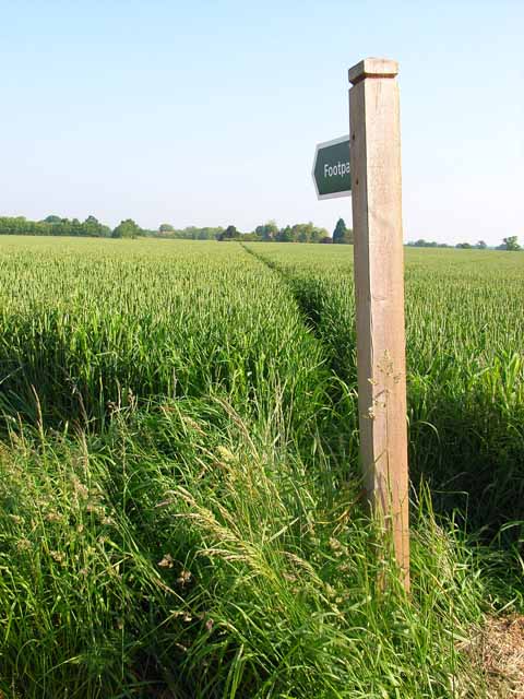
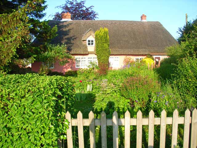
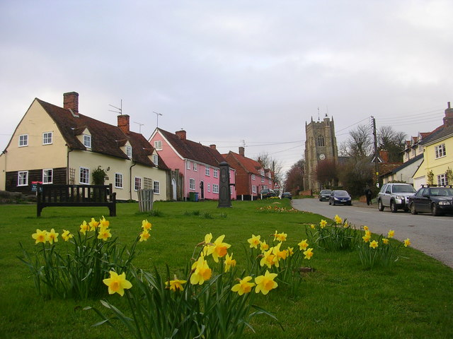
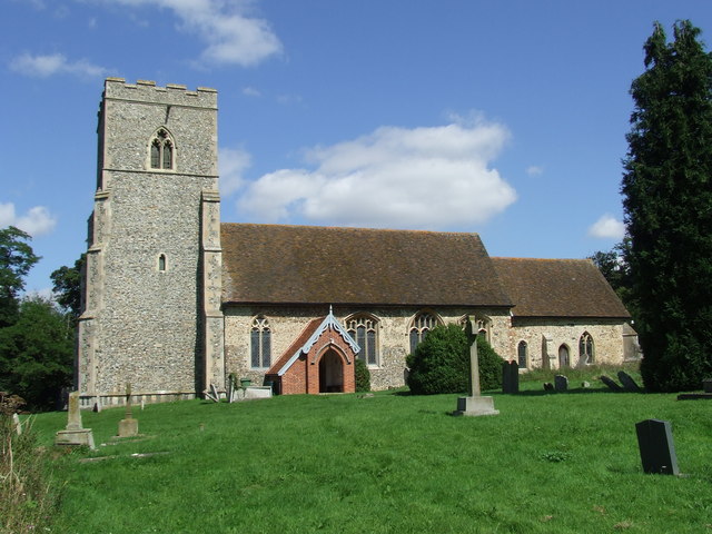
Hazel Wood is a small village located in the county of Suffolk, England. Situated within the larger region of the Suffolk Coast and Heaths Area of Outstanding Natural Beauty, Hazel Wood is known for its picturesque woodland scenery and rustic charm.

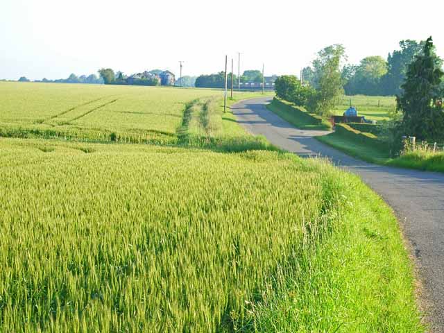
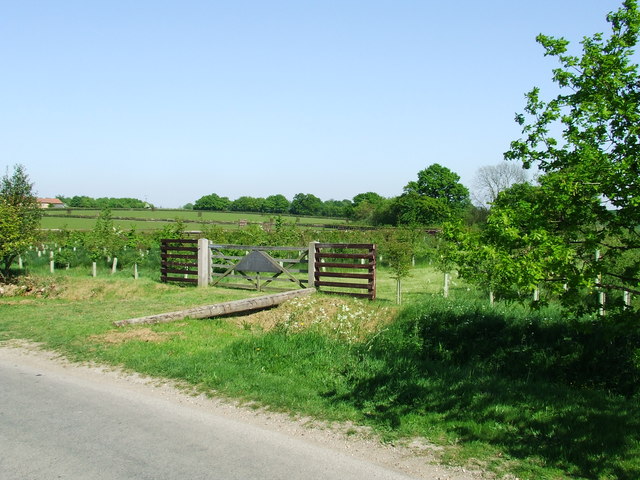
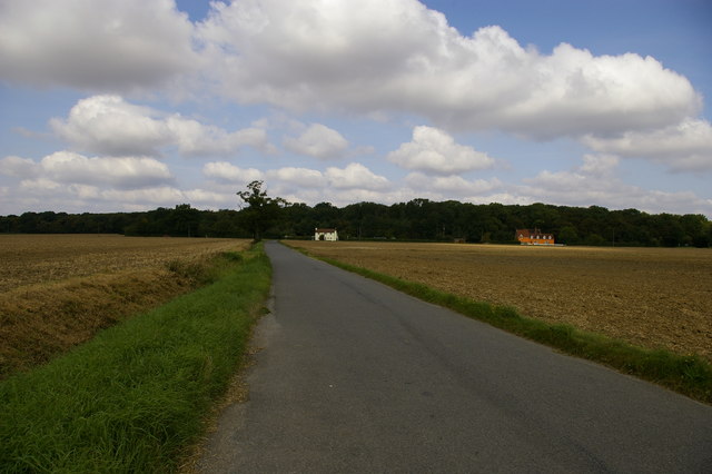
Covering an area of approximately 2 square miles, the village is surrounded by dense forests and lush greenery, making it a haven for nature lovers and outdoor enthusiasts. The woodlands are primarily composed of hazel trees, from which the village derives its name. These trees provide a beautiful backdrop throughout the year, with vibrant green foliage in the spring and summer, followed by golden hues in the autumn months.

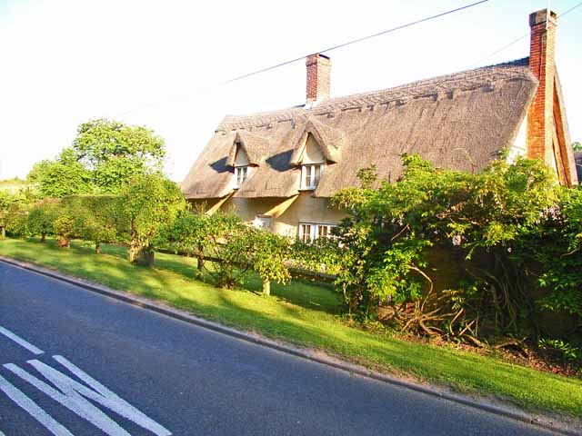
Hazel Wood boasts a rich history, with evidence of human settlement dating back to prehistoric times. The village itself is home to a small population, with scattered cottages and traditional houses nestled among the woodland. The community is known for its warm and welcoming atmosphere, with residents often engaging in local events and activities.

While Hazel Wood may be considered remote and secluded, it offers a tranquil and peaceful environment for those seeking respite from the bustling city life. The village is a popular destination for hikers, cyclists, and birdwatchers, who are drawn to its well-maintained trails and diverse wildlife. Visitors can explore the woodland on foot, taking in the fresh air and enjoying the sights and sounds of nature.

If you have any feedback on the listing, please let us know in the comments section below.

Hazel Wood Images

Images are sourced within 2km of 52.067804/0.84302026 or Grid Reference TL9444. Thanks to Geograph Open Source API. All images are credited.

Footpath near Little Waldingfield A good broad swathe has been cut through this cornfield to allow space for the footpath.
Footpath near Little Waldingfield
A good broad swathe has been cut through this cornfield to allow space for the footpath.
Cornfield near Little Waldingfield Extensive level cornfields are typical of this part of Suffolk. Adjacent to the B1115, Sudbury to Bildeston road.
Cornfield near Little Waldingfield
Extensive level cornfields are typical of this part of Suffolk. Adjacent to the B1115, Sudbury to Bildeston road.
Footpath near Edwardstone A very narrow swathe cut through this cornfield barely accommodates the passage of walkers. Contrast with <a href="https://www.geograph.org.uk/gridref/TL9343">TL9343</a>.
Footpath near Edwardstone
A very narrow swathe cut through this cornfield barely accommodates the passage of walkers. Contrast with TL9343.
Valley Farm, near Brent Eleigh On the B1115 Sudbury to Bildeston road.
Valley Farm, near Brent Eleigh
On the B1115 Sudbury to Bildeston road.
Lodge Farm, Broad Street On the road from Groton to Brent Eleigh.
Lodge Farm, Broad Street
On the road from Groton to Brent Eleigh.
Field adjacent to the Groton to Brent Eleigh road Typical of the large-scale cereal cultivation in this part of Suffolk. The silos at Owl's Farm can be seen in the distance.
Field adjacent to the Groton to Brent Eleigh road
Typical of the large-scale cereal cultivation in this part of Suffolk. The silos at Owl's Farm can be seen in the distance.
Brickpath Cottage On the Groton to Brent Eleigh road. Everybody's dream of a country cottage with a real cottage garden.
Brickpath Cottage
On the Groton to Brent Eleigh road. Everybody's dream of a country cottage with a real cottage garden.
Village centre, Milden Essential services concentrated at the centre of this small hamlet on the Groton to Brent Eleigh road - telephone box, postbox, notice board and bus stop.
Village centre, Milden
Essential services concentrated at the centre of this small hamlet on the Groton to Brent Eleigh road - telephone box, postbox, notice board and bus stop.
Barn conversion at Folly Farm, Rose Green
Farmhouse at Hays Farm
Powney Street, Milden, Suffolk The cottage is called Milden Cottage.
Powney Street, Milden, Suffolk
The cottage is called Milden Cottage.
Farmhouse at Lower Farm This is one of many farms along Boxford Road.
Farmhouse at Lower Farm
This is one of many farms along Boxford Road.
Wood In The Making One day this will be a wooded area for info as to the creation of this wood see <a title="https://www.geograph.org.uk/photo/419787" href="https://www.geograph.org.uk/photo/419787">Link</a>
Wood In The Making
One day this will be a wooded area for info as to the creation of this wood see Link
In Loving Memory Wood in the making the sign tells it all for overall view see <a title="https://www.geograph.org.uk/photo/419784" href="https://www.geograph.org.uk/photo/419784">Link</a>
In Loving Memory
Wood in the making the sign tells it all for overall view see Link
Barley field and Humble Green masts Two telecom masts are situated by a bend in the B1115 near Little Waldingfield.
Barley field and Humble Green masts
Two telecom masts are situated by a bend in the B1115 near Little Waldingfield.
Metal graveyard By the lane beyond Archers Farm, Little Waldingfield. What amused me most was the image of the tractor eyeing up the Fiat, but the expression frozen on its face!
Metal graveyard
By the lane beyond Archers Farm, Little Waldingfield. What amused me most was the image of the tractor eyeing up the Fiat, but the expression frozen on its face!
Metal graveyard (again) The 180 degree view from <a href="https://www.geograph.org.uk/photo/477983">TL9344 : Metal graveyard</a> showing the relative scale of the two protagonists! The tractor even has a tree growing through its undercarriage.
Metal graveyard (again)
The 180 degree view from TL9344 : Metal graveyard showing the relative scale of the two protagonists! The tractor even has a tree growing through its undercarriage.
Old Farmhouse in Stackyard Green
Show me another place!

Hazel Wood is located at Grid Ref: TL9444 (Lat: 52.067804, Lng: 0.84302026)

Administrative County: Suffolk

District: Babergh

Police Authority: Suffolk

What 3 Words

///rally.called.something. Near Great Waldingfield, Suffolk

Related Wikis

Milden Thicks

Milden Thicks is a 42.3-hectare (105-acre) biological Site of Special Scientific Interest east of Great Waldingfield in Suffolk, England. It is in four...

Milden Castle

Milden Castle was a motte-and-bailey castle on Foxburrow hill in Milden, a village in Suffolk, England. It was built in the 12th century, but today all...

Milden, Suffolk

Milden is a small village and civil parish in Suffolk, England. Located in the Babergh district, around four and half miles from Sudbury. The parish contains...

Monks Eleigh

Monks Eleigh is a village and a civil parish in Babergh, Suffolk, United Kingdom, situated on the tributary to the River Brett in a rural area. The parish...

Brent Eleigh Woods

Brent Eleigh Woods is a 31.7-hectare (78-acre) biological Site of Special Scientific Interest south-east of Lavenham in Suffolk.This site consists of three...

Little Waldingfield

Little Waldingfield is a village and civil parish in Suffolk, England. Located two miles from its sister village, Great Waldingfield, it is part of the...

Edwardstone

Edwardstone is a village and civil parish in the Babergh district, in the county of Suffolk, England. The parish contains the hamlets of Mill Green, Priory...

Lindsey, Suffolk

Lindsey is a small village and a civil parish, located in mid-to-south Suffolk, under the purview of Babergh District Council. == Layout == The parish...

Have you been to Hazel Wood?

Leave your review of Hazel Wood below (or comments, questions and feedback).