Blackwater Carr

Wood, Forest in Suffolk West Suffolk

England

Blackwater Carr

Knettishall Heath
Knettishall Heath Credit: Dave Thompson

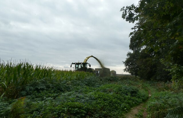
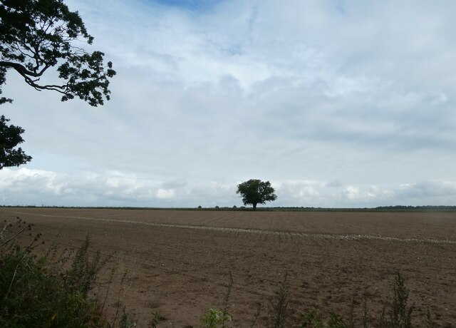
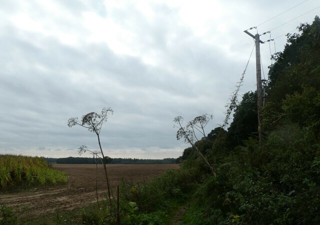
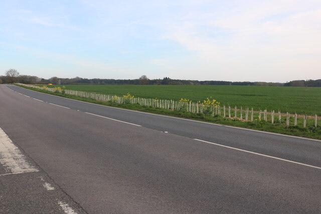
Blackwater Carr is a wooded area located in Suffolk, England. It is known for its picturesque landscapes and diverse flora and fauna. The area is situated near the Blackwater river, which adds to its natural beauty and tranquility.

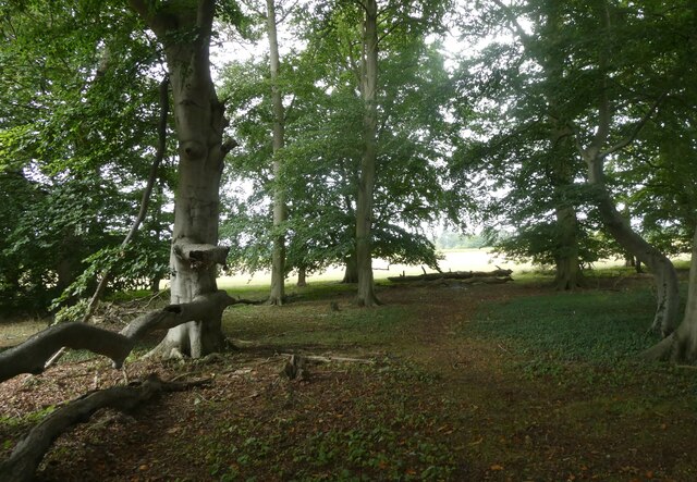
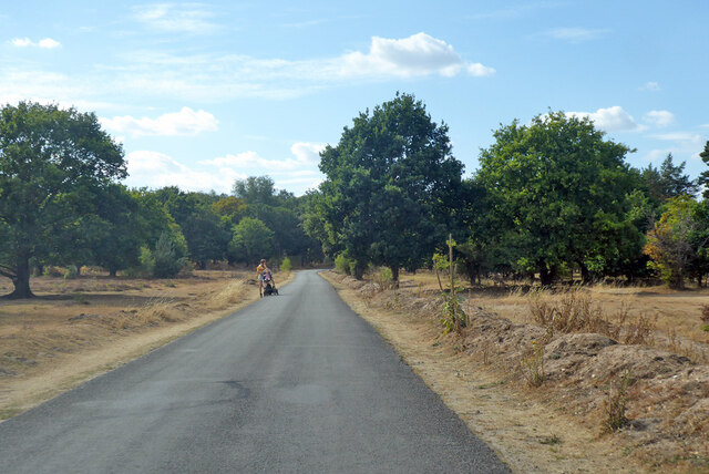
Covering a significant portion of the Blackwater Carr is a dense forest that is home to a wide variety of trees, including oak, birch, and beech. The forest is characterized by its tall, majestic trees that provide shade and shelter for numerous wildlife species.

The woodland floor is covered in a thick carpet of moss, ferns, and wildflowers, creating a rich and vibrant undergrowth. This undergrowth supports a diverse range of insects, small mammals, and birds, making it a haven for wildlife enthusiasts and nature lovers.

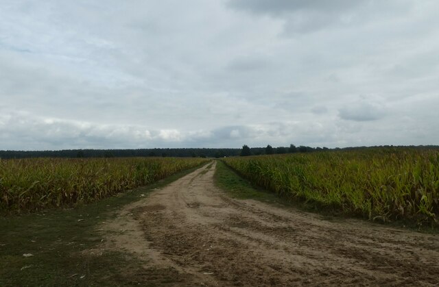
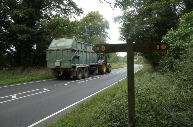
Blackwater Carr is a popular destination for outdoor activities such as hiking, birdwatching, and photography. There are well-maintained trails that wind through the forest, providing visitors with the opportunity to explore its beauty and discover its hidden gems.

The area is also home to a variety of bird species, including woodpeckers, owls, and various songbirds. Birdwatchers can spot these feathered creatures perched on tree branches or soaring through the sky, adding to the enchanting atmosphere of Blackwater Carr.

In conclusion, Blackwater Carr in Suffolk is a captivating woodland area that offers a glimpse into the natural beauty of the region. With its lush forest, diverse wildlife, and scenic landscapes, it provides a serene and peaceful escape for those seeking to immerse themselves in nature.

If you have any feedback on the listing, please let us know in the comments section below.

Blackwater Carr Images

Images are sourced within 2km of 52.39295/0.85792811 or Grid Reference TL9481. Thanks to Geograph Open Source API. All images are credited.

Knettishall Heath
Knettishall Heath
On Heath Covert
On Heath Covert
Common Lizard
Common Lizard
Dog proof fence on the Peddars Way The Peddars Way is a long distance footpath in Norfolk. It is 46 miles long and follows the route of a Roman road. It has been suggested by more than one writer that it was not created by the Romans but was an ancient trackway, a branch or extension of the Icknield Way, used and remodelled by the Romans. The name is said to be derived from the Latin pedester – on foot.  It starts at Knettishall Heath in Suffolk (near the Norfolk-Suffolk border, about 4 miles east of Thetford), and it links with the Norfolk Coast Path at Holme-next-the-Sea.
Combined with the Norfolk Coast Path, it forms the Peddars Way & Norfolk Coast Path National Trail, one of 15 National Trails in England and Wales, and the two paths together run for 97 miles.
Wikipedia: <span class="nowrap"><a title="http://en.wikipedia.org/wiki/Peddars_Way" rel="nofollow ugc noopener" href="http://en.wikipedia.org/wiki/Peddars_Way">Link</a><img style="margin-left:2px;" alt="External link" title="External link - shift click to open in new window" src="https://s1.geograph.org.uk/img/external.png" width="10" height="10"/></span>
Dog proof fence on the Peddars Way
The Peddars Way is a long distance footpath in Norfolk. It is 46 miles long and follows the route of a Roman road. It has been suggested by more than one writer that it was not created by the Romans but was an ancient trackway, a branch or extension of the Icknield Way, used and remodelled by the Romans. The name is said to be derived from the Latin pedester – on foot. It starts at Knettishall Heath in Suffolk (near the Norfolk-Suffolk border, about 4 miles east of Thetford), and it links with the Norfolk Coast Path at Holme-next-the-Sea. Combined with the Norfolk Coast Path, it forms the Peddars Way & Norfolk Coast Path National Trail, one of 15 National Trails in England and Wales, and the two paths together run for 97 miles. Wikipedia: LinkExternal link
Harvesting maize on the Peddars Way The Peddars Way is a long distance footpath in Norfolk. It is 46 miles long and follows the route of a Roman road. It has been suggested by more than one writer that it was not created by the Romans but was an ancient trackway, a branch or extension of the Icknield Way, used and remodelled by the Romans. The name is said to be derived from the Latin pedester – on foot.  It starts at Knettishall Heath in Suffolk (near the Norfolk-Suffolk border, about 4 miles east of Thetford), and it links with the Norfolk Coast Path at Holme-next-the-Sea.
Combined with the Norfolk Coast Path, it forms the Peddars Way & Norfolk Coast Path National Trail, one of 15 National Trails in England and Wales, and the two paths together run for 97 miles.
Wikipedia: <span class="nowrap"><a title="http://en.wikipedia.org/wiki/Peddars_Way" rel="nofollow ugc noopener" href="http://en.wikipedia.org/wiki/Peddars_Way">Link</a><img style="margin-left:2px;" alt="External link" title="External link - shift click to open in new window" src="https://s1.geograph.org.uk/img/external.png" width="10" height="10"/></span>
Harvesting maize on the Peddars Way
The Peddars Way is a long distance footpath in Norfolk. It is 46 miles long and follows the route of a Roman road. It has been suggested by more than one writer that it was not created by the Romans but was an ancient trackway, a branch or extension of the Icknield Way, used and remodelled by the Romans. The name is said to be derived from the Latin pedester – on foot. It starts at Knettishall Heath in Suffolk (near the Norfolk-Suffolk border, about 4 miles east of Thetford), and it links with the Norfolk Coast Path at Holme-next-the-Sea. Combined with the Norfolk Coast Path, it forms the Peddars Way & Norfolk Coast Path National Trail, one of 15 National Trails in England and Wales, and the two paths together run for 97 miles. Wikipedia: LinkExternal link
Gnarled old tree on the Peddars Way The Peddars Way is a long distance footpath in Norfolk. It is 46 miles long and follows the route of a Roman road. It has been suggested by more than one writer that it was not created by the Romans but was an ancient trackway, a branch or extension of the Icknield Way, used and remodelled by the Romans. The name is said to be derived from the Latin pedester – on foot.  It starts at Knettishall Heath in Suffolk (near the Norfolk-Suffolk border, about 4 miles east of Thetford), and it links with the Norfolk Coast Path at Holme-next-the-Sea.
Combined with the Norfolk Coast Path, it forms the Peddars Way & Norfolk Coast Path National Trail, one of 15 National Trails in England and Wales, and the two paths together run for 97 miles.
Wikipedia: <span class="nowrap"><a title="http://en.wikipedia.org/wiki/Peddars_Way" rel="nofollow ugc noopener" href="http://en.wikipedia.org/wiki/Peddars_Way">Link</a><img style="margin-left:2px;" alt="External link" title="External link - shift click to open in new window" src="https://s1.geograph.org.uk/img/external.png" width="10" height="10"/></span>
Gnarled old tree on the Peddars Way
The Peddars Way is a long distance footpath in Norfolk. It is 46 miles long and follows the route of a Roman road. It has been suggested by more than one writer that it was not created by the Romans but was an ancient trackway, a branch or extension of the Icknield Way, used and remodelled by the Romans. The name is said to be derived from the Latin pedester – on foot. It starts at Knettishall Heath in Suffolk (near the Norfolk-Suffolk border, about 4 miles east of Thetford), and it links with the Norfolk Coast Path at Holme-next-the-Sea. Combined with the Norfolk Coast Path, it forms the Peddars Way & Norfolk Coast Path National Trail, one of 15 National Trails in England and Wales, and the two paths together run for 97 miles. Wikipedia: LinkExternal link
Distant tree seen from the Peddars Way The Peddars Way is a long distance footpath in Norfolk. It is 46 miles long and follows the route of a Roman road. It has been suggested by more than one writer that it was not created by the Romans but was an ancient trackway, a branch or extension of the Icknield Way, used and remodelled by the Romans. The name is said to be derived from the Latin pedester – on foot.  It starts at Knettishall Heath in Suffolk (near the Norfolk-Suffolk border, about 4 miles east of Thetford), and it links with the Norfolk Coast Path at Holme-next-the-Sea.
Combined with the Norfolk Coast Path, it forms the Peddars Way & Norfolk Coast Path National Trail, one of 15 National Trails in England and Wales, and the two paths together run for 97 miles.
Wikipedia: <span class="nowrap"><a title="http://en.wikipedia.org/wiki/Peddars_Way" rel="nofollow ugc noopener" href="http://en.wikipedia.org/wiki/Peddars_Way">Link</a><img style="margin-left:2px;" alt="External link" title="External link - shift click to open in new window" src="https://s1.geograph.org.uk/img/external.png" width="10" height="10"/></span>
Distant tree seen from the Peddars Way
The Peddars Way is a long distance footpath in Norfolk. It is 46 miles long and follows the route of a Roman road. It has been suggested by more than one writer that it was not created by the Romans but was an ancient trackway, a branch or extension of the Icknield Way, used and remodelled by the Romans. The name is said to be derived from the Latin pedester – on foot. It starts at Knettishall Heath in Suffolk (near the Norfolk-Suffolk border, about 4 miles east of Thetford), and it links with the Norfolk Coast Path at Holme-next-the-Sea. Combined with the Norfolk Coast Path, it forms the Peddars Way & Norfolk Coast Path National Trail, one of 15 National Trails in England and Wales, and the two paths together run for 97 miles. Wikipedia: LinkExternal link
Small copse on the Peddars Way The Peddars Way is a long distance footpath in Norfolk. It is 46 miles long and follows the route of a Roman road. It has been suggested by more than one writer that it was not created by the Romans but was an ancient trackway, a branch or extension of the Icknield Way, used and remodelled by the Romans. The name is said to be derived from the Latin pedester – on foot.  It starts at Knettishall Heath in Suffolk (near the Norfolk-Suffolk border, about 4 miles east of Thetford), and it links with the Norfolk Coast Path at Holme-next-the-Sea.
Combined with the Norfolk Coast Path, it forms the Peddars Way & Norfolk Coast Path National Trail, one of 15 National Trails in England and Wales, and the two paths together run for 97 miles.
Wikipedia: <span class="nowrap"><a title="http://en.wikipedia.org/wiki/Peddars_Way" rel="nofollow ugc noopener" href="http://en.wikipedia.org/wiki/Peddars_Way">Link</a><img style="margin-left:2px;" alt="External link" title="External link - shift click to open in new window" src="https://s1.geograph.org.uk/img/external.png" width="10" height="10"/></span>
Small copse on the Peddars Way
The Peddars Way is a long distance footpath in Norfolk. It is 46 miles long and follows the route of a Roman road. It has been suggested by more than one writer that it was not created by the Romans but was an ancient trackway, a branch or extension of the Icknield Way, used and remodelled by the Romans. The name is said to be derived from the Latin pedester – on foot. It starts at Knettishall Heath in Suffolk (near the Norfolk-Suffolk border, about 4 miles east of Thetford), and it links with the Norfolk Coast Path at Holme-next-the-Sea. Combined with the Norfolk Coast Path, it forms the Peddars Way & Norfolk Coast Path National Trail, one of 15 National Trails in England and Wales, and the two paths together run for 97 miles. Wikipedia: LinkExternal link
Pathway through a field seen from the Peddars Way
Telegraph pole on the Peddars Way The Peddars Way is a long distance footpath in Norfolk. It is 46 miles long and follows the route of a Roman road. It has been suggested by more than one writer that it was not created by the Romans but was an ancient trackway, a branch or extension of the Icknield Way, used and remodelled by the Romans. The name is said to be derived from the Latin pedester – on foot.  It starts at Knettishall Heath in Suffolk (near the Norfolk-Suffolk border, about 4 miles east of Thetford), and it links with the Norfolk Coast Path at Holme-next-the-Sea.
Combined with the Norfolk Coast Path, it forms the Peddars Way & Norfolk Coast Path National Trail, one of 15 National Trails in England and Wales, and the two paths together run for 97 miles.
Wikipedia: <span class="nowrap"><a title="http://en.wikipedia.org/wiki/Peddars_Way" rel="nofollow ugc noopener" href="http://en.wikipedia.org/wiki/Peddars_Way">Link</a><img style="margin-left:2px;" alt="External link" title="External link - shift click to open in new window" src="https://s1.geograph.org.uk/img/external.png" width="10" height="10"/></span>
Telegraph pole on the Peddars Way
The Peddars Way is a long distance footpath in Norfolk. It is 46 miles long and follows the route of a Roman road. It has been suggested by more than one writer that it was not created by the Romans but was an ancient trackway, a branch or extension of the Icknield Way, used and remodelled by the Romans. The name is said to be derived from the Latin pedester – on foot. It starts at Knettishall Heath in Suffolk (near the Norfolk-Suffolk border, about 4 miles east of Thetford), and it links with the Norfolk Coast Path at Holme-next-the-Sea. Combined with the Norfolk Coast Path, it forms the Peddars Way & Norfolk Coast Path National Trail, one of 15 National Trails in England and Wales, and the two paths together run for 97 miles. Wikipedia: LinkExternal link
Tractor on the A1066 (taken while walking the Peddars Way)
Tractor on the A1066
(taken while walking the Peddars Way)
Dolphin Business Park on Thetford Road
Thetford Road between Shadwell and Riddlesworth
Home Farm, Riddlesworth
Road across Knettishall Heath Nature Reserve
Lane towards Rushford from the east
Show me another place!

Blackwater Carr is located at Grid Ref: TL9481 (Lat: 52.39295, Lng: 0.85792811)

Administrative County: Suffolk

District: West Suffolk

Police Authority: Suffolk

What 3 Words

///earlobes.pollution.luggage. Near East Harling, Norfolk

Related Wikis

Knettishall Heath

Knettishall Heath is a 91.7-hectare (227-acre) biological Site of Special Scientific Interest west of Knettishall in Suffolk. A larger area of 176 hectares...

Iceni Way

The Iceni Way is a collective name for several long-distance footpaths running from Knettishall Heath to Hunstanton via the Little Ouse and Great Ouse...

Riddlesworth Hall

Riddlesworth Hall is a country house, and was formerly used as a boarding school. It is located in Riddlesworth, Norfolk, England. == History == It was...

Rushford, Norfolk

Rushford is a small village in the English county of Norfolk. It is situated on the north bank of the River Little Ouse, 3+1⁄2 miles (5.6 km) east of the...

Riddlesworth

Riddlesworth is a civil parish in the English county of Norfolk. It covers an area of 8.26 km2 (3.19 sq mi) and had a population of 147 in 48 households...

Shadwell Court

Shadwell Court, Brettenham, Norfolk, England is a country house dating originally from the 18th century. Built for the Buxton baronets, the house was massively...

Brettenham, Norfolk

Brettenham is a village and civil parish in the English county of Norfolk. It covers an area of 26.37 km2 (10.18 sq mi) and had a population of 475 in...

RAF Knettishall

RAF Knettishall is a former World War II airfield in Suffolk. During the conflict, it was numbered as Station 136 by the United States Army Air Forces...

Nearby Amenities

Located within 500m of 52.39295,0.85792811
Peddars Way, adj
Naptan AtcoCode: 2900R32540
Naptan Bearing: E
Naptan BusStopType: CUS
Naptan CommonName: Peddars Way
Naptan Indicator: adj
Naptan Landmark: Peddars Way
Naptan Locality: Riddlesworth
Naptan NaptanCode: nfogpapg
Naptan Street: Theford Road
Naptan Verified: no
Source: naptan_import
Lat/Long: 52.390517/0.8549132
Crossing
Crossing: unmarked
Lat/Long: 52.3905296/0.855044
Barrier: swing_gate
Colour: grey
Locked: yes
Material: aluminium
Lat/Long: 52.3901124/0.8549403
Fixme: incomplete
Lat/Long: 52.3917699/0.8517238
Colour: yellow
Marker: post
Material: concrete
Pipeline: marker
Utility: gas
Lat/Long: 52.3912864/0.8516974
Colour: yellow
Marker: post
Material: concrete
Pipeline: marker
Utility: gas
Lat/Long: 52.3913694/0.8517118
Bench
Armrest: no
Backrest: yes
Colour: light_brown
Inscription: In memory of Brian Patrick Sharpe / 1930 ~ 2003 / Loving husband of Ida / Father of Stephen and owner of Sandy and Brandy
Material: wood
Seats: 3
Lat/Long: 52.3916613/0.8629287
Bench
Armrest: no
Backrest: yes
Colour: brown
Inscription: In memory of Brian Patrick Sharpe / 1930 ~ 2003 / Loving dad of Linda and Family
Material: wood
Seats: 4
Lat/Long: 52.3910449/0.8582412
Waste Basket
Colour: green
Inscription: Clean it up!
Material: metal
Waste: dog_excrement
Lat/Long: 52.3903559/0.8549173
Bench
Armrest: no
Backrest: yes
Colour: light_brown
Inscription: unknown
Material: wood
Seats: 3
Lat/Long: 52.3930561/0.8611656
Please do not feed or approach the ponies
Barrier: kissing_gate
Board Type: notice
Colour: brown
Description: Feeding them can make them very ill and lead to long term behavioural problems. Thank you.
Email: knettishall@suffolkwildlifetrust.org
Information: board
Material: wood
Operator: Suffolk Wildlife Trust
Tourism: information
Lat/Long: 52.3908964/0.8571647
Drinking Water
Lat/Long: 52.3910432/0.8637707
Barrier: cattle_grid
Lat/Long: 52.3902427/0.8563801
Please do not feed or approach the ponies
Barrier: kissing_gate
Board Type: notice
Colour: brown
Description: Feeding them can make them very ill and lead to long term behavioural problems. Thank you.
Email: knettishall@suffolkwildlifetrust.org
Information: board
Material: wood
Operator: Suffolk Wildlife Trust
Tourism: information
Lat/Long: 52.3911178/0.8585418
Knettishall Heath
Boundary: marker
Direction: 290
Inscription: Welcome
Material: wood
Operator: Suffolk Wildlife Trust
Lat/Long: 52.3906079/0.8548495
Welcome to Knettishall Heath Nature Reserve
Board Type: notice
Description: We hope you enjoy your visit / Please help us look after nature by taking litter home with you and using the dog waste bins provided in the car parks and across the Nature Reserve.
Information: board
Material: wood
Operator: Suffolk Wildlife Trust
Tourism: information
Lat/Long: 52.3905932/0.8550645
Black Arrow
Direction: E
Hiking: yes
Information: route_marker
Material: wood
Tourism: information
Lat/Long: 52.3912149/0.8551425
Green Rabbit
Direction: E
Hiking: yes
Information: route_marker
Material: wood
Tourism: information
Lat/Long: 52.391228/0.8551962
Yellow Arrow
Description: Peddars Way
Direction: N;S
Hiking: yes
Information: route_marker
Material: wood
Tourism: information
Lat/Long: 52.3912373/0.8551513
Black Arrow
Direction: E
Hiking: yes
Information: route_marker
Material: wood
Tourism: information
Lat/Long: 52.3911828/0.8561879
Green Rabbit
Direction: SE
Hiking: yes
Information: route_marker
Material: wood
Tourism: information
Lat/Long: 52.3908951/0.857122
Black and Green Arrow
Direction: SSE
Hiking: yes
Information: route_marker
Material: wood
Tourism: information
Lat/Long: 52.3909017/0.8571408
Blue Arrow
Direction: SE
Hiking: yes
Information: route_marker
Material: wood
Tourism: information
Lat/Long: 52.3911026/0.8585161
Blue Arrow
Direction: SW
Hiking: yes
Information: route_marker
Material: wood
Tourism: information
Lat/Long: 52.3914296/0.8591162
Blue and Black Arrow
Direction: SW;W
Hiking: yes
Information: route_marker
Material: wood
Tourism: information
Lat/Long: 52.3930734/0.8611876
Path closed
Board Type: notice
Description: Sorry temporary path closure
Email: knettishall@suffolkwildlifetrust.org
Information: board
Material: wood
Operator: Suffolk Wildlife Trust
Phone: +44 7717 156601
Phone 2: +44 7721 111831
Tourism: information
Lat/Long: 52.3930766/0.8612131
Ʊ
Direction: S
Hiking: yes
Information: route_marker
Inscription: Icknield Way Trail / Walkers' Route / You are entering a dogs off lead area
Material: wood
Operator: Suffolk Wildlife Trust
Tourism: information
Lat/Long: 52.3900571/0.8548857
Knettishall Heath Nature Reserve
Information: map
Map Size: site
Map Type: scheme
Operator: Suffolk Wildlife Trust
Tourism: information
Lat/Long: 52.3901223/0.8548761
Open Access
Hiking: yes
Information: map
Inscription: Welcome to Open Access at Knettishall Heath
Map Size: region
Map Type: street
Operator: Suffolk Wildlife Trust
Tourism: information
Lat/Long: 52.3901178/0.8549056
Man Made: traffic_sign
Traffic Sign: no_motor_vehicle_except_permit
Lat/Long: 52.390116/0.8548656
Inscription: Private
Man Made: post
Lat/Long: 52.3903775/0.8548314
Angles Way
Destination: Thetford;Holme-next-the-Sea;Ivinghoe Beacon;Great Yarmouth
Distance: 24;46;169;124
Hiking: yes
Information: guidepost
Inscription: Peddars Way / Public Byway / Public Footpath / Icknield Way / Icknield Way Trail / Walkers' Route
Material: wood
Tourism: information
Lat/Long: 52.390357/0.854991
The data included in this document is from www.openstreetmap.org. The data is made available under ODbL.

Have you been to Blackwater Carr?

Leave your review of Blackwater Carr below (or comments, questions and feedback).