Blackwater Plantation

Wood, Forest in Suffolk West Suffolk

England

Blackwater Plantation

Knettishall Heath
Knettishall Heath Credit: Dave Thompson

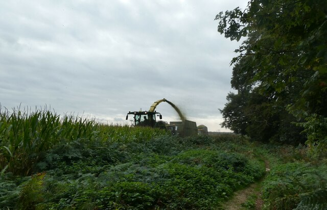
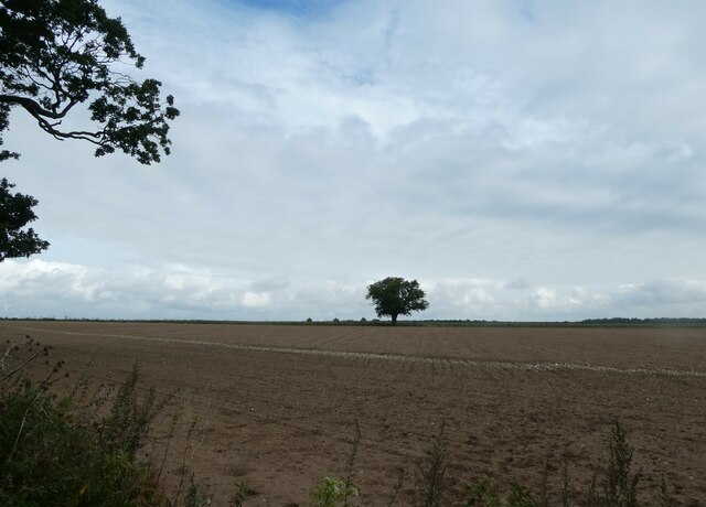
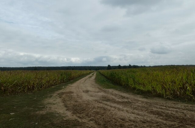
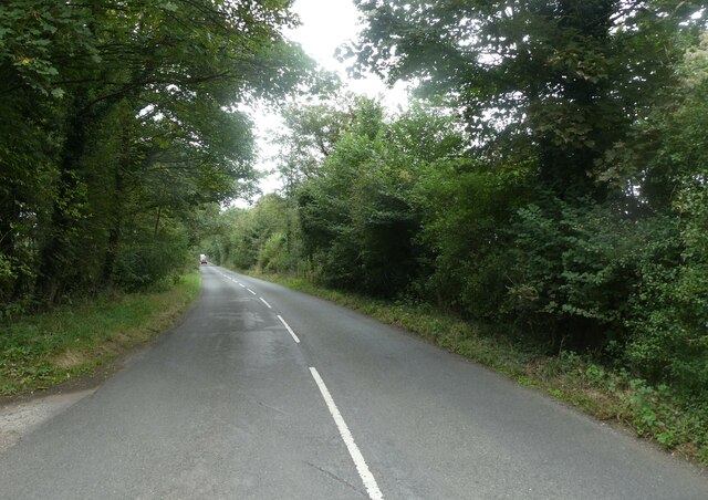
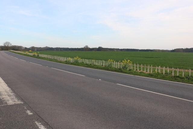
Blackwater Plantation is a sprawling woodland located in Suffolk, England. Covering a vast area, this enchanting forest is a popular destination for nature lovers and outdoor enthusiasts alike. The plantation is named after the nearby Blackwater River, which meanders through the surrounding countryside, enhancing the picturesque charm of the area.

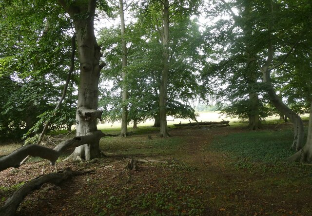
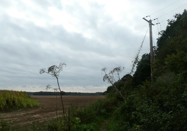
The plantation boasts a diverse array of trees, including oak, beech, and pine, which create a lush and vibrant canopy overhead. These trees provide a habitat for an abundance of wildlife, making it an ideal spot for birdwatching and animal spotting.

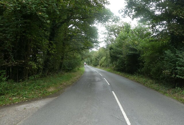
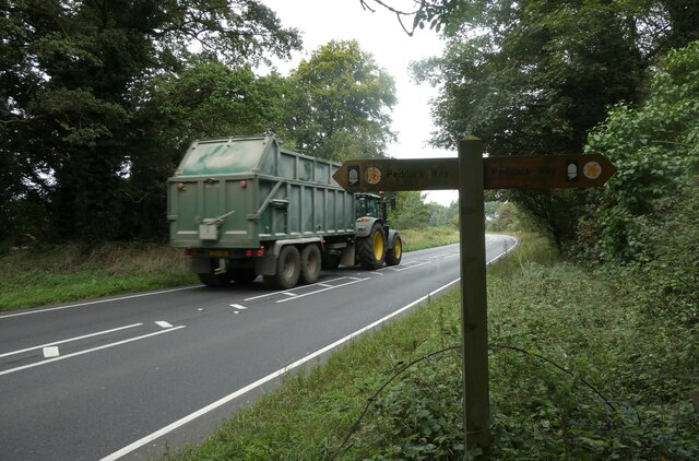
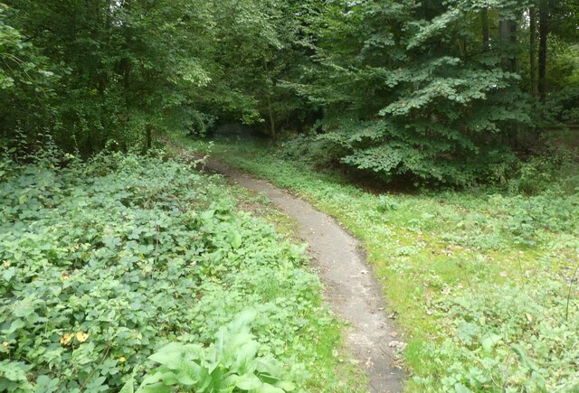
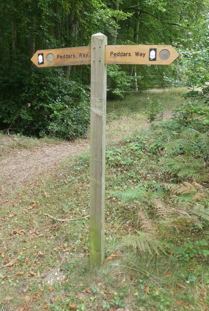
Visitors to Blackwater Plantation can explore the numerous trails that wind through the forest, offering a variety of picturesque views and tranquil settings. The well-maintained paths cater to walkers, joggers, and cyclists, ensuring that everyone can enjoy the beauty of the plantation at their own pace.

In addition to its natural beauty, Blackwater Plantation offers several amenities for visitors. There are picnic areas scattered throughout the forest, providing a perfect spot for a leisurely lunch or a family gathering. The plantation also features a visitor center where guests can learn more about the history and ecology of the area.

Overall, Blackwater Plantation is a haven of natural beauty, offering a peaceful retreat from the hustle and bustle of everyday life. With its diverse flora and fauna, well-maintained trails, and visitor facilities, it is a must-visit destination for anyone seeking a serene and immersive woodland experience.

If you have any feedback on the listing, please let us know in the comments section below.

Blackwater Plantation Images

Images are sourced within 2km of 52.397301/0.85462233 or Grid Reference TL9481. Thanks to Geograph Open Source API. All images are credited.

Knettishall Heath
Knettishall Heath
On Heath Covert
On Heath Covert
Common Lizard
Common Lizard
Dog proof fence on the Peddars Way The Peddars Way is a long distance footpath in Norfolk. It is 46 miles long and follows the route of a Roman road. It has been suggested by more than one writer that it was not created by the Romans but was an ancient trackway, a branch or extension of the Icknield Way, used and remodelled by the Romans. The name is said to be derived from the Latin pedester – on foot.  It starts at Knettishall Heath in Suffolk (near the Norfolk-Suffolk border, about 4 miles east of Thetford), and it links with the Norfolk Coast Path at Holme-next-the-Sea.
Combined with the Norfolk Coast Path, it forms the Peddars Way & Norfolk Coast Path National Trail, one of 15 National Trails in England and Wales, and the two paths together run for 97 miles.
Wikipedia: <span class="nowrap"><a title="http://en.wikipedia.org/wiki/Peddars_Way" rel="nofollow ugc noopener" href="http://en.wikipedia.org/wiki/Peddars_Way">Link</a><img style="margin-left:2px;" alt="External link" title="External link - shift click to open in new window" src="https://s1.geograph.org.uk/img/external.png" width="10" height="10"/></span>
Dog proof fence on the Peddars Way
The Peddars Way is a long distance footpath in Norfolk. It is 46 miles long and follows the route of a Roman road. It has been suggested by more than one writer that it was not created by the Romans but was an ancient trackway, a branch or extension of the Icknield Way, used and remodelled by the Romans. The name is said to be derived from the Latin pedester – on foot. It starts at Knettishall Heath in Suffolk (near the Norfolk-Suffolk border, about 4 miles east of Thetford), and it links with the Norfolk Coast Path at Holme-next-the-Sea. Combined with the Norfolk Coast Path, it forms the Peddars Way & Norfolk Coast Path National Trail, one of 15 National Trails in England and Wales, and the two paths together run for 97 miles. Wikipedia: LinkExternal link
Harvesting maize on the Peddars Way The Peddars Way is a long distance footpath in Norfolk. It is 46 miles long and follows the route of a Roman road. It has been suggested by more than one writer that it was not created by the Romans but was an ancient trackway, a branch or extension of the Icknield Way, used and remodelled by the Romans. The name is said to be derived from the Latin pedester – on foot.  It starts at Knettishall Heath in Suffolk (near the Norfolk-Suffolk border, about 4 miles east of Thetford), and it links with the Norfolk Coast Path at Holme-next-the-Sea.
Combined with the Norfolk Coast Path, it forms the Peddars Way & Norfolk Coast Path National Trail, one of 15 National Trails in England and Wales, and the two paths together run for 97 miles.
Wikipedia: <span class="nowrap"><a title="http://en.wikipedia.org/wiki/Peddars_Way" rel="nofollow ugc noopener" href="http://en.wikipedia.org/wiki/Peddars_Way">Link</a><img style="margin-left:2px;" alt="External link" title="External link - shift click to open in new window" src="https://s1.geograph.org.uk/img/external.png" width="10" height="10"/></span>
Harvesting maize on the Peddars Way
The Peddars Way is a long distance footpath in Norfolk. It is 46 miles long and follows the route of a Roman road. It has been suggested by more than one writer that it was not created by the Romans but was an ancient trackway, a branch or extension of the Icknield Way, used and remodelled by the Romans. The name is said to be derived from the Latin pedester – on foot. It starts at Knettishall Heath in Suffolk (near the Norfolk-Suffolk border, about 4 miles east of Thetford), and it links with the Norfolk Coast Path at Holme-next-the-Sea. Combined with the Norfolk Coast Path, it forms the Peddars Way & Norfolk Coast Path National Trail, one of 15 National Trails in England and Wales, and the two paths together run for 97 miles. Wikipedia: LinkExternal link
Crossing West Harling Belt on the Peddars Way The Peddars Way is a long distance footpath in Norfolk. It is 46 miles long and follows the route of a Roman road. It has been suggested by more than one writer that it was not created by the Romans but was an ancient trackway, a branch or extension of the Icknield Way, used and remodelled by the Romans. The name is said to be derived from the Latin pedester – on foot.  It starts at Knettishall Heath in Suffolk (near the Norfolk-Suffolk border, about 4 miles east of Thetford), and it links with the Norfolk Coast Path at Holme-next-the-Sea.
Combined with the Norfolk Coast Path, it forms the Peddars Way & Norfolk Coast Path National Trail, one of 15 National Trails in England and Wales, and the two paths together run for 97 miles.
Wikipedia: <span class="nowrap"><a title="http://en.wikipedia.org/wiki/Peddars_Way" rel="nofollow ugc noopener" href="http://en.wikipedia.org/wiki/Peddars_Way">Link</a><img style="margin-left:2px;" alt="External link" title="External link - shift click to open in new window" src="https://s1.geograph.org.uk/img/external.png" width="10" height="10"/></span>
Crossing West Harling Belt on the Peddars Way
The Peddars Way is a long distance footpath in Norfolk. It is 46 miles long and follows the route of a Roman road. It has been suggested by more than one writer that it was not created by the Romans but was an ancient trackway, a branch or extension of the Icknield Way, used and remodelled by the Romans. The name is said to be derived from the Latin pedester – on foot. It starts at Knettishall Heath in Suffolk (near the Norfolk-Suffolk border, about 4 miles east of Thetford), and it links with the Norfolk Coast Path at Holme-next-the-Sea. Combined with the Norfolk Coast Path, it forms the Peddars Way & Norfolk Coast Path National Trail, one of 15 National Trails in England and Wales, and the two paths together run for 97 miles. Wikipedia: LinkExternal link
Gnarled old tree on the Peddars Way The Peddars Way is a long distance footpath in Norfolk. It is 46 miles long and follows the route of a Roman road. It has been suggested by more than one writer that it was not created by the Romans but was an ancient trackway, a branch or extension of the Icknield Way, used and remodelled by the Romans. The name is said to be derived from the Latin pedester – on foot.  It starts at Knettishall Heath in Suffolk (near the Norfolk-Suffolk border, about 4 miles east of Thetford), and it links with the Norfolk Coast Path at Holme-next-the-Sea.
Combined with the Norfolk Coast Path, it forms the Peddars Way & Norfolk Coast Path National Trail, one of 15 National Trails in England and Wales, and the two paths together run for 97 miles.
Wikipedia: <span class="nowrap"><a title="http://en.wikipedia.org/wiki/Peddars_Way" rel="nofollow ugc noopener" href="http://en.wikipedia.org/wiki/Peddars_Way">Link</a><img style="margin-left:2px;" alt="External link" title="External link - shift click to open in new window" src="https://s1.geograph.org.uk/img/external.png" width="10" height="10"/></span>
Gnarled old tree on the Peddars Way
The Peddars Way is a long distance footpath in Norfolk. It is 46 miles long and follows the route of a Roman road. It has been suggested by more than one writer that it was not created by the Romans but was an ancient trackway, a branch or extension of the Icknield Way, used and remodelled by the Romans. The name is said to be derived from the Latin pedester – on foot. It starts at Knettishall Heath in Suffolk (near the Norfolk-Suffolk border, about 4 miles east of Thetford), and it links with the Norfolk Coast Path at Holme-next-the-Sea. Combined with the Norfolk Coast Path, it forms the Peddars Way & Norfolk Coast Path National Trail, one of 15 National Trails in England and Wales, and the two paths together run for 97 miles. Wikipedia: LinkExternal link
Distant tree seen from the Peddars Way The Peddars Way is a long distance footpath in Norfolk. It is 46 miles long and follows the route of a Roman road. It has been suggested by more than one writer that it was not created by the Romans but was an ancient trackway, a branch or extension of the Icknield Way, used and remodelled by the Romans. The name is said to be derived from the Latin pedester – on foot.  It starts at Knettishall Heath in Suffolk (near the Norfolk-Suffolk border, about 4 miles east of Thetford), and it links with the Norfolk Coast Path at Holme-next-the-Sea.
Combined with the Norfolk Coast Path, it forms the Peddars Way & Norfolk Coast Path National Trail, one of 15 National Trails in England and Wales, and the two paths together run for 97 miles.
Wikipedia: <span class="nowrap"><a title="http://en.wikipedia.org/wiki/Peddars_Way" rel="nofollow ugc noopener" href="http://en.wikipedia.org/wiki/Peddars_Way">Link</a><img style="margin-left:2px;" alt="External link" title="External link - shift click to open in new window" src="https://s1.geograph.org.uk/img/external.png" width="10" height="10"/></span>
Distant tree seen from the Peddars Way
The Peddars Way is a long distance footpath in Norfolk. It is 46 miles long and follows the route of a Roman road. It has been suggested by more than one writer that it was not created by the Romans but was an ancient trackway, a branch or extension of the Icknield Way, used and remodelled by the Romans. The name is said to be derived from the Latin pedester – on foot. It starts at Knettishall Heath in Suffolk (near the Norfolk-Suffolk border, about 4 miles east of Thetford), and it links with the Norfolk Coast Path at Holme-next-the-Sea. Combined with the Norfolk Coast Path, it forms the Peddars Way & Norfolk Coast Path National Trail, one of 15 National Trails in England and Wales, and the two paths together run for 97 miles. Wikipedia: LinkExternal link
Small copse on the Peddars Way The Peddars Way is a long distance footpath in Norfolk. It is 46 miles long and follows the route of a Roman road. It has been suggested by more than one writer that it was not created by the Romans but was an ancient trackway, a branch or extension of the Icknield Way, used and remodelled by the Romans. The name is said to be derived from the Latin pedester – on foot.  It starts at Knettishall Heath in Suffolk (near the Norfolk-Suffolk border, about 4 miles east of Thetford), and it links with the Norfolk Coast Path at Holme-next-the-Sea.
Combined with the Norfolk Coast Path, it forms the Peddars Way & Norfolk Coast Path National Trail, one of 15 National Trails in England and Wales, and the two paths together run for 97 miles.
Wikipedia: <span class="nowrap"><a title="http://en.wikipedia.org/wiki/Peddars_Way" rel="nofollow ugc noopener" href="http://en.wikipedia.org/wiki/Peddars_Way">Link</a><img style="margin-left:2px;" alt="External link" title="External link - shift click to open in new window" src="https://s1.geograph.org.uk/img/external.png" width="10" height="10"/></span>
Small copse on the Peddars Way
The Peddars Way is a long distance footpath in Norfolk. It is 46 miles long and follows the route of a Roman road. It has been suggested by more than one writer that it was not created by the Romans but was an ancient trackway, a branch or extension of the Icknield Way, used and remodelled by the Romans. The name is said to be derived from the Latin pedester – on foot. It starts at Knettishall Heath in Suffolk (near the Norfolk-Suffolk border, about 4 miles east of Thetford), and it links with the Norfolk Coast Path at Holme-next-the-Sea. Combined with the Norfolk Coast Path, it forms the Peddars Way & Norfolk Coast Path National Trail, one of 15 National Trails in England and Wales, and the two paths together run for 97 miles. Wikipedia: LinkExternal link
Pathway through a field seen from the Peddars Way
Telegraph pole on the Peddars Way The Peddars Way is a long distance footpath in Norfolk. It is 46 miles long and follows the route of a Roman road. It has been suggested by more than one writer that it was not created by the Romans but was an ancient trackway, a branch or extension of the Icknield Way, used and remodelled by the Romans. The name is said to be derived from the Latin pedester – on foot.  It starts at Knettishall Heath in Suffolk (near the Norfolk-Suffolk border, about 4 miles east of Thetford), and it links with the Norfolk Coast Path at Holme-next-the-Sea.
Combined with the Norfolk Coast Path, it forms the Peddars Way & Norfolk Coast Path National Trail, one of 15 National Trails in England and Wales, and the two paths together run for 97 miles.
Wikipedia: <span class="nowrap"><a title="http://en.wikipedia.org/wiki/Peddars_Way" rel="nofollow ugc noopener" href="http://en.wikipedia.org/wiki/Peddars_Way">Link</a><img style="margin-left:2px;" alt="External link" title="External link - shift click to open in new window" src="https://s1.geograph.org.uk/img/external.png" width="10" height="10"/></span>
Telegraph pole on the Peddars Way
The Peddars Way is a long distance footpath in Norfolk. It is 46 miles long and follows the route of a Roman road. It has been suggested by more than one writer that it was not created by the Romans but was an ancient trackway, a branch or extension of the Icknield Way, used and remodelled by the Romans. The name is said to be derived from the Latin pedester – on foot. It starts at Knettishall Heath in Suffolk (near the Norfolk-Suffolk border, about 4 miles east of Thetford), and it links with the Norfolk Coast Path at Holme-next-the-Sea. Combined with the Norfolk Coast Path, it forms the Peddars Way & Norfolk Coast Path National Trail, one of 15 National Trails in England and Wales, and the two paths together run for 97 miles. Wikipedia: LinkExternal link
Tractor on the A1066 (taken while walking the Peddars Way)
Tractor on the A1066
(taken while walking the Peddars Way)
Path within Triangle Covert (taken while walking the Peddars Way)
Path within Triangle Covert
(taken while walking the Peddars Way)
Road between Boundary Plantation and Triangle Covert (taken while walking the Peddars Way)
Road between Boundary Plantation and Triangle Covert
(taken while walking the Peddars Way)
Sign within Boundary Plantation (taken while walking the Peddars Way)
Sign within Boundary Plantation
(taken while walking the Peddars Way)
Dolphin Business Park on Thetford Road
Thetford Road between Shadwell and Riddlesworth
Home Farm, Riddlesworth
Show me another place!

Blackwater Plantation is located at Grid Ref: TL9481 (Lat: 52.397301, Lng: 0.85462233)

Administrative County: Suffolk

District: West Suffolk

Police Authority: Suffolk

What 3 Words

///expired.seducing.thumbnail. Near East Harling, Norfolk

Related Wikis

Knettishall Heath

Knettishall Heath is a 91.7-hectare (227-acre) biological Site of Special Scientific Interest west of Knettishall in Suffolk. A larger area of 176 hectares...

Iceni Way

The Iceni Way is a collective name for several long-distance footpaths running from Knettishall Heath to Hunstanton via the Little Ouse and Great Ouse...

Rushford, Norfolk

Rushford is a small village in the English county of Norfolk. It is situated on the north bank of the River Little Ouse, 3+1⁄2 miles (5.6 km) east of the...

Shadwell Court

Shadwell Court, Brettenham, Norfolk, England is a country house dating originally from the 18th century. Built for the Buxton baronets, the house was massively...

Brettenham, Norfolk

Brettenham is a village and civil parish in the English county of Norfolk. It covers an area of 26.37 km2 (10.18 sq mi) and had a population of 475 in...

Riddlesworth Hall

Riddlesworth Hall is a country house, and was formerly used as a boarding school. It is located in Riddlesworth, Norfolk, England. == History == It was...

Riddlesworth

Riddlesworth is a civil parish in the English county of Norfolk. It covers an area of 8.26 km2 (3.19 sq mi) and had a population of 147 in 48 households...

Bridgham

Bridgham is a village and civil parish in the English county of Norfolk. It covers an area of 11.06 km2 (4.27 sq mi) and had a population of 328 in 130...

Have you been to Blackwater Plantation?

Leave your review of Blackwater Plantation below (or comments, questions and feedback).