Fordham

Settlement in Essex Colchester

England

Fordham

Colchester from a small field in near Fordham
Colchester from a small field in near Fordham Credit: Mr James D

Fordham is a small village located in the county of Essex, England. Situated approximately 50 miles northeast of London, it falls within the district of Colchester and is part of the civil parish of Fordham and Stour. With a population of around 1,500 residents, it offers a peaceful and close-knit community atmosphere.

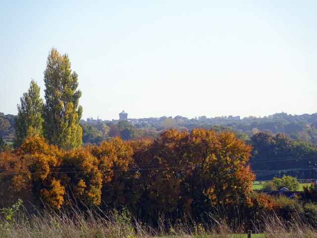
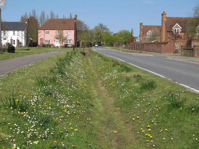
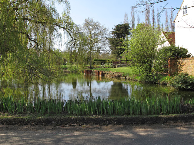
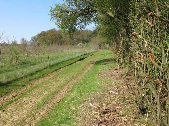
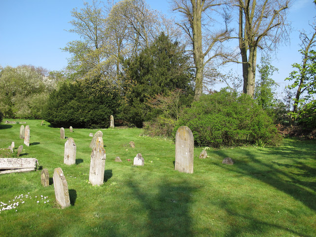
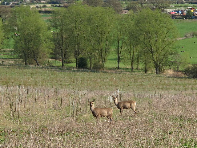
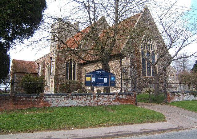
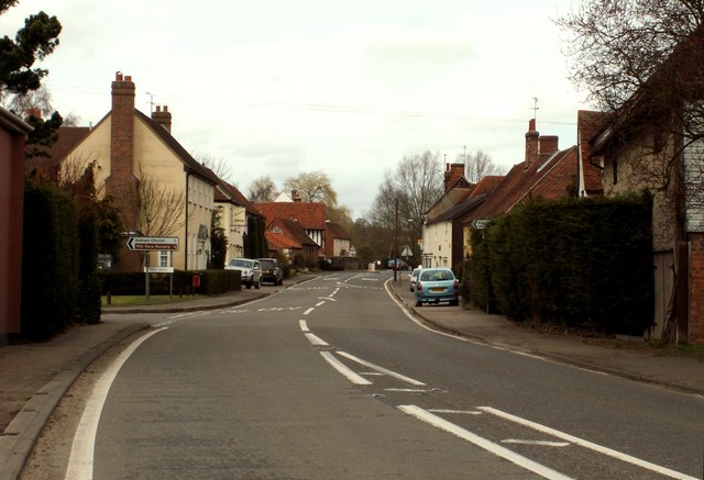
The village is surrounded by picturesque countryside, characterized by rolling fields and farmland. It benefits from a rural charm, with traditional thatched cottages and historic buildings dotting its streets. The St. Mary's Church, a 13th-century structure, stands as a prominent landmark and a testament to the village's rich history.

Despite its small size, Fordham offers a range of amenities to its residents. These include a primary school, a post office, a village store, and a pub, providing essential services and a sense of community. The village also boasts various social and recreational activities, including a cricket club and a village hall that hosts events and gatherings.

Fordham's location provides easy access to larger towns and cities in the region. The nearby town of Colchester, approximately 8 miles away, offers a wider range of facilities and services, including shopping centers, restaurants, and entertainment venues. Additionally, Fordham benefits from good transport links, with regular bus services connecting it to surrounding areas.

Overall, Fordham, Essex, presents an idyllic rural village with a strong sense of community and a peaceful countryside setting. With its historic charm and convenient location, it provides a desirable living environment for those seeking a tranquil lifestyle within reach of urban amenities.

If you have any feedback on the listing, please let us know in the comments section below.

Fordham Images

Images are sourced within 2km of 51.922719/0.802654 or Grid Reference TL9228. Thanks to Geograph Open Source API. All images are credited.

Colchester from a small field in near Fordham
Wormingford Airfield This is the perimeter track of Wormingford Airfield. Military aviation in Wormingford began during WW1 however this aerodrome was operational from November 1943 until the end of the war, after the war it was used by transport command. The base was finally stood down in 1962.  It was used as a civilian airfield for a further nine years. During the 1970’s and 80’s the hard standings and other infrastructure were broken up as the land returned to agriculture as the Air ministry had promised when all land was requisitioned for airfield construction (it is worth noting this promise was also made to the owners of the land at RAF Heathrow). In 1990 the Essex and Suffolk Gliding Club moved to the airfield they have a history of the airfield and the units that operated from here on their website see club info section <span class="nowrap"><a title="http://www.esgc.co.uk/home.asp?start=esgchome.htm" rel="nofollow ugc noopener" href="http://www.esgc.co.uk/home.asp?start=esgchome.htm">Link</a><img style="margin-left:2px;" alt="External link" title="External link - shift click to open in new window" src="https://s1.geograph.org.uk/img/external.png" width="10" height="10"/></span>. To go to the next field in an alphabetical tour of Essex WW2 airfields click on <a href="https://www.geograph.org.uk/photo/221140">TL6824 : Andrews Field</a>. Much information was gleaned from Graham Smith’s book “Essex Airfields In The Second World War”. <span class="nowrap"><a title="https://books.google.co.uk/books/about/Essex_Airfields_in_the_Second_World_War.html?id=u3atAAAACAAJ&redir_esc=y" rel="nofollow ugc noopener" href="https://books.google.co.uk/books/about/Essex_Airfields_in_the_Second_World_War.html?id=u3atAAAACAAJ&redir_esc=y">Link</a><img style="margin-left:2px;" alt="External link" title="External link - shift click to open in new window" src="https://s1.geograph.org.uk/img/external.png" width="10" height="10"/></span>
Wormingford Airfield
This is the perimeter track of Wormingford Airfield. Military aviation in Wormingford began during WW1 however this aerodrome was operational from November 1943 until the end of the war, after the war it was used by transport command. The base was finally stood down in 1962. It was used as a civilian airfield for a further nine years. During the 1970’s and 80’s the hard standings and other infrastructure were broken up as the land returned to agriculture as the Air ministry had promised when all land was requisitioned for airfield construction (it is worth noting this promise was also made to the owners of the land at RAF Heathrow). In 1990 the Essex and Suffolk Gliding Club moved to the airfield they have a history of the airfield and the units that operated from here on their website see club info section LinkExternal link. To go to the next field in an alphabetical tour of Essex WW2 airfields click on TL6824 : Andrews Field. Much information was gleaned from Graham Smith’s book “Essex Airfields In The Second World War”. LinkExternal link
Wormingford Secondary This is the remains of <a href="https://www.geograph.org.uk/photo/251938">TL9230 : Wormingford Airfield</a> secondary runway. The airfield is now used by the Essex & Suffolk Gliding Club <span class="nowrap"><a title="http://www.esgc.co.uk/home.asp?start=esgchome.htm" rel="nofollow ugc noopener" href="http://www.esgc.co.uk/home.asp?start=esgchome.htm">Link</a><img style="margin-left:2px;" alt="External link" title="External link - shift click to open in new window" src="https://s1.geograph.org.uk/img/external.png" width="10" height="10"/></span> as the <a href="https://www.geograph.org.uk/photo/251966">TL9230 : Warning Sign</a> attests. There is some more info on the base at <span class="nowrap"><a title="http://mighty8thaf.preller.us/php/1Loc.php?Base=Wormingford" rel="nofollow ugc noopener" href="http://mighty8thaf.preller.us/php/1Loc.php?Base=Wormingford">Link</a><img style="margin-left:2px;" alt="External link" title="External link - shift click to open in new window" src="https://s1.geograph.org.uk/img/external.png" width="10" height="10"/></span>
Wormingford Secondary
This is the remains of TL9230 : Wormingford Airfield secondary runway. The airfield is now used by the Essex & Suffolk Gliding Club LinkExternal link as the TL9230 : Warning Sign attests. There is some more info on the base at LinkExternal link
Warning Sign This warning sign on <a href="https://www.geograph.org.uk/photo/251957">TL9230 : Wormingford Secondary</a> runway tells walkers on the footpath that follows the perimeter track not to stray, there is no  mention that maximum penalty for failure to comply is death!
Warning Sign
This warning sign on TL9230 : Wormingford Secondary runway tells walkers on the footpath that follows the perimeter track not to stray, there is no mention that maximum penalty for failure to comply is death!
Rights of Way and Rusting Relics This is the junction of the <a href="https://www.geograph.org.uk/photo/251984">TL9229 : Wormingford Peri Track</a> footpath (running left to right) and the path to Hammonds Farm (behind the stile). The whole of the perimeter track of the airfield has been dedicated as a public right of way.
Rights of Way and Rusting Relics
This is the junction of the TL9229 : Wormingford Peri Track footpath (running left to right) and the path to Hammonds Farm (behind the stile). The whole of the perimeter track of the airfield has been dedicated as a public right of way.
Looking over wheat crop to Fairfields Farm, Wormingford
Farmland near Penlan Hall Lane
Footpath sign near Penlan Hall Lane
Shoulder of Mutton, Fordstreet c1948 Photographed across Halstead Road by my grandfather George W Baker. His car (registration number EMY 85) is parked in front of the public house. I've no idea who the pedestrian was but it may have been a warm day as he's got his shirt sleeves rolled up!
Shoulder of Mutton, Fordstreet c1948
Photographed across Halstead Road by my grandfather George W Baker. His car (registration number EMY 85) is parked in front of the public house. I've no idea who the pedestrian was but it may have been a warm day as he's got his shirt sleeves rolled up!
Flower Lined Ditch, Fordham Spring flowers line this ditch, near the Village Green, Fordham
Flower Lined Ditch, Fordham
Spring flowers line this ditch, near the Village Green, Fordham
Moat on Moat Road, Fordham This may be a remnant of the Moat that the road is named after.
Moat on Moat Road, Fordham
This may be a remnant of the Moat that the road is named after.
Saplings, Footpath, Hedge - Fordham Hall Estate Young saplings at Fordham Hall Estate, with evidence of recent hedge maintenance along this public footpath running north from Chappel Road.
Saplings, Footpath, Hedge - Fordham Hall Estate
Young saplings at Fordham Hall Estate, with evidence of recent hedge maintenance along this public footpath running north from Chappel Road.
Chapel Cemetery, Fordham Cemetery near Chapel House, Fordham
Chapel Cemetery, Fordham
Cemetery near Chapel House, Fordham
Deer in the field, Fordham Roe deer in a field, south of Fosset's Lane. Note saplings fitted with protection guards.
Deer in the field, Fordham
Roe deer in a field, south of Fosset's Lane. Note saplings fitted with protection guards.
Saplings and Spring Hedgerow, Fordham Hall Estate Fordham Hall Estate is managed by the Woodland Trust.

The land which almost surrounds the village of Fordham is now the site of a major woodland creation scheme.

<span class="nowrap"><a title="http://www.webcitation.org/6GL4IMFjp" rel="nofollow ugc noopener" href="http://www.webcitation.org/6GL4IMFjp">Link</a><img style="margin-left:2px;" alt="External link" title="External link - shift click to open in new window" src="https://s1.geograph.org.uk/img/external.png" width="10" height="10"/></span>
Saplings and Spring Hedgerow, Fordham Hall Estate
Fordham Hall Estate is managed by the Woodland Trust. The land which almost surrounds the village of Fordham is now the site of a major woodland creation scheme. LinkExternal link
Stile to sapling plantation, Fordham Hall Estate Fordham Hall Estate is managed by the Woodland Trust.

The land which almost surrounds the village of Fordham is now the site of a major woodland creation scheme.

<span class="nowrap"><a title="http://www.webcitation.org/6GL4IMFjp" rel="nofollow ugc noopener" href="http://www.webcitation.org/6GL4IMFjp">Link</a><img style="margin-left:2px;" alt="External link" title="External link - shift click to open in new window" src="https://s1.geograph.org.uk/img/external.png" width="10" height="10"/></span>
Stile to sapling plantation, Fordham Hall Estate
Fordham Hall Estate is managed by the Woodland Trust. The land which almost surrounds the village of Fordham is now the site of a major woodland creation scheme. LinkExternal link
Boundary of Fordham Hall Estate Western boundary of Fordham Hall Estate.
Boundary of Fordham Hall Estate
Western boundary of Fordham Hall Estate.
Hedgerow, Footpath,  Arable Land - Fordstreet Footpath leading from Fordstreet Hill to the woodland at Fordham Hall Estate.
Hedgerow, Footpath, Arable Land - Fordstreet
Footpath leading from Fordstreet Hill to the woodland at Fordham Hall Estate.
Show me another place!

Fordham is located at Grid Ref: TL9228 (Lat: 51.922719, Lng: 0.802654)

Administrative County: Essex

District: Colchester

Police Authority: Essex

What 3 Words

///dolly.silent.litters. Near Eight Ash Green, Essex

Nearby Locations

Fordham Fordham

Related Wikis

Fordham, Essex

Fordham is a village and civil parish in the Colchester district of Essex, England, six miles north-west of Colchester. Its population was recorded as...

All Saints Church, Fordham

All Saints Church is a Church of England parish church in Fordham, Essex. The church is a Grade I listed building. == History == All Saints' Anglican Church...

Hemp's Green

Hemp's Green or Hemps Green is a hamlet in the civil parish of Fordham, in the Colchester borough and the county of Essex, England. == Nearby == Hemp's...

Fordstreet

Fordstreet or Ford Street is a village on the A1124 road, in the civil parish of Aldham in the Colchester district in Essex, England. It is located on...

Nearby Amenities

Located within 500m of 51.922719,0.802654
Crossing
Lat/Long: 51.9235006/0.8041601
Quilters Lane
Naptan AtcoCode: 150029080017
Naptan Bearing: NE
Naptan BusStopType: CUS
Naptan CommonName: Quilters Lane
Naptan Crossing: Quilters Lane
Naptan Indicator: Adj
Naptan Landmark: Quilters Lane
Naptan NaptanCode: esxgdwjd
Naptan Street: Ponders Road
Naptan Verified: no
Public Transport: platform
Source: naptan_import
Lat/Long: 51.9225703/0.8020809
Bus Stop
Memorial
Naptan AtcoCode: 150029080018
Naptan Bearing: N
Naptan BusStopType: CUS
Naptan CommonName: Memorial
Naptan Indicator: Opp
Naptan Landmark: Memorial
Naptan NaptanCode: esxgdwgt
Naptan Street: Church Road
Naptan Verified: no
Public Transport: platform
Source: naptan_import
Lat/Long: 51.9229352/0.8035127
Quilters Lane
Naptan AtcoCode: 150029080Y17
Naptan Bearing: SW
Naptan BusStopType: CUS
Naptan CommonName: Quilters Lane
Naptan Crossing: Quilters Lane
Naptan Indicator: Opp
Naptan Landmark: Quilters Lane
Naptan NaptanCode: esxjajwg
Naptan Street: Ponders Road
Naptan Verified: no
Public Transport: platform
Source: naptan_import
Lat/Long: 51.9225571/0.8022969
Bus Stop
Memorial
Naptan AtcoCode: 1500IM1364
Naptan Bearing: S
Naptan CommonName: Memorial
Naptan Indicator: o/s
Naptan Landmark: Memorial
Naptan NaptanCode: esxdjmtp
Naptan Street: Church Road
Naptan Verified: no
Public Transport: platform
Source: naptan_import
Lat/Long: 51.9225517/0.8036282
Post Box
Ref: CO6 199
Lat/Long: 51.9231629/0.8036748
Turning Circle
Lat/Long: 51.9207464/0.8015377
Turning Circle
Lat/Long: 51.918711/0.8000884
Crossing
Lat/Long: 51.921883/0.8032848
Crossing
Lat/Long: 51.9228279/0.8034957
Power: pole
Lat/Long: 51.9223692/0.800815
Power: pole
Lat/Long: 51.9215893/0.8000596
Power: pole
Lat/Long: 51.9208026/0.7992603
Clock
Display: sundial
Lat/Long: 51.923521/0.8039085
Wren Wood
Place: locality
Lat/Long: 51.9240362/0.7998414
Bench
Lat/Long: 51.9242427/0.7984137
Public Bookcase
Public Bookcase Type: shelf
Lat/Long: 51.922573/0.8037085
Defibrillator
Access: yes
Defibrillator Location: on front wall of the village hall at left side, viewed from road
Emergency: defibrillator
Indoor: no
Ref GB The Circuit: 891B6D02-DCB3-4ABE-9676-AFB100C69B33
Lat/Long: 51.9225602/0.803792
The data included in this document is from www.openstreetmap.org. The data is made available under ODbL.

Have you been to Fordham?

Leave your review of Fordham below (or comments, questions and feedback).