Arger Fen

Wood, Forest in Suffolk Babergh

England

Arger Fen

Sylvan Birches, Arger Fen & Spouse's Vale Nature Reserve A January view of some Silver Birches near a walk in Spouse's Grove.
Sylvan Birches, Arger Fen & Spouse's Vale Nature Reserve Credit: Roger Jones

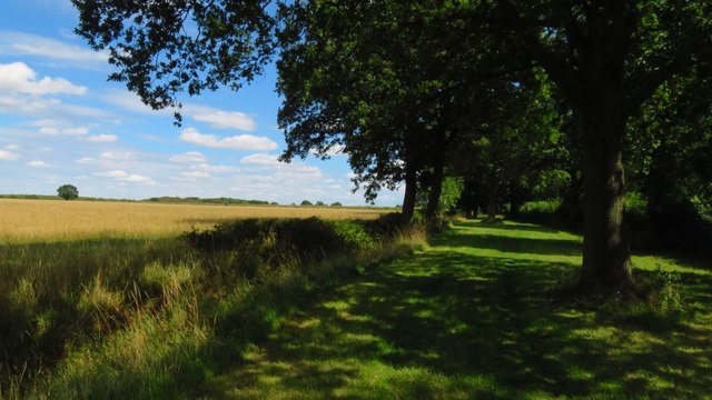
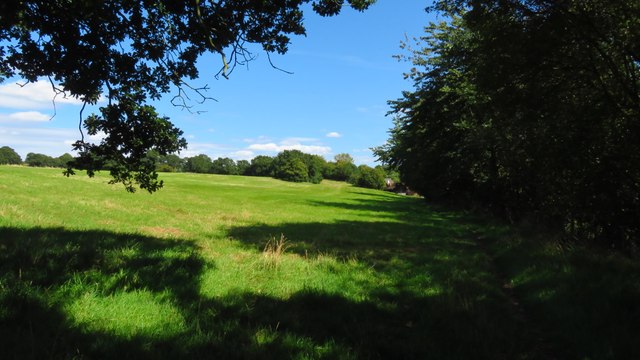
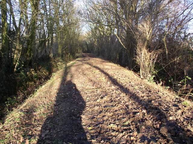
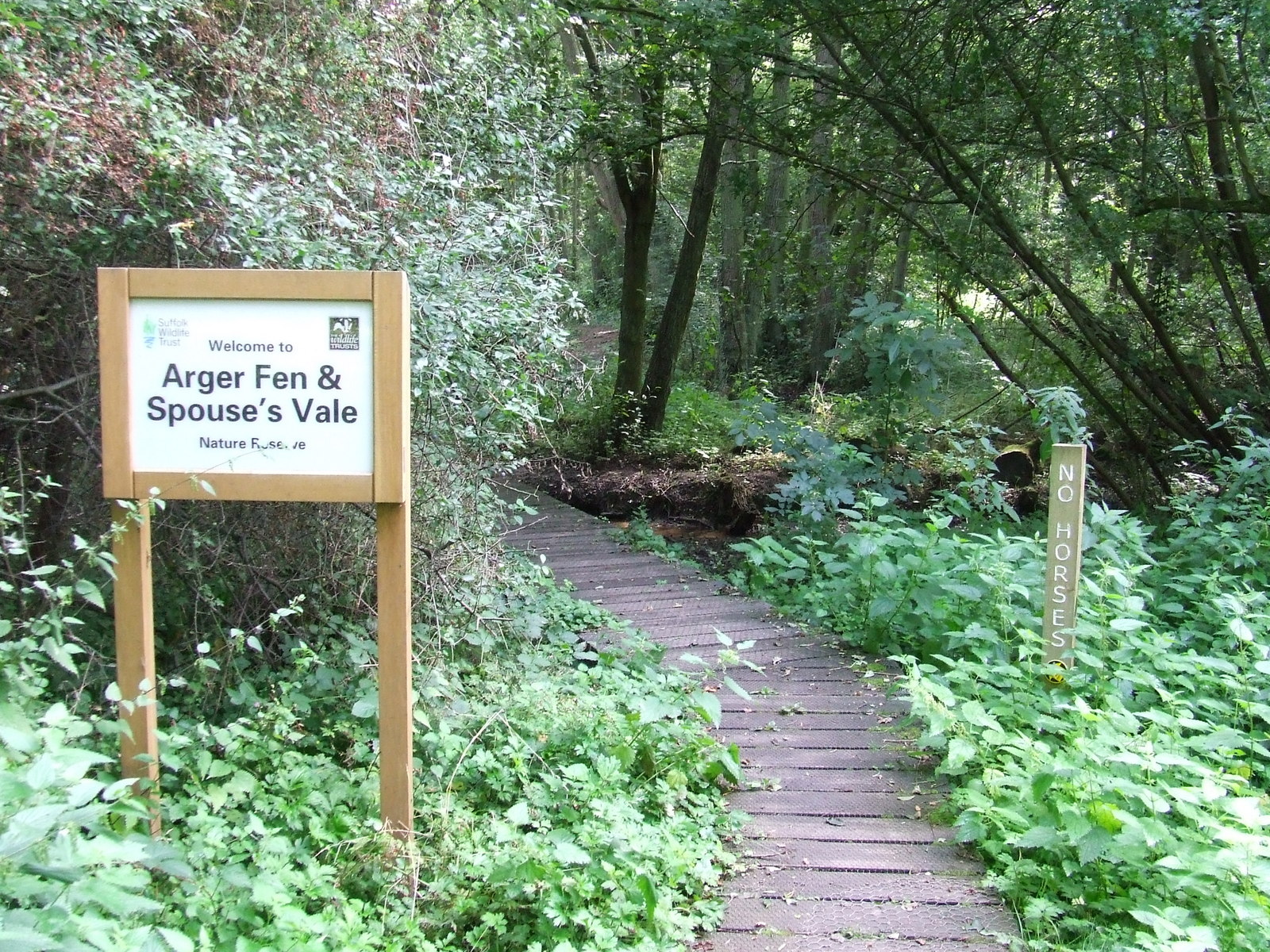
Arger Fen is a picturesque woodland located in Suffolk, England. Covering an area of approximately 200 acres, it is known for its rich biodiversity and stunning natural beauty. The fen is part of the larger Arger Fen and Spouse's Vale Nature Reserve, which is managed by the Suffolk Wildlife Trust.

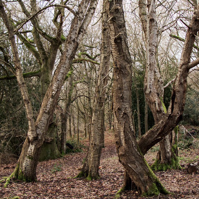
The woodland is predominantly composed of ancient coppice woodlands, with a variety of tree species such as oak, ash, hornbeam, and birch. These trees provide a dense canopy, creating a tranquil and shady environment for visitors to explore. The woodland floor is adorned with a diverse array of wildflowers, including bluebells, wood anemones, and primroses, which bloom in vibrant colors during the spring.

Arger Fen is also home to an abundance of wildlife. It is a haven for birdwatchers, with species such as nightingales, woodpeckers, and tawny owls frequently spotted among the trees. The fen itself provides a habitat for rare and protected species of dragonflies and damselflies, including the beautiful emperor dragonfly and the scarce blue-tailed damselfly.

For nature enthusiasts, Arger Fen offers a network of well-maintained footpaths and trails, allowing visitors to explore the woodland at their own pace. The reserve also features several bird hides and observation platforms, providing excellent opportunities for wildlife observation and photography. Educational activities and guided walks are often organized by the Suffolk Wildlife Trust to promote awareness and understanding of the unique ecosystems found within Arger Fen.

Overall, Arger Fen is a hidden gem of natural beauty in Suffolk, offering a peaceful retreat for nature lovers and a sanctuary for a wide range of plant and animal species.

If you have any feedback on the listing, please let us know in the comments section below.
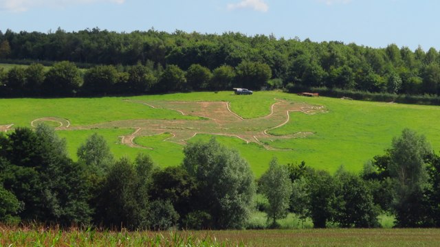
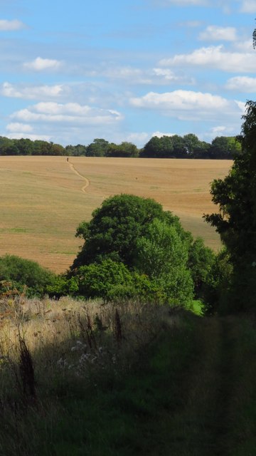
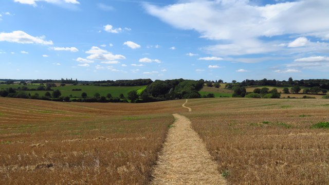
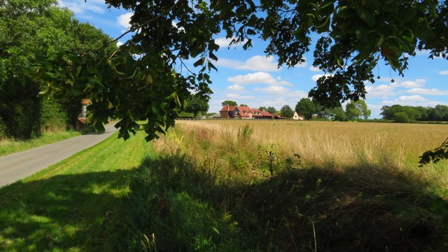
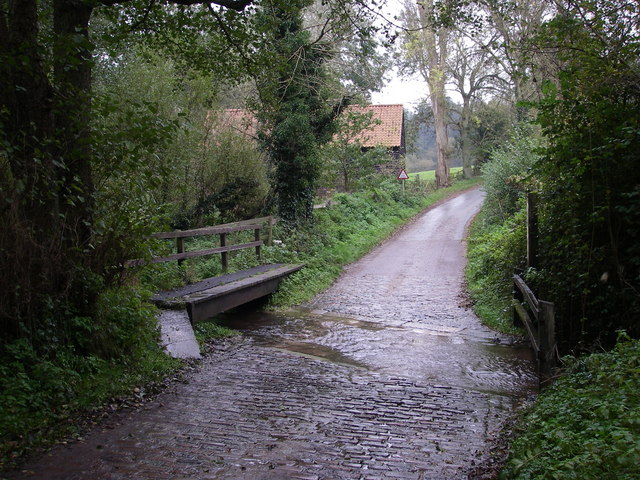
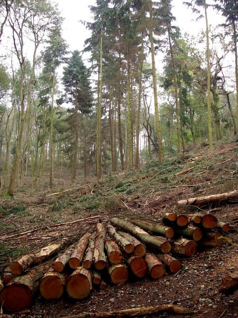
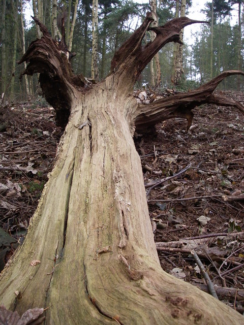
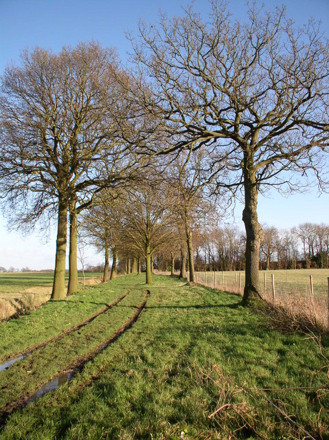
Arger Fen Images

Images are sourced within 2km of 51.984162/0.81435517 or Grid Reference TL9335. Thanks to Geograph Open Source API. All images are credited.

Sylvan Birches, Arger Fen & Spouse's Vale Nature Reserve A January view of some Silver Birches near a walk in Spouse's Grove.
Sylvan Birches, Arger Fen & Spouse's Vale Nature Reserve
A January view of some Silver Birches near a walk in Spouse's Grove.
Horses at their Hay, Assington  Seen from the road that runs between Tiger Hill and Arger Fen.

There are quite a few stables and livery businesses in the area.
Horses at their Hay, Assington
Seen from the road that runs between Tiger Hill and Arger Fen. There are quite a few stables and livery businesses in the area.
St Stephen's Chapel St Stephen's Chapel, Bures, near the viewpoint for the Bures Dragon.
St Stephen's Chapel
St Stephen's Chapel, Bures, near the viewpoint for the Bures Dragon.
Bures - St Stephen's Chapel
Bures Old Dragon - ground figure This chalk figure was restored in 2012 It is not unlike one of the ‘White Horses’ chalked into the hillside of Wiltshire but here in Suffolk the countryside is much flatter and hence probably the best viewing is from the air.
The story of the dragon probably stems from 1307AD when Richard I returned from the Holy Land with a collection of animals for his royal menagerie, including a crocodile reportedly gifted to him from Saladin. This animal was kept in the Tower of London, where it lived without incident for several years until a storm flooded the Tower. Washed into the river, the creature, somehow, found its way to 'Anglia' and ascended into myth. The reptile found its way to Wormingford where it terrorised the local people who had never seen anything like it. The reptile feasted itself on sheep and even killed a local farmer. As panic spread, a local landowner, Sir Richard de Waldegrave, assembled a posse of workmen armed with bows and arrows to kill the creature. They found the “dragon” near the farm and cornered it, unleashing a fusillade of arrows. Unfortunately the beast “eluded all of his shots and sprang back arrow from his ribs like a knife or hard stone". After this violent encounter, the wounded creature fled to the swamp, and lay hidden among the reeds; nor was seen any more. The story has been passed down through the generations with its size increasing.
Bures Old Dragon - ground figure
This chalk figure was restored in 2012 It is not unlike one of the ‘White Horses’ chalked into the hillside of Wiltshire but here in Suffolk the countryside is much flatter and hence probably the best viewing is from the air. The story of the dragon probably stems from 1307AD when Richard I returned from the Holy Land with a collection of animals for his royal menagerie, including a crocodile reportedly gifted to him from Saladin. This animal was kept in the Tower of London, where it lived without incident for several years until a storm flooded the Tower. Washed into the river, the creature, somehow, found its way to 'Anglia' and ascended into myth. The reptile found its way to Wormingford where it terrorised the local people who had never seen anything like it. The reptile feasted itself on sheep and even killed a local farmer. As panic spread, a local landowner, Sir Richard de Waldegrave, assembled a posse of workmen armed with bows and arrows to kill the creature. They found the “dragon” near the farm and cornered it, unleashing a fusillade of arrows. Unfortunately the beast “eluded all of his shots and sprang back arrow from his ribs like a knife or hard stone". After this violent encounter, the wounded creature fled to the swamp, and lay hidden among the reeds; nor was seen any more. The story has been passed down through the generations with its size increasing.
St Edmund Way between Bures and Over Hall Farm
Smallbridge Entry and Highfields Farm, Bures
Dead Lane east of Highfields Farm, Bures
Following St Edmund Way east towards Wissington Grange
Cottage at Dorking Tye, Suffolk Dorking Tye is an area near the village of Assington. This lovely thatched timber-framed cottage is just one of the few buildings in this part of rural suffolk.
Cottage at Dorking Tye, Suffolk
Dorking Tye is an area near the village of Assington. This lovely thatched timber-framed cottage is just one of the few buildings in this part of rural suffolk.
Leavenheath Village Hall A busy meeting point for a growing South Suffolk village.
Leavenheath Village Hall
A busy meeting point for a growing South Suffolk village.
The Ford Cobbled ford still in use between Arger Fen and Tiger Hill.
The Ford
Cobbled ford still in use between Arger Fen and Tiger Hill.
Arger Fen Native woodland in the process of restoration by Suffolk County Council.
Arger Fen
Native woodland in the process of restoration by Suffolk County Council.
Arger Fen - retained deadwood During restoration of this site, deadwood has been retained for wildlife.
Arger Fen - retained deadwood
During restoration of this site, deadwood has been retained for wildlife.
St Edmund Way, Suffolk The St Edmund Way east of Bures, part of a long distance walk of 88 miles across Suffolk
St Edmund Way, Suffolk
The St Edmund Way east of Bures, part of a long distance walk of 88 miles across Suffolk
Kingsland Lane, Leavenheath, Suffolk A public bridleway south of Leavenheath. Very muddy and littered with debris from recent storms.
Kingsland Lane, Leavenheath, Suffolk
A public bridleway south of Leavenheath. Very muddy and littered with debris from recent storms.
One of the buildings at Dorking Tye House
Show me another place!

Arger Fen is located at Grid Ref: TL9335 (Lat: 51.984162, Lng: 0.81435517)

Administrative County: Suffolk

District: Babergh

Police Authority: Suffolk

What 3 Words

///champions.topics.cold. Near Bures St Mary, Suffolk

Nearby Locations

Arger Fen

Related Wikis

Arger Fen

Arger Fen is a 49.7-hectare (123-acre) biological Site of Special Scientific Interest (SSSI) south-east of Sudbury in Suffolk, England. The site occupies...

Tiger Hill, Suffolk

Tiger Hill is a 21 hectare Local Nature Reserve between Bures St Mary and Leavenheath in Suffolk. It is owned by [a group of landowners and declared under...

Leavenheath

Leavenheath is a village and civil parish in Suffolk, England, close to the Essex border. Located on the A134 between Sudbury and Colchester, it is part...

Smallbridge Hall

Smallbridge Hall is a Grade II* listed English country house in Bures St. Mary, Suffolk, near Colchester, England. The house is partially surrounded by...

Nearby Amenities

Located within 500m of 51.984162,0.81435517
Ford: yes
Lat/Long: 51.9851893/0.8097473
Parking
Arger Fen
Lat/Long: 51.9822118/0.8094909
Bench
Lat/Long: 51.9849656/0.8207635
Bench
Lat/Long: 51.9852448/0.8146936
The data included in this document is from www.openstreetmap.org. The data is made available under ODbL.

Have you been to Arger Fen?

Leave your review of Arger Fen below (or comments, questions and feedback).