Plurenden Wood

Wood, Forest in Kent Ashford

England

Plurenden Wood

Bethersden Village Sign This sign was erected for the Millennium and is located in School Road near the junction with the A28 Ashford Road. School Road can be seen to the right of the photo whilst behind the sign, Whiston Avenue branches off School Road.
Bethersden Village Sign Credit: David Hillas

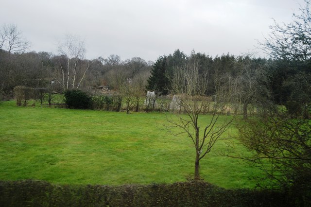
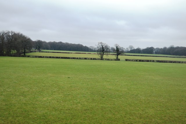
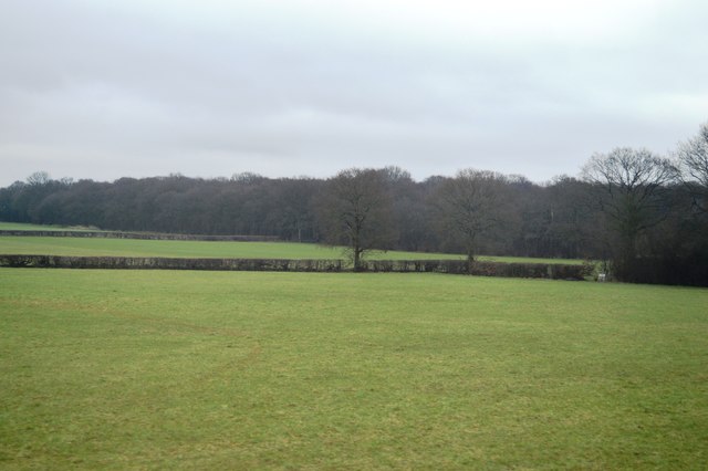
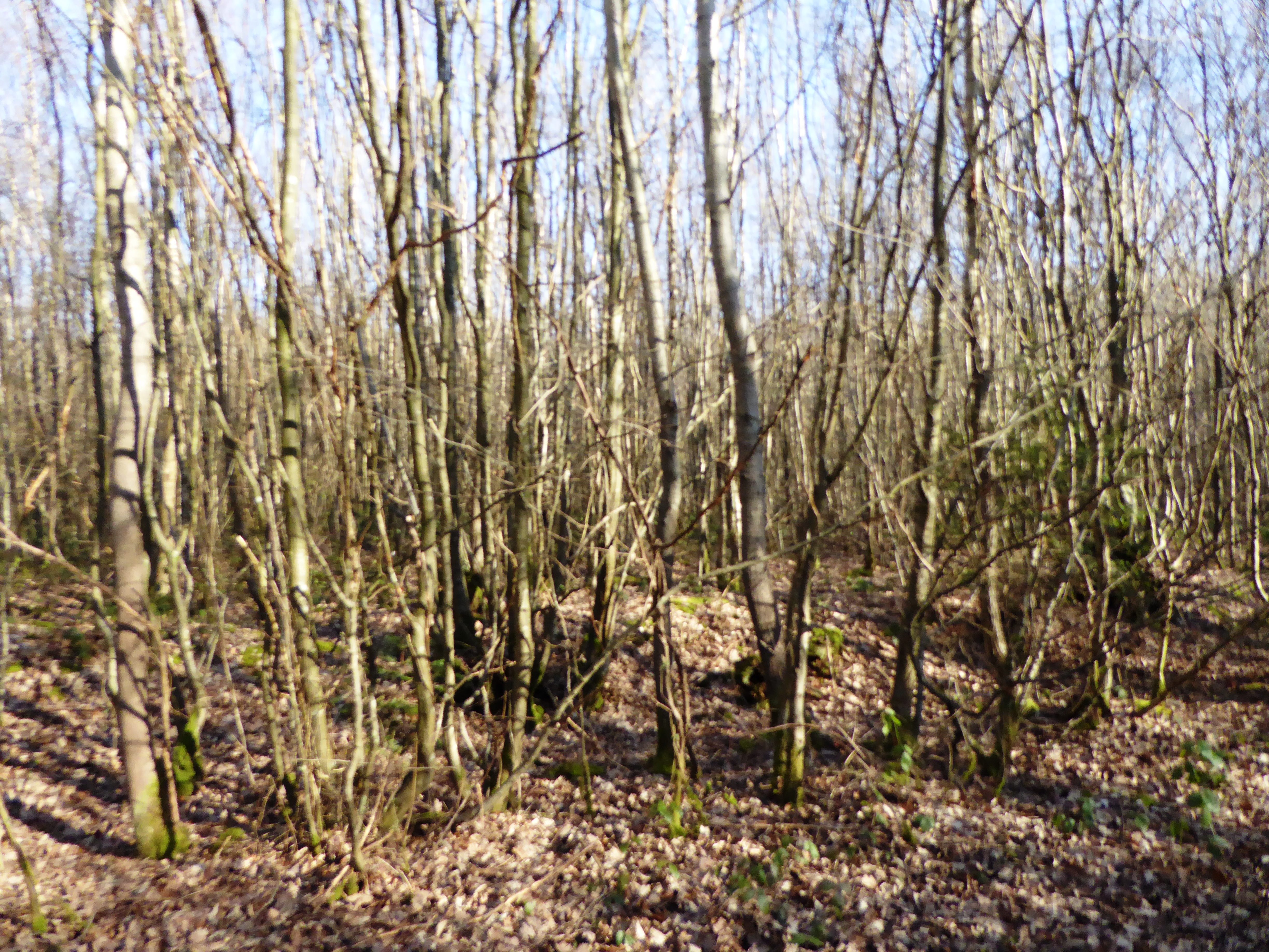
Plurenden Wood, located in Kent, England, is a charming woodland area renowned for its natural beauty and rich biodiversity. Covering an area of approximately 100 acres, the wood is a popular destination for nature enthusiasts and hikers seeking a peaceful retreat from the bustling city life.

The wood is predominantly composed of native broadleaf trees, including oak, beech, and ash, which create a dense canopy, providing shade and shelter for various wildlife species. The diverse flora and fauna found within Plurenden Wood make it an important ecological site in the region.

Walking through the wood, visitors can admire a plethora of wildflowers, such as bluebells, primroses, and foxgloves, which add vibrant colors to the woodland floor during the spring and summer months. The tranquil atmosphere is further enhanced by the melodic songs of numerous bird species, including woodpeckers, thrushes, and warblers.

Plurenden Wood also offers several designated walking trails, providing visitors with the opportunity to explore the area at their own pace. These well-maintained paths wind through the wood, offering picturesque views of the surrounding countryside and occasional glimpses of wildlife, such as deer and squirrels.

The wood is managed by a local conservation organization in collaboration with the Forestry Commission, ensuring the preservation of its natural beauty and protecting its unique ecosystem. Plurenden Wood stands as a testament to the importance of preserving and appreciating natural environments, offering a sanctuary for both wildlife and humans alike.

If you have any feedback on the listing, please let us know in the comments section below.

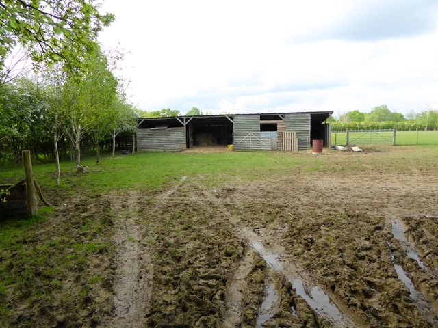
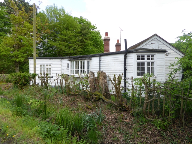
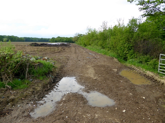
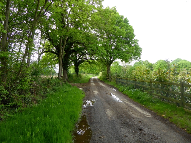
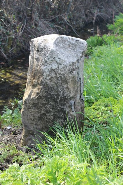
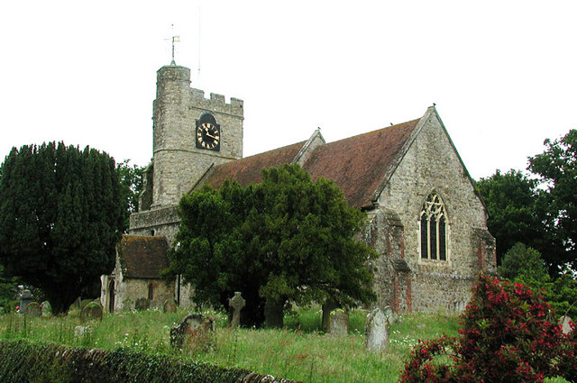
Plurenden Wood Images

Images are sourced within 2km of 51.110309/0.75557231 or Grid Reference TQ9238. Thanks to Geograph Open Source API. All images are credited.

Bethersden Village Sign This sign was erected for the Millennium and is located in School Road near the junction with the A28 Ashford Road. School Road can be seen to the right of the photo whilst behind the sign, Whiston Avenue branches off School Road.
Bethersden Village Sign
This sign was erected for the Millennium and is located in School Road near the junction with the A28 Ashford Road. School Road can be seen to the right of the photo whilst behind the sign, Whiston Avenue branches off School Road.
Close Up of the Bethersden Village Sign This photo shows the eight symbols round the sign with St Margaret's Parish Church  and a few houses in its centre.
Close Up of the Bethersden Village Sign
This photo shows the eight symbols round the sign with St Margaret's Parish Church and a few houses in its centre.
Notice on Bethersden Village Sign (1) This photo shows one of four notices on the Bethersden Village Sign. It says the following:
                                  BETHERSDEN

People have lived here for more than 1000 years. St Margaret's Church is mentioned  in the 12th C Domesday Monachorum. Baptist and Methodist Chapels are more modern.
Bethersden "marble" - formed from fossilised shells of tiny freshwater snails is no longer quarried but traditional crafts (woodworking, iron forging etc) continue, as do horticulture and pig, sheep and cereal farming.
Riding, cricket, football, tennis and cycle-racing are features of village life, as is a spirit of community care.
Notice on Bethersden Village Sign (1)
This photo shows one of four notices on the Bethersden Village Sign. It says the following: BETHERSDEN People have lived here for more than 1000 years. St Margaret's Church is mentioned in the 12th C Domesday Monachorum. Baptist and Methodist Chapels are more modern. Bethersden "marble" - formed from fossilised shells of tiny freshwater snails is no longer quarried but traditional crafts (woodworking, iron forging etc) continue, as do horticulture and pig, sheep and cereal farming. Riding, cricket, football, tennis and cycle-racing are features of village life, as is a spirit of community care.
Notice on Bethersden Village Sign (2) This photo shows one of the four notices on the Bethersden village sign in School Road near the A28 Ashford Road. It has the following wording:

                                BETHERSDEN
                              MILLENNIUM SIGN

 The material in this sign - iron, oak and a limestone "marble" - and the symbols all relate to activities for which Bethersden is famous. The plaque is a montage of features in the village centre.
 The sign was designed by residents and built by local craftsmen with a grant from Ashford Borough Council. Beneath the base, a Time Capsule is buried - to be opened no sooner than 2100 AD.
Notice on Bethersden Village Sign (2)
This photo shows one of the four notices on the Bethersden village sign in School Road near the A28 Ashford Road. It has the following wording: BETHERSDEN MILLENNIUM SIGN The material in this sign - iron, oak and a limestone "marble" - and the symbols all relate to activities for which Bethersden is famous. The plaque is a montage of features in the village centre. The sign was designed by residents and built by local craftsmen with a grant from Ashford Borough Council. Beneath the base, a Time Capsule is buried - to be opened no sooner than 2100 AD.
Notice on Bethersden Village Sign (3) This photo shows one of the four notices on the Bethersden village sign in School Road near the A28 Ashford Road. It says the following:
     
                              THE SIGN SYMBOLS

 OAST HOUSES -  hop farming area until 1970s
 ROCKING HORSE - Stevenson Brothers export them all over the world
 ANVIL -  forges in the parish still operational
 BOOK -  Richard Lovelace, 17th C Cavalier Poet, owned land in Bethersden. He           wrote: "Stone walls do not a prison make
        Nor i'ron bars a cage"
 PLANE - village's wood craftmanship renowned.
 SHEARS - sheep farming commercially important.
 PIG - 1086 village named "Beadericesdenne". "denne" meant woodland where swine   are pastured
Notice on Bethersden Village Sign (3)
This photo shows one of the four notices on the Bethersden village sign in School Road near the A28 Ashford Road. It says the following: THE SIGN SYMBOLS OAST HOUSES - hop farming area until 1970s ROCKING HORSE - Stevenson Brothers export them all over the world ANVIL - forges in the parish still operational BOOK - Richard Lovelace, 17th C Cavalier Poet, owned land in Bethersden. He wrote: "Stone walls do not a prison make Nor i'ron bars a cage" PLANE - village's wood craftmanship renowned. SHEARS - sheep farming commercially important. PIG - 1086 village named "Beadericesdenne". "denne" meant woodland where swine are pastured
Notice on Bethersden Village Sign (4) This notice is one of four on the Betherden Village Sign and lists the acknowledgements to those who were responsible for the sign being erected for the Millennium. Included on that list is the Bethersden "Marble" donated by 44 residents.
Notice on Bethersden Village Sign (4)
This notice is one of four on the Betherden Village Sign and lists the acknowledgements to those who were responsible for the sign being erected for the Millennium. Included on that list is the Bethersden "Marble" donated by 44 residents.
The Bull Inn, Bethersden Situated on the A28 road at Bull Hill, this inn dates from 1645. Later, its stables were used as a prison and the local Home Guard occupied the Inn for training during World War 2. It now provides food and drink daily, and has a garden and car parking space. For SatNav purposes, its postcode is TN26 3LB.
The Bull Inn, Bethersden
Situated on the A28 road at Bull Hill, this inn dates from 1645. Later, its stables were used as a prison and the local Home Guard occupied the Inn for training during World War 2. It now provides food and drink daily, and has a garden and car parking space. For SatNav purposes, its postcode is TN26 3LB.
School Rd
School Rd
By Ashford Rd
By Ashford Rd
Two trees in a hedge
Field by Ashford Rd
Field by Ashford Rd
Cuckolds Corner The intersection of Plurenden Road and Redbrook Street. There must be a story behind the name.
Cuckolds Corner
The intersection of Plurenden Road and Redbrook Street. There must be a story behind the name.
Muddy field and makeshift stable Off Plurenden Road.
Muddy field and makeshift stable
Off Plurenden Road.
Roadside cottage on Plurenden Road
Field entrance off Plurenden Road
Road junction on Plurenden Road The cycleway signs indicate that National Cycle Route 18 passes along Plurenden Road.
Road junction on Plurenden Road
The cycleway signs indicate that National Cycle Route 18 passes along Plurenden Road.
Lane off Plurenden Road
Old Milestone by the A28, Ashford Road, east of Bethersden Metal plate attached to stone post by the A28, in parish of BETHERSDEN (ASHFORD District), by junction to Woodchurch, found by Mr Buss and due to be re-instated 2009, on West side of road. Tenterden marker, erected by the Bethersden turnpike trust in the 19th century. 

Inscription once read:-
: (TENTERDEN / 7) : : (Ashford 5) :
Rivet benchmark on top.  

Milestone Society National ID: KE_TTAF07
Old Milestone by the A28, Ashford Road, east of Bethersden
Metal plate attached to stone post by the A28, in parish of BETHERSDEN (ASHFORD District), by junction to Woodchurch, found by Mr Buss and due to be re-instated 2009, on West side of road. Tenterden marker, erected by the Bethersden turnpike trust in the 19th century. Inscription once read:- : (TENTERDEN / 7) : : (Ashford 5) : Rivet benchmark on top. Milestone Society National ID: KE_TTAF07
Show me another place!

Plurenden Wood is located at Grid Ref: TQ9238 (Lat: 51.110309, Lng: 0.75557231)

Administrative County: Kent

District: Ashford

Police Authority: Kent

What 3 Words

///eyelid.winning.seatbelt. Near High Halden, Kent

Nearby Locations

Plurenden Wood Paul's Wood

Related Wikis

National Cycle Route 18

National Cycle Route 18 (NCR18) runs from Canterbury to Royal Tunbridge Wells. It follows the valley of the River Stour to Ashford and then runs through...
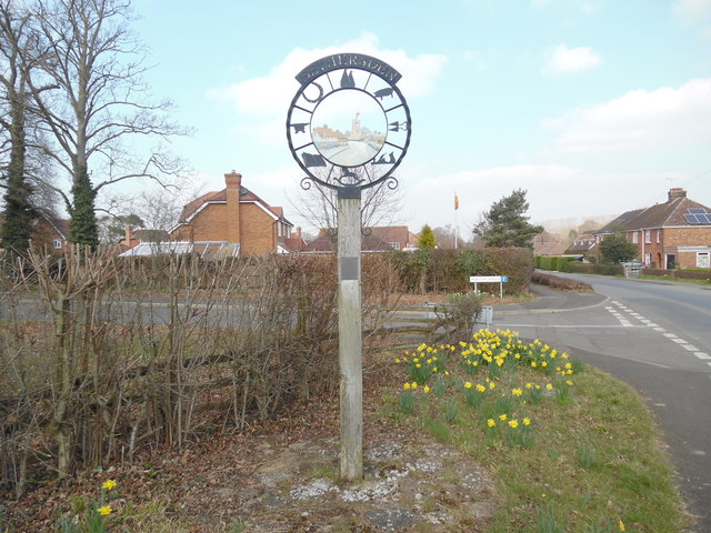
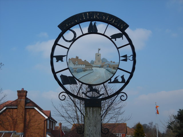
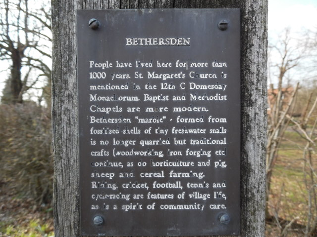
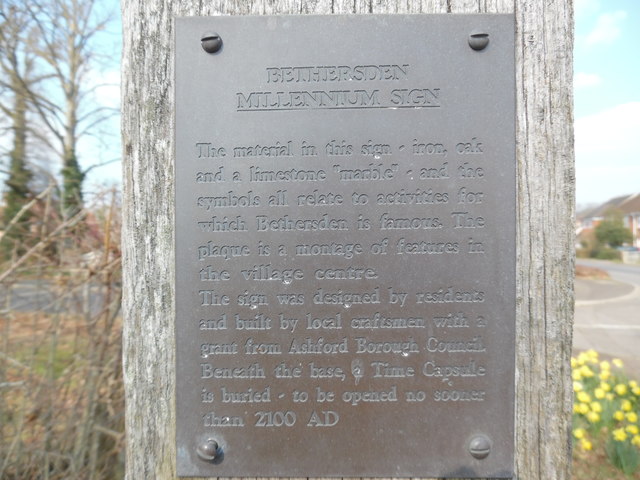
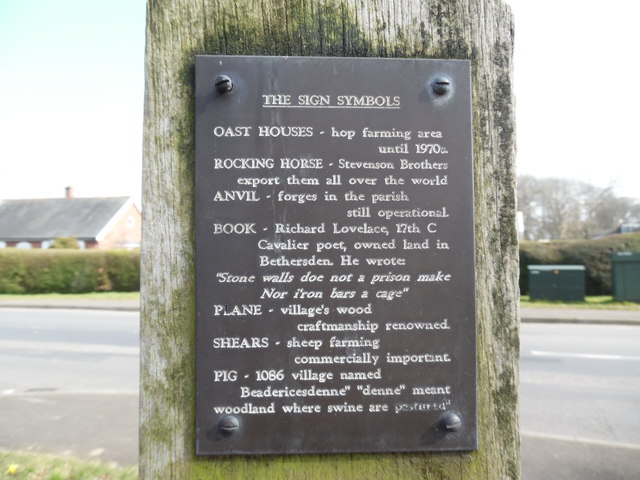
Bethersden

Bethersden is a village and civil parish in the borough of Ashford in Kent, England, 5 miles (8 km) west of the town of Ashford. Located on the main road...

Shirkoak

Shirkoak is a hamlet in the civil parish of Woodchurch, southwest of the town of Ashford in Kent, England. == External links == Media related to Shirkoak...

RAF Woodchurch

Royal Air Force Woodchurch, or more simply RAF Woodchurch, is a former Royal Air Force Advanced Landing Ground located in Kent, England. The airfield...

High Halden

High Halden is a village and civil parish in the Ashford District of Kent, England. The village is on the A28 road between Ashford and Tenterden, 3 miles...

Lower Mill, Woodchurch

Lower Mill is a smock mill in Woodchurch, Kent, England that was built in 1820. It is a Scheduled Ancient Monument and a Grade II* listed building. �...

Ashford (UK Parliament constituency)

Ashford is a constituency in Kent created in 1885 and represented in the House of Commons of the UK Parliament since 1997 by Damian Green, a Conservative...

Stone Wood

Stone Wood is a nature reserve south-west of Shadoxhurst in Kent. It is managed by Kent Wildlife Trust (KWT).This site was clear felled in 1992 and left...

Nearby Amenities

Located within 500m of 51.110309,0.75557231
The data included in this document is from www.openstreetmap.org. The data is made available under ODbL.

Have you been to Plurenden Wood?

Leave your review of Plurenden Wood below (or comments, questions and feedback).