Birch Wood
Wood, Forest in Kent Maidstone
England
Birch Wood

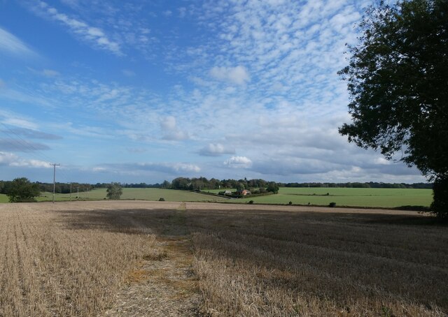
Birch Wood, located in Kent, England, is a picturesque forest known for its dense population of birch trees. Spanning an area of approximately 50 hectares, this woodland is a natural haven for flora and fauna, offering visitors an opportunity to connect with nature.
The dominant species in Birch Wood is the silver birch (Betula pendula), which is characterized by its distinctive white bark and slender, pendulous branches. These trees create a stunning visual display, especially during the spring when their delicate green leaves emerge, creating a vibrant canopy. The forest floor beneath is covered in a lush carpet of ferns, mosses, and wildflowers, contributing to the area's enchanting ambiance.
The wood is home to a diverse range of wildlife, making it an ideal destination for birdwatching and animal spotting. Visitors may have the chance to spot various bird species, such as woodpeckers, nightingales, and warblers, which find shelter among the trees. Additionally, the forest provides a habitat for mammals such as foxes, badgers, and deer, adding to the ecological richness of the area.
Birch Wood offers a variety of recreational activities for nature enthusiasts. There are well-maintained walking trails that wind through the forest, providing visitors with an opportunity to explore its beauty at their own pace. The wood also features designated picnic areas, where visitors can relax and enjoy a meal amidst the tranquility of the surroundings.
Overall, Birch Wood in Kent is a captivating woodland that showcases the beauty of nature. Its lush vegetation, diverse wildlife, and serene atmosphere make it a popular destination for both locals and tourists seeking solace in the great outdoors.
If you have any feedback on the listing, please let us know in the comments section below.
Birch Wood Images
Images are sourced within 2km of 51.247201/0.74179598 or Grid Reference TQ9153. Thanks to Geograph Open Source API. All images are credited.


Birch Wood is located at Grid Ref: TQ9153 (Lat: 51.247201, Lng: 0.74179598)
Administrative County: Kent
District: Maidstone
Police Authority: Kent
What 3 Words
///conspire.slim.soft. Near Lenham, Kent
Nearby Locations
Related Wikis

Lenham Quarry
Lenham Quarry is a 4-hectare (9.9-acre) geological Site of Special Scientific Interest east of Lenham in Kent. It is a Geological Conservation Review site...
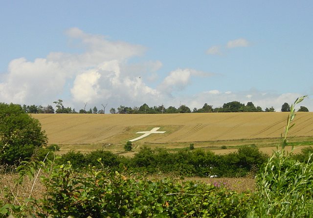
Lenham Cross
The Lenham Cross is a chalk cross carved into the hillside to the north of Lenham in Kent, in England. The Latin cross is 200 ft (61 m) high with arms...

St Mary's Church, Lenham
St Mary's is a parish church in Lenham, Kent begun in the 12th century with additions in the next three centuries. It is a Grade I listed building. �...
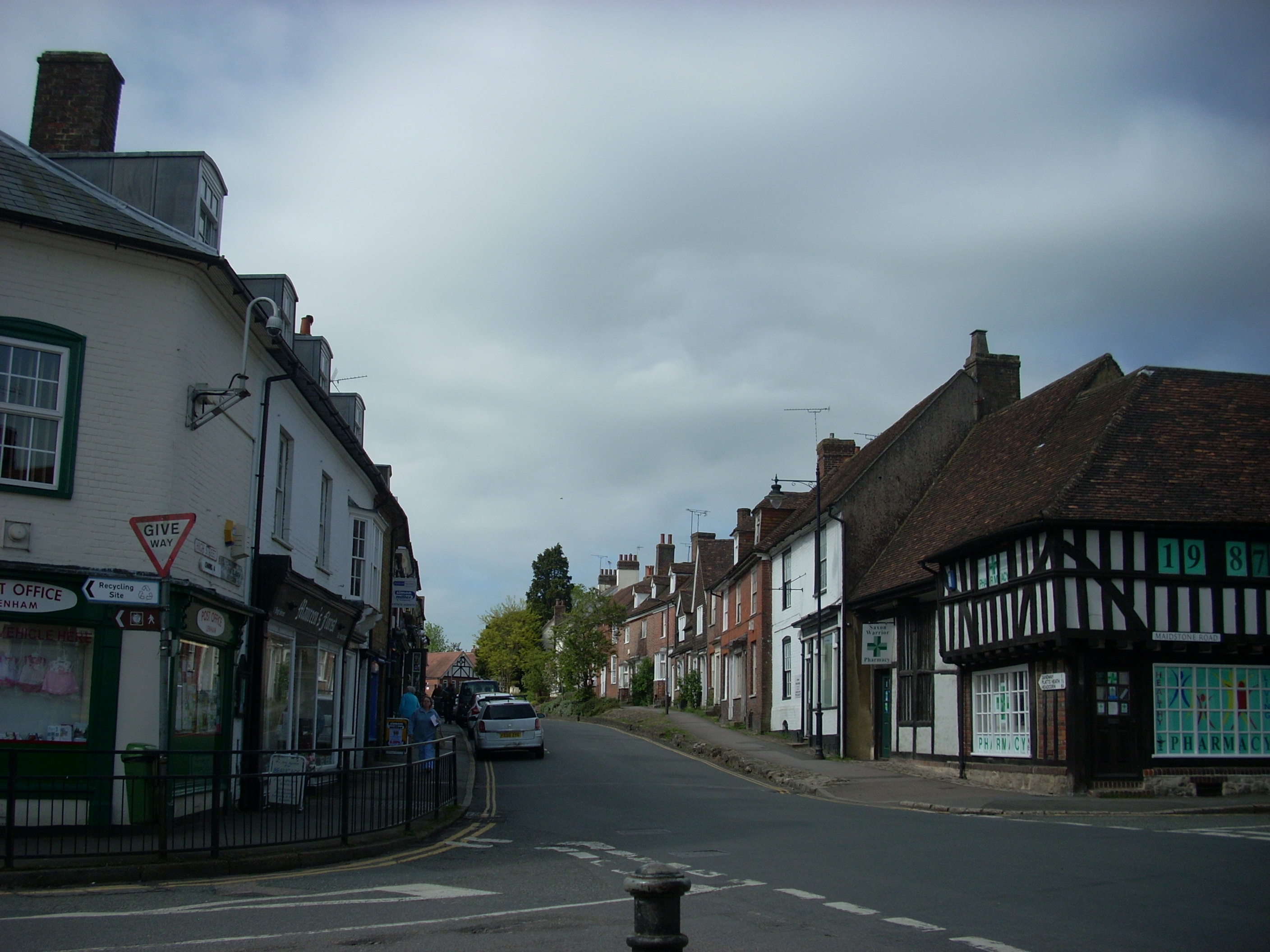
Lenham
Lenham is a market village and civil parish in Kent situated on the southern edge of the North Downs, 9 miles (14 km) east of Maidstone. The picturesque...

Wichling
Wichling (otherwise Wychling) is a village and civil parish within the local government district of Maidstone, in England. The parish lies approximately...

The Lenham School
The Lenham School is a coeducational secondary school and sixth form located in Lenham, Kent, England. It opened in 1952, as Swadelands School, and provides...
Bunce Court School
The Bunce Court School was an independent, private boarding school in the village of Otterden, in Kent, England. It was founded in 1933 by Anna Essinger...
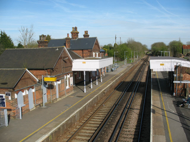
Lenham railway station
Lenham railway station serves Lenham in Kent, England. It is 49 miles 11 chains (79.1 km) down the line from London Victoria. The station, and all trains...
Nearby Amenities
Located within 500m of 51.247201,0.74179598Have you been to Birch Wood?
Leave your review of Birch Wood below (or comments, questions and feedback).