Waterhouse Plantation

Wood, Forest in Norfolk Breckland

England

Waterhouse Plantation

Tottington Road Tottington Road looking west near to Thompson, Norfolk.
Tottington Road Credit: Claire Evans

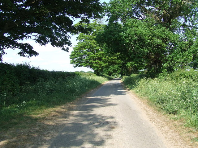
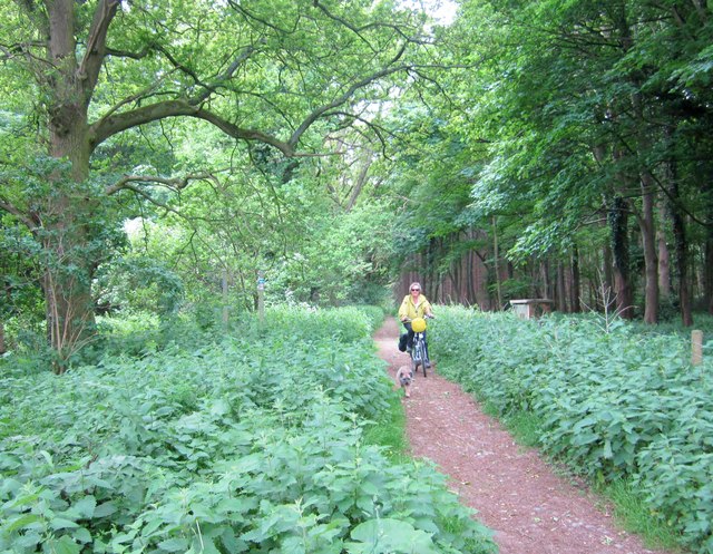
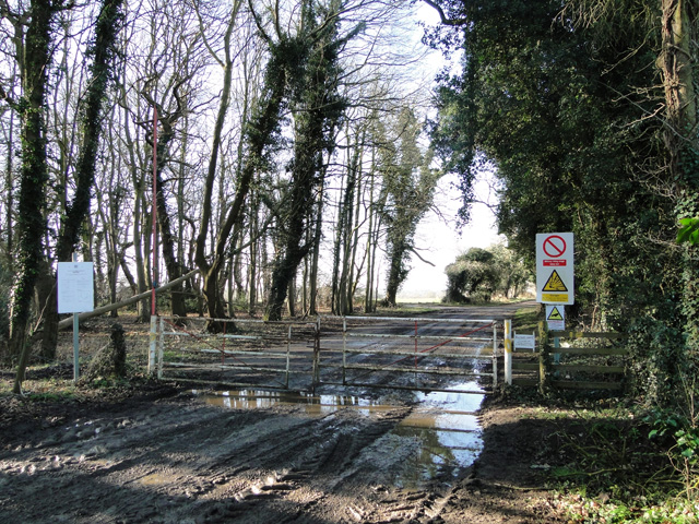
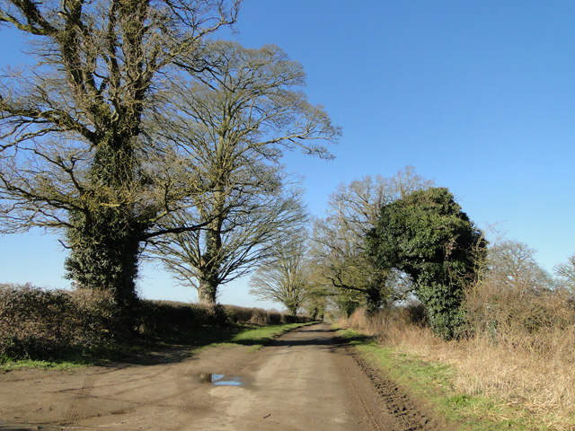
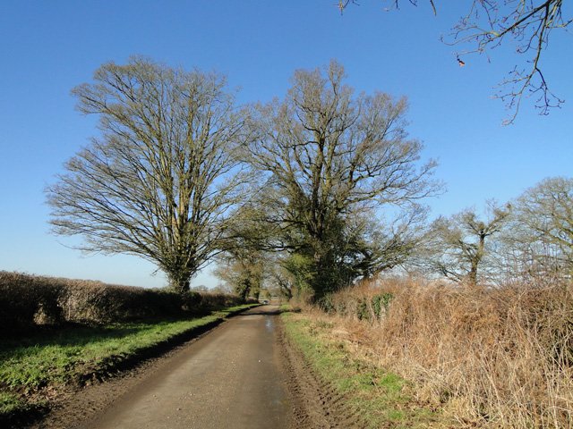
Waterhouse Plantation is a picturesque woodland area located in Norfolk, England. Spanning over a vast expanse, it is renowned for its diverse vegetation and tranquil atmosphere, attracting nature enthusiasts and walkers alike.

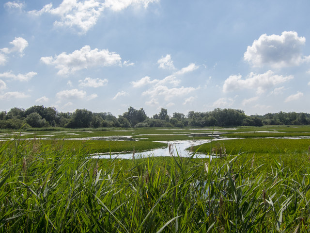
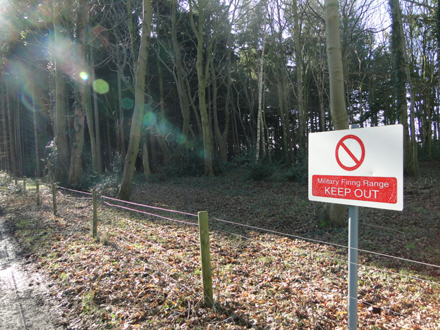
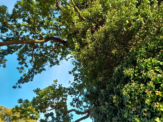
Nestled amidst the captivating Norfolk countryside, Waterhouse Plantation boasts a rich and diverse ecosystem. The plantation is predominantly composed of a mixture of broadleaf and coniferous trees, such as oak, beech, pine, and spruce, which create a beautifully textured forest canopy. This varied vegetation provides a haven for a wide range of wildlife, including numerous bird species, small mammals, and insects.

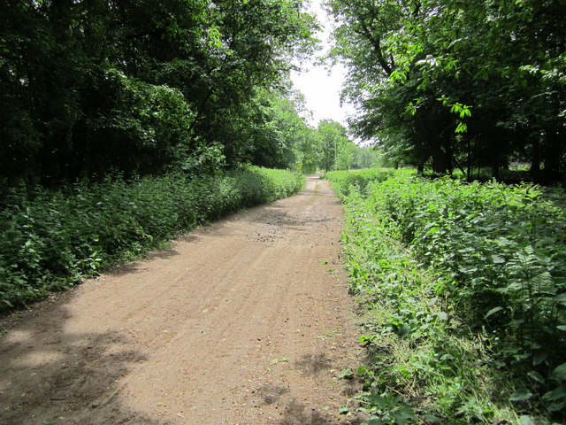
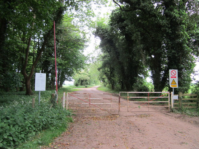
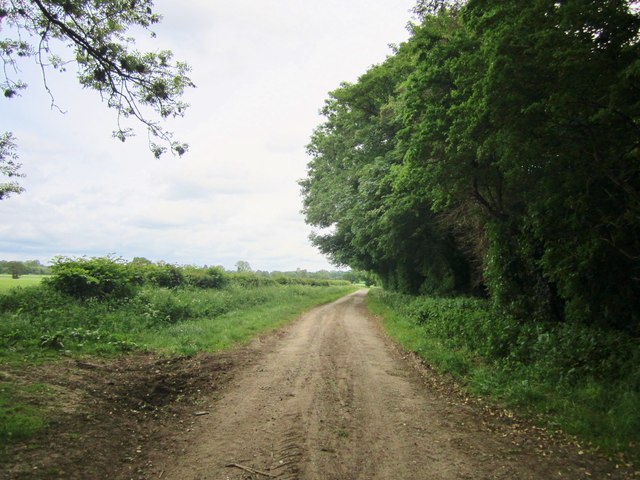
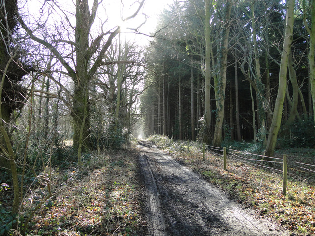
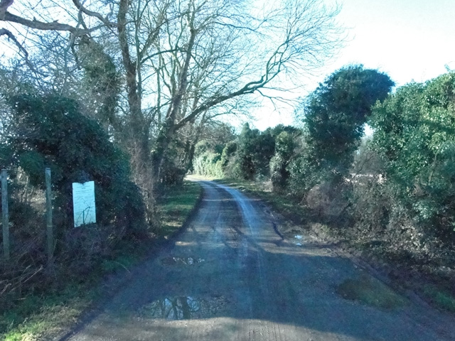
The plantation offers an extensive network of well-maintained footpaths, allowing visitors to explore the enchanting woodlands at their leisure. These pathways meander through the plantation, offering glimpses of stunning vistas and secluded clearings. The peaceful ambiance of the woodland is enhanced by the gentle rustling of leaves, harmonizing with the occasional chorus of birdsong.

Throughout the seasons, Waterhouse Plantation showcases its natural splendor. Spring brings a vibrant burst of color, as wildflowers carpet the forest floor. In summer, the lush greenery provides cool shade, inviting walkers to take respite from the warm sun. Autumn transforms the woodland into a kaleidoscope of red, orange, and gold, as the trees shed their leaves, while winter unveils a serene landscape, blanketed in a delicate layer of frost or snow.

Waterhouse Plantation offers a serene and rejuvenating escape from the hustle and bustle of city life. Its natural beauty and tranquil atmosphere make it an ideal destination for nature lovers seeking solace in the heart of the Norfolk countryside.

If you have any feedback on the listing, please let us know in the comments section below.

Waterhouse Plantation Images

Images are sourced within 2km of 52.519632/0.811425 or Grid Reference TL9095. Thanks to Geograph Open Source API. All images are credited.

Tottington Road Tottington Road looking west near to Thompson, Norfolk.
Tottington Road
Tottington Road looking west near to Thompson, Norfolk.
Entering Thompson Speed restriction of Thompson, Norfolk.
Entering Thompson
Speed restriction of Thompson, Norfolk.
Village Hall Thompson village hall Thompson, Norfolk.
Village Hall
Thompson village hall Thompson, Norfolk.
Gates Gates on the Peddars Way near to Thompson, Norfolk.
Gates
Gates on the Peddars Way near to Thompson, Norfolk.
Old Pre-Worboys Sign Old pre-Worboys road sign at one of the gates into Stanford training area near Thompson, Norfolk.
Old Pre-Worboys Sign
Old pre-Worboys road sign at one of the gates into Stanford training area near Thompson, Norfolk.
Old Fingerpost Old Norfolk County Council finger post at Thompson, Norfolk.
Old Fingerpost
Old Norfolk County Council finger post at Thompson, Norfolk.
Peddars Way A section of the Peddars Way & Norfolk Coast Path, also the NCR 13 follows this section of the Peddars Way.
Peddars Way
A section of the Peddars Way & Norfolk Coast Path, also the NCR 13 follows this section of the Peddars Way.
Shakers Furze Approaching the end of a cycle section on the NCR 13 of the Peddars Way.
Shakers Furze
Approaching the end of a cycle section on the NCR 13 of the Peddars Way.
Danger Area Gate access to a military firing range.
Danger Area
Gate access to a military firing range.
Tottington Road
Tottington Road
Thomson Water
Thomson Water
One of the many entrances to STANTA STANTA stands for STANford Training Area situated roughly TL 8495. 
The area was established in 1942 when a battle training area was required and a 'Nazi village' established. Military exercises were already taking place in the area; tanks had deployed to Thetford in the First World War. The complete takeover involved the complete evacuation of the villages of Buckenham Tofts, Langford, Stanford, Sturston, Tottington and West Tofts. The occupants of the houses were all rehoused in the belief that they would be allowed to return after the war. However the site was so valuable to the military that they have taken up permanent occupancy.  
The area was used during the run-up to the D-Day invasion and since then has hosted many exercises. 
The battle area includes four historic churches; the one at West Tofts was restored by Pugin and a new "church" forms part of the specially constructed village of Eastmere. Eastmere was originally built to give soldiers experience of fighting on the northern European plains.
There is a short landing strip for Harrier aircraft at TL 8332 9704
As a live firing area, access is not allowed without special permission from the Army. In the main this is limited to a number of tours a year and compassionate grounds for former residents of the villages or their relatives.
The area forms part of the distinctive Breckland landscape region, a gorse-covered sandy heath which offers poor agricultural opportunities but farms are still active and sheep graze within its confines. Arguably, its use as a military training area has safeguarded a substantial archaeological landscape. It is the home of a wealth of rare species of flora and fauna already lost in other parts of the country. Parts of the training area are designated Site of Special Scientific Interest (SSSI).
The battle area was used in the filming of many of the episodes of the TV comedy series, Dad's Army.
One of the many entrances to STANTA
STANTA stands for STANford Training Area situated roughly TL 8495. The area was established in 1942 when a battle training area was required and a 'Nazi village' established. Military exercises were already taking place in the area; tanks had deployed to Thetford in the First World War. The complete takeover involved the complete evacuation of the villages of Buckenham Tofts, Langford, Stanford, Sturston, Tottington and West Tofts. The occupants of the houses were all rehoused in the belief that they would be allowed to return after the war. However the site was so valuable to the military that they have taken up permanent occupancy. The area was used during the run-up to the D-Day invasion and since then has hosted many exercises. The battle area includes four historic churches; the one at West Tofts was restored by Pugin and a new "church" forms part of the specially constructed village of Eastmere. Eastmere was originally built to give soldiers experience of fighting on the northern European plains. There is a short landing strip for Harrier aircraft at TL 8332 9704 As a live firing area, access is not allowed without special permission from the Army. In the main this is limited to a number of tours a year and compassionate grounds for former residents of the villages or their relatives. The area forms part of the distinctive Breckland landscape region, a gorse-covered sandy heath which offers poor agricultural opportunities but farms are still active and sheep graze within its confines. Arguably, its use as a military training area has safeguarded a substantial archaeological landscape. It is the home of a wealth of rare species of flora and fauna already lost in other parts of the country. Parts of the training area are designated Site of Special Scientific Interest (SSSI). The battle area was used in the filming of many of the episodes of the TV comedy series, Dad's Army.
Military firing range warning sign STANTA stands for STANford Training Area situated roughly TL 8495. 
The area was established in 1942 when a battle training area was required and a 'Nazi village' established. Military exercises were already taking place in the area; tanks had deployed to Thetford in the First World War. The complete takeover involved the complete evacuation of the villages of Buckenham Tofts, Langford, Stanford, Sturston, Tottington and West Tofts. The occupants of the houses were all rehoused in the belief that they would be allowed to return after the war. However the site was so valuable to the military that they have taken up permanent occupancy.  
The area was used during the run-up to the D-Day invasion and since then has hosted many exercises. 
The battle area includes four historic churches; the one at West Tofts was restored by Pugin and a new "church" forms part of the specially constructed village of Eastmere. Eastmere was originally built to give soldiers experience of fighting on the northern European plains.
There is a short landing strip for Harrier aircraft at TL 8332 9704
As a live firing area, access is not allowed without special permission from the Army. In the main this is limited to a number of tours a year and compassionate grounds for former residents of the villages or their relatives.
The area forms part of the distinctive Breckland landscape region, a gorse-covered sandy heath which offers poor agricultural opportunities but farms are still active and sheep graze within its confines. Arguably, its use as a military training area has safeguarded a substantial archaeological landscape. It is the home of a wealth of rare species of flora and fauna already lost in other parts of the country. Parts of the training area are designated Site of Special Scientific Interest (SSSI).
The battle area was used in the filming of many of the episodes of the TV comedy series, Dad's Army.
Military firing range warning sign
STANTA stands for STANford Training Area situated roughly TL 8495. The area was established in 1942 when a battle training area was required and a 'Nazi village' established. Military exercises were already taking place in the area; tanks had deployed to Thetford in the First World War. The complete takeover involved the complete evacuation of the villages of Buckenham Tofts, Langford, Stanford, Sturston, Tottington and West Tofts. The occupants of the houses were all rehoused in the belief that they would be allowed to return after the war. However the site was so valuable to the military that they have taken up permanent occupancy. The area was used during the run-up to the D-Day invasion and since then has hosted many exercises. The battle area includes four historic churches; the one at West Tofts was restored by Pugin and a new "church" forms part of the specially constructed village of Eastmere. Eastmere was originally built to give soldiers experience of fighting on the northern European plains. There is a short landing strip for Harrier aircraft at TL 8332 9704 As a live firing area, access is not allowed without special permission from the Army. In the main this is limited to a number of tours a year and compassionate grounds for former residents of the villages or their relatives. The area forms part of the distinctive Breckland landscape region, a gorse-covered sandy heath which offers poor agricultural opportunities but farms are still active and sheep graze within its confines. Arguably, its use as a military training area has safeguarded a substantial archaeological landscape. It is the home of a wealth of rare species of flora and fauna already lost in other parts of the country. Parts of the training area are designated Site of Special Scientific Interest (SSSI). The battle area was used in the filming of many of the episodes of the TV comedy series, Dad's Army.
The Peddars Way and Norfolk Coast Path past STANTA STANTA stands for STANford Training Area situated roughly TL 8495. 
The area was established in 1942 when a battle training area was required and a 'Nazi village' established. Military exercises were already taking place in the area; tanks had deployed to Thetford in the First World War. The complete takeover involved the complete evacuation of the villages of Buckenham Tofts, Langford, Stanford, Sturston, Tottington and West Tofts. The occupants of the houses were all rehoused in the belief that they would be allowed to return after the war. However the site was so valuable to the military that they have taken up permanent occupancy.  
The area was used during the run-up to the D-Day invasion and since then has hosted many exercises. 
The battle area includes four historic churches; the one at West Tofts was restored by Pugin and a new "church" forms part of the specially constructed village of Eastmere. Eastmere was originally built to give soldiers experience of fighting on the northern European plains.
There is a short landing strip for Harrier aircraft at TL 8332 9704
As a live firing area, access is not allowed without special permission from the Army. In the main this is limited to a number of tours a year and compassionate grounds for former residents of the villages or their relatives.
The area forms part of the distinctive Breckland landscape region, a gorse-covered sandy heath which offers poor agricultural opportunities but farms are still active and sheep graze within its confines. Arguably, its use as a military training area has safeguarded a substantial archaeological landscape. It is the home of a wealth of rare species of flora and fauna already lost in other parts of the country. Parts of the training area are designated Site of Special Scientific Interest (SSSI).
The battle area was used in the filming of many of the episodes of the TV comedy series, Dad's Army.
The Peddars Way and Norfolk Coast Path past STANTA
STANTA stands for STANford Training Area situated roughly TL 8495. The area was established in 1942 when a battle training area was required and a 'Nazi village' established. Military exercises were already taking place in the area; tanks had deployed to Thetford in the First World War. The complete takeover involved the complete evacuation of the villages of Buckenham Tofts, Langford, Stanford, Sturston, Tottington and West Tofts. The occupants of the houses were all rehoused in the belief that they would be allowed to return after the war. However the site was so valuable to the military that they have taken up permanent occupancy. The area was used during the run-up to the D-Day invasion and since then has hosted many exercises. The battle area includes four historic churches; the one at West Tofts was restored by Pugin and a new "church" forms part of the specially constructed village of Eastmere. Eastmere was originally built to give soldiers experience of fighting on the northern European plains. There is a short landing strip for Harrier aircraft at TL 8332 9704 As a live firing area, access is not allowed without special permission from the Army. In the main this is limited to a number of tours a year and compassionate grounds for former residents of the villages or their relatives. The area forms part of the distinctive Breckland landscape region, a gorse-covered sandy heath which offers poor agricultural opportunities but farms are still active and sheep graze within its confines. Arguably, its use as a military training area has safeguarded a substantial archaeological landscape. It is the home of a wealth of rare species of flora and fauna already lost in other parts of the country. Parts of the training area are designated Site of Special Scientific Interest (SSSI). The battle area was used in the filming of many of the episodes of the TV comedy series, Dad's Army.
Road to STANTA from Thompson Grove STANTA stands for STANford Training Area situated roughly TL 8495. 
The area was established in 1942 when a battle training area was required and a 'Nazi village' established. Military exercises were already taking place in the area; tanks had deployed to Thetford in the First World War. The complete takeover involved the complete evacuation of the villages of Buckenham Tofts, Langford, Stanford, Sturston, Tottington and West Tofts. The occupants of the houses were all rehoused in the belief that they would be allowed to return after the war. However the site was so valuable to the military that they have taken up permanent occupancy.  
The area was used during the run-up to the D-Day invasion and since then has hosted many exercises. 
The battle area includes four historic churches; the one at West Tofts was restored by Pugin and a new "church" forms part of the specially constructed village of Eastmere. Eastmere was originally built to give soldiers experience of fighting on the northern European plains.
There is a short landing strip for Harrier aircraft at TL 8332 9704
As a live firing area, access is not allowed without special permission from the Army. In the main this is limited to a number of tours a year and compassionate grounds for former residents of the villages or their relatives.
The area forms part of the distinctive Breckland landscape region, a gorse-covered sandy heath which offers poor agricultural opportunities but farms are still active and sheep graze within its confines. Arguably, its use as a military training area has safeguarded a substantial archaeological landscape. It is the home of a wealth of rare species of flora and fauna already lost in other parts of the country. Parts of the training area are designated Site of Special Scientific Interest (SSSI).
The battle area was used in the filming of many of the episodes of the TV comedy series, Dad's Army.
Road to STANTA from Thompson Grove
STANTA stands for STANford Training Area situated roughly TL 8495. The area was established in 1942 when a battle training area was required and a 'Nazi village' established. Military exercises were already taking place in the area; tanks had deployed to Thetford in the First World War. The complete takeover involved the complete evacuation of the villages of Buckenham Tofts, Langford, Stanford, Sturston, Tottington and West Tofts. The occupants of the houses were all rehoused in the belief that they would be allowed to return after the war. However the site was so valuable to the military that they have taken up permanent occupancy. The area was used during the run-up to the D-Day invasion and since then has hosted many exercises. The battle area includes four historic churches; the one at West Tofts was restored by Pugin and a new "church" forms part of the specially constructed village of Eastmere. Eastmere was originally built to give soldiers experience of fighting on the northern European plains. There is a short landing strip for Harrier aircraft at TL 8332 9704 As a live firing area, access is not allowed without special permission from the Army. In the main this is limited to a number of tours a year and compassionate grounds for former residents of the villages or their relatives. The area forms part of the distinctive Breckland landscape region, a gorse-covered sandy heath which offers poor agricultural opportunities but farms are still active and sheep graze within its confines. Arguably, its use as a military training area has safeguarded a substantial archaeological landscape. It is the home of a wealth of rare species of flora and fauna already lost in other parts of the country. Parts of the training area are designated Site of Special Scientific Interest (SSSI). The battle area was used in the filming of many of the episodes of the TV comedy series, Dad's Army.
Tottington Road, Thompson
Oak and Ivy Near Thompson, Norfolk.
Oak and Ivy
Near Thompson, Norfolk.
Show me another place!

Waterhouse Plantation is located at Grid Ref: TL9095 (Lat: 52.519632, Lng: 0.811425)

Administrative County: Norfolk

District: Breckland

Police Authority: Norfolk

What 3 Words

///cute.guessing.greet. Near Watton, Norfolk

Related Wikis

Tottington, Norfolk

Tottington is a deserted village and civil parish in the English county of Norfolk. It is situated some 6.2 miles (10.0 km) north of the town of Thetford...

Thompson, Norfolk

Thompson is a civil parish in the English county of Norfolk. It covers an area of 9.20 km2 (3.55 sq mi) and including Tottington had a population of 341...

Great Eastern Pingo Trail

Great Eastern Pingo Trail is a 9.2 kilometres (5.7 miles) long footpath along a disused railway line north of Thetford in Norfolk. It is a 4.2-hectare...

Merton Hall, Norfolk

Merton Hall is a 19th century country house in Merton, Norfolk, England. The extant north-west wing is a Grade II listed building. The 17th-century gatehouse...

Thompson Water, Carr and Common

Thompson Water, Carr and Common is a 154.7-hectare (382-acre) biological Site of Special Scientific Interest north of Thetford in Norfolk. Most of it is...

Cranberry Rough, Hockham

Cranberry Rough is an 81.1-hectare (200-acre) biological and geological Site of Special Scientific Interest in the parish of Hockham, east of Attleborough...

Wretham Park Meres

Wretham Park Meres is a 30-hectare (74-acre) biological Site of Special Scientific Interest north of Thetford in Norfolk.This site consists of four natural...

Sturston, Norfolk

Sturston is a deserted village and civil parish in the English county of Norfolk. It is situated some 7+1⁄2 miles (12 km) north of the town of Thetford...

Nearby Amenities

Located within 500m of 52.519632,0.811425
Peddars Way / Pingo Trail
Destination: Stow Bedon Station
Hiking: yes
Information: guidepost
Inscription: Breaking New Ground / HLF Landscape Parternship / Supported by The Heritage Lottery Fund / Rock up & Run
Material: wood
Operator: Norfolk Trails
Tourism: information
Lat/Long: 52.5181615/0.8179316
The data included in this document is from www.openstreetmap.org. The data is made available under ODbL.

Have you been to Waterhouse Plantation?

Leave your review of Waterhouse Plantation below (or comments, questions and feedback).