Birch Wood

Wood, Forest in Essex Colchester

England

Birch Wood

Tiptree: 'Springfields' show home
Tiptree: 'Springfields' show home Credit: Michael Garlick

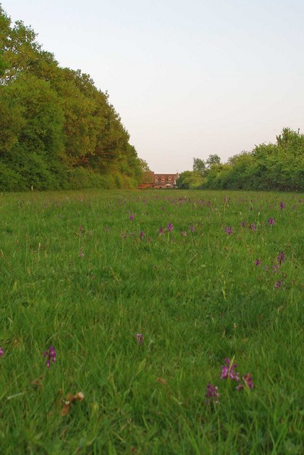
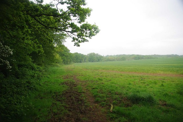
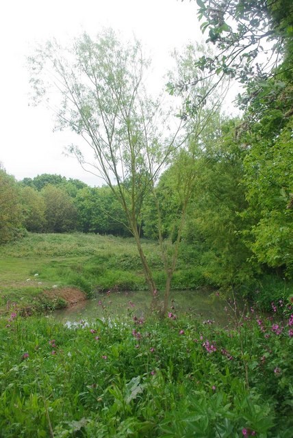
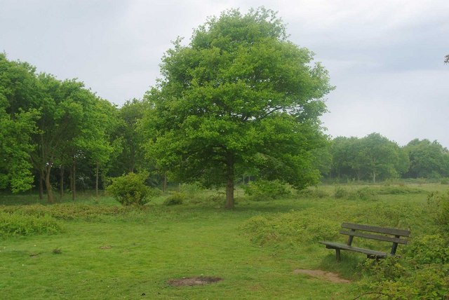
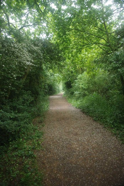
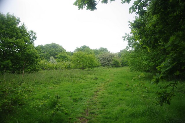
Birch Wood, located in the county of Essex, England, is a serene and picturesque woodland area encompassing approximately 370 acres. It is situated within the larger Epping Forest, a protected area known for its rich biodiversity and natural beauty. Birch Wood is recognized for its dense population of birch trees, which dominate the landscape and give the woodland its name.

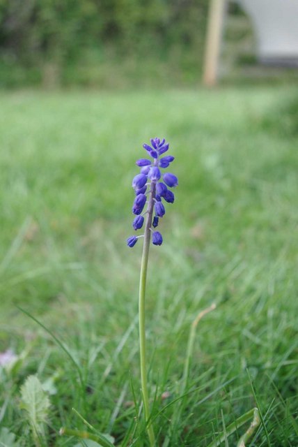
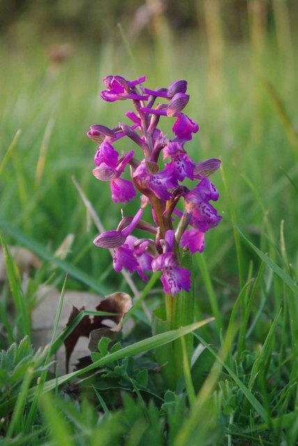
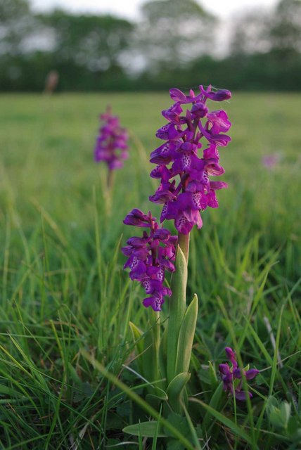
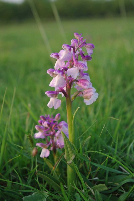
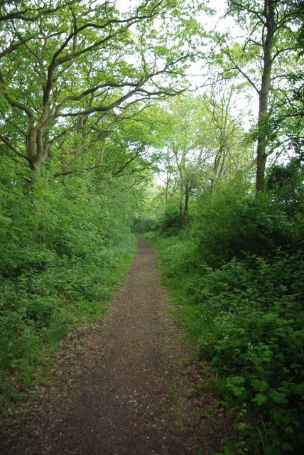
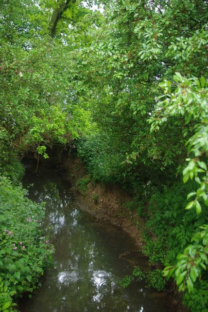
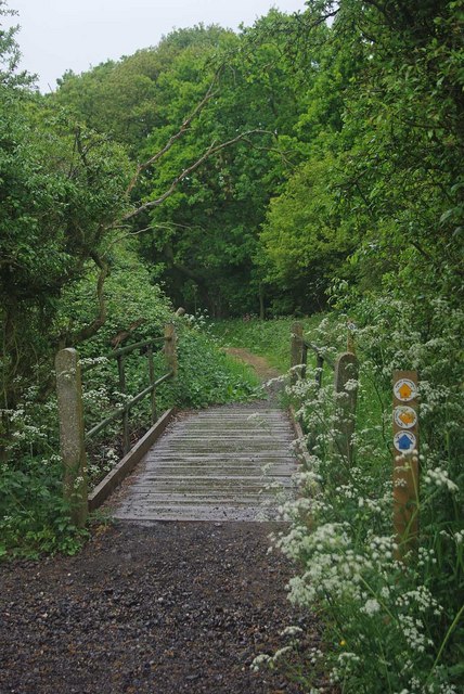
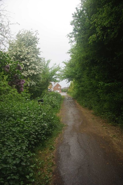
The wood is renowned for its tranquil atmosphere and is a popular destination for nature enthusiasts, hikers, and birdwatchers. Its well-maintained trails offer visitors the opportunity to explore the diverse flora and fauna that call this woodland home. Bluebells and wildflowers carpet the forest floor during spring, creating a dazzling display of colors.

The birch trees, with their distinctive silvery-white bark, provide a striking visual contrast against the backdrop of greenery. The wood is also home to other tree species such as oak, beech, and hornbeam, adding to its ecological diversity. Wildlife thrives within the wood, with numerous species of birds, mammals, and insects inhabiting the area.

The woodland is managed by the City of London Corporation, ensuring its preservation and conservation for future generations. Educational programs and guided walks are organized regularly, allowing visitors to learn about the woodland's history, ecological significance, and conservation efforts.

Birch Wood, Essex, offers a peaceful escape from the hustle and bustle of city life, providing a haven for both nature lovers and those seeking a tranquil retreat in a beautiful forest setting.

If you have any feedback on the listing, please let us know in the comments section below.

Birch Wood Images

Images are sourced within 2km of 51.809073/0.76113741 or Grid Reference TL9015. Thanks to Geograph Open Source API. All images are credited.

Tiptree: 'Springfields' show home
Tiptree: Heathland Avenue
Tiptree: Grange Road
Grape Hyacinth When I posted this picture I thought I had found some rare piece of flora. However    I am now reliably informed it is Muscari neglectum.  I came to <a href="https://www.geograph.org.uk/photo/150006">TL9114 : Oxley Meadow</a> in a hunt for this years crop of <a href="https://www.geograph.org.uk/photo/2379964">TL9114 : Oxley Orchids</a> This single specimen was in grave danger of being crushed by the wheels of the next vehicle that entered the car park.
Grape Hyacinth
When I posted this picture I thought I had found some rare piece of flora. However I am now reliably informed it is Muscari neglectum. I came to TL9114 : Oxley Meadow in a hunt for this years crop of TL9114 : Oxley Orchids This single specimen was in grave danger of being crushed by the wheels of the next vehicle that entered the car park.
Oxley Orchids This is Essex Wildlife Trust's <a href="https://www.geograph.org.uk/photo/150006">TL9114 : Oxley Meadow</a> in full bloom with <a href="https://www.geograph.org.uk/photo/2379976">TL9114 : 2011 Crop</a>
Oxley Orchids
This is Essex Wildlife Trust's TL9114 : Oxley Meadow in full bloom with TL9114 : 2011 Crop
Orchid in Bloom One of the 2011 crop of <a href="https://www.geograph.org.uk/photo/790815">TL9114 : Green Winged Orchids</a> in  <a href="https://www.geograph.org.uk/photo/150006">TL9114 : Oxley Meadow</a>
Orchid in Bloom
2011 Crop A few of the 2011 crop of <a href="https://www.geograph.org.uk/photo/790815">TL9114 : Green Winged Orchids</a> in  <a href="https://www.geograph.org.uk/photo/150006">TL9114 : Oxley Meadow</a>
2011 Crop
A Pink One One of the 2011 crop of <a href="https://www.geograph.org.uk/photo/790846">TL9114 : Pink Orchis morio</a> in  <a href="https://www.geograph.org.uk/photo/150006">TL9114 : Oxley Meadow</a>
A Pink One
Bridle Path to Tiptree This Bridle Path connects Park Lane in Tolleshunt Knights with <a href="https://www.geograph.org.uk/photo/2403260">TL9115 : Tiptree Parish Field</a>
Bridle Path to Tiptree
This Bridle Path connects Park Lane in Tolleshunt Knights with TL9115 : Tiptree Parish Field
A Damp Morning Near Patternoster Heath A little further along the <a href="https://www.geograph.org.uk/photo/2403191">TL9115 : Bridle Path to Tiptree</a> and my waterproofs got tested.
A Damp Morning Near Patternoster Heath
A little further along the TL9115 : Bridle Path to Tiptree and my waterproofs got tested.
Layer Brook Layer Brook marks the southern boundary to <a href="https://www.geograph.org.uk/photo/2403260">TL9115 : Tiptree Parish Field</a>
Layer Brook
Layer Brook marks the southern boundary to TL9115 : Tiptree Parish Field
Footbridge Near Tiptree Parish Field This bridge over Layer Brook carries the <a href="https://www.geograph.org.uk/photo/2403191">TL9115 : Bridle Path to Tiptree</a> the Parish Field is behind the trees
Footbridge Near Tiptree Parish Field
This bridge over Layer Brook carries the TL9115 : Bridle Path to Tiptree the Parish Field is behind the trees
Pond in Tiptree Parish Field This pond is fed by <a href="https://www.geograph.org.uk/photo/2403213">TL9115 : Layer Brook</a>. <a href="https://www.geograph.org.uk/photo/2403260">TL9115 : Tiptree Parish Field</a> was declared as a local nature reserve in 1999 <span class="nowrap"><a title="http://www.wildessex.net/sites/Tiptree%20Parish%20Field.htm" rel="nofollow ugc noopener" href="http://www.wildessex.net/sites/Tiptree%20Parish%20Field.htm">Link</a><img style="margin-left:2px;" alt="External link" title="External link - shift click to open in new window" src="https://s1.geograph.org.uk/img/external.png" width="10" height="10"/></span> it is managed by Tiptree Council <span class="nowrap"><a title="http://www.english-nature.org.uk/Special/lnr/lnr_details.asp?C=0&N=&ID=1486" rel="nofollow ugc noopener" href="http://www.english-nature.org.uk/Special/lnr/lnr_details.asp?C=0&N=&ID=1486">Link</a><img style="margin-left:2px;" alt="External link" title="External link - shift click to open in new window" src="https://s1.geograph.org.uk/img/external.png" width="10" height="10"/></span>
Pond in Tiptree Parish Field
This pond is fed by TL9115 : Layer Brook. TL9115 : Tiptree Parish Field was declared as a local nature reserve in 1999 LinkExternal link it is managed by Tiptree Council LinkExternal link
Tiptree Parish Field Declared as a nature reserve in 1999 the Parish Field is rich in wild flowers. see
<span class="nowrap"><a title="http://www.wildessex.net/sites/Tiptree%20Parish%20Field.htm" rel="nofollow ugc noopener" href="http://www.wildessex.net/sites/Tiptree%20Parish%20Field.htm">Link</a><img style="margin-left:2px;" alt="External link" title="External link - shift click to open in new window" src="https://s1.geograph.org.uk/img/external.png" width="10" height="10"/></span> & <span class="nowrap"><a title="http://www.english-nature.org.uk/Special/lnr/lnr_details.asp?C=0&N=&ID=1486" rel="nofollow ugc noopener" href="http://www.english-nature.org.uk/Special/lnr/lnr_details.asp?C=0&N=&ID=1486">Link</a><img style="margin-left:2px;" alt="External link" title="External link - shift click to open in new window" src="https://s1.geograph.org.uk/img/external.png" width="10" height="10"/></span>
Tiptree Parish Field
Declared as a nature reserve in 1999 the Parish Field is rich in wild flowers. see LinkExternal link & LinkExternal link
Bridleway Beside Tiptree Parish Field The bridleway just cuts the north east corner of the grid square
Bridleway Beside Tiptree Parish Field
The bridleway just cuts the north east corner of the grid square
Tiptree Parish Field (North End) <a href="https://www.geograph.org.uk/photo/2403260">TL9115 : Tiptree Parish Field</a> has been a nature reserve since 1999 it is managed by the Parish Council see <span class="nowrap"><a title="http://www.wildessex.net/sites/Tiptree%20Parish%20Field.htm" rel="nofollow ugc noopener" href="http://www.wildessex.net/sites/Tiptree%20Parish%20Field.htm">Link</a><img style="margin-left:2px;" alt="External link" title="External link - shift click to open in new window" src="https://s1.geograph.org.uk/img/external.png" width="10" height="10"/></span> for more info
Tiptree Parish Field (North End)
TL9115 : Tiptree Parish Field has been a nature reserve since 1999 it is managed by the Parish Council see LinkExternal link for more info
End of the Bridleway This is the end of the bridleway from Tolleshunt Knights
End of the Bridleway
This is the end of the bridleway from Tolleshunt Knights
Tiptree URC The back entrance of Tiptree United Reformed Church
Tiptree URC
The back entrance of Tiptree United Reformed Church
Show me another place!

Birch Wood is located at Grid Ref: TL9015 (Lat: 51.809073, Lng: 0.76113741)

Administrative County: Essex

District: Colchester

Police Authority: Essex

What 3 Words

///aced.commenced.galaxy. Near Tiptree, Essex

Related Wikis

Nearby Amenities

Located within 500m of 51.809073,0.76113741
Place Of Worship
Tiptree United Reformed Church
Denomination: united_reformed
Religion: christian
Lat/Long: 51.8111163/0.7590691
Mini Roundabout
Direction: clockwise
Lat/Long: 51.8135126/0.7617043
Mini Roundabout
Direction: clockwise
Lat/Long: 51.8135419/0.7603923
Turning Circle
Lat/Long: 51.8104838/0.7542549
The data included in this document is from www.openstreetmap.org. The data is made available under ODbL.

Have you been to Birch Wood?

Leave your review of Birch Wood below (or comments, questions and feedback).