Church Wood

Wood, Forest in Kent Ashford

England

Church Wood

Parish Church, Wittersham, Kent One of the many churches around the Isle of Oxney and Romney Marsh.
Parish Church, Wittersham, Kent Credit: Ronald G Nash

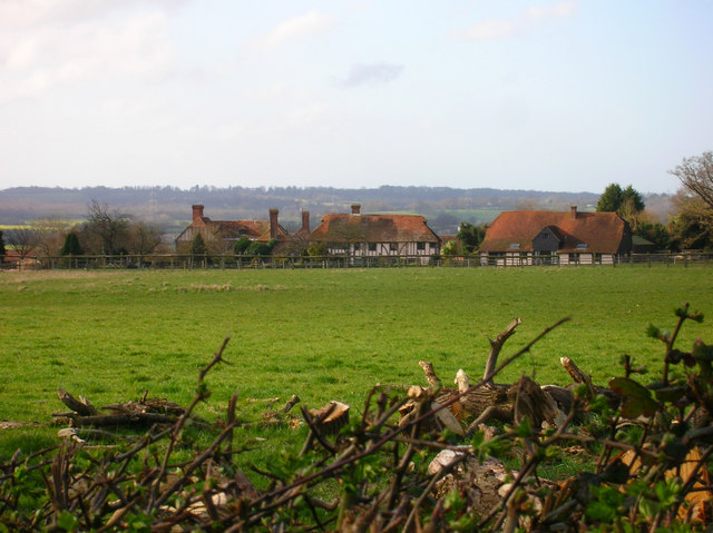
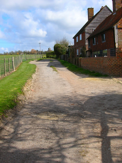
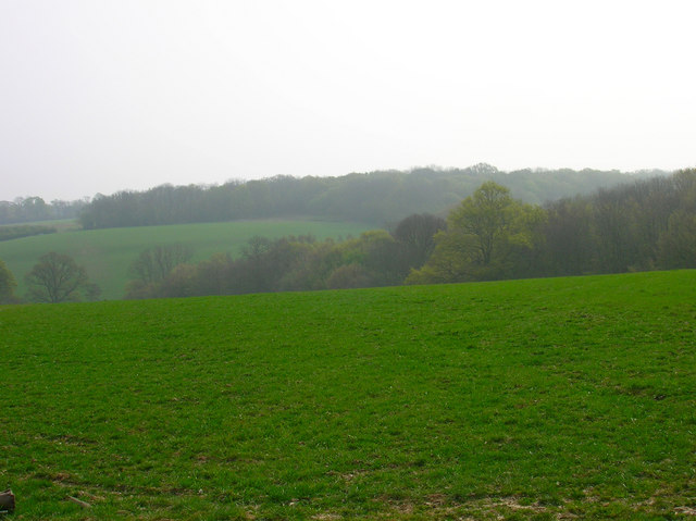
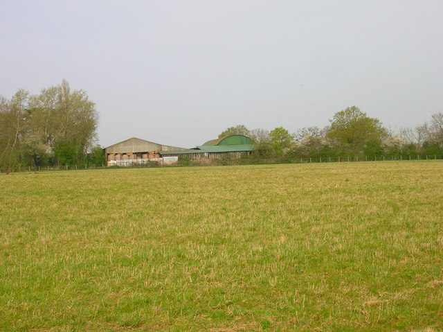
Church Wood is a picturesque woodland located in the county of Kent, England. Situated near the village of Woodchurch, this forested area covers approximately 44 hectares of land and is known for its natural beauty and diverse flora and fauna.

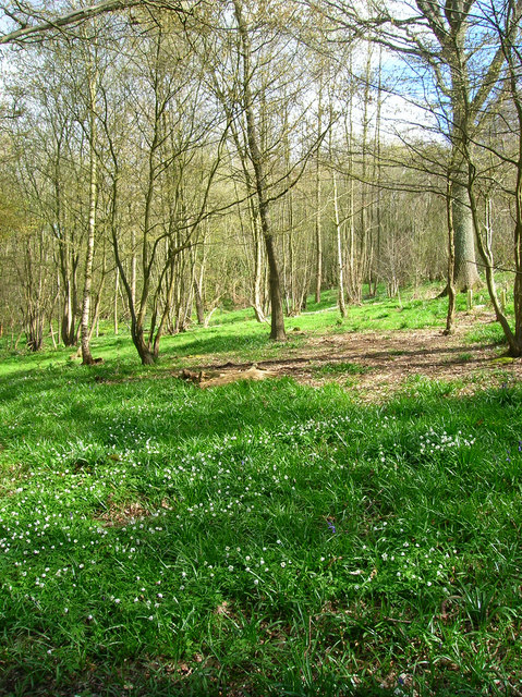
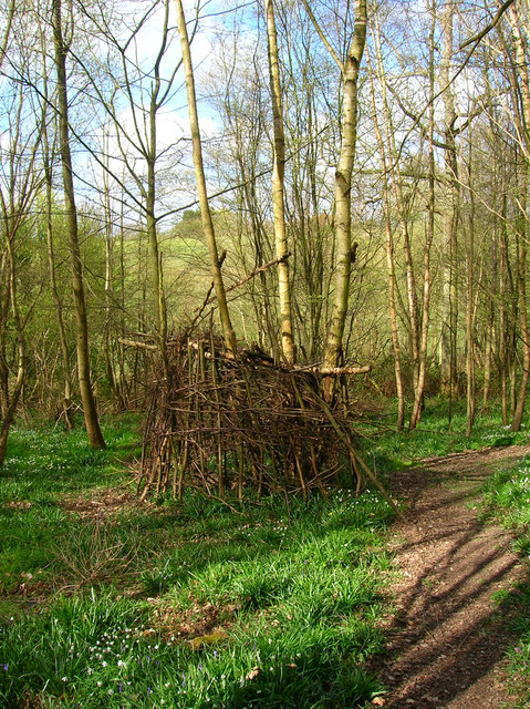
The wood is primarily composed of a mix of broadleaf trees, including oak, beech, and ash, which create a dense canopy that provides shade and shelter to a variety of wildlife. The forest floor is adorned with a rich carpet of ferns, bluebells, and wildflowers, making it a popular destination for nature enthusiasts and photographers.

Church Wood is also home to a range of animal species, including badgers, foxes, rabbits, and numerous bird species, such as woodpeckers and owls. The tranquil atmosphere and abundance of wildlife make it an ideal spot for birdwatching and wildlife spotting.

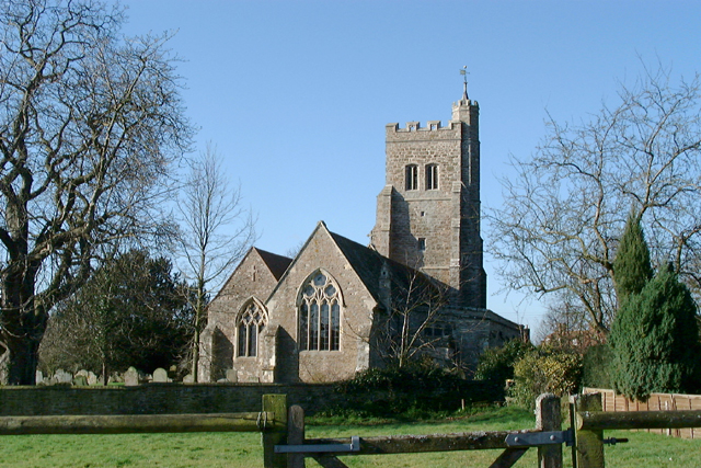
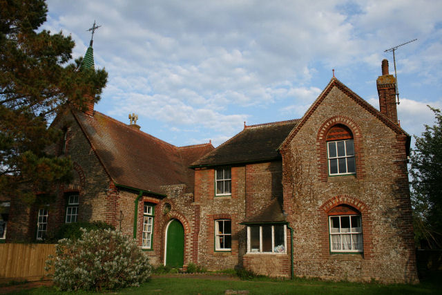
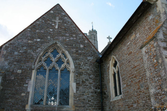
The wood is intersected by a network of well-maintained footpaths and trails, allowing visitors to explore its enchanting surroundings at their own pace. These paths lead to a delightful church nestled within the woodland, which dates back to the 12th century. The church adds a touch of historical charm to the area and is a popular attraction for history enthusiasts.

Overall, Church Wood in Kent offers a peaceful and idyllic setting for those seeking a break from the hustle and bustle of everyday life. With its ancient trees, vibrant flora, and diverse wildlife, it provides a haven for both nature lovers and history buffs alike.

If you have any feedback on the listing, please let us know in the comments section below.

Church Wood Images

Images are sourced within 2km of 51.019272/0.70891479 or Grid Reference TQ9027. Thanks to Geograph Open Source API. All images are credited.

Parish Church, Wittersham, Kent One of the many churches around the Isle of Oxney and Romney Marsh.
Parish Church, Wittersham, Kent
One of the many churches around the Isle of Oxney and Romney Marsh.
The Swan On the junction of Poplar Road (B2082) and Swan Street. Wittersham is the chief village of the Isle of Oxney.
The Swan
On the junction of Poplar Road (B2082) and Swan Street. Wittersham is the chief village of the Isle of Oxney.
Swan Street Weatherboarded cottages along Swan Street. The street connects Wittersham to Moon's Green and Potman's Heath.
Swan Street
Weatherboarded cottages along Swan Street. The street connects Wittersham to Moon's Green and Potman's Heath.
Wittersham Manor Sixteenth Century manor building a mile out of the village. About as near as you can get to the front view without trespassing.
Wittersham Manor
Sixteenth Century manor building a mile out of the village. About as near as you can get to the front view without trespassing.
Hall Cottage Swan Street ends at the bend then an unnamed lane heads right towards Potman's Heath. The footpath to Blackwell Bridge is straight ahead.
Hall Cottage
Swan Street ends at the bend then an unnamed lane heads right towards Potman's Heath. The footpath to Blackwell Bridge is straight ahead.
Behind Wittersham Manor In the medieval period the tide would have reached as far as this point from the sea. Here the Isle of Oxney rises abruptly out of the flat lands to the south. The roofs of Wittersham Manor buildings can be seen in the centre.
Behind Wittersham Manor
In the medieval period the tide would have reached as far as this point from the sea. Here the Isle of Oxney rises abruptly out of the flat lands to the south. The roofs of Wittersham Manor buildings can be seen in the centre.
Ham Green Cottages Wittersham church tower can be seen beyond the stile in the background.
Ham Green Cottages
Wittersham church tower can be seen beyond the stile in the background.
College Wood The manor of Wittersham was once owned by the Master and Fellows of All Saints College, Maidstone which probably accounts for the name of the wood.
College Wood
The manor of Wittersham was once owned by the Master and Fellows of All Saints College, Maidstone which probably accounts for the name of the wood.
College Wood Would be very interested to know what is happening here. On the footpath through College Wood.
College Wood
Would be very interested to know what is happening here. On the footpath through College Wood.
Palstre Court Farm On the Isle of Oxney above the levels. Marsh Wood is to the right and Reading Sewer is in the foreground.
Palstre Court Farm
On the Isle of Oxney above the levels. Marsh Wood is to the right and Reading Sewer is in the foreground.
Comb Wood and Timber Wood Comb Wood is in the foreground going into the dip, Timber Wood is on the ridge beyond. The image also highlights the very hazy day which made long distance visibility very poor.
Comb Wood and Timber Wood
Comb Wood is in the foreground going into the dip, Timber Wood is on the ridge beyond. The image also highlights the very hazy day which made long distance visibility very poor.
Barn, Black Barn Farm Taken from the High Weald Landscape Trail.
Barn, Black Barn Farm
Taken from the High Weald Landscape Trail.
Cuckoo Cottage, Wittersham Road Next to the footpath to Moon's Green.
Cuckoo Cottage, Wittersham Road
Next to the footpath to Moon's Green.
Wittersham Primary School (left) and the old Doctor's Surgery (right) The wording above the green arched door says 'Girls'.
Wittersham Primary School (left) and the old Doctor's Surgery (right)
The wording above the green arched door says 'Girls'.
Wittersham Church
Wittersham Church
Wittersham Church - window over the altar
Drainage dyke alongside Smallhythe Road, looking up to the Isle of Oxney
Drainage dyke alongside Smallhythe Road
Show me another place!

Church Wood is located at Grid Ref: TQ9027 (Lat: 51.019272, Lng: 0.70891479)

Administrative County: Kent

District: Ashford

Police Authority: Kent

What 3 Words

///hindering.lizard.stunt. Near Stone, Kent

Nearby Locations

Church Wood Acton

Related Wikis

Wittersham

Wittersham is a small village and civil parish in the borough of Ashford in Kent, England. It is part of the Isle of Oxney. == History == The Domesday...

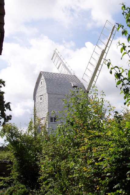
Stocks Mill, Wittersham

Stocks Mill is a Grade II* listed post mill in Wittersham on the Isle of Oxney, in Kent, England which has been preserved. == History == Probably built...
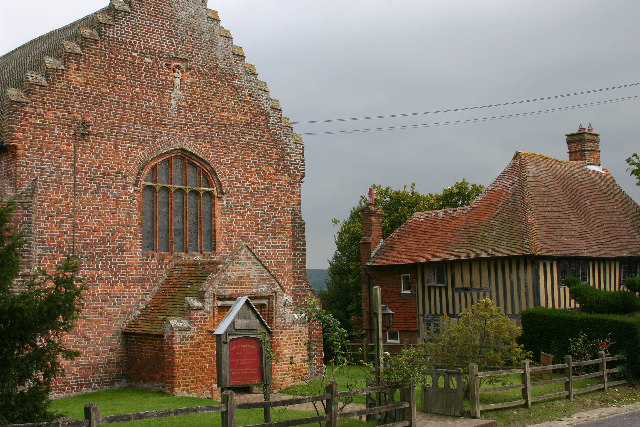
Smallhythe Place

Smallhythe Place in Small Hythe, near Tenterden in Kent, is a half-timbered house built in the late 15th or early 16th century and since 1947 cared for...

Chapel Down

Chapel Down based in Tenterden in Kent, is an English vineyard and winemaker. It is the largest producer of English wine, with over 950 acres under vine...

Small Hythe

Small Hythe (or Smallhythe) is a hamlet near Tenterden in Kent, England. The population is included in Tenterden. It stood on a branch of the Rother estuary...

Isle of Oxney

Isle of Oxney is an area in Kent, England, close to the boundary with East Sussex. Up to the 13th century, the island was part of the coastline bordering...

Reading Street, Ashford

Reading Street is a hamlet approximately 3 miles (4.8 km) south east of Tenterden in Kent, England. It is situated on the B2080 road between Tenterden...

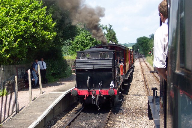
Wittersham Road railway station

Wittersham Road is a railway station on the Kent and East Sussex Railway. It is located to the north-east of the level crossing on Maytham Road which links...

Nearby Amenities

Located within 500m of 51.019272,0.70891479
Bus Stop
Lloyds Green
Bus: yes
Naptan AtcoCode: 2400A024360A
Naptan Bearing: SE
Naptan CommonName: Lloyds Green
Naptan Indicator: adj
Naptan Landmark: Lloyd Green
Naptan NaptanCode: kntdajad
Naptan Street: Wittersham Rd
Naptan Verified: no
Public Transport: platform
Source: naptan_import
Lat/Long: 51.0170438/0.7037621
Bus Stop
Coombe Lands
Bus: yes
Flag: no
Naptan AtcoCode: 2400A036920A
Naptan Bearing: SE
Naptan BusStopType: CUS
Naptan CommonName: Coombe Lands
Naptan Indicator: adj
Naptan Landmark: Coombe Lands
Naptan NaptanCode: kntdmwgd
Naptan Street: Poplar Rd
Naptan Verified: no
Public Transport: platform
Source: naptan_import
Lat/Long: 51.0180265/0.7021081
Generator Method: photovoltaic
Generator Output Electricity: yes
Generator Source: solar
Generator Type: solar_photovoltaic_panel
Location: roof
Power: generator
Lat/Long: 51.0176807/0.7045189
Generator Method: photovoltaic
Generator Output Electricity: yes
Generator Source: solar
Generator Type: solar_photovoltaic_panel
Location: roof
Power: generator
Lat/Long: 51.0177591/0.703011
Generator Method: photovoltaic
Generator Output Electricity: yes
Generator Source: solar
Generator Type: solar_photovoltaic_panel
Location: roof
Power: generator
Lat/Long: 51.0189594/0.7025711
Generator Method: photovoltaic
Generator Output Electricity: yes
Generator Source: solar
Generator Type: solar_photovoltaic_panel
Location: roof
Power: generator
Lat/Long: 51.0189172/0.702716
Generator Method: photovoltaic
Generator Output Electricity: yes
Generator Source: solar
Generator Type: solar_photovoltaic_panel
Location: roof
Power: generator
Lat/Long: 51.0188969/0.7029466
Generator Method: photovoltaic
Generator Output Electricity: yes
Generator Source: solar
Generator Type: solar_photovoltaic_panel
Location: roof
Power: generator
Lat/Long: 51.0169038/0.7034449
Generator Method: photovoltaic
Generator Output Electricity: yes
Generator Source: solar
Generator Type: solar_photovoltaic_panel
Location: roof
Power: generator
Lat/Long: 51.015383/0.7071564
Generator Method: photovoltaic
Generator Output Electricity: yes
Generator Source: solar
Generator Type: solar_photovoltaic_panel
Location: roof
Power: generator
Lat/Long: 51.0162056/0.7087643
Generator Method: photovoltaic
Generator Output Electricity: yes
Generator Source: solar
Generator Type: solar_photovoltaic_panel
Location: roof
Power: generator
Lat/Long: 51.0153906/0.7082815
Generator Method: photovoltaic
Generator Output Electricity: yes
Generator Source: solar
Generator Type: solar_photovoltaic_panel
Location: roof
Power: generator
Lat/Long: 51.0154311/0.7082896
The data included in this document is from www.openstreetmap.org. The data is made available under ODbL.

Have you been to Church Wood?

Leave your review of Church Wood below (or comments, questions and feedback).