Romden Wood
Wood, Forest in Kent Ashford
England
Romden Wood

Romden Wood is a picturesque forest located in the county of Kent, England. Covering an area of approximately 100 acres, it offers a serene and enchanting escape from the hustle and bustle of everyday life. The wood is situated near the village of Smarden, surrounded by rolling hills and lush green meadows.
The woodland consists primarily of mature oak trees, interspersed with an array of other native species such as beech, ash, and birch. These ancient trees create a dense canopy, providing shelter for a diverse range of flora and fauna. Bluebells, wood anemones, and wild garlic carpet the forest floor during the spring months, adding vibrant bursts of color to the surroundings.
Romden Wood is known for its tranquil atmosphere and abundant wildlife. Visitors may catch glimpses of roe deer, foxes, and badgers as they explore the woodland trails. The area is also a haven for birdwatchers, with species such as woodpeckers, owls, and the elusive nightingale often spotted here.
Several footpaths wind through the wood, allowing visitors to fully immerse themselves in its natural beauty. These paths lead to secluded clearings and tranquil ponds, providing opportunities for peaceful reflection or a refreshing picnic.
Romden Wood is a cherished local treasure, and efforts have been made to preserve its natural integrity. It is maintained by the local authorities, ensuring that it remains a valuable habitat for wildlife and a peaceful retreat for nature enthusiasts.
If you have any feedback on the listing, please let us know in the comments section below.
Romden Wood Images
Images are sourced within 2km of 51.142269/0.71043552 or Grid Reference TQ8941. Thanks to Geograph Open Source API. All images are credited.


Romden Wood is located at Grid Ref: TQ8941 (Lat: 51.142269, Lng: 0.71043552)
Administrative County: Kent
District: Ashford
Police Authority: Kent
What 3 Words
///free.flitting.spindles. Near High Halden, Kent
Nearby Locations
Related Wikis
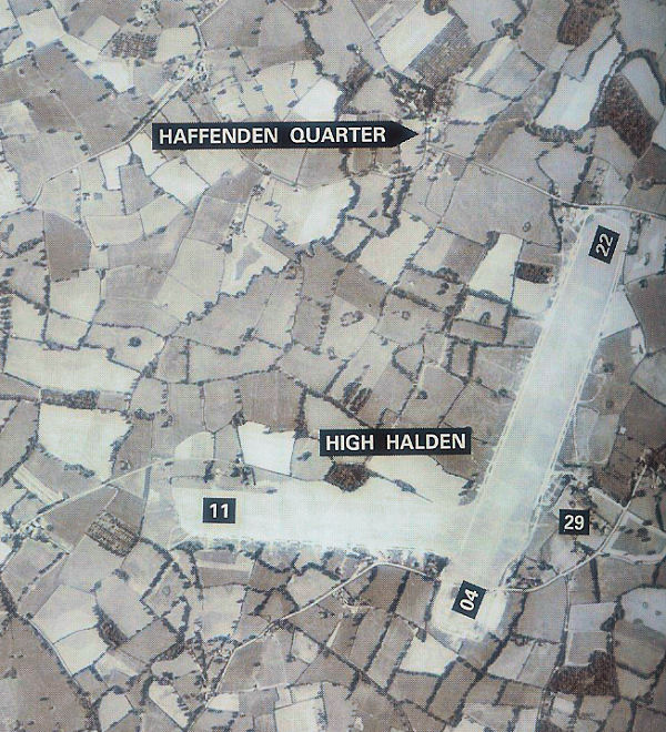
RAF High Halden
Royal Air Force High Halden or more simply RAF High Halden is a former Royal Air Force Advanced Landing Ground in Kent, England. The airfield is located...

Pluckley railway station
Pluckley railway station is on the South Eastern Main Line in England, serving the village of Pluckley, Kent, which is approximately 1.2 miles (2 km) to...
Bethersden
Bethersden is a village and civil parish in the borough of Ashford in Kent, England, 5 miles (8 km) west of the town of Ashford. Located on the main road...

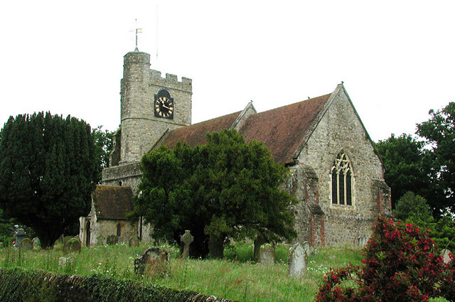
High Halden
High Halden is a village and civil parish in the Ashford District of Kent, England. The village is on the A28 road between Ashford and Tenterden, 3 miles...

Chart Hills Golf Club
Chart Hills Golf Club is a championship golf club in England, located in Biddenden, Kent. == History == The golf course at Chart Hills was designed by...
Lashenden Air Warfare Museum
Lashenden Air Warfare Museum is an aviation museum at Lashenden (Headcorn) Airfield in Kent in southeast England. == Exhibits == A Fieseler Fi 103R Reichenberg...
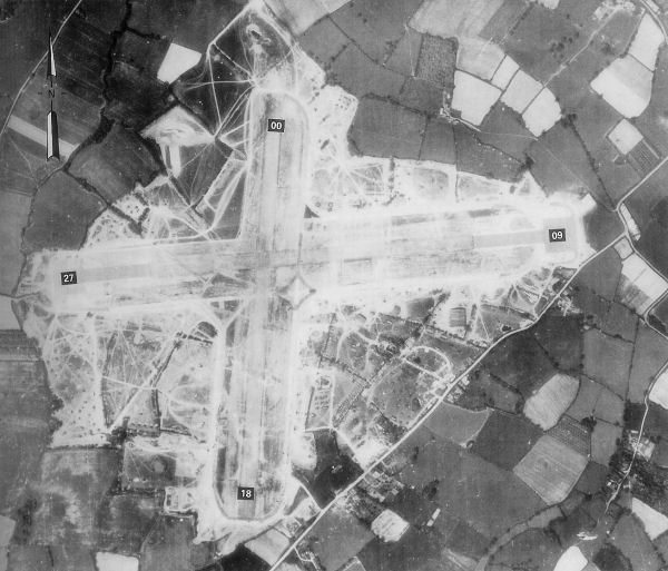
RAF Headcorn
Royal Air Force Headcorn or more commonly known as RAF Headcorn is a former Royal Air Force Advanced Landing Ground located 2 miles (3.2 km) northeast...
National Cycle Route 18
National Cycle Route 18 (NCR18) runs from Canterbury to Royal Tunbridge Wells. It follows the valley of the River Stour to Ashford and then runs through...
Nearby Amenities
Located within 500m of 51.142269,0.71043552Have you been to Romden Wood?
Leave your review of Romden Wood below (or comments, questions and feedback).