Folkingham

Settlement in Lincolnshire South Kesteven

England

Folkingham

Church of St Andrew, Folkingham Listed Grade I; from the 12th century. The dedication, to St Andrew, is particularly common in this area (see very good information boards inside church).
Church of St Andrew, Folkingham Credit: Tim Heaton

Folkingham is a small village located in the county of Lincolnshire, England. Situated approximately 10 miles south of Sleaford, it has a population of around 750 residents.

The village has a rich history dating back to the Roman times, with archaeological finds suggesting early settlement. It played a significant role during the medieval period, being a market town and a center for trade and commerce. The village's name is derived from the Old English words "Folca" and "Inga," meaning "the people's dwelling."

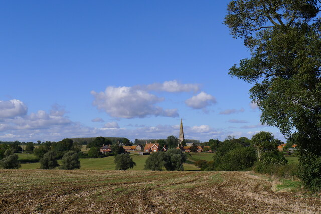
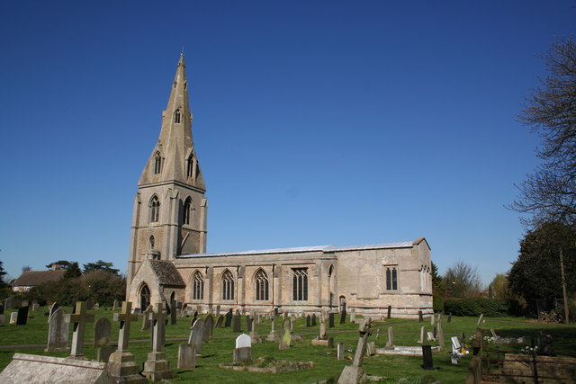
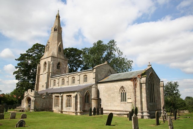
Folkingham boasts a charming and picturesque setting, with its traditional stone cottages and well-preserved historic buildings. The village is home to St. Andrew's Church, a Grade I listed building that dates back to the 12th century. The church features stunning stained glass windows and intricate architectural details.

Despite its small size, Folkingham offers a range of local amenities and services for its residents. These include a village hall, a primary school, a post office, and a convenience store. The village also has a pub, The Tollemache Arms, which is a popular spot for locals and visitors alike.

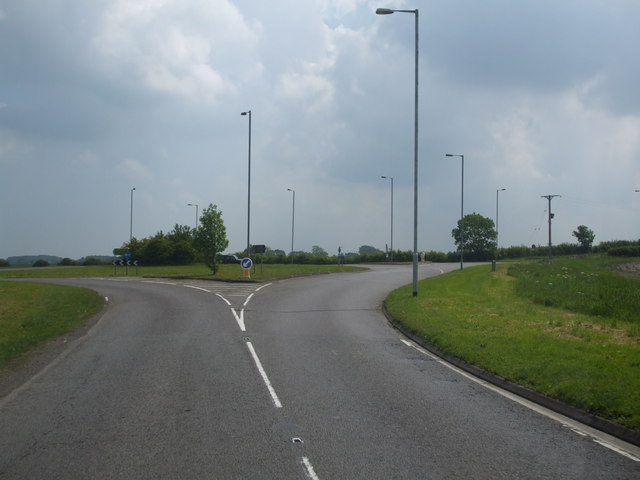
Surrounded by serene countryside, Folkingham provides ample opportunities for outdoor activities and leisure pursuits. The village is well-connected by road, with the A15 passing nearby, providing easy access to neighboring towns and cities.

Overall, Folkingham is a charming and historic village that offers a tranquil escape from the hustle and bustle of city life, while still providing essential amenities for its residents.

If you have any feedback on the listing, please let us know in the comments section below.
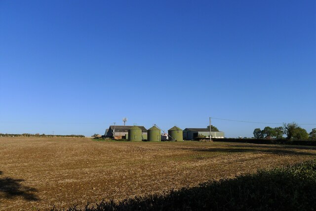
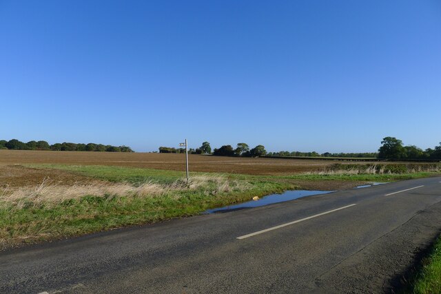
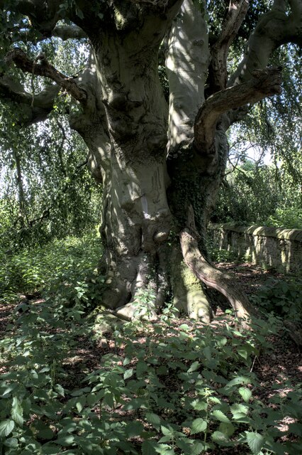
Folkingham Images

Images are sourced within 2km of 52.889887/-0.407886 or Grid Reference TF0733. Thanks to Geograph Open Source API. All images are credited.

Church of St Andrew, Folkingham Listed Grade I; from the 12th century. The dedication, to St Andrew, is particularly common in this area (see very good information boards inside church).
Church of St Andrew, Folkingham
Listed Grade I; from the 12th century. The dedication, to St Andrew, is particularly common in this area (see very good information boards inside church).
The Cross Britain Way leaving Folkingham Proceeding west through Folkingham's playing field
The Cross Britain Way leaving Folkingham
Proceeding west through Folkingham's playing field
The Cross Britain Way heading west over the Kesteven Uplands 'Uplands' perhaps a relative term after the Way has traversed the Fens.
The Cross Britain Way heading west over the Kesteven Uplands
'Uplands' perhaps a relative term after the Way has traversed the Fens.
Crossing a headwater tributary of the Ouse Mere Lode The Cross Britain Way between Folkingham and Pickworth
Crossing a headwater tributary of the Ouse Mere Lode
The Cross Britain Way between Folkingham and Pickworth
Ford approaching Walcot Crossing a headwater tributary of Ouse Mere Lode
Ford approaching Walcot
Crossing a headwater tributary of Ouse Mere Lode
Road junction, Walcot A 17th century barn at Manor Farm behind the fingerpost
Road junction, Walcot
A 17th century barn at Manor Farm behind the fingerpost
Church of St Nicholas, Walcot Grade I listed.
Dating from the 12th century onwards, and restored in 1907 & 1926.
It has a 2 stage west tower with a tall crocketed broached spire from 14th Century. The tower arch is also from this period. Entered through a 17th C door in the south porch, the nave arcades are 13th C. but rest on even older bases. The font is Norman but recut in 18th C. The clerestory windows are 15th Century. The carved pew ends are 500 years old.
There is a double hagioscope. In the south aisle is a C13 trefoil headed piscina. The roof is a 14th C braced tie beam.
Church of St Nicholas, Walcot
Grade I listed. Dating from the 12th century onwards, and restored in 1907 & 1926. It has a 2 stage west tower with a tall crocketed broached spire from 14th Century. The tower arch is also from this period. Entered through a 17th C door in the south porch, the nave arcades are 13th C. but rest on even older bases. The font is Norman but recut in 18th C. The clerestory windows are 15th Century. The carved pew ends are 500 years old. There is a double hagioscope. In the south aisle is a C13 trefoil headed piscina. The roof is a 14th C braced tie beam.
The road from Walcot to Folkingham
Walcot from the south The tall, 14th century spire of St Nicholas easily visible
Walcot from the south
The tall, 14th century spire of St Nicholas easily visible
The road from Folkingham to Walcot
Washdyke Farm from Billingborough Road A limited archaeological investigation was carried out at the farm prior to construction of a grain store, but nothing of note was found <span class="nowrap"><a title="https://archaeologydataservice.ac.uk/library/browse/issue.xhtml?recordId=1111651&recordType=GreyLitSeries" rel="nofollow ugc noopener" href="https://archaeologydataservice.ac.uk/library/browse/issue.xhtml?recordId=1111651&recordType=GreyLitSeries">Link</a><img style="margin-left:2px;" alt="External link" title="External link - shift click to open in new window" src="https://s1.geograph.org.uk/img/external.png" width="10" height="10"/></span> .
Washdyke Farm from Billingborough Road
A limited archaeological investigation was carried out at the farm prior to construction of a grain store, but nothing of note was found LinkExternal link .
Footpath off Billingborough Road The footpath leads to Folkingham
Footpath off Billingborough Road
The footpath leads to Folkingham
Walcot Bar, Sleaford Road (A15) The name suggests that there used to be a toll gate (barrier) on this former turnpike road?
Walcot Bar, Sleaford Road (A15)
The name suggests that there used to be a toll gate (barrier) on this former turnpike road?
The A15 north of Folkingham The A15 is the main north-south road in Lincolnshire, running the entire length of the county for almost 100 miles between Hessle, near Kingston upon Hull, and Peterborough via Lincoln, Sleaford and Bourne. It is also the road that crosses the Humber Bridge.
The A15 north of Folkingham
The A15 is the main north-south road in Lincolnshire, running the entire length of the county for almost 100 miles between Hessle, near Kingston upon Hull, and Peterborough via Lincoln, Sleaford and Bourne. It is also the road that crosses the Humber Bridge.
Saint Nicholas, Walcot: Fagus sylvatica pendula The Weeping Beech at Walcot remains one of my favourite trees in England
Saint Nicholas, Walcot: Fagus sylvatica pendula
The Weeping Beech at Walcot remains one of my favourite trees in England
The trunk of the tree Under the canopy of <a href="https://www.geograph.org.uk/photo/7522956">TF0635 : Saint Nicholas, Walcot: Fagus sylvatica pendula</a>.  This is the trunk of the Weeping Beech, Fagus sylvatica pendula.
The trunk of the tree
Under the canopy of TF0635 : Saint Nicholas, Walcot: Fagus sylvatica pendula. This is the trunk of the Weeping Beech, Fagus sylvatica pendula.
Bark of the beech tree This is a look at the bark texture of <a href="https://www.geograph.org.uk/photo/7522956">TF0635 : Saint Nicholas, Walcot: Fagus sylvatica pendula</a>, a weeping Beech.  It is gettin g on for 200 years old.
Bark of the beech tree
This is a look at the bark texture of TF0635 : Saint Nicholas, Walcot: Fagus sylvatica pendula, a weeping Beech. It is gettin g on for 200 years old.
Beech Tree Bark The bark on the Weeping Beech at Walcot Church
Beech Tree Bark
The bark on the Weeping Beech at Walcot Church
Show me another place!

Folkingham is located at Grid Ref: TF0733 (Lat: 52.889887, Lng: -0.407886)

Division: Parts of Kesteven

Administrative County: Lincolnshire

District: South Kesteven

Police Authority: Lincolnshire

What 3 Words

///doctor.superhero.pilots. Near Billingborough, Lincolnshire

Nearby Locations

Folkingham Folkingham

Related Wikis

St Andrew's Church, Folkingham

The Church of St Andrew in Folkingham, Lincolnshire, England, is Grade I–listed Anglican church. Originating in the late 12th century, it was largely completed...

Folkingham Castle

Folkingham Castle is located near the village of Folkingham, Lincolnshire, England. The castle was the caput baroniae of the barony of Folkingham. A motte...

Folkingham

Folkingham ( FOK-ing-əm) is a village and civil parish in the South Kesteven district of Lincolnshire, England. It lies on the A15 road 11 miles (18 km...

Walcot, Lincolnshire

Walcot is a village and civil parish in the North Kesteven district of Lincolnshire, England. It lies 1 mile (1.6 km) west from the A15, 7 miles (11 km...

Stow Fair, Lincolnshire

Stow Fair was an English medieval fair inaugurated in 1233 and held at Stow Green Hill in Lincolnshire.The Prior of Sempringham was granted permission...

St Peter's Church, Threekingham

St Peter's Church is a church in Threekingham, Lincolnshire. It is dedicated to St. Peter ad Vincula (St Peter in chains). It became a Grade I listed building...

Pickworth, Lincolnshire

Pickworth is a village and civil parish in the South Kesteven district of Lincolnshire, England. The population of the civil parish including Braceby and...

Threekingham Bar

Threekingham Bar is the name given to interception of the A52 (Grantham to Boston) and A15 (Peterborough to Lincoln and Hull) roads, 1 mile (1.6 km) to...

Nearby Amenities

Located within 500m of 52.889887,-0.407886
Bus Stop
House of Correction
Bus: yes
Naptan AtcoCode: 270000008948
Naptan Bearing: W
Naptan CommonName: House of Correction
Naptan Indicator: opp
Naptan Landmark: House Of Correction
Naptan NaptanCode: lingwjgp
Naptan Street: Billingborough Road
Naptan Verified: no
Public Transport: platform
Source: naptan_import
Lat/Long: 52.8875355/-0.4035933
Bus Stop
House of Correction
Bus: yes
Naptan AtcoCode: 270000008949
Naptan Bearing: E
Naptan CommonName: House of Correction
Naptan Indicator: adj
Naptan Landmark: House Of Correction
Naptan NaptanCode: lingwjgt
Naptan Street: Billingborough Road
Naptan Verified: no
Public Transport: platform
Source: naptan_import
Lat/Long: 52.8875433/-0.4041727
Bus Stop
Market Place
Bus: yes
Naptan AtcoCode: 270000008950
Naptan Bearing: N
Naptan CommonName: Market Place
Naptan Indicator: adj
Naptan Landmark: Market Place
Naptan NaptanCode: lingwjgw
Naptan Street: Bourne Road
Naptan Verified: no
Public Transport: platform
Source: naptan_import
Lat/Long: 52.8895439/-0.4078096
Bus Stop
Walcot Lane
Bus: yes
Naptan AtcoCode: 270000008951
Naptan Bearing: E
Naptan CommonName: Walcot Lane
Naptan Indicator: adj
Naptan Landmark: Walcot Lane
Naptan NaptanCode: lingwjma
Naptan Street: West Street
Naptan Verified: no
Public Transport: platform
Source: naptan_import
Lat/Long: 52.8881608/-0.4146129
Bus Stop
Walcot Lane
Bus: yes
Naptan AtcoCode: 270000008952
Naptan Bearing: W
Naptan CommonName: Walcot Lane
Naptan Indicator: opp
Naptan Landmark: Walcot Lane
Naptan NaptanCode: lingwjmd
Naptan Street: West Street
Naptan Verified: no
Public Transport: platform
Source: naptan_import
Lat/Long: 52.8880933/-0.4145896
Bus Stop
Market Place
Bus: yes
Naptan AtcoCode: 2700LFMP2949
Naptan Bearing: S
Naptan CommonName: Market Place
Naptan Indicator: opp
Naptan Landmark: Market Place
Naptan NaptanCode: linawawm
Naptan Street: Bourne Road
Naptan Verified: no
Public Transport: platform
Source: naptan_import
Lat/Long: 52.8898185/-0.4075674
Folkingham
Description: Folkingham's market place gives the appearance of a town, while the surroundings a village, reflecting its history (it was previously a town). It is located on the A15 road, and has a church, and previously had a castle (later converted into a jail).
Place: village
Population: 796
Population Date: 2011
Source Population: wikipedia
Wikidata: Q2705733
Wikipedia: en:Folkingham
Lat/Long: 52.8897225/-0.4079369
Power: pole
Lat/Long: 52.8940809/-0.4099874
Power: pole
Lat/Long: 52.894289/-0.407333
Low Farm
Place: farm
Source: Bing
Lat/Long: 52.8872745/-0.4116207
Noexit: yes
Lat/Long: 52.8906353/-0.4111767
Noexit: yes
Lat/Long: 52.8897367/-0.4111249
Ford: yes
Lat/Long: 52.8870839/-0.4092584
Telephone
Booth: K6
Covered: booth
Listed Status: Grade II
Operator: BT
Operator Wikidata: Q593786
Phone: +44 1529 497213
Lat/Long: 52.8895437/-0.4078836
Post Box
Post Box Type: pillar
Lat/Long: 52.8895401/-0.4079162
Bench
Lat/Long: 52.889392/-0.4078786
Folkingham Store
Addr City: Folkingham
Addr Housenumber: 33
Addr Postcode: NG34 0SE
Addr Street: Market Place
Fhrs Authority: South Kesteven
Fhrs Id: 1091647
Fhrs Local Authority Id: 88052
Shop: convenience
Lat/Long: 52.8897653/-0.4085059
Hansens Chocolate House
Addr City: Folkingham
Addr Housenumber: 13
Addr Postcode: NG34 0SE
Addr Street: Market Place
Fhrs Authority: South Kesteven
Fhrs Id: 238666
Fhrs Local Authority Id: 9204
Shop: confectionery
Lat/Long: 52.8888376/-0.407677
Social Facility
Five Bells Care Home
Addr City: Folkingham
Addr Housenumber: 28
Addr Postcode: NG34 0SF
Addr Street: Market Place
Fhrs Authority: South Kesteven
Fhrs Id: 238899
Fhrs Local Authority Id: 4532
Social Facility: assisted_living
Social Facility For: senior
Lat/Long: 52.8895982/-0.4073739
Entrance: yes
Lat/Long: 52.8902363/-0.4092492
Bench
Lat/Long: 52.886418/-0.4090326
Noexit: yes
Lat/Long: 52.8905419/-0.4067634
Noexit: yes
Lat/Long: 52.889679/-0.4115073
Noexit: yes
Lat/Long: 52.889812/-0.4080419
Noexit: yes
Lat/Long: 52.889524/-0.4148244
Noexit: yes
Lat/Long: 52.8895507/-0.4147292
Noexit: yes
Lat/Long: 52.8891029/-0.4143874
Noexit: yes
Lat/Long: 52.8889722/-0.4140803
Noexit: yes
Lat/Long: 52.8889787/-0.4135593
Noexit: yes
Lat/Long: 52.8894698/-0.4120371
Noexit: yes
Lat/Long: 52.8897807/-0.4113585
Noexit: yes
Lat/Long: 52.8900779/-0.4120552
Noexit: yes
Lat/Long: 52.8903453/-0.412185
Noexit: yes
Lat/Long: 52.890434/-0.4119595
Noexit: yes
Lat/Long: 52.8905227/-0.4117535
Noexit: yes
Lat/Long: 52.8901738/-0.4125238
Noexit: yes
Lat/Long: 52.8903003/-0.4128696
Noexit: yes
Lat/Long: 52.8900861/-0.4135766
Noexit: yes
Lat/Long: 52.8898557/-0.413641
Noexit: yes
Lat/Long: 52.8896654/-0.4148417
Noexit: yes
Lat/Long: 52.8895635/-0.4149665
Noexit: yes
Lat/Long: 52.8902926/-0.4141681
Noexit: yes
Lat/Long: 52.8899819/-0.4152493
Noexit: yes
Lat/Long: 52.8901668/-0.4152475
Noexit: yes
Lat/Long: 52.8902013/-0.4139861
Noexit: yes
Lat/Long: 52.888812/-0.4147977
Man Made: flagpole
Lat/Long: 52.8879993/-0.4074139
Advertising: board
Lat/Long: 52.8880134/-0.4073473
Entrance: yes
Lat/Long: 52.887985/-0.407528
Noexit: yes
Lat/Long: 52.888901/-0.4081711
Noexit: yes
Lat/Long: 52.8887256/-0.4080053
Noexit: yes
Lat/Long: 52.8885625/-0.4075536
Noexit: yes
Lat/Long: 52.8899198/-0.4064153
Noexit: yes
Lat/Long: 52.8892501/-0.4086076
Noexit: yes
Lat/Long: 52.8894707/-0.4088114
Noexit: yes
Lat/Long: 52.8890402/-0.4084893
The data included in this document is from www.openstreetmap.org. The data is made available under ODbL.

Have you been to Folkingham?

Leave your review of Folkingham below (or comments, questions and feedback).