Gravelpit Plantation

Wood, Forest in Suffolk West Suffolk

England

Gravelpit Plantation

Euston watermill on the Black Bourn Disused watermill. Late C18/early C19. In red brick with black glazed pantiled roof: designed to look like a church, with a small crenellated tower. Pointed Gothic windows to top stage. The machinery is complete. The waterwheel drove a single pair of stones and also a reciprocating pump for raising water up to a tank in the tower, which provided the water supply for Euston Hall. A watermill was included in the estate as purchased by Lord Arlington in the 1660's: this is presumably a rebuilding on the same site. Copied from Historic England website <span class="nowrap"><a title="https://historicengland.org.uk/listing/the-list/list-entry/1031255" rel="nofollow ugc noopener" href="https://historicengland.org.uk/listing/the-list/list-entry/1031255">Link</a><img style="margin-left:2px;" alt="External link" title="External link - shift click to open in new window" src="https://s1.geograph.org.uk/img/external.png" width="10" height="10"/></span>
Euston watermill on the Black Bourn Credit: Adrian S Pye

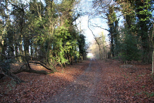
Gravelpit Plantation is a picturesque woodland located in Suffolk, England. Spread across a sprawling area, the plantation is renowned for its rich history and natural beauty. Nestled amidst a serene countryside, it offers a tranquil escape from the hustle and bustle of city life.

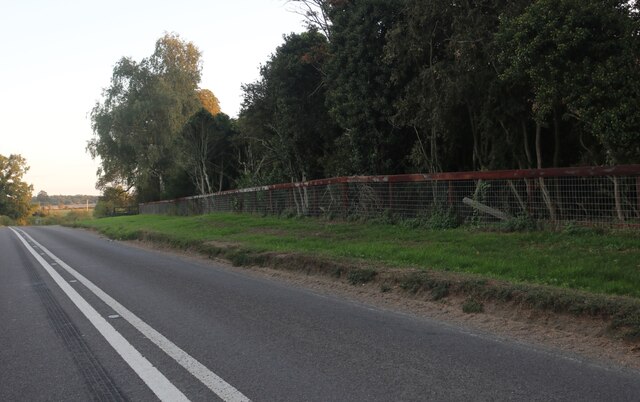
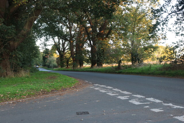
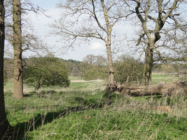
Covered in a dense canopy of trees, Gravelpit Plantation is predominantly composed of various species of oak, beech, and birch. The woodland's diverse flora and fauna make it an ideal habitat for a wide range of wildlife, including deer, foxes, and numerous bird species. Visitors can often catch glimpses of these creatures as they explore the plantation's well-maintained trails.

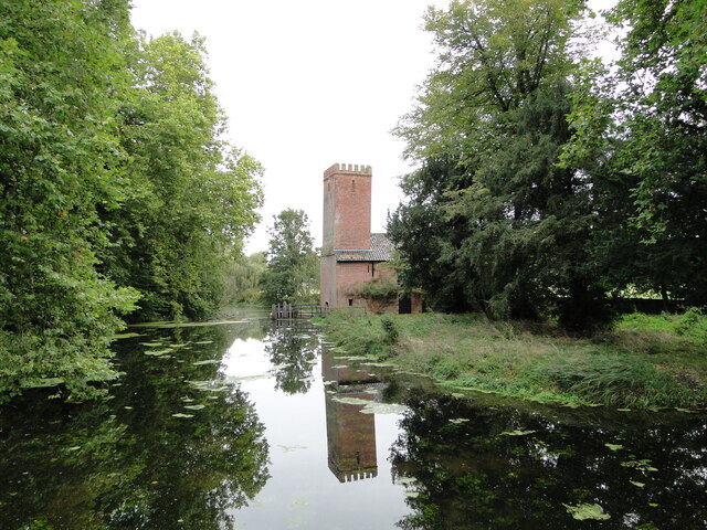
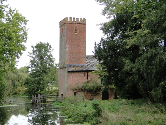
The plantation's name, Gravelpit, originates from the remnants of an old gravel quarry that was once in operation. These pits have now been reclaimed by nature, creating small ponds and wetland areas that add to the plantation's charm.

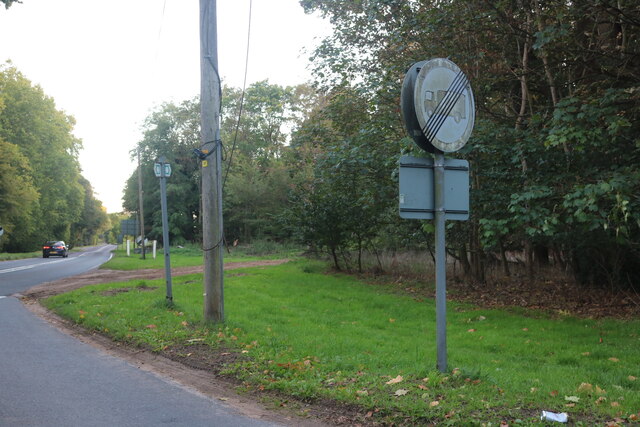
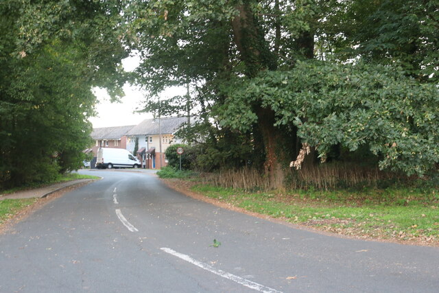
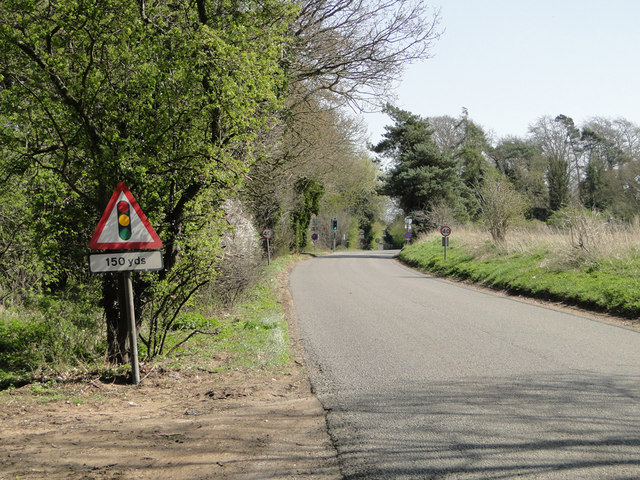
With its interconnected network of paths, Gravelpit Plantation offers a range of activities for outdoor enthusiasts. Hiking, cycling, and horseback riding are popular ways to explore the woodland and take in its scenic vistas. There are also designated areas for picnicking, allowing visitors to relax and enjoy the peaceful surroundings.

Due to its historical significance and natural beauty, Gravelpit Plantation attracts both locals and tourists alike. It provides a unique opportunity to immerse oneself in the tranquility of Suffolk's countryside, while also offering a glimpse into the region's past. Whether it's for a leisurely stroll or a day of exploration, Gravelpit Plantation offers an idyllic destination for nature lovers and history enthusiasts.

If you have any feedback on the listing, please let us know in the comments section below.

Gravelpit Plantation Images

Images are sourced within 2km of 52.379247/0.76296494 or Grid Reference TL8879. Thanks to Geograph Open Source API. All images are credited.

Euston watermill on the Black Bourn Disused watermill. Late C18/early C19. In red brick with black glazed pantiled roof: designed to look like a church, with a small crenellated tower. Pointed Gothic windows to top stage. The machinery is complete. The waterwheel drove a single pair of stones and also a reciprocating pump for raising water up to a tank in the tower, which provided the water supply for Euston Hall. A watermill was included in the estate as purchased by Lord Arlington in the 1660's: this is presumably a rebuilding on the same site. Copied from Historic England website <span class="nowrap"><a title="https://historicengland.org.uk/listing/the-list/list-entry/1031255" rel="nofollow ugc noopener" href="https://historicengland.org.uk/listing/the-list/list-entry/1031255">Link</a><img style="margin-left:2px;" alt="External link" title="External link - shift click to open in new window" src="https://s1.geograph.org.uk/img/external.png" width="10" height="10"/></span>
Euston watermill on the Black Bourn
Disused watermill. Late C18/early C19. In red brick with black glazed pantiled roof: designed to look like a church, with a small crenellated tower. Pointed Gothic windows to top stage. The machinery is complete. The waterwheel drove a single pair of stones and also a reciprocating pump for raising water up to a tank in the tower, which provided the water supply for Euston Hall. A watermill was included in the estate as purchased by Lord Arlington in the 1660's: this is presumably a rebuilding on the same site. Copied from Historic England website LinkExternal link
Euston watermill on the Black Bourn Disused watermill. Late C18/early C19. In red brick with black glazed pantiled roof: designed to look like a church, with a small crenellated tower. Pointed Gothic windows to top stage. The machinery is complete. The waterwheel drove a single pair of stones and also a reciprocating pump for raising water up to a tank in the tower, which provided the water supply for Euston Hall. A watermill was included in the estate as purchased by Lord Arlington in the 1660's: this is presumably a rebuilding on the same site. Copied from Historic England website  <span class="nowrap"><a title="https://historicengland.org.uk/listing/the-list/list-entry/1031255" rel="nofollow ugc noopener" href="https://historicengland.org.uk/listing/the-list/list-entry/1031255">Link</a><img style="margin-left:2px;" alt="External link" title="External link - shift click to open in new window" src="https://s1.geograph.org.uk/img/external.png" width="10" height="10"/></span>
Euston watermill on the Black Bourn
Disused watermill. Late C18/early C19. In red brick with black glazed pantiled roof: designed to look like a church, with a small crenellated tower. Pointed Gothic windows to top stage. The machinery is complete. The waterwheel drove a single pair of stones and also a reciprocating pump for raising water up to a tank in the tower, which provided the water supply for Euston Hall. A watermill was included in the estate as purchased by Lord Arlington in the 1660's: this is presumably a rebuilding on the same site. Copied from Historic England website LinkExternal link
Vintage covered cart Of the type used as an ambulance in WW1
Vintage covered cart
Of the type used as an ambulance in WW1
Old fuel pump still in use
Thetford Road, Euston
Barnham Road at the junction of Thetford Road
Salmond Drive, Barnham
Barnham Road at the junction of Salmond Drive
Icknield Way east of Euston The Icknield Way trail leads eastwards from the village of Euston, through a wooded area.
Icknield Way east of Euston
The Icknield Way trail leads eastwards from the village of Euston, through a wooded area.
Footpaths and Road Junction Footpaths and road junction at Euston, Suffolk.
Footpaths and Road Junction
Footpaths and road junction at Euston, Suffolk.
Euston Hall, Euston A long, low and plain elevation, the work of Matthew Brettingham, 1750-56. Much of the house was demolished in 1950. Grade II* listed.
The date of the photo is uncertain.
Euston Hall, Euston
A long, low and plain elevation, the work of Matthew Brettingham, 1750-56. Much of the house was demolished in 1950. Grade II* listed. The date of the photo is uncertain.
Barnham village sign Village signs are typically placed along the principal road or in a prominent location such as a village green or close by the church. The design often depicts a particularly feature of the village or a scene from its history, heritage, or culture. They are typically made of wood or metal or a combination of both, the designs are often made by the local community.
Although they do appear in villages and towns all over the country they are more prominent in East Anglia than elsewhere in the country.
Barnham village sign
Village signs are typically placed along the principal road or in a prominent location such as a village green or close by the church. The design often depicts a particularly feature of the village or a scene from its history, heritage, or culture. They are typically made of wood or metal or a combination of both, the designs are often made by the local community. Although they do appear in villages and towns all over the country they are more prominent in East Anglia than elsewhere in the country.
Euston (Suffolk) village sign The sign is simply the Family Arms of the Duke of Grafton, who own the village and live at Euston Hall. <a title="https://www.geograph.org.uk/photo/949799" href="https://www.geograph.org.uk/photo/949799">Link</a>
Euston (Suffolk) village sign
The sign is simply the Family Arms of the Duke of Grafton, who own the village and live at Euston Hall. Link
Traffic lights ahead on the A134 at Barnham
Fallen tree and meadowland behind
The war Memorial at Barnham There are 19 names for WW1 and 3 for WW2 which can be seen here: <a title="https://www.geograph.org.uk/photo/4430279" href="https://www.geograph.org.uk/photo/4430279">Link</a>
The war Memorial at Barnham
There are 19 names for WW1 and 3 for WW2 which can be seen here: Link
The War Memorial at Barnham There are 19 names for WW1 and 3 for WW2 which can be seen here: <a title="https://www.geograph.org.uk/photo/4430279" href="https://www.geograph.org.uk/photo/4430279">Link</a>
The War Memorial at Barnham
There are 19 names for WW1 and 3 for WW2 which can be seen here: Link
The War Memorial at Barnham The names on the Memorial for WW1 are: William Clarke, John Catchpole, Frederick Harold Davey, Sidney Charles Davey, John Davey, Edward Debenham, George Gaut, Edgar Gould, William Palfrey, Sidney Charles Pryke, Arthur James Pryke, Herbert Victor Rampley, Sidney Rampley,  Harry Rumsey, Albert Edward Sayer, Alfred William Turner, William Vincent. Names for WW2 are: Gerald Thomas Chamberlain, Arthur Lewis Price, Walter Edward Steward.
The War Memorial at Barnham
The names on the Memorial for WW1 are: William Clarke, John Catchpole, Frederick Harold Davey, Sidney Charles Davey, John Davey, Edward Debenham, George Gaut, Edgar Gould, William Palfrey, Sidney Charles Pryke, Arthur James Pryke, Herbert Victor Rampley, Sidney Rampley, Harry Rumsey, Albert Edward Sayer, Alfred William Turner, William Vincent. Names for WW2 are: Gerald Thomas Chamberlain, Arthur Lewis Price, Walter Edward Steward.
Show me another place!

Gravelpit Plantation is located at Grid Ref: TL8879 (Lat: 52.379247, Lng: 0.76296494)

Administrative County: Suffolk

District: West Suffolk

Police Authority: Suffolk

What 3 Words

///rekindle.crass.moth. Near Thetford, Norfolk
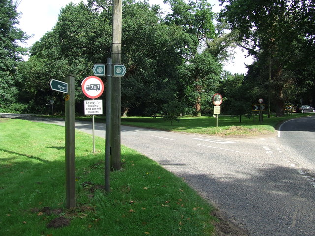
Related Wikis

Barnham Heath

Barnham Heath is a 78.6-hectare (194-acre) biological Site of Special Scientific Interest near Barnham, a village south of Thetford in Suffolk. It is a...
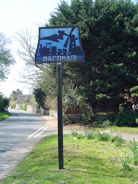
Barnham, Suffolk

Barnham is a village and civil parish in the West Suffolk district of the English county of Suffolk about 3 miles (4.8 km) south of Thetford and 9 miles...

Barnham Windmill, Suffolk

Barnham Mill is a tower mill at Barnham, Suffolk, England which has been converted to residential accommodation. == History == Barnham Mill was built for...

Brandon Rural District

Brandon was a rural district in Suffolk, England from 1894 to 1935. The district was created in 1894 as the Suffolk part of the Thetford rural sanitary...
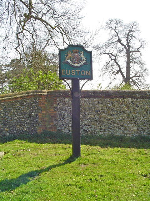
Euston, Suffolk

Euston is a village and civil parish in the West Suffolk district of Suffolk in eastern England. Located on the A1088 around two miles south of Thetford...

Euston Hall

Euston Hall is a country house, with park by William Kent and Capability Brown, located in Euston, a small village in Suffolk located just south of Thetford...

Barnham railway station (Suffolk)

Barnham railway station is a former station in Barnham, Suffolk on a now closed line between Thetford and Bury St Edmunds. It was located close to the...

RAF Barnham

RAF Barnham (also called Barnham Camp) is a Royal Air Force station situated in the English county of Suffolk 2 miles (3.2 km) south of the Norfolk town...

Nearby Amenities

Located within 500m of 52.379247,0.76296494
Post Box
Collection Times: Mo-Fr 09:00; Sa 07:00
Post Box Mounting: pier
Post Box Type: lamp
Ref: IP24 3389D
Royal Cypher: EIIR
Royal Cypher Wikidata: Q33102113
Lat/Long: 52.3788806/0.7556882
Pipeline: marker
Pipeline Ref: T/HO
Lat/Long: 52.3786307/0.7644962
Power: pole
Lat/Long: 52.3823876/0.7661403
Power: pole
Lat/Long: 52.3806914/0.7694743
Power: pole
Lat/Long: 52.378784/0.770067
Power: pole
Lat/Long: 52.381235/0.7684228
Power: pole
Lat/Long: 52.3829507/0.7650357
Power: pole
Lat/Long: 52.3836007/0.7637456
Power: pole
Lat/Long: 52.3818162/0.7672808
The data included in this document is from www.openstreetmap.org. The data is made available under ODbL.

Have you been to Gravelpit Plantation?

Leave your review of Gravelpit Plantation below (or comments, questions and feedback).