Oak Plantation

Wood, Forest in Suffolk West Suffolk

England

Oak Plantation

Bales of hay and pig shelters
Bales of hay and pig shelters Credit: Robert Edwards

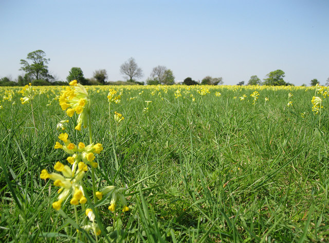
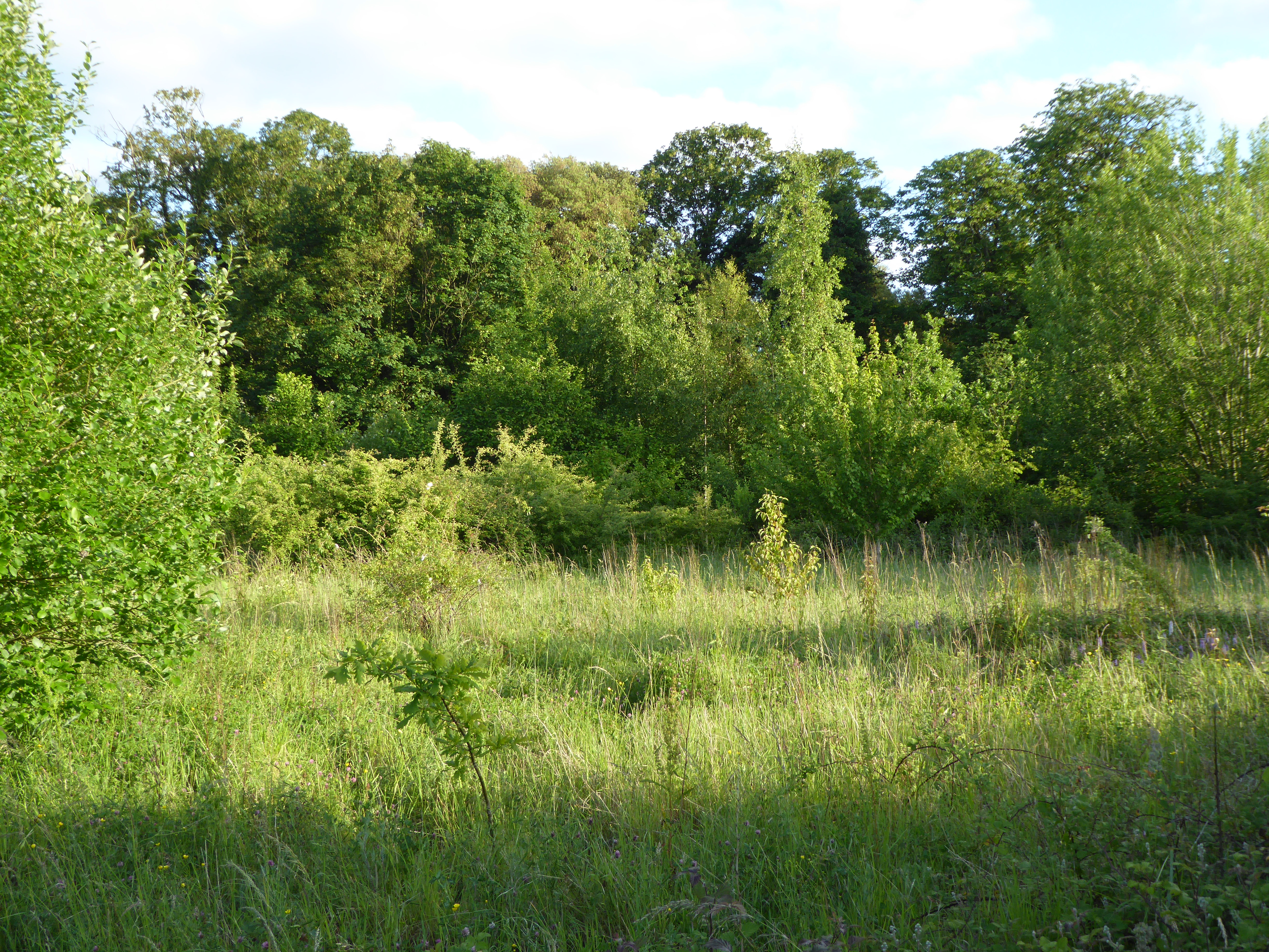
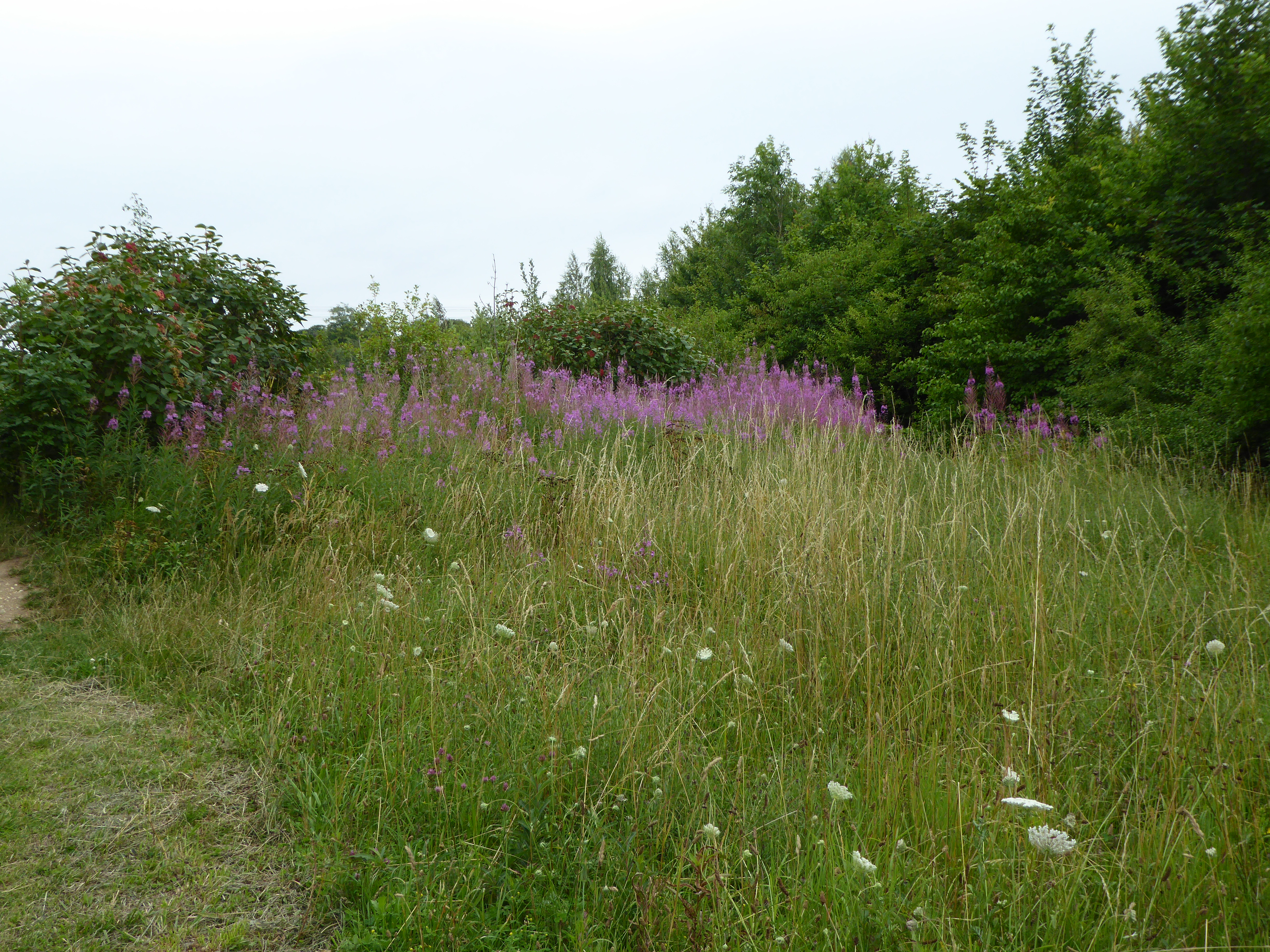
Oak Plantation is a sprawling woodland located in Suffolk, a county in the East of England. Covering a vast area of about 500 acres, this forested area is dominated by ancient oak trees, thus earning its name. The plantation is a popular destination for nature enthusiasts, hikers, and wildlife photographers due to its breathtaking natural beauty and diverse ecosystem.

The oak trees in Oak Plantation are estimated to be several centuries old, with some reaching heights of over 100 feet. These majestic trees provide a dense canopy that offers shade and shelter to a wide range of flora and fauna. The forest floor is covered with a thick layer of moss, wildflowers, and ferns, creating a picturesque scene that changes with the seasons.

The woodland is home to numerous species of wildlife, including deer, foxes, badgers, and a variety of bird species. Birdwatchers can spot woodpeckers, owls, and various songbirds, making Oak Plantation a haven for bird lovers.

Visitors to Oak Plantation can explore a network of well-maintained trails that wind through the forest, allowing for peaceful walks and hikes. These trails offer opportunities to encounter the diverse plant life and wildlife that thrive within the woodland.

The plantation also provides educational programs and guided tours for schools and interested groups. These activities aim to educate participants about the importance of preserving and protecting natural habitats and the various species that rely on them.

In conclusion, Oak Plantation in Suffolk is a captivating woodland that showcases the beauty of ancient oak trees and supports a rich ecosystem. It offers visitors the chance to immerse themselves in nature, explore its trails, and appreciate the wonders of this well-preserved forest.

If you have any feedback on the listing, please let us know in the comments section below.

Oak Plantation Images

Images are sourced within 2km of 52.249264/0.74832819 or Grid Reference TL8764. Thanks to Geograph Open Source API. All images are credited.

Bales of hay and pig shelters
Cowslip carpet This meadow west of Moreton Hall Preparatory School is covered with cowslips at this time of year. Permissive paths have been provided around this field.
Cowslip carpet
This meadow west of Moreton Hall Preparatory School is covered with cowslips at this time of year. Permissive paths have been provided around this field.
The edge of Moreton Hall estate A very large model of a Yak aerobatic aircraft makes an emergency landing, with smoke on, in front of Rougham airfield's famous row of trees. Behind that we see the Audi dealership and a few houses, neatly symbolising the mixed industrial and housing nature of the Moreton Hall estate.

The event was Bury Model Flying Club's "Flying At Its Best" model show.
The edge of Moreton Hall estate
A very large model of a Yak aerobatic aircraft makes an emergency landing, with smoke on, in front of Rougham airfield's famous row of trees. Behind that we see the Audi dealership and a few houses, neatly symbolising the mixed industrial and housing nature of the Moreton Hall estate. The event was Bury Model Flying Club's "Flying At Its Best" model show.
Last Game of the Season Football match at Ram Lane. Bury Utd vs Wealdstone in the Ryman Premiership. A sell out crowd of 694! The game finished 1-0 to the home team.
Last Game of the Season
Football match at Ram Lane. Bury Utd vs Wealdstone in the Ryman Premiership. A sell out crowd of 694! The game finished 1-0 to the home team.
Railway bridge over Orttewell Road
Roundabout at Hollow Road This roundabout is one of several entrances to the British Sugar factory.
Roundabout at Hollow Road
This roundabout is one of several entrances to the British Sugar factory.
View from Control Tower, Rougham airshow This second world war airfield hosts several events each year. This 4 picture panorama covers almost 180 degrees of the Warbird and Classic Car show. The main grass strip runs along the horizon, with a second strip on the left (west). The show itself is based on the grass area on the left, which is separated by a hedge and row of trees behind that central tree from the large field of harvested cereal used for the car park.
View from Control Tower, Rougham airshow
This second world war airfield hosts several events each year. This 4 picture panorama covers almost 180 degrees of the Warbird and Classic Car show. The main grass strip runs along the horizon, with a second strip on the left (west). The show itself is based on the grass area on the left, which is separated by a hedge and row of trees behind that central tree from the large field of harvested cereal used for the car park.
Car parking area, Rougham airshow A harvested cereal field forms the car park for an airshow on the Rougham Airfield. This is a 2 shot panorama. Dozens of aircraft can be seen parked along the runway on the left (north). To the centre-right a row of industrial buildings can be seen, built along the perimeter track. Behind the tall hedge on the right there are further industrial premises, some based on former wartime buildings. 

The photographs were taken from the top of the old control tower.
Car parking area, Rougham airshow
A harvested cereal field forms the car park for an airshow on the Rougham Airfield. This is a 2 shot panorama. Dozens of aircraft can be seen parked along the runway on the left (north). To the centre-right a row of industrial buildings can be seen, built along the perimeter track. Behind the tall hedge on the right there are further industrial premises, some based on former wartime buildings. The photographs were taken from the top of the old control tower.
View of airshow from control tower Photographed from the top of the control tower of this second world war airfield, Spitfires are featured over the display ring, which seems to be showing off Jaguars at this moment. At least 3 rows of other classics surround the ring. Situated right on the edge of Bury St. Edmunds, only a few houses can be seen in the background.
View of airshow from control tower
Photographed from the top of the control tower of this second world war airfield, Spitfires are featured over the display ring, which seems to be showing off Jaguars at this moment. At least 3 rows of other classics surround the ring. Situated right on the edge of Bury St. Edmunds, only a few houses can be seen in the background.
Car parking area for airshow, plus industrial buildings Very early in the day but the car park is already filling. Behind the cars we can see the industrial operations based on the second world war airfield sites. 

This is a two picture panorama.
Car parking area for airshow, plus industrial buildings
Very early in the day but the car park is already filling. Behind the cars we can see the industrial operations based on the second world war airfield sites. This is a two picture panorama.
View from No Man's Meadow towards Rougham Hill Across the valley of the River Lark.
View from No Man's Meadow towards Rougham Hill
Across the valley of the River Lark.
Waterway junction in No Man's Meadow These low lying meadows have a complex network of man-made waterways as part of the abbey fish farm and the water supply to the abbey watermill. This is just behind the rugby club.
Waterway junction in No Man's Meadow
These low lying meadows have a complex network of man-made waterways as part of the abbey fish farm and the water supply to the abbey watermill. This is just behind the rugby club.
Rugby Club A 3 picture panorama.
Rugby Club
A 3 picture panorama.
Look both ways before crossing. This is the old main road out of Bury St Edmunds towards Ipswich, now supplanted by the A14. I'd parked up at Bury St Edmunds truckstop and gone for a walk with my camera. This wasn't the most scenic location - it seems to be mostly used for flytipping these days - but I was interested to find the old cats' eyes in the road surface.
Look both ways before crossing.
This is the old main road out of Bury St Edmunds towards Ipswich, now supplanted by the A14. I'd parked up at Bury St Edmunds truckstop and gone for a walk with my camera. This wasn't the most scenic location - it seems to be mostly used for flytipping these days - but I was interested to find the old cats' eyes in the road surface.
Path and cycle-way Track near Pond Covert
Path and cycle-way
Track near Pond Covert
St. Edmundsbury Retail Park Footpath/Cycleway to Easlea Road
St. Edmundsbury Retail Park
Footpath/Cycleway to Easlea Road
Path from Layhill Covert Exit to Bedingfield Way
Path from Layhill Covert
Exit to Bedingfield Way
Protecting our sugar Razor wire atop the wall protects the British Sugar processing site in Bury St Edmunds, as viewed from the Eastern Way Industrial Estate.
Protecting our sugar
Razor wire atop the wall protects the British Sugar processing site in Bury St Edmunds, as viewed from the Eastern Way Industrial Estate.
Show me another place!

Oak Plantation is located at Grid Ref: TL8764 (Lat: 52.249264, Lng: 0.74832819)

Administrative County: Suffolk

District: West Suffolk

Police Authority: Suffolk

What 3 Words

///lakes.drumbeat.coaching. Near Bury St Edmunds, Suffolk

Related Wikis

Moreton Hall, Bury St Edmunds

Moreton Hall is a Grade II* listed building in Bury St Edmunds, a market town in the county of Suffolk, England. It was designed by the Scottish architect...

Moreton Hall Community Woods

Moreton Hall Community Woods is an 18.5 hectare local nature reserve in Bury St Edmunds in Suffolk. it is owned by West Suffolk Council and managed by...
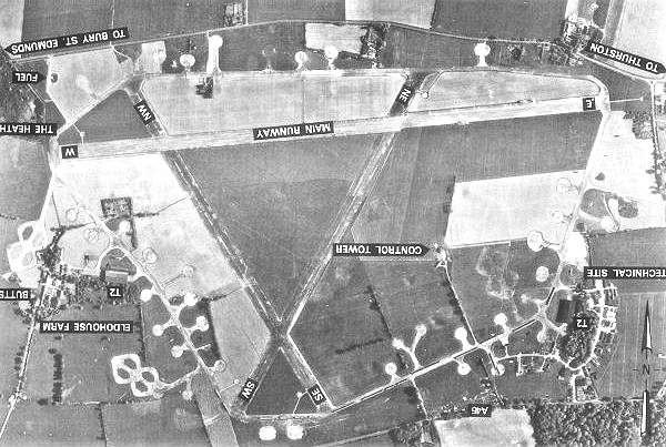
Rougham Airfield

Rougham Airfield, formerly Royal Air Force Bury St Edmunds or more simply RAF Bury St Edmunds is a former Royal Air Force station located 3 miles (4.8...

The Glen Chalk Caves, Bury St Edmunds

The Glen Chalk Caves, Bury St Edmunds is a 1.6-hectare (4.0-acre) biological Site of Special Scientific Interest in Bury St Edmunds in Suffolk.Tunnels...

Bury St Edmunds Eastgate railway station

Bury St Edmunds Eastgate railway station (also known as Bury Eastgate was a station in the town of Bury St Edmunds, England, on the Long Melford-Bury...

Team Bury F.C.

Team Bury Football Club was a football club based in Bury St Edmunds, Suffolk. Consisting of players largely drawn from the West Suffolk College Football...
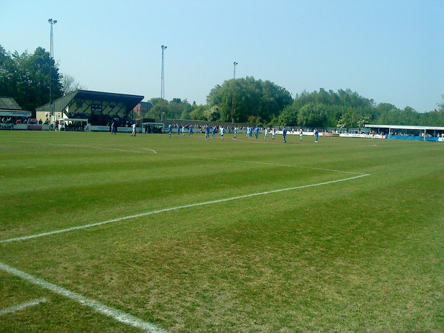
Bury Town F.C.

Bury Town Football Club is a semi-professional football club, based in Bury St Edmunds, Suffolk, England. The club are currently members of the Isthmian...

Bury St Edmunds

Bury St Edmunds (), commonly referred to locally as Bury, is a historic market and cathedral town and civil parish in Suffolk, England. The town is best...

Nearby Amenities

Located within 500m of 52.249264,0.74832819
Crossing
Crossing: traffic_signals
Crossing Ref: pelican
Lat/Long: 52.2486312/0.7433358
Crossing
Lat/Long: 52.2487837/0.7472189
Crossing
Crossing: traffic_signals
Crossing Ref: toucan
Lat/Long: 52.2489377/0.7495733
Traffic Calming: table
Lat/Long: 52.2514077/0.7521939
Traffic Calming: table
Lat/Long: 52.2501659/0.7511436
Traffic Calming: table
Lat/Long: 52.2501498/0.7550687
Crossing
Crossing: traffic_signals
Lat/Long: 52.2493132/0.754229
Noexit: yes
Lat/Long: 52.249734/0.7443369
Traffic Calming: table
Lat/Long: 52.2496182/0.7517843
Barrier: bollard
Lat/Long: 52.2510572/0.7514686
Traffic Calming: table
Lat/Long: 52.2511302/0.7532481
Noexit: yes
Lat/Long: 52.2515289/0.7516205
Traffic Calming: table
Lat/Long: 52.2511464/0.7511778
Crossing
Crossing: zebra
Lat/Long: 52.2477274/0.7527257
Crossing
Traffic Calming: hump
Lat/Long: 52.2490705/0.7531483
Post Box
Ref: IP32 2284
Lat/Long: 52.2497676/0.7433771
Bus Stop
Bus: yes
Public Transport: platform
Lat/Long: 52.2514609/0.7433177
Post Box
Fixme: Resurvey to complete ref and get collection times
Post Box Type: pillar
Ref: IP32 8216
Lat/Long: 52.2491245/0.7532822
Leisure: playground
Lat/Long: 52.2510765/0.7547016
Leisure: playground
Lat/Long: 52.2477286/0.7475365
Bus Stop
Brunwyn Close
Bus: yes
Naptan AtcoCode: 390050706
Naptan Bearing: S
Naptan CommonName: Brunwyn Close
Naptan Indicator: Adjacent
Naptan NaptanCode: sufgjmjt
Naptan PlusbusZoneRef: BSTEDMS
Naptan Street: Tassel Road
Naptan Verified: no
Public Transport: platform
Lat/Long: 52.2477009/0.7487029
Post Box
Ref: IP32 2300
Lat/Long: 52.2469107/0.7447668
Kindergarten
Tassel Road Children's Nursery
Lat/Long: 52.2472515/0.746703
Bus Stop
Tassel Road
Bus: yes
Naptan AtcoCode: 390050698
Naptan Bearing: W
Naptan BusStopType: CUS
Naptan CommonName: Tassel Road
Naptan Indicator: adj
Naptan Landmark: Tassel Road
Naptan NaptanCode: sufgjmgp
Naptan PlusbusZoneRef: BSTEDMS
Naptan Street: Mount Road
Naptan Verified: no
Public Transport: platform
Source: naptan_import
Lat/Long: 52.2485322/0.7441691
Bus Stop
Tassel Road
Bus: yes
Naptan AtcoCode: 390050699
Naptan Bearing: E
Naptan BusStopType: CUS
Naptan CommonName: Tassel Road
Naptan Indicator: opp
Naptan Landmark: Tassel Road
Naptan NaptanCode: sufgjmgt
Naptan PlusbusZoneRef: BSTEDMS
Naptan Street: Mount Road
Naptan Verified: no
Public Transport: platform
Source: naptan_import
Lat/Long: 52.2486679/0.7441336
Bus Stop
Sheerwater Close
Bus: yes
Naptan AtcoCode: 390050700
Naptan Bearing: S
Naptan CommonName: Sheerwater Close
Naptan Indicator: Adjacent
Naptan Landmark: Sheerwater Close
Naptan NaptanCode: sufgjmgw
Naptan PlusbusZoneRef: BSTEDMS
Naptan Street: Appledown Drive
Naptan Verified: no
Public Transport: platform
Source: naptan_import
Lat/Long: 52.2495174/0.7466623
Bus Stop
Codling Road
Bus: yes
Naptan AtcoCode: 390050702
Naptan Bearing: N
Naptan CommonName: Codling Road
Naptan Indicator: adj
Naptan Landmark: Codling Road
Naptan NaptanCode: sufgjmjd
Naptan PlusbusZoneRef: BSTEDMS
Naptan Street: Appledown Drive
Naptan Verified: no
Public Transport: platform
Source: naptan_import
Lat/Long: 52.2514144/0.7432042
Bus Stop
Alvis Close
Bus: yes
Naptan AtcoCode: 390050704
Naptan Bearing: W
Naptan CommonName: Alvis Close
Naptan Indicator: adj
Naptan Landmark: Alvis Close
Naptan NaptanCode: sufgjmjm
Naptan PlusbusZoneRef: BSTEDMS
Naptan Street: Tassel Road
Naptan Verified: no
Public Transport: platform
Source: naptan_import
Lat/Long: 52.2470153/0.7463611
Bus Stop
Brunwyn Close
Bus: yes
Naptan AtcoCode: 390050707
Naptan Bearing: N
Naptan BusStopType: CUS
Naptan CommonName: Brunwyn Close
Naptan Indicator: Opposite
Naptan Landmark: Brunwen Close
Naptan NaptanCode: sufgjmjw
Naptan PlusbusZoneRef: BSTEDMS
Naptan Street: Tassel Road
Naptan Verified: no
Public Transport: platform
Source: naptan_import
Lat/Long: 52.2477371/0.7485742
Bus Stop
Orchard Park
Bus: yes
Naptan AtcoCode: 390051019
Naptan Bearing: W
Naptan CommonName: Orchard Park
Naptan Indicator: o/s
Naptan Landmark: Orchard Park
Naptan NaptanCode: sufjgpmd
Naptan PlusbusZoneRef: BSTEDMS
Naptan Street: Mount Road
Naptan Verified: no
Public Transport: platform
Source: naptan_import
Lat/Long: 52.2490743/0.7525543
Bus Stop
Orchard Park
Bus: yes
Naptan AtcoCode: 390051020
Naptan Bearing: E
Naptan BusStopType: CUS
Naptan CommonName: Orchard Park
Naptan Indicator: opp
Naptan Landmark: Orchard Park
Naptan NaptanCode: sufjgpmg
Naptan PlusbusZoneRef: BSTEDMS
Naptan Street: Mount Road
Naptan Verified: no
Public Transport: platform
Source: naptan_import
Lat/Long: 52.2492096/0.7525334
Crossing
Traffic Calming: hump
Lat/Long: 52.2492847/0.75187
Barrier: bollard
Lat/Long: 52.2503869/0.7552664
Crossing
Crossing: traffic_signals
Crossing Ref: pelican
Lat/Long: 52.2485032/0.7426863
Crossing
Lat/Long: 52.2470527/0.7532608
Crossing
Lat/Long: 52.2470645/0.7535378
The data included in this document is from www.openstreetmap.org. The data is made available under ODbL.

Have you been to Oak Plantation?

Leave your review of Oak Plantation below (or comments, questions and feedback).