Affers Wood
Wood, Forest in Kent Maidstone
England
Affers Wood

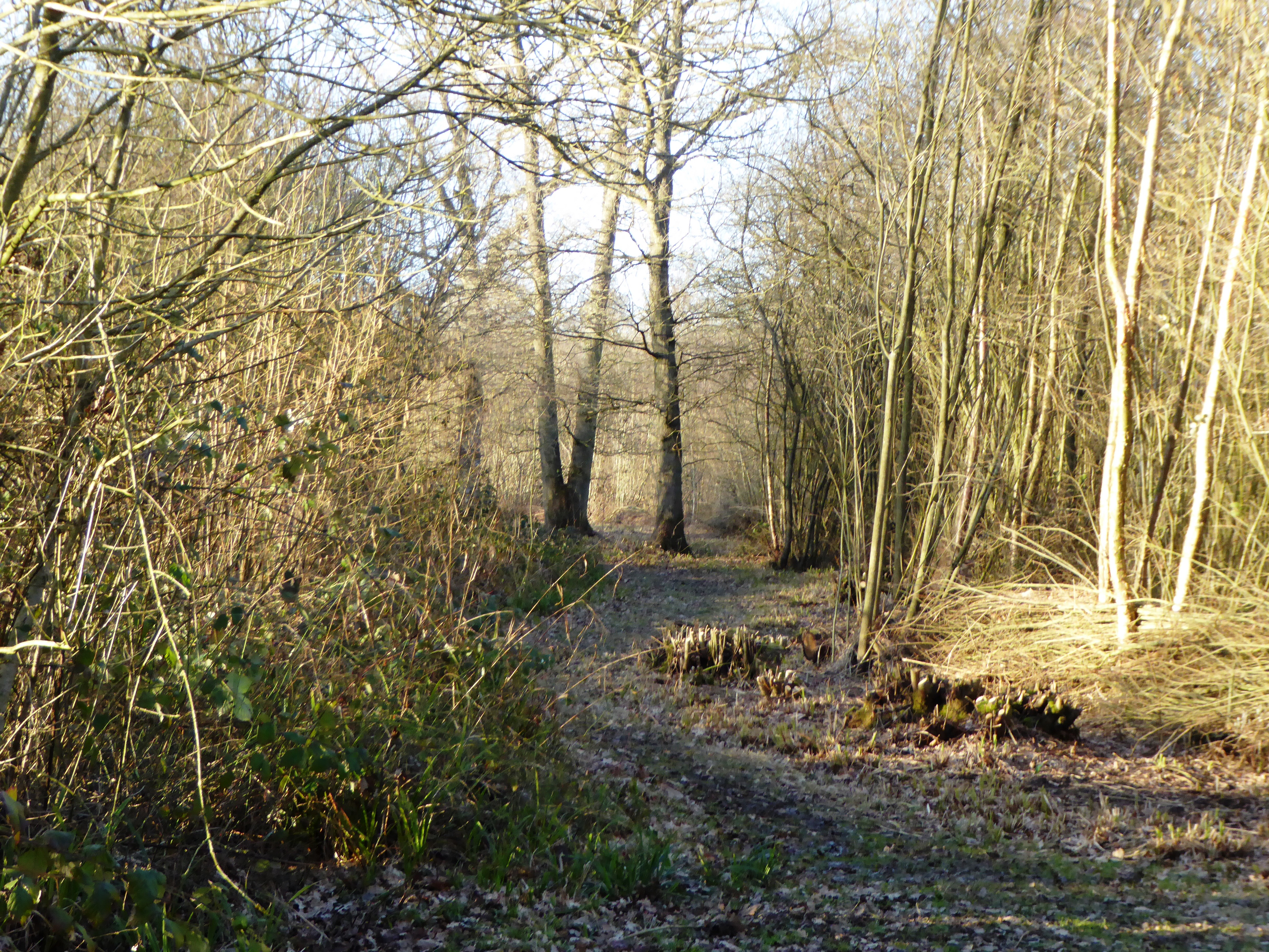
Affers Wood is a picturesque woodland located in Kent, England. Situated near the village of Affers, this woodland covers an area of approximately 100 acres. It is a popular destination for nature enthusiasts, hikers, and those seeking a tranquil escape from the hustle and bustle of everyday life.
The wood is predominantly made up of broadleaf trees, including oak, beech, and ash, which create a dense canopy that provides shade during the summer months. This lush vegetation also supports a diverse array of wildlife, making it a haven for birdwatchers and wildlife enthusiasts. Visitors may spot various species of birds, such as woodpeckers, jays, and tawny owls, as well as small mammals like foxes, badgers, and deer.
A network of well-maintained footpaths crisscrosses the woodland, allowing visitors to explore its hidden gems. These paths wind through ancient trees, past tranquil ponds, and alongside babbling brooks. Along the way, there are several designated picnic areas and benches where visitors can rest and enjoy a packed lunch amidst the natural beauty.
Affers Wood is managed by the local council, which ensures the preservation of its natural habitats and the safety of its visitors. It is open to the public throughout the year, with no admission fee. The woodland can be accessed by car or on foot, and there is ample parking available nearby.
Overall, Affers Wood in Kent offers a delightful escape into nature, providing a peaceful and serene environment for visitors to enjoy the beauty of the British countryside.
If you have any feedback on the listing, please let us know in the comments section below.
Affers Wood Images
Images are sourced within 2km of 51.226673/0.68571396 or Grid Reference TQ8750. Thanks to Geograph Open Source API. All images are credited.


Affers Wood is located at Grid Ref: TQ8750 (Lat: 51.226673, Lng: 0.68571396)
Administrative County: Kent
District: Maidstone
Police Authority: Kent
What 3 Words
///foiled.jumped.florists. Near Harrietsham, Kent
Nearby Locations
Related Wikis

Platt's Heath
Platts Heath is a hamlet in the civil parish of Lenham, Kent, England. It is also the source of the River Len, which flows in a westerly direction to join...
Sandway
Sandway is a hamlet about one mile (1.6 km) to the SW of Lenham in the Maidstone district of Kent, England. The population is included in the civil parish...
Kiln Wood
Kiln Wood is a 6-hectare (15-acre) nature reserve south of Lenham in Kent. It is managed by Kent Wildlife Trust.This wood is mainly oak, hornbeam and...
Boughton Malherbe
Boughton Malherbe ( BAW-tən MAL-ər-bee) is a village and civil parish in the Maidstone district of Kent, England, equidistant between Maidstone and Ashford...
Hollingbourne Rural District
Hollingbourne Rural District was a rural district in the county of Kent, England. It was named after the village of Hollingbourne. Following the Local...
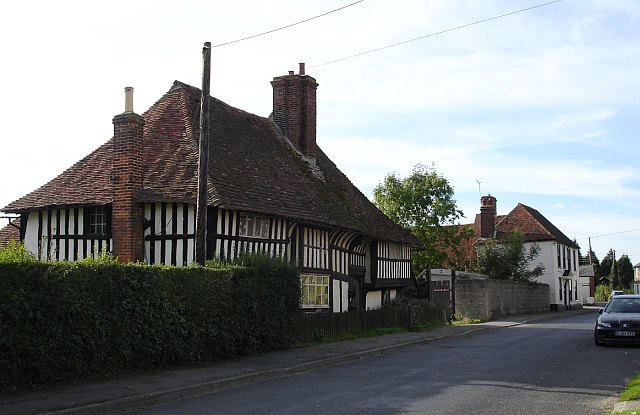
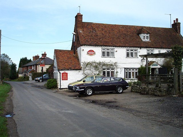
The Old House, Harrietsham
The Old House is a former farmhouse in Harrietsham, Kent, England, built around 1500 and described as "unusually well preserved".The house is a two-storey...
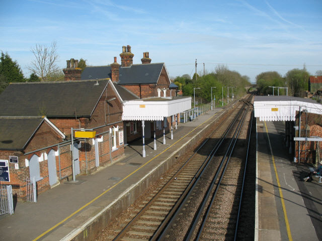
Lenham railway station
Lenham railway station serves Lenham in Kent, England. It is 49 miles 11 chains (79.1 km) down the line from London Victoria. The station, and all trains...
Fairbourne Heath, Kent
Fairbourne Heath is a scattered settlement in the civil parish of Harrietsham, Kent, England. It is located on a crossroads of two minor roads. Fairbourne...
Nearby Amenities
Located within 500m of 51.226673,0.68571396Have you been to Affers Wood?
Leave your review of Affers Wood below (or comments, questions and feedback).