Hook Wood

Wood, Forest in Kent Ashford

England

Hook Wood

Biddenden The village green with the Biddenden Maids sign, and the High Street, taken from the east side of the A262.
Biddenden Credit: Derek Harper

Hook Wood is a picturesque woodland located in the county of Kent, England. Covering an area of approximately 50 acres, it forms part of the larger Hook Green Nature Reserve. The woodland is situated near the village of Hook Green, nestled between the towns of Sevenoaks and Tonbridge.

Hook Wood is primarily composed of native broadleaf trees, including oak, beech, and ash, creating a diverse and vibrant ecosystem. The wood is also home to a variety of wildlife, including birds, small mammals, and insects, making it a popular spot for nature enthusiasts and birdwatchers.

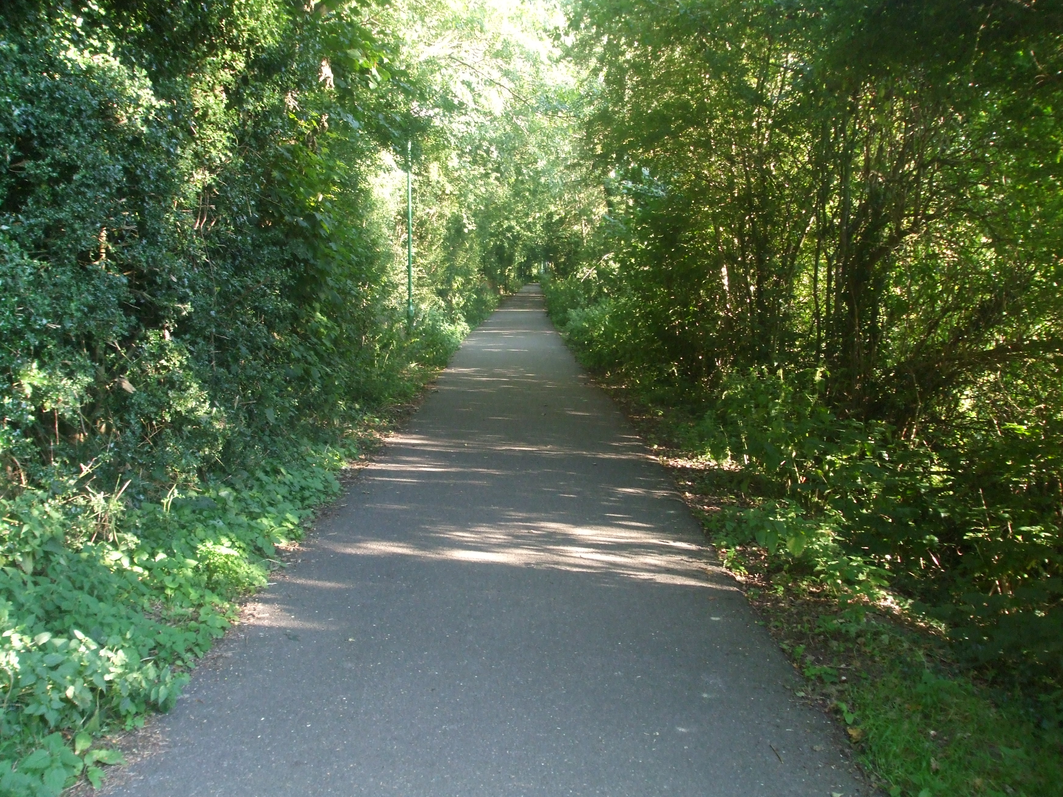
Visitors to Hook Wood can enjoy a network of well-maintained walking trails that wind through the picturesque landscape. These trails offer stunning views of the woodland, providing an opportunity to immerse oneself in nature and appreciate the tranquility of the surroundings. The wood is especially beautiful in the spring and autumn, when the trees are adorned with vibrant blossoms or display a stunning array of colors.

Hook Wood is managed by the local authorities, who work to preserve its natural beauty and protect its wildlife. The wood also serves as an important educational resource, with guided nature walks and educational programs organized for schools and community groups.

Overall, Hook Wood, Kent, is a charming and peaceful woodland that offers a serene escape from the hustle and bustle of everyday life. Its natural beauty, diverse wildlife, and well-maintained trails make it a popular destination for both locals and visitors seeking a connection with nature.

If you have any feedback on the listing, please let us know in the comments section below.
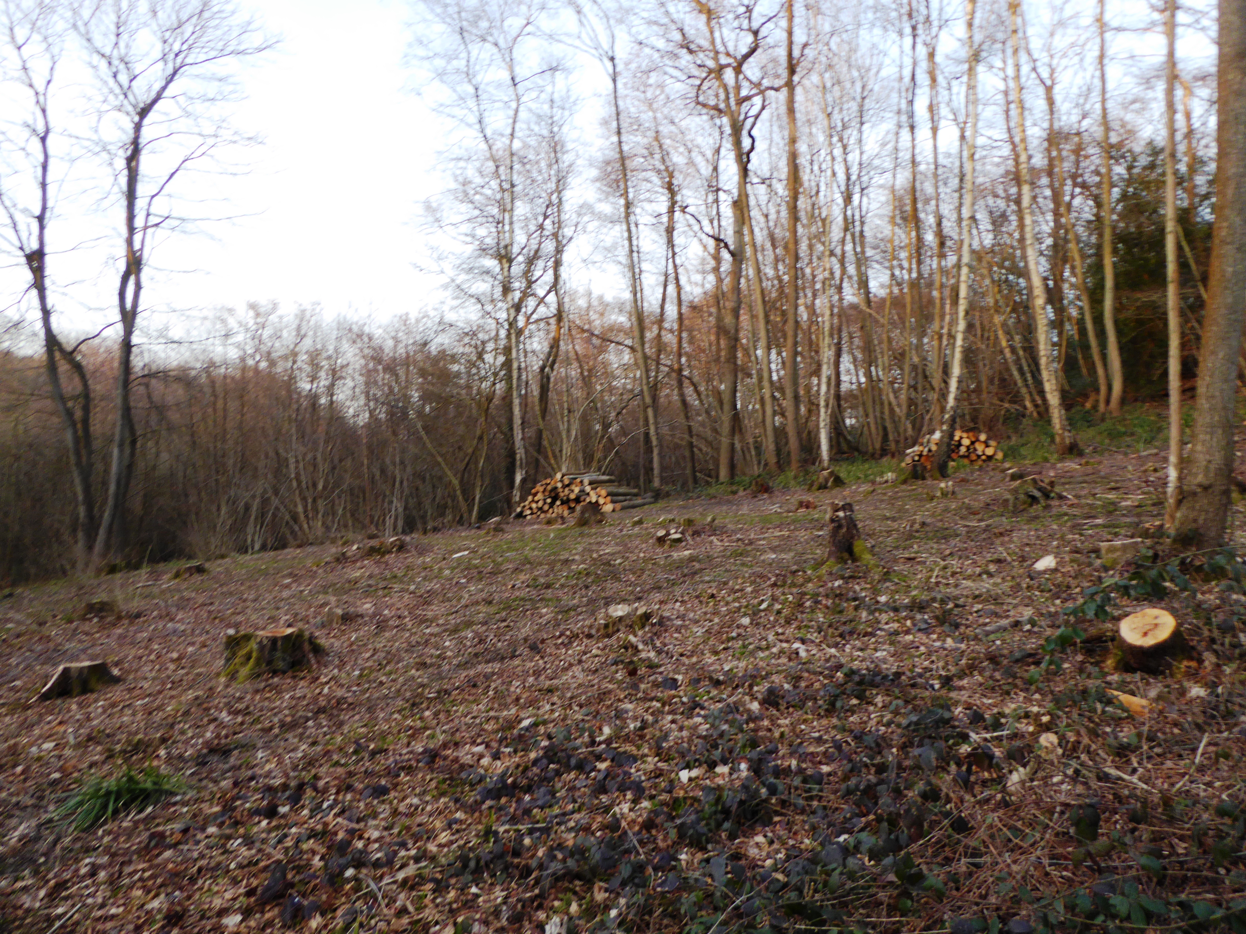
Hook Wood Images

Images are sourced within 2km of 51.108879/0.66956154 or Grid Reference TQ8637. Thanks to Geograph Open Source API. All images are credited.

Biddenden The village green with the Biddenden Maids sign, and the High Street, taken from the east side of the A262.
Biddenden
The village green with the Biddenden Maids sign, and the High Street, taken from the east side of the A262.
The Biddenden Maids Plaques attached to the sign read:
Eliza and Mary Chulkhurst the famous twins known as the Biddenden Maids were born in the year 1100 joined together at hips and shoulders. They lived together thus joined for 34 years when one of them was seized with a fatal illness and died. The other refusing to be separated died 6 hours later. By their Will they left their property to the poor of Biddenden.

In commemoration of the Biddenden Maids an annual distribution of bread and cheese takes place on Easter Monday morning from the old bakehouse. Biscuits bearing the impress of the two maids, their names and year of birth are available at the same time to all who apply, visitor and parishioners.
The Biddenden Maids
Plaques attached to the sign read: Eliza and Mary Chulkhurst the famous twins known as the Biddenden Maids were born in the year 1100 joined together at hips and shoulders. They lived together thus joined for 34 years when one of them was seized with a fatal illness and died. The other refusing to be separated died 6 hours later. By their Will they left their property to the poor of Biddenden. In commemoration of the Biddenden Maids an annual distribution of bread and cheese takes place on Easter Monday morning from the old bakehouse. Biscuits bearing the impress of the two maids, their names and year of birth are available at the same time to all who apply, visitor and parishioners.
Claris's Tea Rooms Photo of The Tea Rooms in Biddenden
Claris's Tea Rooms
Photo of The Tea Rooms in Biddenden
Biddenden Green
Biddenden Green
Biddenden Maids Village Green Plaques on sign read:

Eliza and Mary Chulkhurst the famous twins known as the Biddenden Maids were born in the year 1100 joined together at hips and shoulders. They lived together thus joined for 34 years when one of them was seized with a fatal illness and died. The other refusing to be separated died 6 hours later. By their Will they left their property to the poor of Biddenden.

In commemoration of the Biddenden Maids an annual distribution of bread and cheese takes place on Easter Monday morning from the old bakehouse. Biscuits bearing the impress of the two maids, their names and year of birth are available at the same time to all who apply, visitor and parishioners.
Biddenden Maids Village Green
Plaques on sign read: Eliza and Mary Chulkhurst the famous twins known as the Biddenden Maids were born in the year 1100 joined together at hips and shoulders. They lived together thus joined for 34 years when one of them was seized with a fatal illness and died. The other refusing to be separated died 6 hours later. By their Will they left their property to the poor of Biddenden. In commemoration of the Biddenden Maids an annual distribution of bread and cheese takes place on Easter Monday morning from the old bakehouse. Biscuits bearing the impress of the two maids, their names and year of birth are available at the same time to all who apply, visitor and parishioners.
Vineyards Row upon row of grapes on the vine
Vineyards
Row upon row of grapes on the vine
Hop Garden, Bugglesden Road, near Biddenden The hop picking season starts in September.

These are taken to the nearby <a href="https://www.geograph.org.uk/photo/1533642">TQ8736 : Oast House at Haffenden Farm, Bugglesden Road, St Michaels, Kent</a>
Hop Garden, Bugglesden Road, near Biddenden
The hop picking season starts in September. These are taken to the nearby TQ8736 : Oast House at Haffenden Farm, Bugglesden Road, St Michaels, Kent
Oast House at Haffenden Farm, Bugglesden Road, St Michaels, Kent 20th Century ridge ventilated oast house. Believed to still be working. The corrugated building to the right houses a suspended conveyor, the tractor drives underneath and the hop bines are hook onto the conveyor and taken into the building to be processed.
Oast House at Haffenden Farm, Bugglesden Road, St Michaels, Kent
20th Century ridge ventilated oast house. Believed to still be working. The corrugated building to the right houses a suspended conveyor, the tractor drives underneath and the hop bines are hook onto the conveyor and taken into the building to be processed.
River Hall Oast, River Hall, Cot Lane, Biddenden, Kent Twin round kiln oast house.
River Hall Oast, River Hall, Cot Lane, Biddenden, Kent
Twin round kiln oast house.
Hop Fields at Wagstaff Farm, Wagstaff Lane, Biddenden It is not clear if this hop garden is still in use. The strings would begin to be strung around this time of year.
Hop Fields at Wagstaff Farm, Wagstaff Lane, Biddenden
It is not clear if this hop garden is still in use. The strings would begin to be strung around this time of year.
The Oast House, High Halden Road, Biddenden, Kent Single round kiln oast house.

Also see <a href="https://www.geograph.org.uk/photo/1424732">TQ8638 : The Oast House, High Halden Road, Biddenden, Kent</a>
The Oast House, High Halden Road, Biddenden, Kent
Single round kiln oast house. Also see TQ8638 : The Oast House, High Halden Road, Biddenden, Kent
Defunct railway station The Rother valley light railway was one of Colonel Stephens 16 light railways. It was started in 1900 from Robertsbridge to Tenterden, extended in 1905 to Headcorn the line was renamed Kent & East Sussex Railway. Services were withdrawn in 1954 and the lines from Tenterden to Headcorn removed. The rest is still a thriving private steam railway. The view is north from the A262 Biddenden road at what is now Applegate Farm.
Defunct railway station
The Rother valley light railway was one of Colonel Stephens 16 light railways. It was started in 1900 from Robertsbridge to Tenterden, extended in 1905 to Headcorn the line was renamed Kent & East Sussex Railway. Services were withdrawn in 1954 and the lines from Tenterden to Headcorn removed. The rest is still a thriving private steam railway. The view is north from the A262 Biddenden road at what is now Applegate Farm.
Footpath through Gribble Wood Some coppicing had been done elsewhere in the wood.
Footpath through Gribble Wood
Some coppicing had been done elsewhere in the wood.
Stream under Gribble Bridge Lane The greenery is mainly Ramsons, a wild garlic, not yet in flower. Apparently this is Gribble Bridge on Gribble Bridge Lane, not Cradocks lane as the OS  Explorer map has it.
Stream under Gribble Bridge Lane
The greenery is mainly Ramsons, a wild garlic, not yet in flower. Apparently this is Gribble Bridge on Gribble Bridge Lane, not Cradocks lane as the OS Explorer map has it.
The Raja of Kent "Bangladeshi and Indian cuisine".
The Raja of Kent
"Bangladeshi and Indian cuisine".
A bend on a lane The lane is unnamed on the map. The left-hand hedge hides a very small parcel of land hedged from the fields, with a new gate, but little in it apart from scrub and bits of corrugated iron.
A bend on a lane
The lane is unnamed on the map. The left-hand hedge hides a very small parcel of land hedged from the fields, with a new gate, but little in it apart from scrub and bits of corrugated iron.
Byway towards Marlands Farm This is signed as a byway (called Gore Lane). The dead-end sign is possibly misleading, as the byway, after skirting Marlands Farm, eventually reaches another road.
Byway towards Marlands Farm
This is signed as a byway (called Gore Lane). The dead-end sign is possibly misleading, as the byway, after skirting Marlands Farm, eventually reaches another road.
High Halden Road Bush House Farm on the left looks in a bad way, the cottage opposite is selling charcoal at £3.50/bag.
High Halden Road
Bush House Farm on the left looks in a bad way, the cottage opposite is selling charcoal at £3.50/bag.
Show me another place!

Hook Wood is located at Grid Ref: TQ8637 (Lat: 51.108879, Lng: 0.66956154)

Administrative County: Kent

District: Ashford

Police Authority: Kent

What 3 Words

///shunning.cakes.grower. Near Biddenden, Kent

Nearby Locations

Hook Wood

Related Wikis

High Halden Road railway station

High Halden Road is a disused railway station on the defunct Kent and East Sussex Railway which closed in 1954. The station building and platform still...

Biddenden

Biddenden is a large, mostly agricultural and wooded village and civil parish in the borough of Ashford in Kent, England. The village lies on the Weald...
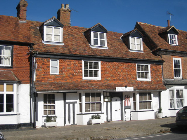
The West House

The West House is a family restaurant located in Biddenden, Kent, England. As of 2008, the restaurant holds one star in the Michelin Guide. == See also... ==

Biddenden railway station

Biddenden was a railway station on the Kent and East Sussex Railway which closed in January 1954. As of 2014 the station building has been converted to...

Wattle Wood

Wattle Wood is a 1-hectare (2.5-acre) nature reserve north-west of Tenterden in Kent. It is managed by Kent Wildlife Trust.This ancient coppice with standards...
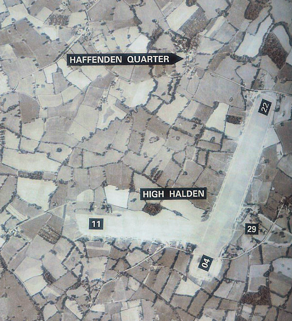
RAF High Halden

Royal Air Force High Halden or more simply RAF High Halden is a former Royal Air Force Advanced Landing Ground in Kent, England. The airfield is located...

St Michaels, Kent

St Michaels is a village in the civil parish of Tenterden, in the Ashford district, in the county of Kent, England. Before 1863 it was known as Boar's...

Tenterden St Michael's railway station

Tenterden St. Michael's was a railway station on the Kent and East Sussex Railway which served the Tenterden suburb of St Michaels in Kent, England. The...

Nearby Amenities

Located within 500m of 51.108879,0.66956154
Barrier: stile
Foot: yes
Source: survey
Lat/Long: 51.1046204/0.668084
Barrier: stile
Foot: yes
Source: survey
Lat/Long: 51.1073756/0.664596
The data included in this document is from www.openstreetmap.org. The data is made available under ODbL.

Have you been to Hook Wood?

Leave your review of Hook Wood below (or comments, questions and feedback).