Larch Plantation

Wood, Forest in Norfolk Breckland

England

Larch Plantation

OS Cut Mark: South Pickenham, All Saints Church Nice clear cut mark on this handsome church.
OS Cut Mark: South Pickenham, All Saints Church Credit: David Bremner

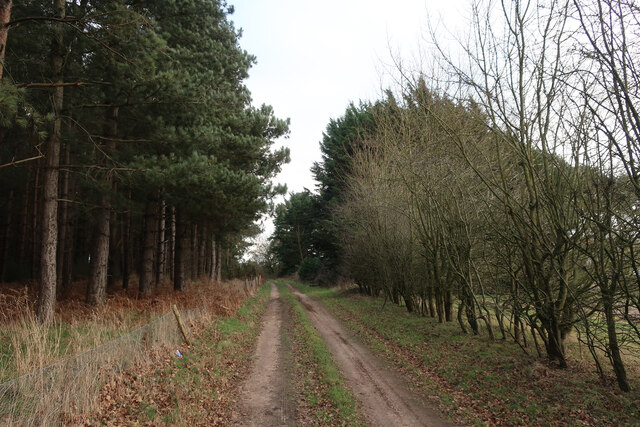
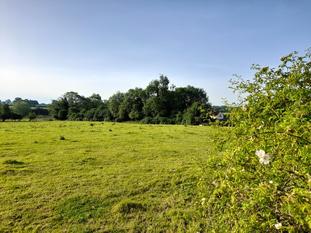
Larch Plantation, located in Norfolk, England, is a sprawling woodland area known for its dense growth of larch trees. Covering an approximate area of several hectares, the plantation is a significant contributor to the region's forestry industry. Larch trees dominate the landscape, with their distinctive needle-like leaves and tall, straight trunks.

The plantation's larch trees are known for their rapid growth and ability to adapt to various soil conditions, making them a popular choice for commercial timber production. The trees typically reach heights of up to 30 meters, creating a striking visual impact within the plantation. The forest floor is covered in a thick layer of fallen needles, providing a soft carpet underfoot.

The management of Larch Plantation follows sustainable forestry practices, ensuring that the trees are harvested and replanted in a cycle that maintains the health and productivity of the woodland. This approach not only guarantees a renewable source of timber but also supports the local ecosystem by providing habitats for various species of birds, insects, and small mammals.

The plantation is accessible to the public, with designated walking trails that wind through the woodland, allowing visitors to immerse themselves in the natural beauty of the area. These paths provide an opportunity to observe the diverse flora and fauna that thrive within the plantation.

Larch Plantation, Norfolk, is a testament to the importance of sustainable forestry management and serves both as an economic resource and a haven for nature enthusiasts seeking a tranquil escape into the heart of a vibrant woodland ecosystem.

If you have any feedback on the listing, please let us know in the comments section below.

Larch Plantation Images

Images are sourced within 2km of 52.599362/0.72991216 or Grid Reference TF8403. Thanks to Geograph Open Source API. All images are credited.

OS Cut Mark: South Pickenham, All Saints Church Nice clear cut mark on this handsome church.
OS Cut Mark: South Pickenham, All Saints Church
Nice clear cut mark on this handsome church.
Footpath by tree belt
Track past Cockleycley Clumps
Path from Cockleycley Clumps
Arable field
Arable field
Tree belt by the path
A Field in Norfolk Near Lower Farm.
A Field in Norfolk
Near Lower Farm.
A Glimpse of Norfolk Taken from a spot very near to the Peddars Way.
A Glimpse of Norfolk
Taken from a spot very near to the Peddars Way.
A Glimpse of Norfolk Agricultural land is glimpsed through a roadside hedge.
A Glimpse of Norfolk
Agricultural land is glimpsed through a roadside hedge.
Post Box at Great Cressingham IP25 3211. Royal Mail list this box as 'IP25 Priory Drove Watton'.
Post Box at Great Cressingham
IP25 3211. Royal Mail list this box as 'IP25 Priory Drove Watton'.
O.S Benchmark Recorded on the Benchmark Database as 'Great Cressingham, Olde Windmill Inn'.
O.S Benchmark
Recorded on the Benchmark Database as 'Great Cressingham, Olde Windmill Inn'.
Great Cressingham, St Michael
St Michael's church, Great Cressingham
St. Michael's church, Great Cressingham Dominating the centre of the village, this impressive church is mainly 15th c. with a 13th c. chancel with its weatherworn pinnacles. A blocked low side window can be seen adjacent to the priest’s door. Above the porch door is a niche with a rather battered St Michael, and inside is a broken stoup. The octagonal font is dull but has a Jacobean cover; the roof alternates with arch-braced tie-beam and hammer-beams with  recumbent  angels on the hammers. The pulpit, although of Victorian stone is well carved and not too out of place. The rood loft stairs  were once accessible from the chancel before nave was restructured.  Good glass in the north nave windows and a fine early chest stands at the west end. Set into the nave floor are five early brasses some of which have been ravaged over the years.
St. Michael's church, Great Cressingham
Dominating the centre of the village, this impressive church is mainly 15th c. with a 13th c. chancel with its weatherworn pinnacles. A blocked low side window can be seen adjacent to the priest’s door. Above the porch door is a niche with a rather battered St Michael, and inside is a broken stoup. The octagonal font is dull but has a Jacobean cover; the roof alternates with arch-braced tie-beam and hammer-beams with recumbent angels on the hammers. The pulpit, although of Victorian stone is well carved and not too out of place. The rood loft stairs were once accessible from the chancel before nave was restructured. Good glass in the north nave windows and a fine early chest stands at the west end. Set into the nave floor are five early brasses some of which have been ravaged over the years.
All Saints church, South Pickenham The round base of the tower is Norman, the octagonal upper stage is probably 15th c. The church itself was built in the Early English period but later alterations have been made particularly the good 14th c. east window which has an unusual ogee arch, and below is a small trefoil-headed image niche. In the nave the roof structure is also somewhat unusual, it replaces the old roof after a violent storm destroyed it in the early 17th c. The upper part of the nave wall was replaced at the same time. The font is 14th c. has a traceried octagonal bowl with a coved corona. On the north wall one can just make out a painting of St Christopher. The 17th c. pulpit was presented to the church in 1973 and came from a private chapel in the west country. In the chancel is an angle piscina and dropped-sill sedilia.
All Saints church, South Pickenham
The round base of the tower is Norman, the octagonal upper stage is probably 15th c. The church itself was built in the Early English period but later alterations have been made particularly the good 14th c. east window which has an unusual ogee arch, and below is a small trefoil-headed image niche. In the nave the roof structure is also somewhat unusual, it replaces the old roof after a violent storm destroyed it in the early 17th c. The upper part of the nave wall was replaced at the same time. The font is 14th c. has a traceried octagonal bowl with a coved corona. On the north wall one can just make out a painting of St Christopher. The 17th c. pulpit was presented to the church in 1973 and came from a private chapel in the west country. In the chancel is an angle piscina and dropped-sill sedilia.
Fields of plastic Air pollution from the continent is obscuring the landscape.
Fields of plastic
Air pollution from the continent is obscuring the landscape.
Road to South Pickenham
South Pickenham information sign
Show me another place!

Larch Plantation is located at Grid Ref: TF8403 (Lat: 52.599362, Lng: 0.72991216)

Administrative County: Norfolk

District: Breckland

Police Authority: Norfolk

What 3 Words

///thanks.included.chucked. Near Ashill, Norfolk

Related Wikis

South Pickenham

South Pickenham is a small village and civil parish in the Breckland district of mid Norfolk, East Anglia, England. It has an area of 758 hectares (2.93...

Great Cressingham Fen

Great Cressingham Fen is a 14.3-hectare (35-acre) biological Site of Special Scientific Interest near Great Cressingham in Norfolk. It is part of the Norfolk...

Houghton on the Hill, Norfolk

Houghton on the Hill is a deserted medieval village and former civil parish, now in the parish of North Pickenham in the Breckland district of Norfolk...

Hooks Well Meadows, Great Cressingham

Hooks Well Meadows, Great Cressingham is a 15.6-hectare (39-acre) biological Site of Special Scientific Interest near Great Cressingham] in Norfolk.This...

Nearby Amenities

Located within 500m of 52.599362,0.72991216
The data included in this document is from www.openstreetmap.org. The data is made available under ODbL.

Have you been to Larch Plantation?

Leave your review of Larch Plantation below (or comments, questions and feedback).