Fleetlands

Settlement in Hampshire Gosport

England

Fleetlands

On Hartlands Road, Fareham – 1969 The location as seen has disappeared with the creation of Western Way and its split-level junction with Gosport Road. The coach is roughly underneath the footbridge in this view <a title="https://www.geograph.org.uk/photo/2385672" href="https://www.geograph.org.uk/photo/2385672">Link</a> .

It belonged to Red & White of Chepstow, one of the nationalised companies under the British Transport Commission, and is probably working from Cardiff to Portsmouth. It is a Bristol RE with ECW coachwork, new in 1968.

This is one of a series of views featuring buses in the 60s, 70s, and 80s. <a title="https://www.geograph.org.uk/search.php?i=137652761" href="https://www.geograph.org.uk/search.php?i=137652761">Link</a>
On Hartlands Road, Fareham – 1969 Credit: Alan Murray-Rust

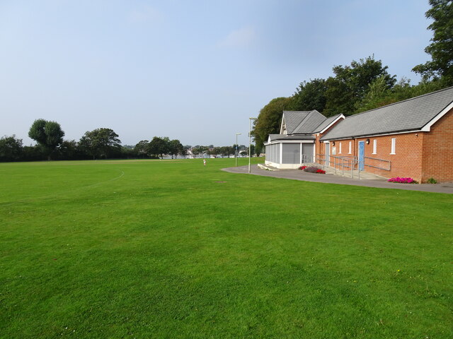
Fleetlands is a small village located in the county of Hampshire, England. Situated approximately 4 miles northwest of Fareham, it is part of the borough of Gosport. The village is surrounded by scenic countryside and benefits from its proximity to the River Meon, which flows nearby.

Historically, Fleetlands was primarily an agricultural community, with farming being the main occupation of its residents. However, with the development of the naval aviation industry in the early 20th century, the village underwent significant changes. Today, Fleetlands is best known for its association with the aviation industry, as it is home to the Fleetlands Aircraft Support Unit (FASU).

FASU is a maintenance facility for helicopters, particularly those used by the Royal Navy and the British Army. The site provides essential support services, including repairs, overhauls, and modifications to ensure the airworthiness of the aircraft. It also serves as a training center for engineers and technicians working in the aviation industry.

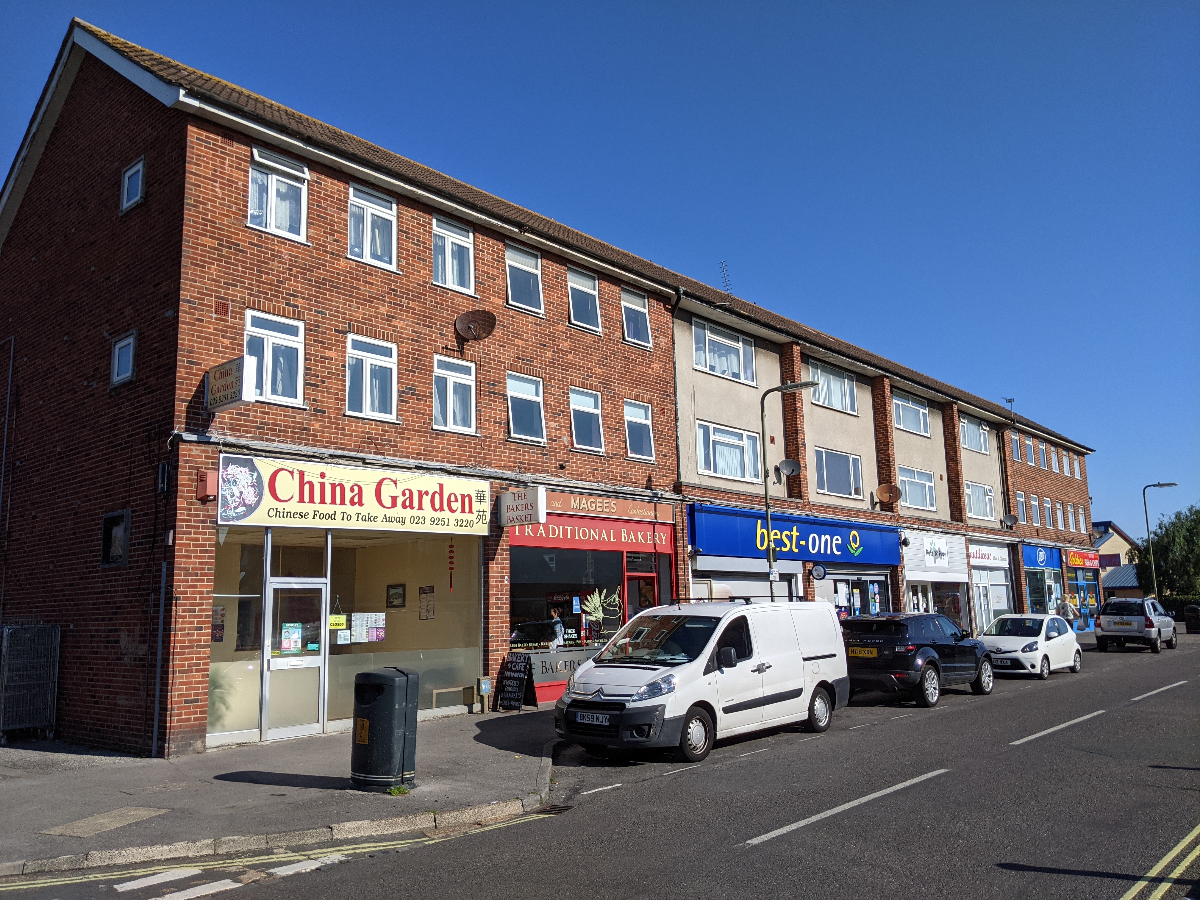
Despite its industrial importance, Fleetlands has managed to retain its rural charm. The village features a mix of traditional and modern housing, along with a few local amenities such as a post office and a small convenience store. The nearby River Meon offers opportunities for outdoor activities, including fishing and boating.

In conclusion, Fleetlands is a picturesque village in Hampshire, renowned for its association with the aviation industry and the presence of the Fleetlands Aircraft Support Unit. With its scenic surroundings and rural charm, it offers a unique blend of industrial and natural beauty.

If you have any feedback on the listing, please let us know in the comments section below.
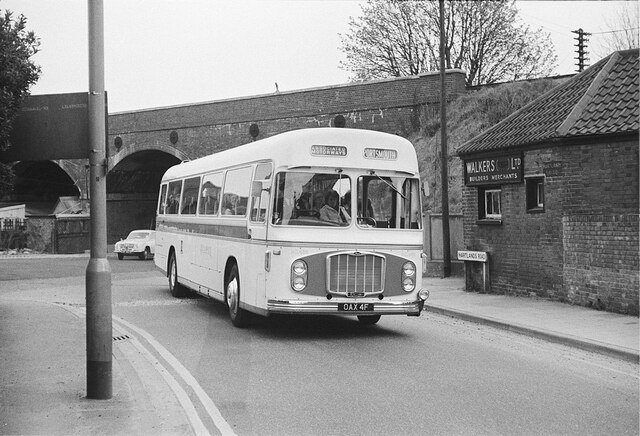
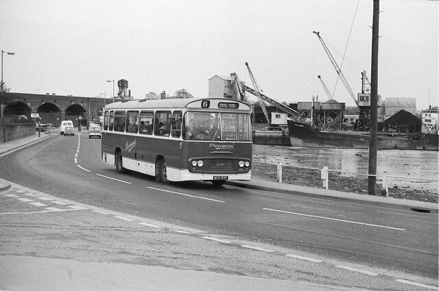
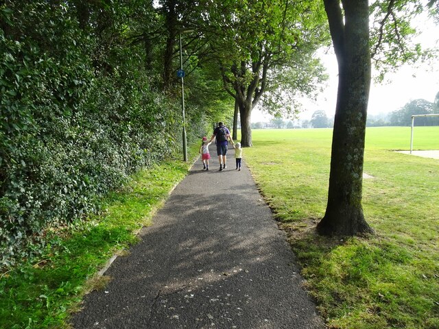
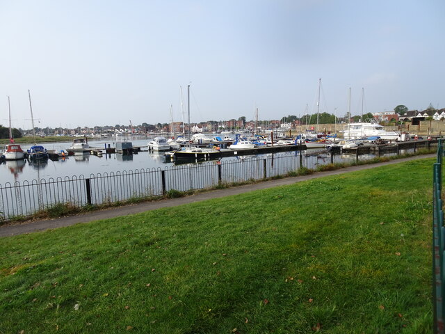
Fleetlands Images

Images are sourced within 2km of 50.833936/-1.172475 or Grid Reference SU5804. Thanks to Geograph Open Source API. All images are credited.

On Hartlands Road, Fareham – 1969 The location as seen has disappeared with the creation of Western Way and its split-level junction with Gosport Road. The coach is roughly underneath the footbridge in this view <a title="https://www.geograph.org.uk/photo/2385672" href="https://www.geograph.org.uk/photo/2385672">Link</a> .

It belonged to Red & White of Chepstow, one of the nationalised companies under the British Transport Commission, and is probably working from Cardiff to Portsmouth. It is a Bristol RE with ECW coachwork, new in 1968.

This is one of a series of views featuring buses in the 60s, 70s, and 80s. <a title="https://www.geograph.org.uk/search.php?i=137652761" href="https://www.geograph.org.uk/search.php?i=137652761">Link</a>
On Hartlands Road, Fareham – 1969
The location as seen has disappeared with the creation of Western Way and its split-level junction with Gosport Road. The coach is roughly underneath the footbridge in this view Link . It belonged to Red & White of Chepstow, one of the nationalised companies under the British Transport Commission, and is probably working from Cardiff to Portsmouth. It is a Bristol RE with ECW coachwork, new in 1968. This is one of a series of views featuring buses in the 60s, 70s, and 80s. Link
Gosport Road at Gosport Quay - 1969 The location has seen significant change. The road itself has become a promenade following the construction of the new dual carriageway a bit to the west.

The vessel at the quay has an interesting history. It is the MV 'Mark Bowen', belonging to the firm T. Bowen & P. Caines. It started life in 1943 as a Royal Fleet Auxiliary vessel NAV Chattenden, carrying naval armaments, remaining in naval service until 1967 when it was sold. Bowen & Caines bought the vessel in 1969 and it was converted into an aggregates suction dredger, the form in which it is seen here.

The bus is Gosport & Fareham 38, a Seddon Pennine 4 with locally-built Strachans bodywork, new in 1968. It was one of the last vehicles to be bought before the company was bought by the National Bus Company, and represents the company's tradition of buying lightweight or second-hand vehicles.

This is one of a series of views featuring buses in the 60s, 70s, and 80s. <a title="https://www.geograph.org.uk/search.php?i=137652761" href="https://www.geograph.org.uk/search.php?i=137652761">Link</a>
Gosport Road at Gosport Quay - 1969
The location has seen significant change. The road itself has become a promenade following the construction of the new dual carriageway a bit to the west. The vessel at the quay has an interesting history. It is the MV 'Mark Bowen', belonging to the firm T. Bowen & P. Caines. It started life in 1943 as a Royal Fleet Auxiliary vessel NAV Chattenden, carrying naval armaments, remaining in naval service until 1967 when it was sold. Bowen & Caines bought the vessel in 1969 and it was converted into an aggregates suction dredger, the form in which it is seen here. The bus is Gosport & Fareham 38, a Seddon Pennine 4 with locally-built Strachans bodywork, new in 1968. It was one of the last vehicles to be bought before the company was bought by the National Bus Company, and represents the company's tradition of buying lightweight or second-hand vehicles. This is one of a series of views featuring buses in the 60s, 70s, and 80s. Link
Park Path The view in Bath Lane Recreation Ground, Fareham.
Park Path
The view in Bath Lane Recreation Ground, Fareham.
Fareham Boats The view from Bath Lane Recreation Ground.
Fareham Boats
The view from Bath Lane Recreation Ground.
Fareham Park The view of Bath Lane Recreation Ground.
Fareham Park
The view of Bath Lane Recreation Ground.
Houses on Rowner Road
Rowner Road (B3334)
Rowner Road (B3334)
B3385 towards Fareham
Houses on Longfield Avenue
Longfield Avenue
Longfield Avenue
Entrance to HMS Collingwood
Bus stop on Longfield Avenue
Houses on Jubilee Court
Jubilee Court
Jubilee Court
Houses on St Michael's Grove
St Michael's Grove
St Michael's Grove
Elizabeth II postbox on Trafalgar Court Postbox No. PO14 146.
Elizabeth II postbox on Trafalgar Court
Postbox No. PO14 146.
Houses on Trafalgar Court Showing position of Postbox No. PO14 146.
Houses on Trafalgar Court
Showing position of Postbox No. PO14 146.
Show me another place!

Fleetlands is located at Grid Ref: SU5804 (Lat: 50.833936, Lng: -1.172475)

Administrative County: Hampshire

District: Gosport

Police Authority: Hampshire

What 3 Words

///rehearsed.defends.buddy. Near Fareham, Hampshire

Nearby Locations

Fleetlands Hoeford Lake

Related Wikis

Fleetlands F.C.

Fleetlands Football Club is a football club based in Gosport, Hampshire, England. They are members of the Wessex League Division One. The club is affiliated...

Fleetlands Heliport

Fleetlands is a heliport operated by Standard Aero located within Gosport, Hampshire, England. == History == In 1940 a Royal Naval Air Yard, RNAY Fleetlands...

Bridgemary School

Bridgemary School is an 11-16 secondary school with academy status in Gosport, Hampshire, England. Bridgemary School takes part of its cohort from the...

Fort Fareham

Fort Fareham is one of the Palmerston Forts, in Fareham, England. After the Gosport Advanced Line of Fort Brockhurst, Fort Elson, Fort Rowner, Fort Grange...

Rowner

Rowner is a small settlement which forms part of the borough of Gosport, on the south coast of Hampshire, England. == History == As Roman burial shrouds...

HMS Collingwood (shore establishment)

HMS Collingwood is a stone frigate (shore establishment) of the Royal Navy, in Fareham, England. It is the lead establishment of the Maritime Warfare School...

Bridgemary

Bridgemary is a ward in Gosport, Hampshire, England. It is situated to the north of Gosport on the A32 towards Fareham. Every year there is a carnival...

Cams Hall

Cams Hall at Fareham, Hampshire, United Kingdom, is a Palladian mansion set in parkland overlooking Portsmouth Harbour. The land at Cams Hall was mentioned...

Nearby Amenities

Located within 500m of 50.833936,-1.172475
Traffic Signals
Traffic Signals Direction: backward
Lat/Long: 50.833153/-1.1729775
Crossing
Crossing: traffic_signals
Crossing Island: yes
Crossing Markings: dots
Crossing Ref: puffin
Kerb: flush
Tactile Paving: yes
Lat/Long: 50.835422/-1.1776755
Traffic Signals
Traffic Signals Direction: forward
Lat/Long: 50.833363/-1.1733515
Source: PGS
Lat/Long: 50.8351209/-1.1658075
Source: PGS
Lat/Long: 50.8375213/-1.1692641
Source: PGS
Lat/Long: 50.8375193/-1.1697507
Traffic Signals
Lat/Long: 50.8348296/-1.1765171
Traffic Signals
Traffic Signals Direction: forward
Lat/Long: 50.8346879/-1.1767171
Bus Stop
Wych Lane
Bus: yes
Naptan AtcoCode: 1900HA050001
Naptan Bearing: NW
Naptan CommonName: Wych Lane
Naptan Crossing: Wych Lane
Naptan NaptanCode: hamdtgwg
Naptan PlusbusZoneRef: FAREHAM
Naptan Street: Fareham Road
Naptan Verified: no
Public Transport: platform
Source: naptan_import
Lat/Long: 50.8350674/-1.1771851
Bus Stop
Wych Lane
Bus: yes
Naptan AtcoCode: 1900HA050002
Naptan Bearing: SE
Naptan CommonName: Wych Lane
Naptan Crossing: Wych Lane
Naptan NaptanCode: hamdtjdm
Naptan PlusbusZoneRef: FAREHAM
Naptan Street: Fareham Road
Naptan Verified: no
Public Transport: platform
Source: naptan_import
Lat/Long: 50.8345616/-1.1758953
Bus Stop
Cyanamid
Bus: yes
Naptan AtcoCode: 1900HA050003
Naptan Bearing: SE
Naptan CommonName: Cyanamid
Naptan Crossing: Lederle Lane
Naptan NaptanCode: hamdtjwp
Naptan PlusbusZoneRef: FAREHAM
Naptan Street: Fareham Road
Naptan Verified: no
Public Transport: platform
Source: naptan_import
Lat/Long: 50.8336545/-1.1739505
Bus Stop
Cyanamid
Bus: yes
Naptan AtcoCode: 1900HA050004
Naptan Bearing: NW
Naptan CommonName: Cyanamid
Naptan Crossing: Bridgemary Way
Naptan NaptanCode: hamdtmdm
Naptan PlusbusZoneRef: FAREHAM
Naptan Street: Fareham Road
Naptan Verified: no
Public Transport: platform
Source: naptan_import
Lat/Long: 50.8328954/-1.1727835
Bus Stop
Fleetlands
Bus: yes
Naptan AtcoCode: 1900HA050005
Naptan Bearing: NW
Naptan CommonName: Fleetlands
Naptan Landmark: Opp Dara Fleetlands
Naptan NaptanCode: hamdtmtp
Naptan PlusbusZoneRef: FAREHAM
Naptan Street: Fareham Road
Naptan Verified: no
Public Transport: platform
Source: naptan_import
Lat/Long: 50.8311549/-1.1708031
Bus Stop
Fleetlands
Bus: yes
Naptan AtcoCode: 1900HA050006
Naptan Bearing: SE
Naptan CommonName: Fleetlands
Naptan Crossing: Foxbury Lane
Naptan NaptanCode: hamdtpaj
Naptan PlusbusZoneRef: FAREHAM
Naptan Street: Fareham Road
Naptan Verified: no
Public Transport: platform
Source: naptan_import
Lat/Long: 50.8308527/-1.1700416
Bus Stop
Meadow Walk
Bus: yes
Naptan AtcoCode: 1900HA050042
Naptan Bearing: E
Naptan CommonName: Meadow Walk
Naptan Crossing: Wych Lane
Naptan NaptanCode: hamdtgdp
Naptan PlusbusZoneRef: FAREHAM
Naptan Street: Tukes Avenue
Naptan Verified: no
Public Transport: platform
Source: naptan_import
Lat/Long: 50.8325415/-1.1791495
Bus Stop
Wych Lane Arch
Bus: yes
Naptan AtcoCode: 1900HA050043
Naptan Bearing: SW
Naptan CommonName: Wych Lane Arch
Naptan Crossing: Fareham Road
Naptan NaptanCode: hamdtjag
Naptan PlusbusZoneRef: FAREHAM
Naptan Street: Wych Lane
Naptan Verified: no
Public Transport: platform
Source: naptan_import
Lat/Long: 50.8343116/-1.1771802
Crossing
Crossing: traffic_signals
Crossing Markings: dots
Crossing Ref: puffin
Kerb: lowered
Tactile Paving: yes
Lat/Long: 50.8310724/-1.1705334
Post Box
Collection Plate: CP7D
Collection Times: Mo-Fr 09:00; Sa 07:00
Operator: Royal Mail
Post Box Type: lamp
Ref: PO13 77D
Royal Cypher: EIIR
Royal Cypher Wikidata: Q33102113
Lat/Long: 50.8312889/-1.1710298
Traffic Signals
Lat/Long: 50.8338927/-1.1778556
TeamSport Go Karting
Addr Postcode: PO13 0FW
Addr Street: Fareham Reach
Addr Town: Gospoirt
Tourism: yes
Website: https://www.team-sport.co.uk/gosport/
Lat/Long: 50.8369275/-1.1751158
Bus Stop
Bus: yes
Naptan AtcoCode: 1900HAA91146
Naptan NaptanCode: hamjpgtj
Public Transport: platform
Lat/Long: 50.8344197/-1.1783568
Bus Stop
Bus: yes
Public Transport: platform
Lat/Long: 50.8342441/-1.1780476
Crossing
Crossing: uncontrolled
Tactile Paving: yes
Lat/Long: 50.8308117/-1.1753863
Barrier: cycle_barrier
Lat/Long: 50.8315547/-1.176239
Barrier: cycle_barrier
Lat/Long: 50.8318737/-1.1781168
Bicycle Parking
Bicycle Parking: stands
Capacity: 8
Covered: yes
Lat/Long: 50.8340501/-1.1777982
Post Box
Brand: Royal Mail
Brand Wikidata: Q638098
Check Date Collection Times: 2022-04-15
Collection Plate: CP1D
Collection Times: Mo-Fr 09:00; Sa 07:00
Operator: Royal Mail
Operator Wikidata: Q638098
Post Box Type: pillar
Ref: PO13 91D
Royal Cypher: GVIR
Royal Cypher Wikidata: Q33102169
Lat/Long: 50.8343614/-1.175845
Car Wash
Hand Car Wash & Valeting Centre
Addr City: Gosport
Addr Street: Fareham Road
Opening Hours: Mo-Su 08:00-19:00
Lat/Long: 50.8347417/-1.1756573
Source: PGS
Lat/Long: 50.8349032/-1.1661763
Crossing
Crossing: uncontrolled
Crossing Markings: dots
Tactile Paving: no
Lat/Long: 50.8333904/-1.1728878
Traffic Signals
Traffic Signals Direction: forward
Lat/Long: 50.8333195/-1.1729757
Crossing
Bicycle: yes
Crossing: uncontrolled
Lat/Long: 50.8339843/-1.1779291
Crossing
Bicycle: dismount
Crossing: uncontrolled
Crossing Markings: dots
Kerb: lowered
Tactile Paving: no
Lat/Long: 50.8347184/-1.176673
Turning Circle
Lat/Long: 50.8302867/-1.1757807
Barrier: bollard
Foot: yes
Motor Vehicle: no
Lat/Long: 50.830773/-1.1737264
Barrier: bollard
Foot: yes
Motor Vehicle: no
Lat/Long: 50.8304616/-1.172519
Barrier: bollard
Foot: yes
Motor Vehicle: no
Lat/Long: 50.8299202/-1.1729117
Barrier: bollard
Foot: yes
Motor Vehicle: no
Lat/Long: 50.8306173/-1.1741469
Barrier: bollard
Foot: yes
Motor Vehicle: no
Lat/Long: 50.8312498/-1.1749731
Generator Method: photovoltaic
Generator Output Electricity: yes
Generator Source: solar
Generator Type: solar_photovoltaic_panel
Power: generator
Lat/Long: 50.8312497/-1.1732969
Generator Method: photovoltaic
Generator Output Electricity: yes
Generator Source: solar
Generator Type: solar_photovoltaic_panel
Power: generator
Lat/Long: 50.8311377/-1.1747097
Generator Method: photovoltaic
Generator Output Electricity: yes
Generator Source: solar
Generator Type: solar_photovoltaic_panel
Power: generator
Lat/Long: 50.8310785/-1.1746614
Generator Method: photovoltaic
Generator Output Electricity: yes
Generator Source: solar
Generator Type: solar_photovoltaic_panel
Power: generator
Lat/Long: 50.8307322/-1.1732936
Generator Method: photovoltaic
Generator Output Electricity: yes
Generator Source: solar
Generator Type: solar_photovoltaic_panel
Power: generator
Lat/Long: 50.8303502/-1.1747147
Generator Method: photovoltaic
Generator Output Electricity: yes
Generator Source: solar
Generator Type: solar_photovoltaic_panel
Power: generator
Lat/Long: 50.830752/-1.1750311
Generator Method: photovoltaic
Generator Output Electricity: yes
Generator Source: solar
Generator Type: solar_photovoltaic_panel
Power: generator
Lat/Long: 50.8318511/-1.1745428
Generator Method: photovoltaic
Generator Output Electricity: yes
Generator Source: solar
Generator Type: solar_photovoltaic_panel
Power: generator
Lat/Long: 50.8296124/-1.1720885
Generator Method: photovoltaic
Generator Output Electricity: yes
Generator Source: solar
Generator Type: solar_photovoltaic_panel
Power: generator
Lat/Long: 50.8301974/-1.1712745
Generator Method: photovoltaic
Generator Output Electricity: yes
Generator Source: solar
Generator Type: solar_photovoltaic_panel
Power: generator
Lat/Long: 50.8301763/-1.1711834
Generator Method: photovoltaic
Generator Output Electricity: yes
Generator Source: solar
Generator Type: solar_photovoltaic_panel
Power: generator
Lat/Long: 50.8301552/-1.1712442
Generator Method: photovoltaic
Generator Output Electricity: yes
Generator Source: solar
Generator Type: solar_photovoltaic_panel
Power: generator
Lat/Long: 50.8319047/-1.173276
Generator Method: photovoltaic
Generator Output Electricity: yes
Generator Source: solar
Generator Type: solar_photovoltaic_panel
Power: generator
Lat/Long: 50.8318141/-1.1758223
Generator Method: photovoltaic
Generator Output Electricity: yes
Generator Source: solar
Generator Type: solar_photovoltaic_panel
Power: generator
Lat/Long: 50.832251/-1.1757198
Generator Method: photovoltaic
Generator Output Electricity: yes
Generator Source: solar
Generator Type: solar_photovoltaic_panel
Power: generator
Lat/Long: 50.8322649/-1.1756569
Generator Method: photovoltaic
Generator Output Electricity: yes
Generator Source: solar
Generator Type: solar_photovoltaic_panel
Power: generator
Lat/Long: 50.8328668/-1.1766496
Crossing
Crossing: uncontrolled
Crossing Ref: zebra
Lat/Long: 50.8339181/-1.1729825
Crossing
Crossing: uncontrolled
Crossing Ref: zebra
Lat/Long: 50.8338437/-1.1730488
Crossing
Crossing: uncontrolled
Crossing Ref: zebra
Lat/Long: 50.8337824/-1.1731701
Crossing
Crossing: uncontrolled
Crossing Ref: zebra
Lat/Long: 50.8338002/-1.1736327
Crossing
Crossing: uncontrolled
Crossing Ref: zebra
Lat/Long: 50.8335833/-1.1731955
Power: substation
Lat/Long: 50.8319562/-1.1743368
Generator Source: solar
Power: generator
Lat/Long: 50.8336782/-1.1750664
Generator Source: solar
Power: generator
Lat/Long: 50.8335799/-1.174888
Generator Method: photovoltaic
Generator Output Electricity: yes
Generator Source: solar
Generator Type: solar_photovoltaic_panel
Location: roof
Power: generator
Lat/Long: 50.8353146/-1.1783655
Generator Method: photovoltaic
Generator Output Electricity: yes
Generator Source: solar
Generator Type: solar_photovoltaic_panel
Location: roof
Power: generator
Lat/Long: 50.8351045/-1.177876
Generator Method: photovoltaic
Generator Output Electricity: yes
Generator Source: solar
Generator Type: solar_photovoltaic_panel
Location: roof
Power: generator
Lat/Long: 50.8345006/-1.1766382
Generator Method: photovoltaic
Generator Output Electricity: yes
Generator Source: solar
Generator Type: solar_photovoltaic_panel
Location: roof
Power: generator
Lat/Long: 50.8351774/-1.1779752
Briar Glen Bed & Breakfast
Addr City: Gosport
Addr Country: GB
Addr Housenumber: 110
Addr Postcode: PO13 0AQ
Addr Street: Fareham Road
Fhrs Id: 627261
Guest House: bed_and_breakfast
Tourism: guest_house
Lat/Long: 50.8317563/-1.1710551
Fleetlands
Place: suburb
Lat/Long: 50.8355562/-1.1698518
Traffic Signals
Traffic Signals Direction: backward
Lat/Long: 50.8347687/-1.1764048
Crossing
Crossing: uncontrolled
Crossing Markings: dots
Kerb: lowered
Tactile Paving: no
Lat/Long: 50.8347885/-1.1764416
Traffic Signals
Traffic Signals Direction: forward
Lat/Long: 50.8349766/-1.1767964
Crossing
Crossing: traffic_signals
Crossing Markings: dots
Kerb: lowered
Tactile Paving: yes
Lat/Long: 50.8333434/-1.173315
The data included in this document is from www.openstreetmap.org. The data is made available under ODbL.

Have you been to Fleetlands?

Leave your review of Fleetlands below (or comments, questions and feedback).