Fleet Hargate

Settlement in Lincolnshire South Holland

England

Fleet Hargate

Gedney railway station (site), Lincolnshire Opened in 1862 by the Norwich & Spalding Railway on what became part of the Midland & Great Northern Joint Railway line from Leicester to Yarmouth, this station closed to passengers in 1959 and completely in 1965.
View east across the former level crossing towards Long Sutton and ultimately Yarmouth. There used to be two parallel platforms here. For many years, the station was derelict (for example, see <a href="https://www.geograph.org.uk/photo/28557">TF4123 : Gedney Station</a>) but was undergoing renovation when this image was taken.
Gedney railway station (site), Lincolnshire Credit: Nigel Thompson

The requested URL returned error: 429 Too Many Requests

If you have any feedback on the listing, please let us know in the comments section below.

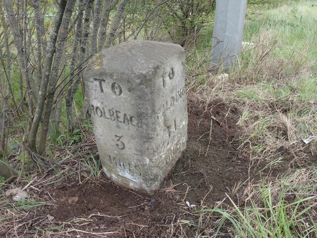
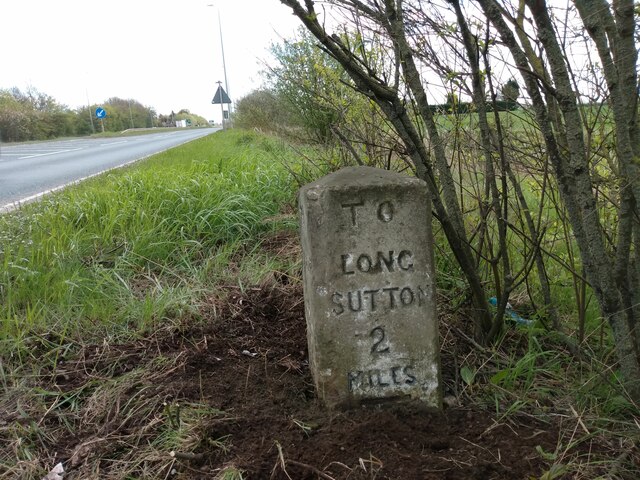
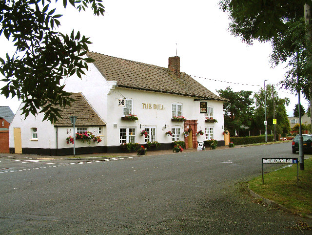
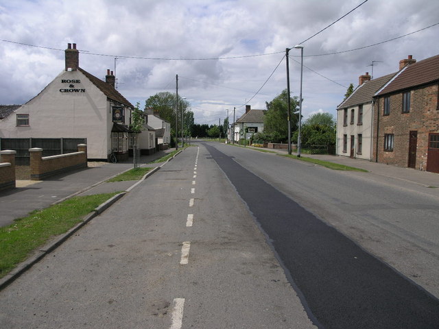
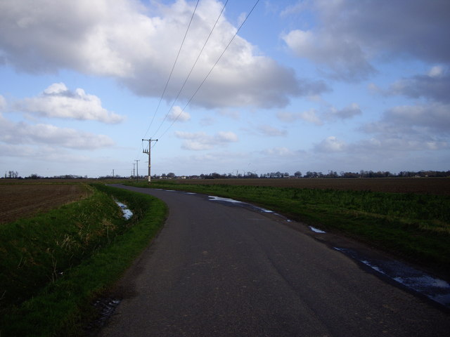
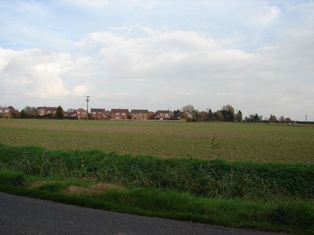
Fleet Hargate Images

Images are sourced within 2km of 52.802336/0.067879 or Grid Reference TF3924. Thanks to Geograph Open Source API. All images are credited.

Gedney railway station (site), Lincolnshire Opened in 1862 by the Norwich & Spalding Railway on what became part of the Midland & Great Northern Joint Railway line from Leicester to Yarmouth, this station closed to passengers in 1959 and completely in 1965.
View east across the former level crossing towards Long Sutton and ultimately Yarmouth. There used to be two parallel platforms here. For many years, the station was derelict (for example, see <a href="https://www.geograph.org.uk/photo/28557">TF4123 : Gedney Station</a>) but was undergoing renovation when this image was taken.
Gedney railway station (site), Lincolnshire
Opened in 1862 by the Norwich & Spalding Railway on what became part of the Midland & Great Northern Joint Railway line from Leicester to Yarmouth, this station closed to passengers in 1959 and completely in 1965. View east across the former level crossing towards Long Sutton and ultimately Yarmouth. There used to be two parallel platforms here. For many years, the station was derelict (for example, see TF4123 : Gedney Station) but was undergoing renovation when this image was taken.
Gedney Station in 1998 View from Station Road of the east bound platform station buildings
Gedney Station in 1998
View from Station Road of the east bound platform station buildings
Gedney Station in 1998 The west bound railway platform & sign from Station Road
Gedney Station in 1998
The west bound railway platform & sign from Station Road
View over the fields to Gedney St Mary Magdalene Church on the horizon
View over the fields to Gedney
St Mary Magdalene Church on the horizon
Old Milestone by A17, Long Sutton Road, beyond end of dual carriageway The Milestone is located on the verge on the South of the road.  Parish of Gedney (South Holland District). Carved stone post, erected by the Holbeach turnpike trust in the 19th Century. An earlier photograph can be found here: <a title="https://www.geograph.org.uk/photo/2730276" href="https://www.geograph.org.uk/photo/2730276">Link</a> 

Inscription reads:-  
TO / SPALDING / 11 / : : TO / HOLBEACH / 3  : : TO / LONG / SUTTON / 2 / MILES 

Grade II listed. List Entry Number: 1064581 <span class="nowrap"><a title="https://historicengland.org.uk/listing/the-list/list-entry/1064581" rel="nofollow ugc noopener" href="https://historicengland.org.uk/listing/the-list/list-entry/1064581">Link</a><img style="margin-left:2px;" alt="External link" title="External link - shift click to open in new window" src="https://s1.geograph.org.uk/img/external.png" width="10" height="10"/></span> 

Milestone Society National ID: LI_HBSU03
Old Milestone by A17, Long Sutton Road, beyond end of dual carriageway
The Milestone is located on the verge on the South of the road.  Parish of Gedney (South Holland District). Carved stone post, erected by the Holbeach turnpike trust in the 19th Century. An earlier photograph can be found here: Link  Inscription reads:- TO / SPALDING / 11 / : : TO / HOLBEACH / 3 : : TO / LONG / SUTTON / 2 / MILES Grade II listed. List Entry Number: 1064581 LinkExternal link Milestone Society National ID: LI_HBSU03
Old Milestone by B1515, Fleet Road The Milestone is located on the verge on the South of the road.  Parish of Fleet (South Holland District). Carved stone post,  erected by the Holbeach turnpike trust in the 19th Century. An earlier photograph can be found here: <a title="https://www.geograph.org.uk/photo/6728737" href="https://www.geograph.org.uk/photo/6728737">Link</a> 

Inscription reads:-   
HOLBEACH / 1 / MILE / FLEET / 2 : : SUTTON / 4 / MILES / FLEET / 2

Grade II listed. List Entry Number: 1064519 <span class="nowrap"><a title="https://historicengland.org.uk/listing/the-list/list-entry/1064519" rel="nofollow ugc noopener" href="https://historicengland.org.uk/listing/the-list/list-entry/1064519">Link</a><img style="margin-left:2px;" alt="External link" title="External link - shift click to open in new window" src="https://s1.geograph.org.uk/img/external.png" width="10" height="10"/></span> 

Milestone Society National ID: LI_HBSU01
Old Milestone by B1515, Fleet Road
The Milestone is located on the verge on the South of the road.  Parish of Fleet (South Holland District). Carved stone post, erected by the Holbeach turnpike trust in the 19th Century. An earlier photograph can be found here: Link  Inscription reads:- HOLBEACH / 1 / MILE / FLEET / 2 : : SUTTON / 4 / MILES / FLEET / 2 Grade II listed. List Entry Number: 1064519 LinkExternal link Milestone Society National ID: LI_HBSU01
Old Milestone by B1515, Fleet Road The Milestone is located on the verge on the South of the road.  Parish of Fleet (South Holland District). Carved stone post,  erected by the Holbeach turnpike trust in the 19th Century. An earlier photograph can be found here: <a title="https://www.geograph.org.uk/photo/6728737" href="https://www.geograph.org.uk/photo/6728737">Link</a> 

Inscription reads:-   HOLBEACH / 1 / MILE / FLEET / 2 : : SUTTON / 4 / MILES / FLEET / 2 

Grade II listed. List Entry Number: 1064519 <span class="nowrap"><a title="https://historicengland.org.uk/listing/the-list/list-entry/1064519" rel="nofollow ugc noopener" href="https://historicengland.org.uk/listing/the-list/list-entry/1064519">Link</a><img style="margin-left:2px;" alt="External link" title="External link - shift click to open in new window" src="https://s1.geograph.org.uk/img/external.png" width="10" height="10"/></span> 

Milestone Society National ID: LI_HBSU01
Old Milestone by B1515, Fleet Road
The Milestone is located on the verge on the South of the road.  Parish of Fleet (South Holland District). Carved stone post, erected by the Holbeach turnpike trust in the 19th Century. An earlier photograph can be found here: Link  Inscription reads:- HOLBEACH / 1 / MILE / FLEET / 2 : : SUTTON / 4 / MILES / FLEET / 2 Grade II listed. List Entry Number: 1064519 LinkExternal link Milestone Society National ID: LI_HBSU01
The Bull at Fleet Hargate The village of Fleet Hargate formerly Fleet Harbourgate a small port
The Bull at Fleet Hargate
The village of Fleet Hargate formerly Fleet Harbourgate a small port
Fleet parish church The steeple is detached from the body of the church, a feature of several other churches in the area.
Fleet parish church
The steeple is detached from the body of the church, a feature of several other churches in the area.
Hurn Road Looking west
Hurn Road
Looking west
Fleet Road Industry As the sign clearly states this is Fleet Road Industrial Estate to the east of Holbeach.
Fleet Road Industry
As the sign clearly states this is Fleet Road Industrial Estate to the east of Holbeach.
Two Pubs The Bull and The Rose and Crown cluster together on the main street through Fleet Hargate.  The road repair doesn't quite match colour.
Two Pubs
The Bull and The Rose and Crown cluster together on the main street through Fleet Hargate. The road repair doesn't quite match colour.
Windbreaks and Potatoes The black windbreaks are clearly in place to protect the greenhouses next to them.  The field in the foreground was growing potatoes.
Windbreaks and Potatoes
The black windbreaks are clearly in place to protect the greenhouses next to them. The field in the foreground was growing potatoes.
Field and Cafe The cafe is beyond the busy A17.  The field is protected by this unusual one bar gate.
Field and Cafe
The cafe is beyond the busy A17. The field is protected by this unusual one bar gate.
The Road to Holbeach Hurn On my journey, this seemed to be the point of no return. Once leaving Holbeach towards the 'Wash area' The roads get no wider than this and the landscape littered with wind farms. If you look carefully, you can see some turbines in the distance to the mid right of this picture.
The Road to Holbeach Hurn
On my journey, this seemed to be the point of no return. Once leaving Holbeach towards the 'Wash area' The roads get no wider than this and the landscape littered with wind farms. If you look carefully, you can see some turbines in the distance to the mid right of this picture.
Haven Close from Hockle's Gate
Tractor Garden A collection of tractors old and new adorn the garden of this roadside house.
Tractor Garden
A collection of tractors old and new adorn the garden of this roadside house.
Show me another place!

Fleet Hargate is located at Grid Ref: TF3924 (Lat: 52.802336, Lng: 0.067879)

Division: Parts of Holland

Administrative County: Lincolnshire

District: South Holland

Police Authority: Lincolnshire

What 3 Words

///smiles.elevates.stood. Near Fleet, Lincolnshire

Nearby Locations

Fleet Hargate

Related Wikis

Fleet Hargate

Fleet Hargate is a village in the South Holland district of Lincolnshire, England. It is situated 2 miles (3.2 km) east from Holbeach, and just south from...

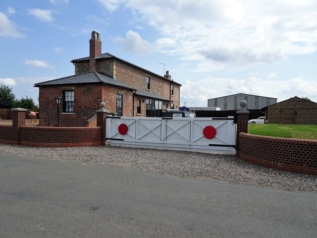
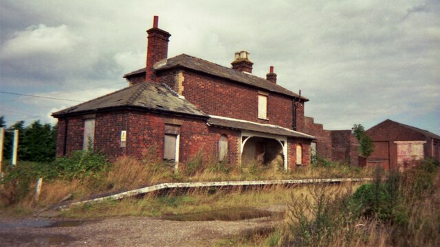
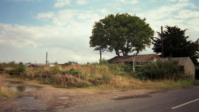
Fleet railway station (Lincolnshire)

Fleet railway station was a station in Fleet, Lincolnshire. It opened in 1862 and closed to passengers in 1959, with the goods yard closing on 3 February...

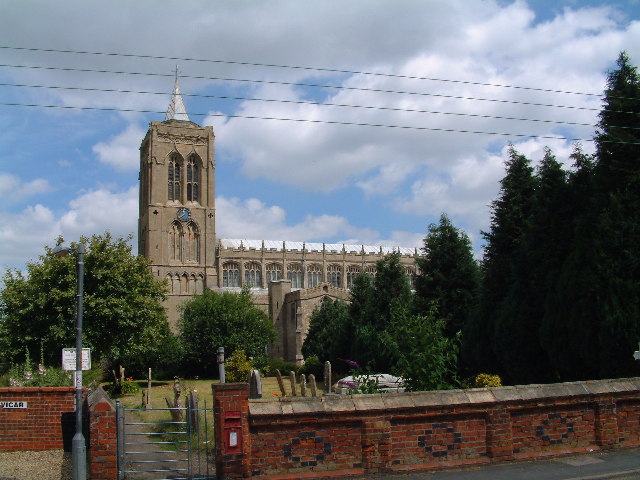
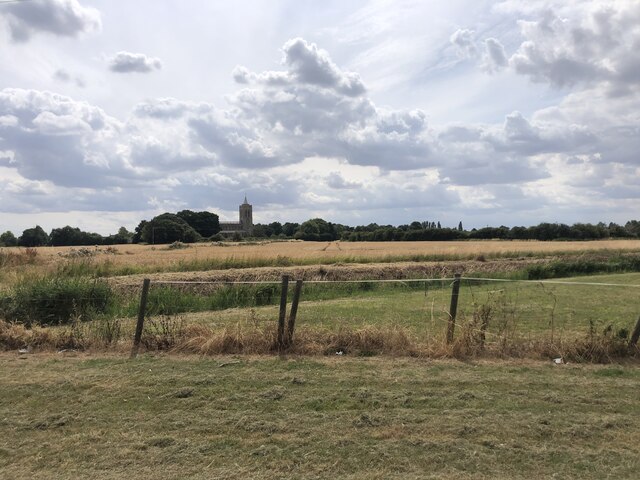
St Mary Magdalene Church, Gedney

St Mary Magdalene Church is an Anglican parish church of medieval origin in Gedney, Lincolnshire. Renowned for its large size in the surrounding low-lying...

Gedney, Lincolnshire

Gedney is a village, civil parish and electoral ward in the South Holland district of Lincolnshire, England. It is just to the south of the A17 Boston...

Nearby Amenities

Located within 500m of 52.802336,0.067879
Fixme: OMR does not match bus stops
Lat/Long: 52.8047291/0.0668287
Bus Stop
Proctors Close, opp
Bus: yes
Naptan AtcoCode: 270000009614
Naptan Bearing: NE
Naptan CommonName: Proctors Close
Naptan Indicator: opp
Naptan Landmark: Proctors Close
Naptan NaptanCode: linjdjwp
Naptan Street: B1515 Fleet Road
Naptan Verified: no
Public Transport: platform
Source: naptan_import
Lat/Long: 52.8044287/0.06219
Bus Stop
Proctors Close, adj
Bus: yes
Naptan AtcoCode: 270000009615
Naptan Bearing: SW
Naptan CommonName: Proctors Close
Naptan Indicator: adj
Naptan Landmark: Proctors Close
Naptan NaptanCode: linjdjwt
Naptan Street: B1515 Fleet Road
Naptan Verified: no
Public Transport: platform
Source: naptan_import
Lat/Long: 52.8043032/0.0621692
Bus Stop
The Old Schoolhouse, opp
Bus: yes
Naptan AtcoCode: 270000009616
Naptan Bearing: E
Naptan CommonName: The Old Schoolhouse
Naptan Indicator: opp
Naptan Landmark: The Old Schoolhouse
Naptan NaptanCode: linjdmad
Naptan Street: Old Main Road
Naptan Verified: no
Public Transport: platform
Source: naptan_import
Lat/Long: 52.8046802/0.0678843
Bus Stop
Seaforth
Bus: yes
Naptan AtcoCode: 270002700602
Naptan Bearing: SE
Naptan CommonName: Seaforth
Naptan Indicator: opp
Naptan Landmark: Seaforth
Naptan Street: Old Main Road
Naptan Verified: no
Public Transport: platform
Source: naptan_import
Lat/Long: 52.8033692/0.0744835
Bus Stop
Seaforth
Bus: yes
Naptan AtcoCode: 270002700603
Naptan Bearing: NW
Naptan CommonName: Seaforth
Naptan Indicator: o/s
Naptan Landmark: Seaforth
Naptan Street: Old Main Road
Naptan Verified: no
Public Transport: platform
Source: naptan_import
Lat/Long: 52.8032431/0.0744923
Bus Stop
The Old Schoolhouse, adj
Bus: yes
Naptan AtcoCode: 2700LFHT3062
Naptan Bearing: W
Naptan CommonName: The Old Schoolhouse
Naptan Indicator: adj
Naptan Landmark: The Old Schoolhouse
Naptan NaptanCode: linawgwa
Naptan Street: Old Main Road
Naptan Verified: no
Public Transport: platform
Shelter: yes
Source: naptan_import
Lat/Long: 52.8045858/0.0677145
Fixme: Road is seriously out of parallel with this WM
Historic: memorial
Memorial: war_memorial
Source: walking GPS
Lat/Long: 52.8047315/0.0650171
Post Box
Collection Times: Mo-Fr 16:30; Sa 11:30
Description: Outside Fleet Post Office /Fleet Road / Hocklesgate;Outside Fleet Post Office /Fleet Road / Hocklesgate//
Operator: Royal Mail
Post Box Design: type_k
Post Box Type: pillar
Ref: PE12 65
Royal Cypher: EIIR
Royal Cypher Wikidata: Q33102113
Lat/Long: 52.804592/0.067038
Post Office
Fleet Post Office (Closed)
Addr City: Spalding
Addr Country: GB
Addr Housename: The Old Post Office
Addr Postcode: PE12 8LJ
Addr Street: Old Main Road
Addr Suburb: Fleet Hargate
Nohousenumber: yes
Lat/Long: 52.8045625/0.0670856
Turning Circle
Lat/Long: 52.801492/0.0669099
Turning Circle
Lat/Long: 52.8035414/0.0701973
Place Of Worship
Fleet Baptist Church
Building: chapel
Denomination: baptist
Religion: christian
Lat/Long: 52.804209/0.0703024
Turning Circle
Lat/Long: 52.802251/0.0681665
Turning Circle
Lat/Long: 52.8028915/0.0686105
Turning Circle
Lat/Long: 52.8038774/0.0636511
Fleet Hargate
Place: village
Lat/Long: 52.8033592/0.0660717
Field House
Place: isolated_dwelling
Source: Bing
Lat/Long: 52.8018871/0.0717647
Crossing
Crossing: island
Tactile Paving: yes
Lat/Long: 52.8060552/0.0692594
Crossing
Crossing: island
Tactile Paving: yes
Lat/Long: 52.8059704/0.0692067
Social Facility
Field House Residential Home
Addr City: Spalding
Addr Country: GB
Addr Postcode: PE12 8LL
Addr Street: Old Main Road
Addr Suburb: Fleet Hargate
Fhrs Authority: South Holland
Fhrs Id: 243232
Fhrs Local Authority Id: 5365
Social Facility: nursing_home
Lat/Long: 52.8019531/0.0717048
Kindergarten
The Willows Day Nursery
Addr City: Spalding
Addr Country: GB
Addr Postcode: PE12 8LL
Addr Street: Old Main Road
Addr Suburb: Fleet Hargate
Fhrs Authority: South Holland
Fhrs Id: 451707
Fhrs Local Authority Id: 35039
Lat/Long: 52.8043789/0.070695
Defibrillator
Emergency: defibrillator
Lat/Long: 52.8047515/0.066085
Community Centre
Sheltered Housing
Addr City: Spalding
Addr Country: GB
Addr Postcode: PE12 8LU
Addr Street: Hargate Close
Addr Suburb: Fleet Hargate
Lat/Long: 52.8041008/0.0660253
Direction: SSW
Generator Method: photovoltaic
Generator Output Electricity: yes
Generator Solar Modules: 18
Generator Source: solar
Generator Type: solar_photovoltaic_panel
Location: roof
Power: generator
Lat/Long: 52.8037367/0.0700796
Direction: SE
Generator Method: photovoltaic
Generator Output Electricity: yes
Generator Solar Modules: 12
Generator Source: solar
Generator Type: solar_photovoltaic_panel
Location: roof
Power: generator
Lat/Long: 52.8027157/0.0665344
Direction: SE
Generator Method: photovoltaic
Generator Output Electricity: yes
Generator Source: solar
Generator Type: solar_photovoltaic_panel
Location: roof
Power: generator
Lat/Long: 52.8031011/0.067958
Direction: SSW
Generator Method: photovoltaic
Generator Output Electricity: yes
Generator Solar Modules: 16
Generator Source: solar
Generator Type: solar_photovoltaic_panel
Location: roof
Power: generator
Lat/Long: 52.8029359/0.0647072
Direction: SSW
Generator Method: photovoltaic
Generator Output Electricity: yes
Generator Solar Modules: 14
Generator Source: solar
Generator Type: solar_photovoltaic_panel
Location: roof
Power: generator
Lat/Long: 52.8027962/0.0641292
Direction: SSW
Generator Method: photovoltaic
Generator Output Electricity: yes
Generator Solar Modules: 10
Generator Source: solar
Generator Type: solar_photovoltaic_panel
Location: roof
Power: generator
Lat/Long: 52.8024113/0.0634613
Direction: ESE
Generator Method: photovoltaic
Generator Output Electricity: yes
Generator Solar Modules: 6
Generator Source: solar
Generator Type: solar_photovoltaic_panel
Location: roof
Power: generator
Lat/Long: 52.8023412/0.0635632
Direction: 190
Generator Method: photovoltaic
Generator Output Electricity: yes
Generator Solar Modules: 10
Generator Source: solar
Generator Type: solar_photovoltaic_panel
Location: roof
Power: generator
Lat/Long: 52.8020934/0.0633788
Direction: 100
Generator Method: photovoltaic
Generator Output Electricity: yes
Generator Solar Modules: 6
Generator Source: solar
Generator Type: solar_photovoltaic_panel
Location: roof
Power: generator
Lat/Long: 52.8020598/0.0635109
Direction: SE
Generator Method: photovoltaic
Generator Output Electricity: yes
Generator Source: solar
Generator Type: solar_photovoltaic_panel
Location: roof
Power: generator
Lat/Long: 52.8033248/0.0635706
Generator Method: photovoltaic
Generator Output Electricity: yes
Generator Source: solar
Generator Type: solar_photovoltaic_panel
Location: roof
Power: generator
Lat/Long: 52.8046373/0.0645067
Generator Method: photovoltaic
Generator Output Electricity: yes
Generator Source: solar
Generator Type: solar_photovoltaic_panel
Location: roof
Power: generator
Lat/Long: 52.804634/0.0645067
Generator Method: photovoltaic
Generator Output Electricity: yes
Generator Source: solar
Generator Type: solar_photovoltaic_panel
Location: roof
Power: generator
Lat/Long: 52.8046502/0.0644235
Generator Method: photovoltaic
Generator Output Electricity: yes
Generator Solar Modules: 4
Generator Source: solar
Generator Type: solar_photovoltaic_panel
Location: roof
Power: generator
Lat/Long: 52.8043827/0.0617547
Generator Method: photovoltaic
Generator Output Electricity: yes
Generator Solar Modules: 4
Generator Source: solar
Generator Type: solar_photovoltaic_panel
Location: roof
Power: generator
Lat/Long: 52.8043916/0.0619183
The data included in this document is from www.openstreetmap.org. The data is made available under ODbL.

Have you been to Fleet Hargate?

Leave your review of Fleet Hargate below (or comments, questions and feedback).