Fleet Downs

Settlement in Kent Dartford

England

Fleet Downs

Hill Rise, Darenth Hill Rise in the village of Darenth, in north Kent, photographed at dusk on an October day.
Hill Rise, Darenth Credit: Malc McDonald

Fleet Downs is a residential area located in the district of Kent, England. Situated in the northwest part of the county, it forms part of the larger town of Dartford. The area is primarily known for its peaceful and family-friendly atmosphere, offering residents a suburban lifestyle with easy access to a range of amenities and nearby green spaces.

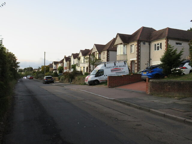
Fleet Downs is characterized by its predominantly residential nature, with a mix of housing options including detached and semi-detached houses, as well as some apartment buildings. The area boasts a well-established community, with a variety of local shops, schools, and services catering to the needs of its residents.

For those seeking recreational activities, Fleet Downs is home to several parks and open spaces. The nearby Fleetdown Recreation Ground provides ample opportunities for outdoor sports and leisure activities, with facilities such as football fields, tennis courts, and a playground for children.

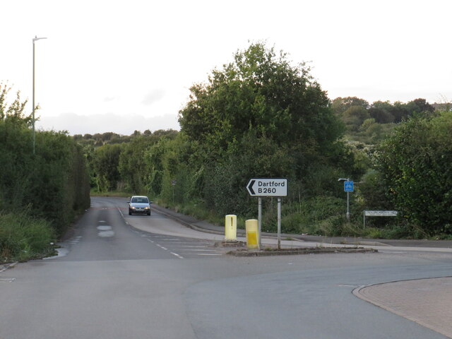
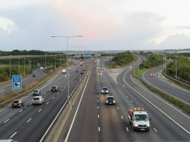
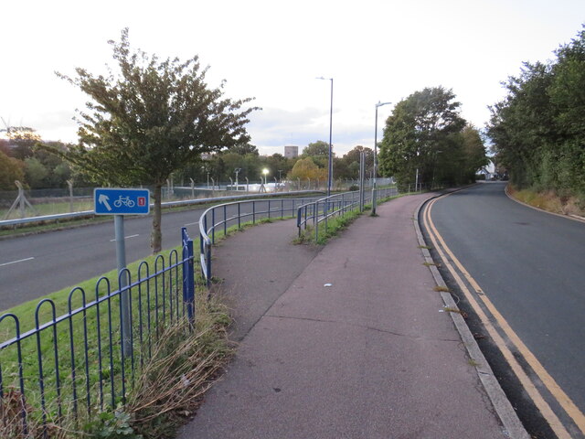
Transportation in Fleet Downs is convenient, with good road connections to the A2 and M25 motorways, providing easy access to neighboring towns and cities. The area is also well-served by public transport, with regular bus services connecting residents to the wider Dartford area and beyond.

Overall, Fleet Downs offers a peaceful and family-oriented lifestyle, with a range of amenities and easy access to nearby green spaces. Its convenient location and strong community spirit make it an attractive place to live for those seeking a suburban setting within reach of urban conveniences.

If you have any feedback on the listing, please let us know in the comments section below.
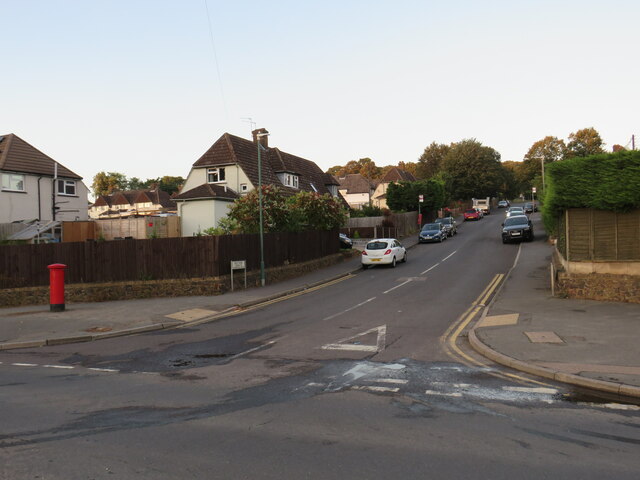
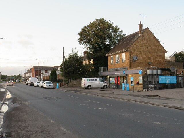
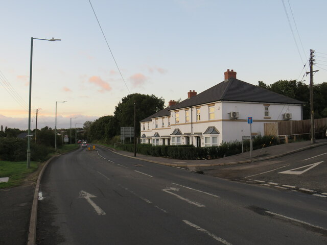
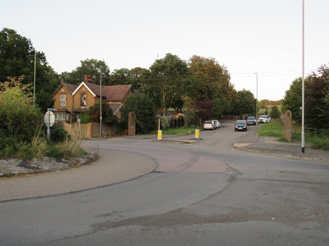
Fleet Downs Images

Images are sourced within 2km of 51.434527/0.24288338 or Grid Reference TQ5673. Thanks to Geograph Open Source API. All images are credited.

Hill Rise, Darenth Hill Rise in the village of Darenth, in north Kent, photographed at dusk on an October day.
Hill Rise, Darenth
Hill Rise in the village of Darenth, in north Kent, photographed at dusk on an October day.
Watchgate, Darenth, near Dartford Watchgate forms part of the route of the B260 road as it passes through the village of Dareth.  A Co-op local convenience store stands in the opposite side of the road.
Watchgate, Darenth, near Dartford
Watchgate forms part of the route of the B260 road as it passes through the village of Dareth. A Co-op local convenience store stands in the opposite side of the road.
Green Street, Darenth Green Street, heading out of the north Kent village of Darenth, forms part of the route of the B260 road.

This image was taken at dusk on an October evening, as the daylight was fading.
Green Street, Darenth
Green Street, heading out of the north Kent village of Darenth, forms part of the route of the B260 road. This image was taken at dusk on an October evening, as the daylight was fading.
Entrance to Darenth Country Park, near Dartford A driveway entering the Darenth Country Park in North Kent.  The driveway enters the park from a roundabout on the B260 road.
Entrance to Darenth Country Park, near Dartford
A driveway entering the Darenth Country Park in North Kent. The driveway enters the park from a roundabout on the B260 road.
Trolling Down Hill, near Dartford Trolling Down Hill forms part of the route of the B260 road in north Kent.

This image was taken in fading light, at dusk on an October day.
Trolling Down Hill, near Dartford
Trolling Down Hill forms part of the route of the B260 road in north Kent. This image was taken in fading light, at dusk on an October day.
Start of the M25, Dartford The M25 almost forms a complete ring around the edge of London.  However the ring is broken between Dartford in Kent and West Thurrock on the north side of the Thames, with the A282 Dartford tunnels and bridge filling in the gap.

This photo shows the start of the M25, heading south from Dartford as it starts its clockwise journey of 117 miles around the edge of London to West Thurrock.  Slip roads carry traffic onto and from the A2, which crosses the M25 about a kilometre to the south.

The photo was taken in fading light, at dusk on an October evening.
Start of the M25, Dartford
The M25 almost forms a complete ring around the edge of London. However the ring is broken between Dartford in Kent and West Thurrock on the north side of the Thames, with the A282 Dartford tunnels and bridge filling in the gap. This photo shows the start of the M25, heading south from Dartford as it starts its clockwise journey of 117 miles around the edge of London to West Thurrock. Slip roads carry traffic onto and from the A2, which crosses the M25 about a kilometre to the south. The photo was taken in fading light, at dusk on an October evening.
Darenth Road, Dartford Darenth Road is a residential road in Dartford.  This image was taken at dusk on an October day, as light was fading.
Darenth Road, Dartford
Darenth Road is a residential road in Dartford. This image was taken at dusk on an October day, as light was fading.
Ivy Leaf pub, Dartford The Ivy Leaf pub in Dartford, photographed at dusk on an October day.
Ivy Leaf pub, Dartford
The Ivy Leaf pub in Dartford, photographed at dusk on an October day.
Brent Lane, Dartford Brent Lane is a residential road in the town of Dartford.  It is on the route of National Cycle Network route 1.
Brent Lane, Dartford
Brent Lane is a residential road in the town of Dartford. It is on the route of National Cycle Network route 1.
National Cycle Network route 1, Dartford The blue sign indicates that National Cycle Network route 1 takes the ramp to the left as it makes its way through the Kent town of Dartford.

This image was taken in fading light, at dusk on an October day.
National Cycle Network route 1, Dartford
The blue sign indicates that National Cycle Network route 1 takes the ramp to the left as it makes its way through the Kent town of Dartford. This image was taken in fading light, at dusk on an October day.
War grave in East Hill Cemetery Burial records for East Hill began in 1856 and the first burial was Elizabeth Barnes on the 5th October of that year. The cemetery was originally known as The Brent Cemetery from this part of Dartford which is known as The Brent.
War grave in East Hill Cemetery
Burial records for East Hill began in 1856 and the first burial was Elizabeth Barnes on the 5th October of that year. The cemetery was originally known as The Brent Cemetery from this part of Dartford which is known as The Brent.
Spanish bluebells in East Hill Cemetery Burial records for East Hill began in 1856 and the first burial was Elizabeth Barnes on the 5th October of that year. The cemetery was originally known as The Brent Cemetery from this part of Dartford which is known as The Brent.
Spanish bluebells in East Hill Cemetery
Burial records for East Hill began in 1856 and the first burial was Elizabeth Barnes on the 5th October of that year. The cemetery was originally known as The Brent Cemetery from this part of Dartford which is known as The Brent.
War grave in East Hill Cemetery Burial records for East Hill began in 1856 and the first burial was Elizabeth Barnes on the 5th October of that year. The cemetery was originally known as The Brent Cemetery from this part of Dartford which is known as The Brent. Interestingly the Royal Flying Corps which was the predecessor of the Royal Air Force had the same motto - Per Ardua Ad Astra.
War grave in East Hill Cemetery
Burial records for East Hill began in 1856 and the first burial was Elizabeth Barnes on the 5th October of that year. The cemetery was originally known as The Brent Cemetery from this part of Dartford which is known as The Brent. Interestingly the Royal Flying Corps which was the predecessor of the Royal Air Force had the same motto - Per Ardua Ad Astra.
East Hill Cemetery Burial records for East Hill began in 1856 and the first burial was Elizabeth Barnes on the 5th October of that year. The cemetery was originally known as The Brent Cemetery from this part of Dartford which is known as The Brent.
East Hill Cemetery
Burial records for East Hill began in 1856 and the first burial was Elizabeth Barnes on the 5th October of that year. The cemetery was originally known as The Brent Cemetery from this part of Dartford which is known as The Brent.
East Hill Cemetery Burial records for East Hill began in 1856 and the first burial was Elizabeth Barnes on the 5th October of that year. The cemetery was originally known as The Brent Cemetery from this part of Dartford which is known as The Brent. The bluebells are Spanish bluebells.
East Hill Cemetery
Burial records for East Hill began in 1856 and the first burial was Elizabeth Barnes on the 5th October of that year. The cemetery was originally known as The Brent Cemetery from this part of Dartford which is known as The Brent. The bluebells are Spanish bluebells.
Spanish bluebells in East Hill Cemetery Burial records for East Hill began in 1856 and the first burial was Elizabeth Barnes on the 5th October of that year. The cemetery was originally known as The Brent Cemetery from this part of Dartford which is known as The Brent. Unusually, the invasive Spanish bluebells see here include not only blue, but also white and pink varieties.
Spanish bluebells in East Hill Cemetery
Burial records for East Hill began in 1856 and the first burial was Elizabeth Barnes on the 5th October of that year. The cemetery was originally known as The Brent Cemetery from this part of Dartford which is known as The Brent. Unusually, the invasive Spanish bluebells see here include not only blue, but also white and pink varieties.
Path in East Hill Cemetery Burial records for East Hill began in 1856 and the first burial was Elizabeth Barnes on the 5th October of that year. The cemetery was originally known as The Brent Cemetery from this part of Dartford which is known as The Brent. Unusually, the invasive Spanish bluebells see here include not only blue, but also white and pink varieties. See also <a title="https://www.geograph.org.uk/photo/7159780" href="https://www.geograph.org.uk/photo/7159780">Link</a>
Path in East Hill Cemetery
Burial records for East Hill began in 1856 and the first burial was Elizabeth Barnes on the 5th October of that year. The cemetery was originally known as The Brent Cemetery from this part of Dartford which is known as The Brent. Unusually, the invasive Spanish bluebells see here include not only blue, but also white and pink varieties. See also Link
Show me another place!

Fleet Downs is located at Grid Ref: TQ5673 (Lat: 51.434527, Lng: 0.24288338)

Administrative County: Kent

District: Dartford

Police Authority: Kent

What 3 Words

///live.common.rider. Near Darenth, Kent

Nearby Locations

Fleet Downs

Related Wikis

Leigh Academy

The Leigh Academy is a state funded academy for the Dartford area of Kent, England. It is part of the Leigh Academies Trust. The academy's principal, also...

Crown Alexandra F.C.

Crown Alexandra Football Club was a football club located in Dartford, in Kent, England == History == Crown Alexandra was formed by Michael Day in July...

Darenth Country Park

Darenth Country Park is in Darenth near Dartford, in Kent, England. On the site of a former demolished hospital site Darenth Park Hospital, also the site...

Watling Street (Dartford)

Watling Street was a football ground in Dartford, England. Located adjacent to Watling Street, it was the home ground of Dartford F.C. from 1921 until...
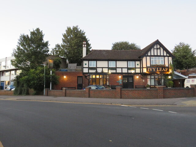
Nearby Amenities

Located within 500m of 51.434527,0.24288338
Princes Avenue
Bus: yes
Public Transport: stop_position
Lat/Long: 51.4379777/0.2416125
Traffic Signals
Traffic Signals: signal
Lat/Long: 51.4378884/0.2401582
Crossing
Lat/Long: 51.4374564/0.2382666
Traffic Calming: table
Lat/Long: 51.4348754/0.24656
Dale Walk
Bus: yes
Public Transport: stop_position
Lat/Long: 51.4353045/0.2426435
Traffic Signals
Traffic Signals: junction
Traffic Signals Direction: forward
Lat/Long: 51.438341/0.2392259
Traffic Signals
Traffic Signals: junction
Traffic Signals Direction: forward
Lat/Long: 51.4375468/0.2384336
Motorway Junction
Darenth
Ref: 2
Lat/Long: 51.4361546/0.2391003
Post Office
Fleetdale Parade Post Office
Addr City: Dartford
Addr Country: GB
Addr Housename: Fleetdale Parade
Addr Postcode: DA2 6JB
Addr Street: Fleet Avenue
Addr Unit: 2-4
Brand: Post Office
Brand Wikidata: Q1783168
Opening Hours: Mo-Sa 06:00-19:00; Su 07:00-18:00
Ref Pol Id: 18863
Website: https://www.postoffice.co.uk/branch-finder/1190148/fleetdale-parade
Lat/Long: 51.4352454/0.2451086
Post Box
Operator: Royal Mail
Lat/Long: 51.4352183/0.2451258
Cafe
Fleetdale Cafe
Addr City: Dartford
Addr Country: GB
Addr Housename: Fleetdale Parade
Addr Postcode: DA2 6JB
Addr Street: Fleet Avenue
Addr Unit: 14-16
Fhrs Id: 590535
Lat/Long: 51.4351074/0.2450998
Costcutter
Addr City: Dartford
Addr Country: GB
Addr Housename: Fleetdale Parade
Addr Postcode: DA2 6JB
Addr Street: Fleet Avenue
Addr Unit: 30-34
Brand: Costcutter
Brand Wikidata: Q5175072
Brand Wikipedia: en:Costcutter
Contact Website: https://store-locator.costcutter.co.uk/costcutter-92997cfa2279
Fhrs Id: 449987
Shop: convenience
Lat/Long: 51.4350204/0.2453833
Post Box
Operator: Royal Mail
Ref: DA2 306
Lat/Long: 51.4372231/0.2422502
Power: substation
Lat/Long: 51.4382593/0.2453489
Restaurant
Miller & Carter
Addr City: Dartford
Addr Housenumber: 526
Addr Postcode: DA2 6NQ
Addr Street: Princes Road
Brand: Miller & Carter
Brand Wikidata: Q87067401
Contact Phone: +44 1322 287 766
Cuisine: steak
Website: https://www.millerandcarter.co.uk/restaurants/london/millerandcarterdartford
Lat/Long: 51.4376559/0.2405768
Beech House
Building: house
Lat/Long: 51.4313677/0.2422062
Blackdale Farm
Building: house
Lat/Long: 51.4318739/0.2414231
Downs Farm
Place: farm
Lat/Long: 51.4337053/0.2430318
Post Box
Collection Times: Mo-Fr 09:00; Sa 07:00; Su off
Drive Through: no
Image: https://archive.org/details/dartford-2021-05-09/2021-05-09_16-46-00_20210509_18_06_13.jpg
Operator: Royal Mail
Post Box Type: lamp
Ref: DA1 509D
Royal Cypher: EIIR
Royal Cypher Wikidata: Q33102113
Source: survey
Lat/Long: 51.4366129/0.2366539
Bus Stop
Princes Avenue
Local Ref: opp
Naptan AtcoCode: 240096619
Naptan Bearing: E
Naptan BusStopType: MKD
Naptan CommonName: Princes Avenue
Naptan Indicator: opp
Naptan Landmark: Princes Avenue
Naptan NaptanCode: kntgpdgj
Naptan RevisionNumber: 5
Naptan Status: act
Naptan Street: Princes Road
Naptan Verified: no
Public Transport: platform
Ref: kntgpdgj
Source: naptan_import
Source Date: 2018-02-14
Lat/Long: 51.4380538/0.241618
Bus Stop
Princes Avenue
Local Ref: adj
Naptan AtcoCode: 240096621
Naptan Bearing: W
Naptan BusStopType: MKD
Naptan CommonName: Princes Avenue
Naptan Indicator: adj
Naptan Landmark: Harvester
Naptan NaptanCode: kntgpdgm
Naptan Notes: Fast-Track Stop
Naptan RevisionNumber: 5
Naptan Status: act
Naptan Street: Princes Road
Naptan Verified: no
Public Transport: platform
Ref: kntgpdgm
Shelter: yes
Source: naptan_import
Source Date: 2018-02-14
Lat/Long: 51.4378253/0.2405844
Bus Stop
Gore Hill
Local Ref: NE-bound
Naptan AtcoCode: 2400A019220A
Naptan Bearing: NE
Naptan BusStopType: MKD
Naptan CommonName: Gore Hill
Naptan Indicator: NE-bound
Naptan Landmark: Darenth Park Avenue
Naptan NaptanCode: kntatptw
Naptan RevisionNumber: 3
Naptan Status: act
Naptan Street: Gore Road
Naptan Verified: no
Public Transport: platform
Ref: kntatptw
Source: naptan_import
Source Date: 2018-08-07
Lat/Long: 51.4331331/0.249606
Bus Stop
Hesketh Avenue
Bus: yes
Naptan AtcoCode: 2400A020020A
Naptan Bearing: N
Naptan CommonName: Hesketh Avenue
Naptan Indicator: adj
Naptan Landmark: Princes Rd
Naptan NaptanCode: kntawajt
Naptan Street: Princes Ave
Naptan Verified: no
Public Transport: platform
Source: naptan_import
Lat/Long: 51.4375513/0.2419666
Bus Stop
Hesketh Avenue
Flag: no
Naptan AtcoCode: 2400A020030A
Naptan Bearing: S
Naptan BusStopType: CUS
Naptan CommonName: Hesketh Avenue
Naptan Indicator: opp
Naptan Landmark: Princes Rd
Naptan NaptanCode: kntawajw
Naptan Street: Princes Ave
Naptan Verified: yes
Public Transport: platform
Source: naptan_import
Lat/Long: 51.4370568/0.2422354
Bus Stop
Dale Walk
Bus: yes
Naptan AtcoCode: 2400A020040A
Naptan Bearing: N
Naptan CommonName: Dale Walk
Naptan Indicator: N-bound
Naptan Landmark: Dale Walk
Naptan NaptanCode: kntawama
Naptan Street: Princes Ave
Naptan Verified: no
Public Transport: platform
Source: naptan_import
Lat/Long: 51.4356032/0.2423617
Bus Stop
Dale Walk
Bus: yes
Naptan AtcoCode: 2400A020050A
Naptan Bearing: S
Naptan CommonName: Dale Walk
Naptan Indicator: S-bound
Naptan Landmark: Dale Walk
Naptan NaptanCode: kntawamd
Naptan Street: Princes Ave
Naptan Verified: no
Public Transport: platform
Source: naptan_import
Lat/Long: 51.4353717/0.2426628
Bus Stop
Library
Local Ref: opp
Naptan AtcoCode: 2400A020060A
Naptan Bearing: SW
Naptan BusStopType: MKD
Naptan CommonName: Library
Naptan Indicator: opp
Naptan Landmark: Eskdale Close
Naptan NaptanCode: kntawamg
Naptan RevisionNumber: 3
Naptan Status: act
Naptan Street: Lunedale Road
Naptan Verified: no
Public Transport: platform
Ref: kntawamg
Source: naptan_import
Source Date: 2018-08-07
Lat/Long: 51.4350768/0.247168
Bus Stop
Library
Local Ref: adj
Naptan AtcoCode: 2400A020070A
Naptan Bearing: NE
Naptan BusStopType: MKD
Naptan CommonName: Library
Naptan Indicator: adj
Naptan Landmark: Library
Naptan NaptanCode: kntawamj
Naptan RevisionNumber: 3
Naptan Status: act
Naptan Street: Lunedale Road
Naptan Verified: no
Public Transport: platform
Ref: kntawamj
Source: naptan_import
Source Date: 2018-08-07
Lat/Long: 51.4348567/0.2463783
Bus Stop
Weardale Avenue
Bus: yes
Naptan AtcoCode: 2400A020080A
Naptan Bearing: NE
Naptan CommonName: Lunedale Road
Naptan Indicator: o/s 44
Naptan Landmark: O/S No 44 Lunedale Rd
Naptan NaptanCode: kntawamp
Naptan Street: Lunedale Rd
Naptan Verified: no
Public Transport: platform
Source: naptan_import
Lat/Long: 51.4362863/0.2493149
Motorway Junction
Darenth
Ref: 2
Lat/Long: 51.4309723/0.2393381
Traffic Calming: table
Lat/Long: 51.4352148/0.2472963
Traffic Signals
Traffic Signals: junction
Traffic Signals Direction: forward
Lat/Long: 51.4374183/0.2382938
Barrier: stile
Foot: yes
Image: https://archive.org/details/dartford-2021-05-09/2021-05-09_16-46-00_20210509_17_50_27.jpg
Material: wood
Stile: stepover
Wheelchair: no
Lat/Long: 51.432155/0.2378606
Phone
Emergency: phone
Source: Local knowledge
Lat/Long: 51.4378258/0.2385878
Phone
Check Date: 2021-09-02
Emergency: phone
Source: Local knowledge
Lat/Long: 51.4378688/0.2391682
Street Lamp
Lamp Model: Philips SGS253
Lamp Type: high_pressure_sodium
Source: Local knowledge
Lat/Long: 51.4346/0.2390678
Street Lamp
Lamp Model: Philips SGS253
Lamp Type: high_pressure_sodium
Source: Local knowledge
Lat/Long: 51.4341621/0.2390771
Street Lamp
Lamp Model: Philips SGS253
Lamp Type: high_pressure_sodium
Source: Local knowledge
Lat/Long: 51.4349707/0.2390339
Street Lamp
Lamp Model: Philips SGS204
Lamp Type: high_pressure_sodium
Source: Local knowledge
Lat/Long: 51.4353613/0.2390124
Street Lamp
Lamp Model: Philips SGS204
Lamp Type: high_pressure_sodium
Source: Local knowledge
Lat/Long: 51.4357666/0.2389908
Street Lamp
Lamp Model: Philips SGS204
Lamp Type: high_pressure_sodium
Source: Local knowledge
Lat/Long: 51.4361528/0.2389689
Street Lamp
Lamp Model: Philips SGS204
Lamp Type: high_pressure_sodium
Source: Local knowledge
Lat/Long: 51.4365605/0.2389446
Street Lamp
Lamp Model: Philips SGS204
Lamp Type: high_pressure_sodium
Source: Local knowledge
Lat/Long: 51.4369843/0.2389199
Street Lamp
Lamp Model: Philips SGS253
Lamp Type: high_pressure_sodium
Source: Local knowledge
Lat/Long: 51.4373823/0.2389015
Street Lamp
Lamp Model: Philips SGS204
Lamp Type: high_pressure_sodium
Source: Local knowledge
Lat/Long: 51.4377026/0.2388799
Street Lamp
Lamp Model: Philips SGS253
Lamp Type: high_pressure_sodium
Source: Local knowledge
Lat/Long: 51.4381539/0.2388079
Street Lamp
Lamp Model: Philips SGS204
Lamp Type: high_pressure_sodium
Source: Local knowledge
Lat/Long: 51.4381577/0.2388964
Princes Avenue
Bus: yes
Public Transport: stop_position
Lat/Long: 51.4378976/0.2405959
Gore Hill
Bus: yes
Public Transport: stop_position
Lat/Long: 51.4331036/0.2496916
Weardale Avenue
Bus: yes
Public Transport: stop_position
Lat/Long: 51.4362346/0.2493608
Library
Bus: yes
Public Transport: stop_position
Lat/Long: 51.4348242/0.2464114
Library
Bus: yes
Public Transport: stop_position
Lat/Long: 51.4351279/0.2471156
Dale Walk
Bus: yes
Public Transport: stop_position
Lat/Long: 51.4356167/0.2424141
Hesketh Avenue
Bus: yes
Public Transport: stop_position
Lat/Long: 51.4375525/0.242083
Hesketh Avenue
Bus: yes
Public Transport: stop_position
Lat/Long: 51.4370558/0.2420952
Image: https://archive.org/details/dartford-2021-05-09/2021-05-09_16-46-00_20210509_17_56_10.jpg
Man Made: mast
Lat/Long: 51.4343249/0.2380139
AMD
Office: company
Website: https://www.amdenvironmental.co.uk/
Lat/Long: 51.4344766/0.2366821
Give Way
Lat/Long: 51.4347693/0.2369759
Crossing
Crossing: unmarked
Crossing Island: yes
Lat/Long: 51.4347282/0.2369121
Place Of Worship
Winners' Chapel International
Addr City: Dartford
Addr Housenumber: 1
Addr Postcode: DA1 1QE
Addr Street: Churchill Close
Denomination: evangelical
Religion: christian
Website: https://www.winners-chapel.org.uk/
Lat/Long: 51.4360291/0.2369893
Traffic Signals
Traffic Signals: signal
Lat/Long: 51.4380046/0.2423002
Clock
Display: sundial
Historic: memorial
Image: https://archive.org/details/dartford-2020-07-11/IMG_20200712_175520.jpg
Memorial: war_memorial
Note: Second World War civilian war memorial, a short stone pillar with sundial on top.
Lat/Long: 51.4388461/0.2422021
Give Way
Lat/Long: 51.4371436/0.2374317
Give Way
Direction: backward
Lat/Long: 51.4372832/0.2376585
Fleet Estate
Place: suburb
Source: naptan_import
Lat/Long: 51.4347751/0.2460229
Traffic Calming: hump
Lat/Long: 51.4321525/0.237934
Street Lamp
Lat/Long: 51.4337722/0.2376414
Street Lamp
Lat/Long: 51.433471/0.2368853
Street Lamp
Lat/Long: 51.4338337/0.2362832
Street Lamp
Lat/Long: 51.4342262/0.2359023
Street Lamp
Lat/Long: 51.434903/0.2367204
Street Lamp
Lat/Long: 51.4342258/0.2379186
Barrier: entrance
Lat/Long: 51.4330227/0.2385336
Street Lamp
Lat/Long: 51.4338588/0.2386214
Dominion Bookshop
Shop: books
Lat/Long: 51.4359134/0.2367619
Give Way
Direction: backward
Lat/Long: 51.4371612/0.2466741
Give Way
Direction: forward
Lat/Long: 51.4371772/0.2455667
Give Way
Direction: backward
Lat/Long: 51.4371695/0.2439561
Give Way
Direction: backward
Lat/Long: 51.4371657/0.2430367
Give Way
Direction: forward
Lat/Long: 51.4371955/0.2421499
Give Way
Direction: backward
Lat/Long: 51.4371983/0.242033
Give Way
Direction: backward
Lat/Long: 51.4377158/0.2461847
Colour: white
Direction: -65
Marker: post
Material: plastic
Operator: Esso
Utility: oil
Lat/Long: 51.432978/0.2496533
Colour: white
Direction: 80
Marker: post
Material: concrete
Operator: Esso
Utility: oil
Lat/Long: 51.4329753/0.249419
The data included in this document is from www.openstreetmap.org. The data is made available under ODbL.

Have you been to Fleet Downs?

Leave your review of Fleet Downs below (or comments, questions and feedback).