West Tofts Covert

Wood, Forest in Norfolk Breckland

England

West Tofts Covert

Paddock at Lynford Arboretum The best place to see Hawfinch in the Brecks, see <a href="https://www.geograph.org.uk/photo/1036176">TL8293 : Hawfinch (Coccothraustes coccothraustes)</a>
Paddock at Lynford Arboretum Credit: Hugh Venables

West Tofts Covert is a woodland area located in Norfolk, England. This enchanting forest spans over a vast expanse of approximately 350 hectares. It is situated near the village of West Tofts, about 7 miles southeast of Thetford.

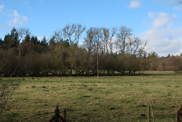
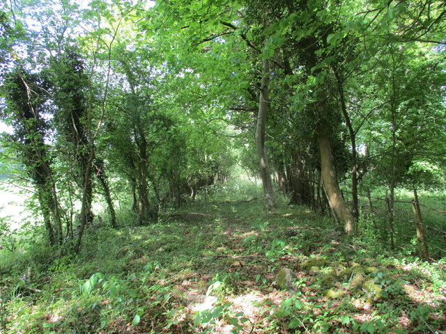
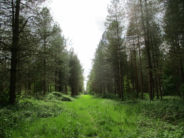
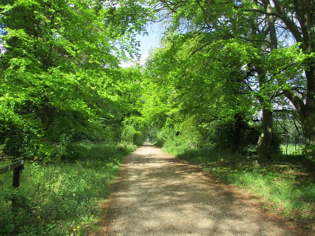
The Covert is predominantly composed of mixed woodland, consisting of various tree species such as oak, beech, pine, and birch. The dense canopy formed by these trees creates a serene and peaceful atmosphere, making it an ideal place for nature enthusiasts and hikers to explore.

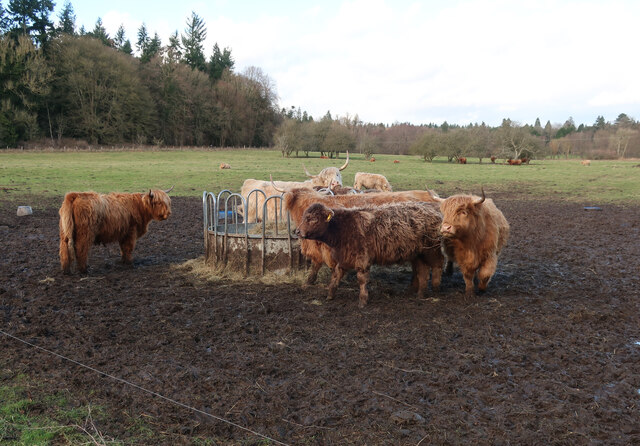
The woodland is home to a diverse range of wildlife, including deer, foxes, rabbits, and a variety of bird species. This makes it a popular destination for birdwatchers, who can spot species such as woodpeckers, owls, and various songbirds.

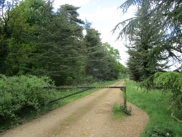
West Tofts Covert offers a network of footpaths and trails, allowing visitors to explore the forest at their leisure. These pathways wind through the woodland, providing scenic views and opportunities to observe the flora and fauna up close.

In addition to its natural beauty, the Covert also holds historical significance. It is believed that the area was once part of the extensive Thetford Forest, which played a crucial role in supplying timber to the British navy during the Napoleonic Wars.

Overall, West Tofts Covert is a stunning woodland area, offering a tranquil escape from the hustle and bustle of everyday life. Whether visitors are looking to immerse themselves in nature, spot wildlife, or simply enjoy a peaceful walk, this Norfolk gem provides a picturesque setting to do so.

If you have any feedback on the listing, please let us know in the comments section below.

West Tofts Covert Images

Images are sourced within 2km of 52.509537/0.70204063 or Grid Reference TL8393. Thanks to Geograph Open Source API. All images are credited.

Paddock at Lynford Arboretum The best place to see Hawfinch in the Brecks, see <a href="https://www.geograph.org.uk/photo/1036176">TL8293 : Hawfinch (Coccothraustes coccothraustes)</a>
Paddock at Lynford Arboretum
The best place to see Hawfinch in the Brecks, see TL8293 : Hawfinch (Coccothraustes coccothraustes)
Paddock at Lynford Arboretum
Forest track at Lynford
Overgrown track to the church of Our Lady of Consolation and St. Stephen, Lynford
Ride in Big Wood, Lynford
Forest track at Lynford
Restoration at the Church of Our Lady of Consolation and St Stephen, Lynford The church was built in 1879 and designed by Henry Clutton <span class="nowrap"><a title="https://historicengland.org.uk/listing/the-list/list-entry/1077247?section=official-list-entry" rel="nofollow ugc noopener" href="https://historicengland.org.uk/listing/the-list/list-entry/1077247?section=official-list-entry">Link</a><img style="margin-left:2px;" alt="External link" title="External link - shift click to open in new window" src="https://s1.geograph.org.uk/img/external.png" width="10" height="10"/></span>
Restoration at the Church of Our Lady of Consolation and St Stephen, Lynford
The church was built in 1879 and designed by Henry Clutton LinkExternal link
Track in Thetford Forest Most of the forest is designated as open access land so you are free to wander down any of the tracks.
Track in Thetford Forest
Most of the forest is designated as open access land so you are free to wander down any of the tracks.
Lynford Arboretum paddocks Looking towards Lynford Hall Hotel.
Lynford Arboretum paddocks
Looking towards Lynford Hall Hotel.
Lynford Water Former gravel pits, now opened for access. This pit is left undisturbed for the birds.
Lynford Water
Former gravel pits, now opened for access. This pit is left undisturbed for the birds.
Lynford Lakes bird hide Overlooking the western pit.
Lynford Lakes bird hide
Overlooking the western pit.
Lynford Water beach The sign says the water is not up to designated standards for swimming and no-one has got round to removing the quicksand sign. There would have been the potential for quicksand when gravel was cleaned and the sand and silt laden water poured back into the pit creating sand supersaturated with water. By now it will have all settled.
Lynford Water beach
The sign says the water is not up to designated standards for swimming and no-one has got round to removing the quicksand sign. There would have been the potential for quicksand when gravel was cleaned and the sand and silt laden water poured back into the pit creating sand supersaturated with water. By now it will have all settled.
Lynford Water information board Giving details about access to the gravel pits.
Lynford Water information board
Giving details about access to the gravel pits.
Lynford Arboretum lake Alders growing on the island.
Lynford Arboretum lake
Alders growing on the island.
Ash Carr Dry part of the woodland by Lynford Arboretum.
Ash Carr
Dry part of the woodland by Lynford Arboretum.
Path around Ash Carr The path is from Lynford Arboretum. The other side of the fence is STANTA (Stanford Training Area) a British Army infantry training area.
Path around Ash Carr
The path is from Lynford Arboretum. The other side of the fence is STANTA (Stanford Training Area) a British Army infantry training area.
Path through Ash Carr By Lynford Arboretum.
Path through Ash Carr
By Lynford Arboretum.
Path through Ash Carr Heading towards Lynford Arboretum.
Path through Ash Carr
Heading towards Lynford Arboretum.
Show me another place!

West Tofts Covert is located at Grid Ref: TL8393 (Lat: 52.509537, Lng: 0.70204063)

Administrative County: Norfolk

District: Breckland

Police Authority: Norfolk

What 3 Words

///awards.interests.crisps. Near Mundford, Norfolk

Related Wikis

West Tofts

West Tofts is a deserted medieval village in the civil parish of Lynford, within the Breckland district, in the county of Norfolk, England. It is within...

Buckenham Tofts

Buckenham Tofts (or Buckenham Parva; Little Buckenham) is a former civil parish, now in the parish of Stanford, in the Breckland district, in the county...

Lynford Hall

Lynford Hall is a neo-Jacobean country house at Mundford, near Thetford in the English county of Norfolk. It is now a hotel. == Location == The Lynford...

Stanford, Norfolk

Stanford is a deserted village and civil parish in the English county of Norfolk. It is situated 7+1⁄2 miles (12 km) north of the town of Thetford and...

Nearby Amenities

Located within 500m of 52.509537,0.70204063
Hunting Stand
Lat/Long: 52.5079953/0.7085812
Hunting Stand
Lat/Long: 52.5075537/0.7086396
The data included in this document is from www.openstreetmap.org. The data is made available under ODbL.

Have you been to West Tofts Covert?

Leave your review of West Tofts Covert below (or comments, questions and feedback).