Ash Carr

Wood, Forest in Norfolk Breckland

England

Ash Carr

Paddock at Lynford Arboretum The best place to see Hawfinch in the Brecks, see <a href="https://www.geograph.org.uk/photo/1036176">TL8293 : Hawfinch (Coccothraustes coccothraustes)</a>
Paddock at Lynford Arboretum Credit: Hugh Venables

Ash Carr is a small village located in the county of Norfolk, England. Situated in the eastern part of the country, Ash Carr is surrounded by picturesque woodlands and forests, making it an idyllic destination for nature enthusiasts and those seeking tranquility away from the bustling city life.

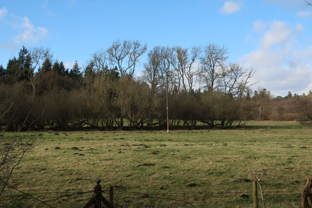
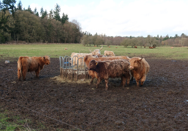
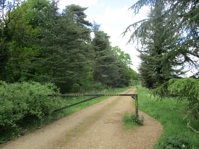
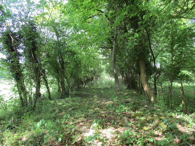
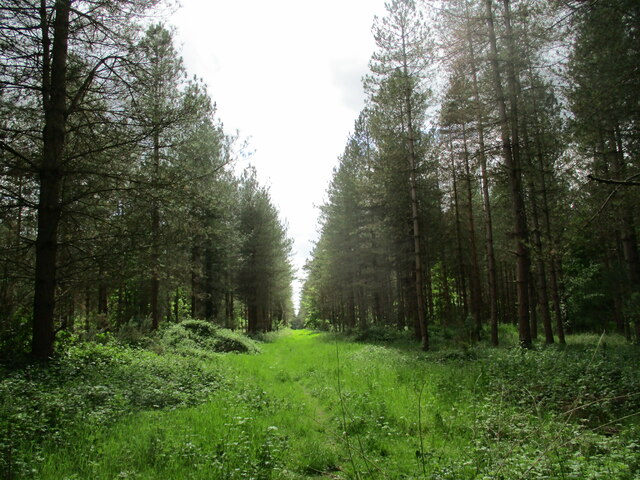
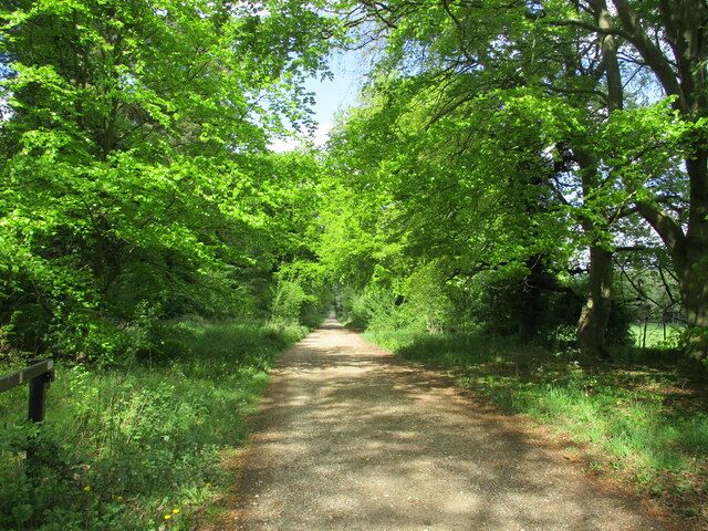
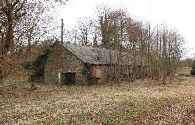
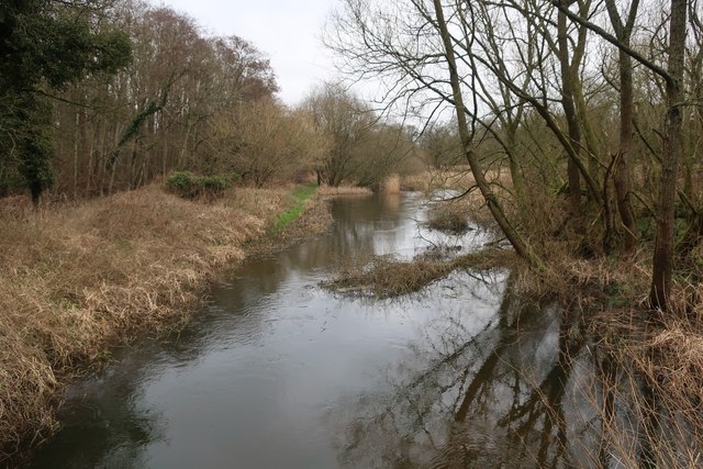
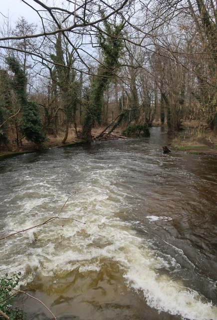
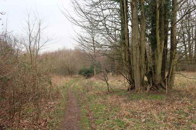
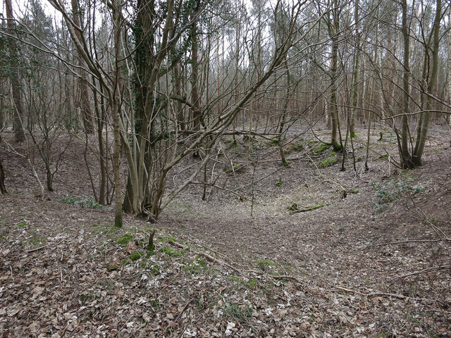
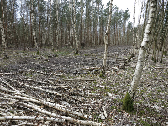
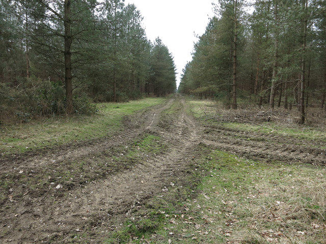
The village of Ash Carr is known for its rich natural beauty, with a dense forest covering much of its landscape. The forest is home to a diverse range of flora and fauna, providing a habitat for various species of birds, mammals, and insects. Visitors to Ash Carr can explore the forest through numerous walking trails that wind through the trees, allowing them to immerse themselves in the peaceful surroundings and observe the local wildlife.

In addition to its natural attractions, Ash Carr also boasts a close-knit community of residents who take great pride in their village. The village center features a few local businesses, including a quaint tea shop and a small grocery store, where visitors can experience the warm hospitality of the locals.

Ash Carr is well-connected to neighboring towns and cities via a network of well-maintained roads, making it easily accessible for both residents and visitors. The village also benefits from its proximity to larger urban areas, such as Norwich, which is only a short drive away and offers a wider range of amenities and attractions.

Overall, Ash Carr, Norfolk, with its enchanting woodlands and friendly community, provides a peaceful retreat for those seeking a connection with nature and a break from the fast-paced modern world.

If you have any feedback on the listing, please let us know in the comments section below.

Ash Carr Images

Images are sourced within 2km of 52.511671/0.68653361 or Grid Reference TL8293. Thanks to Geograph Open Source API. All images are credited.
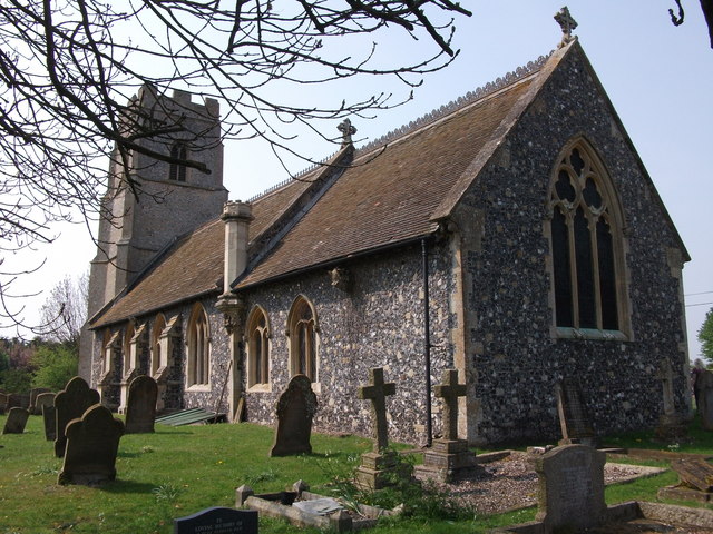
Paddock at Lynford Arboretum The best place to see Hawfinch in the Brecks, see <a href="https://www.geograph.org.uk/photo/1036176">TL8293 : Hawfinch (Coccothraustes coccothraustes)</a>
Paddock at Lynford Arboretum
The best place to see Hawfinch in the Brecks, see TL8293 : Hawfinch (Coccothraustes coccothraustes)
Paddock at Lynford Arboretum
Forest track at Lynford
Overgrown track to the church of Our Lady of Consolation and St. Stephen, Lynford
Ride in Big Wood, Lynford
Forest track at Lynford
Restoration at the Church of Our Lady of Consolation and St Stephen, Lynford The church was built in 1879 and designed by Henry Clutton <span class="nowrap"><a title="https://historicengland.org.uk/listing/the-list/list-entry/1077247?section=official-list-entry" rel="nofollow ugc noopener" href="https://historicengland.org.uk/listing/the-list/list-entry/1077247?section=official-list-entry">Link</a><img style="margin-left:2px;" alt="External link" title="External link - shift click to open in new window" src="https://s1.geograph.org.uk/img/external.png" width="10" height="10"/></span>
Restoration at the Church of Our Lady of Consolation and St Stephen, Lynford
The church was built in 1879 and designed by Henry Clutton LinkExternal link
Study of a Gasoline Station Gulf, Ickburgh.

 This photograph is part of a series taken in homage to the American artist Ed Ruscha's 1963 publication of 'Twentysix Gasoline Stations'.
 More properly known as filling stations in the UK, I am attempting to photograph as many as possible to mark the sixty year anniversary.
Study of a Gasoline Station
Gulf, Ickburgh. This photograph is part of a series taken in homage to the American artist Ed Ruscha's 1963 publication of 'Twentysix Gasoline Stations'. More properly known as filling stations in the UK, I am attempting to photograph as many as possible to mark the sixty year anniversary.
Crown Hotel, Mundford <span class="nowrap"><a title="https://historicengland.org.uk/listing/the-list/list-entry/1077250?section=official-list-entry" rel="nofollow ugc noopener" href="https://historicengland.org.uk/listing/the-list/list-entry/1077250?section=official-list-entry">Link</a><img style="margin-left:2px;" alt="External link" title="External link - shift click to open in new window" src="https://s1.geograph.org.uk/img/external.png" width="10" height="10"/></span>
Crown Hotel, Mundford
Old building by River Wissey
River Wissey in STANTA
High flow in the River Wissey
Path near Lynford Water
St Peter Ickburgh The church of St Peter Ickburgh, Norfolk for more info see <span class="nowrap"><a title="http://www.norfolkchurches.co.uk/ickburgh/ickburgh.htm" rel="nofollow ugc noopener" href="http://www.norfolkchurches.co.uk/ickburgh/ickburgh.htm">Link</a><img style="margin-left:2px;" alt="External link" title="External link - shift click to open in new window" src="https://s1.geograph.org.uk/img/external.png" width="10" height="10"/></span>
St Peter Ickburgh
The church of St Peter Ickburgh, Norfolk for more info see LinkExternal link
Lynford Hall, Mundford Full of standard Victorian motifs such as shaped gables, mullioned and transomed windows, and an exotically-roofed and asymmetrically-placed tower. By William Burn, 1856-61, for Mr and Mrs Lyne-Stephens (he was a banker, "reputedly the richest commoner in England ...[who] made his first fortune by inventing opening eyes for dolls"). Grade II listed.
The house is now a hotel.
Burn (1789-1870), a pupil of Robert Smirke, established himself in his Scottish homeland before doing the same in England. He was a phenomenally prolific designer of country houses, sought after by the wealthy largely because he was very adroit at planning homes to accommodate the increasing complexity of Victorian country house living - vast numbers of very specialised servants requiring specialist rooms and more segregation of the sexes (e.g. billiard rooms). In his Biographical Dictionary of British Architects, Howard Colvin states that by 1840 Burn "had already designed or altered ninety country houses, besides thirty churches and twenty-five public buildings", and he was to be in practice for almost another thirty years. He was competent across the gamut of architectural styles, but the results were rarely very exciting.
Lynford Hall, Mundford
Full of standard Victorian motifs such as shaped gables, mullioned and transomed windows, and an exotically-roofed and asymmetrically-placed tower. By William Burn, 1856-61, for Mr and Mrs Lyne-Stephens (he was a banker, "reputedly the richest commoner in England ...[who] made his first fortune by inventing opening eyes for dolls"). Grade II listed. The house is now a hotel. Burn (1789-1870), a pupil of Robert Smirke, established himself in his Scottish homeland before doing the same in England. He was a phenomenally prolific designer of country houses, sought after by the wealthy largely because he was very adroit at planning homes to accommodate the increasing complexity of Victorian country house living - vast numbers of very specialised servants requiring specialist rooms and more segregation of the sexes (e.g. billiard rooms). In his Biographical Dictionary of British Architects, Howard Colvin states that by 1840 Burn "had already designed or altered ninety country houses, besides thirty churches and twenty-five public buildings", and he was to be in practice for almost another thirty years. He was competent across the gamut of architectural styles, but the results were rarely very exciting.
Bombhole, Great Covert One of several in the area.
Bombhole, Great Covert
One of several in the area.
New track through the birch Parallel to West Tofts Road.
New track through the birch
Parallel to West Tofts Road.
Tyre tracks in Great Covert Signs of forest operations in the area.
Tyre tracks in Great Covert
Signs of forest operations in the area.
Show me another place!

Ash Carr is located at Grid Ref: TL8293 (Lat: 52.511671, Lng: 0.68653361)

Administrative County: Norfolk

District: Breckland

Police Authority: Norfolk

What 3 Words

///tower.shampoo.rationed. Near Mundford, Norfolk

Nearby Locations

Iron Carr Ash Carr

Related Wikis

Lynford Hall

Lynford Hall is a neo-Jacobean country house at Mundford, near Thetford in the English county of Norfolk. It is now a hotel. == Location == The Lynford...

Buckenham Tofts

Buckenham Tofts (or Buckenham Parva; Little Buckenham) is a former civil parish, now in the parish of Stanford, in the Breckland district, in the county...

West Tofts

West Tofts is a deserted medieval village in the civil parish of Lynford, within the Breckland district, in the county of Norfolk, England. It is within...

Ickburgh

Ickburgh is a village and civil parish in the English county of Norfolk. The villages name means 'Ic(c)a's fortification'. == Location == It is situated...

Nearby Amenities

Located within 500m of 52.511671,0.68653361
Man Made: scupture
Lat/Long: 52.512598/0.6830161
Bench
Information: board
Tourism: information
Lat/Long: 52.5112774/0.6833381
Bench
Lat/Long: 52.5120092/0.6824966
Bench
Lat/Long: 52.5126866/0.6826991
Bbq
Lat/Long: 52.5130131/0.6836553
Bbq
Lat/Long: 52.5132041/0.6841193
Information: board
Tourism: information
Lat/Long: 52.5153615/0.6843535
Information: board
Tourism: information
Lat/Long: 52.5153255/0.6843844
Bench
Lat/Long: 52.5140252/0.6832262
Bench
Information: board
Tourism: information
Lat/Long: 52.5141606/0.6821265
Bench
Lat/Long: 52.5146443/0.6819306
Bench
Information: board
Tourism: information
Lat/Long: 52.5150502/0.6829848
Information: board
Tourism: information
Lat/Long: 52.5152668/0.6843546
Bench
Lat/Long: 52.5110813/0.682584
Bench
Lat/Long: 52.5119977/0.6817241
Bench
Lat/Long: 52.512099/0.6808068
Fixme: incomplete
Lat/Long: 52.5122731/0.688697
Leisure: picnic_table
Lat/Long: 52.512835/0.6840608
Dog Agility Obstacle
Spiral Jump
Ref: 4
Lat/Long: 52.5122208/0.6889356
Dog Agility Obstacle
Box Jump
Ref: 5
Lat/Long: 52.5112675/0.6878363
Fixme: incomplete
Lat/Long: 52.5123694/0.6857815
Dog Agility Obstacle
Lat/Long: 52.511359/0.6854757
Dog Waste Bag Dispencer
Lat/Long: 52.511119/0.6834935
Bench
Information: board
Tourism: information
Lat/Long: 52.5132982/0.6845503
Dog Agility Obstacle
Woody Weaves
Ref: 3
Lat/Long: 52.512864/0.6888152
Leisure: picnic_table
Lat/Long: 52.5128986/0.6838224
Dog Agility Obstacle
Box Jump
Ref: 5
Lat/Long: 52.5112691/0.6870314
Fixme: incomplete
Lat/Long: 52.5113671/0.6870877
Fixme: incomplete
Lat/Long: 52.5113883/0.687608
Dog Waste Bag Dispencer
Lat/Long: 52.5149207/0.6845684
Dog Agility Obstacle
Box Jump
Ref: 5
Lat/Long: 52.51123/0.686283
Dog Agility Obstacle
Plank Walk
Ref: 1
Lat/Long: 52.5127644/0.6867444
Dog Agility Obstacle
Tunnel Time
Ref: 2
Lat/Long: 52.5128428/0.6877581
Fixme: incomplete
Lat/Long: 52.5114438/0.6882974
Toilets
Access: private
Lat/Long: 52.5148377/0.6844905
Waste Basket
Note: Actually a "Dog Poo Wormery", but serves the same fuction
Waste: dog_excrement
Lat/Long: 52.512766/0.6849822
The Wagtail
Fixme: check precise location
Operator: Sykes Cottages
Tourism: self_catering
Url: http://www.sykescottages.co.uk/cottage/Norfolk-Ickburgh/The-Wagtail-923232.html
Lat/Long: 52.5151221/0.6858224
Crossbills
Fixme: check precise location
Operator: Sykes Cottages
Tourism: self_catering
Url: http://www.sykescottages.co.uk/cottage/Norfolk-Ickburgh/Crossbills-923233.html
Lat/Long: 52.5151086/0.6856184
Barrier: bar
Lat/Long: 52.515014/0.6845356
Note: Public Footpath ends at STANTA boundary
Lat/Long: 52.5072598/0.6864898
Power: pole
Source: Bing
Lat/Long: 52.5084883/0.6857631
Power: pole
Source: Bing
Lat/Long: 52.5074403/0.6877506
Power: pole
Source: Bing
Lat/Long: 52.5079725/0.6868842
Leisure: picnic_table
Lat/Long: 52.5130542/0.6836267
Bench
Lat/Long: 52.5117153/0.6841068
Power: pole
Lat/Long: 52.5112252/0.680003
Power: pole
Source: Bing
Lat/Long: 52.5108179/0.6808707
Power: pole
Lat/Long: 52.5095242/0.6836106
Power: pole
Source: Bing
Lat/Long: 52.5089707/0.684725
Power: pole
Lat/Long: 52.5104326/0.6816807
Power: pole
Lat/Long: 52.5099927/0.68259
Power: pole
Lat/Long: 52.5106261/0.6831412
Power: pole
Lat/Long: 52.5111231/0.6835905
Power: pole
Lat/Long: 52.5117606/0.6840679
Power: pole
Lat/Long: 52.5123548/0.6845064
Line Management: transition
Power: pole
Lat/Long: 52.5129547/0.6849651
Artwork Type: sculpture
Material: wood
Tourism: artwork
Lat/Long: 52.5151713/0.6824639
Entrance: main
Lat/Long: 52.5153873/0.6845965
The data included in this document is from www.openstreetmap.org. The data is made available under ODbL.

Have you been to Ash Carr?

Leave your review of Ash Carr below (or comments, questions and feedback).