Flanderwell

Settlement in Yorkshire

England

Flanderwell

Aeon Court, Main Street, Bramley
Aeon Court, Main Street, Bramley Credit: Graham Hogg

Flanderwell is a small suburban area located in the Metropolitan Borough of Rotherham, South Yorkshire, England. Situated approximately four miles to the southeast of the town center of Rotherham, Flanderwell is a residential neighborhood known for its peaceful charm and close-knit community.

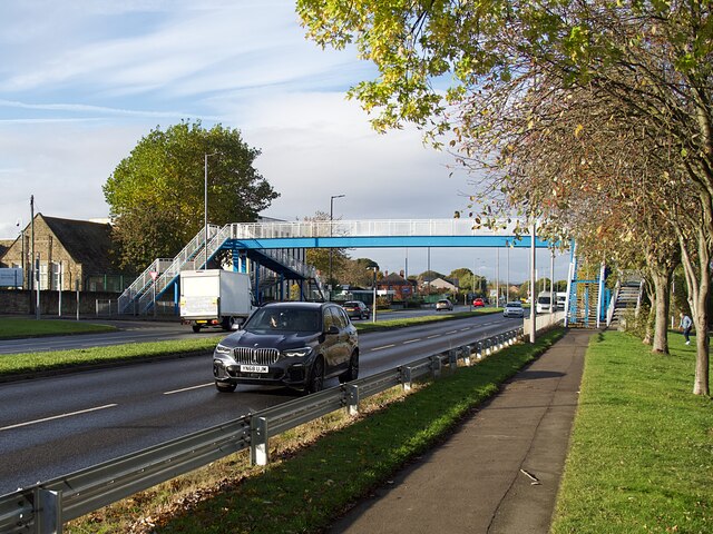
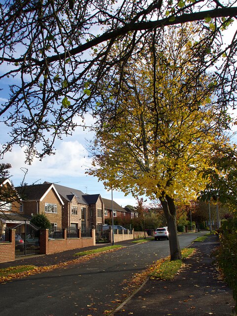
The area is predominantly made up of housing estates, with a mix of detached and semi-detached houses, making it an attractive place for families and professionals alike. Flanderwell benefits from excellent transport links, with easy access to the M18 motorway and regular bus services connecting it to Rotherham and neighboring towns.

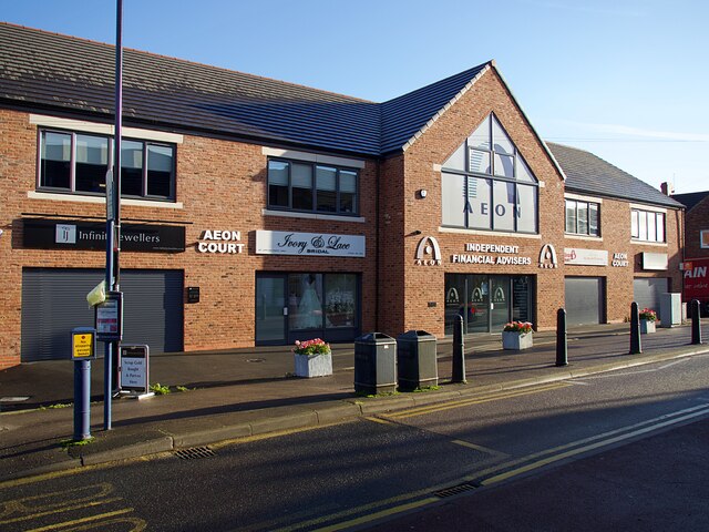
Flanderwell is home to a range of amenities, including several local shops, a post office, and a community center. The nearby Flanderwell Primary School provides education for children in the area, ensuring a convenient option for families.

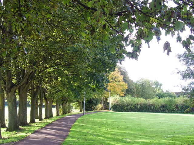
Nature enthusiasts will appreciate the proximity of Flanderwell to open green spaces, such as the nearby Flanderwell Park, which offers recreational facilities like a children's playground and sports fields. Additionally, the area benefits from its close proximity to the beautiful countryside of Yorkshire, providing opportunities for outdoor activities and exploration.

Overall, Flanderwell offers a serene and family-friendly environment with a range of amenities and easy access to both urban and rural areas. Its convenient location and welcoming community make it an appealing place to live or visit in Yorkshire.

If you have any feedback on the listing, please let us know in the comments section below.
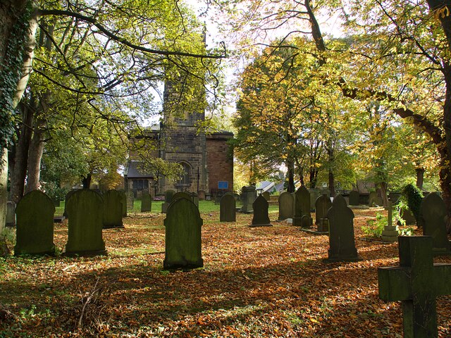
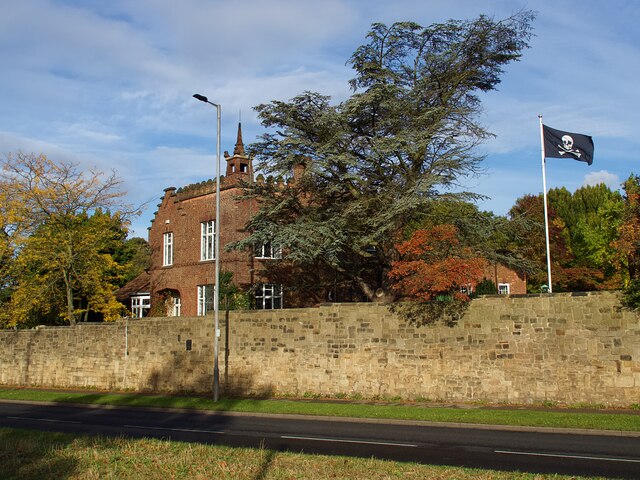
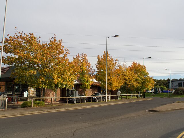
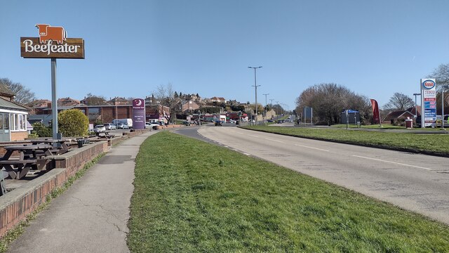
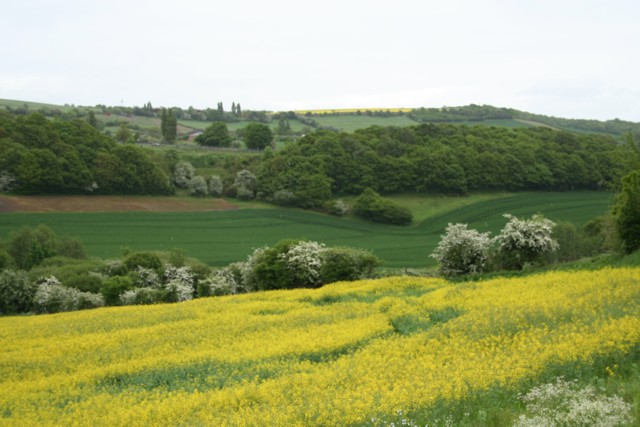
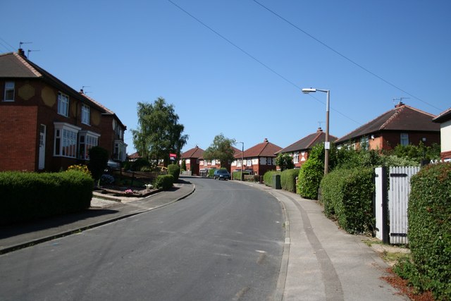
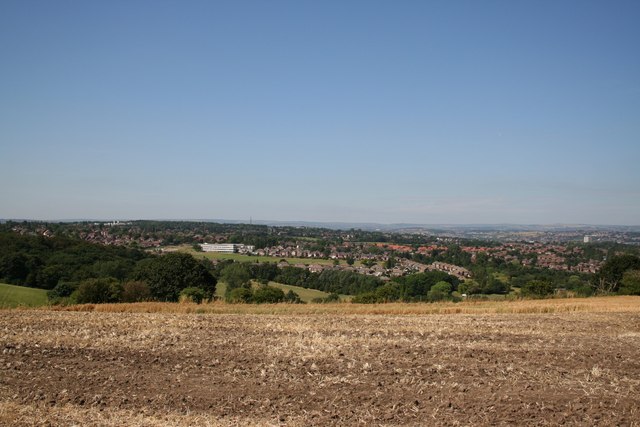
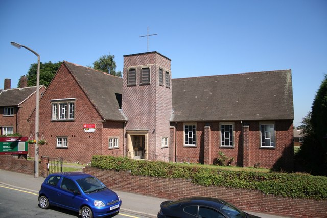
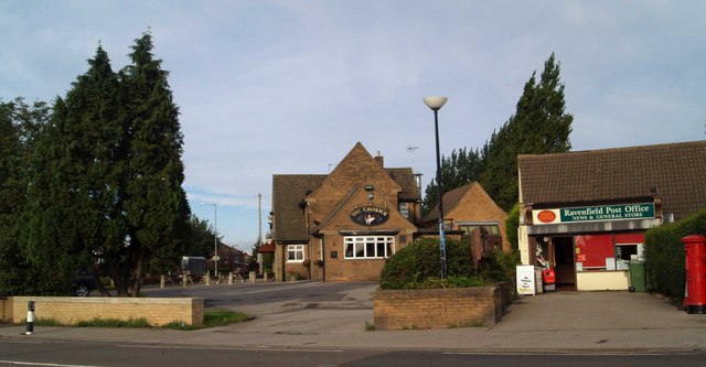
Flanderwell Images

Images are sourced within 2km of 53.42982/-1.2825 or Grid Reference SK4792. Thanks to Geograph Open Source API. All images are credited.

Aeon Court, Main Street, Bramley
Footbridge over A631 Bawtry Road Providing safe access over a busy dual carriageway road to Wickersley School and Sports College
Footbridge over A631 Bawtry Road
Providing safe access over a busy dual carriageway road to Wickersley School and Sports College
Wickersley Park A small suburban park & recreation ground.
Wickersley Park
A small suburban park & recreation ground.
The Masons Arms Judging by the window decorations on entry you should turn left for Halloween and right for Christmas!
The Masons Arms
Judging by the window decorations on entry you should turn left for Halloween and right for Christmas!
St Alban's churchyard Grade II listed parish church dating from the 15th century.
St Alban's churchyard
Grade II listed parish church dating from the 15th century.
Castle House, Bawtry Road Flying a skull & crossbones flag for some reason.
Castle House, Bawtry Road
Flying a skull & crossbones flag for some reason.
Autumnal tree on Moorlands
Autumn colour at Macdonald's Restaurant In a small commercial development adjacent to Junction 1 on the M18.
Autumn colour at Macdonald's Restaurant
In a small commercial development adjacent to Junction 1 on the M18.
Model of a boy on Main Street, Ravenfield Outside the village primary school or "academy". Several primary schools in the Rotherham area have similar model children on adjacent pavements to warn passing drivers to slow down and be more alert. There's a model girl further down the road. She is wearing red.
Model of a boy on Main Street, Ravenfield
Outside the village primary school or "academy". Several primary schools in the Rotherham area have similar model children on adjacent pavements to warn passing drivers to slow down and be more alert. There's a model girl further down the road. She is wearing red.
East Bawtry Road East Bawtry Road passing The Brecks Beefeater
East Bawtry Road
East Bawtry Road passing The Brecks Beefeater
Fields at Dalton Parva Looking East from Dalton Parva, according to the OS map, there's a disused quarry in the bottom and several springs which originate in the area.
Fields at Dalton Parva
Looking East from Dalton Parva, according to the OS map, there's a disused quarry in the bottom and several springs which originate in the area.
St. Alban's church, Wickersley A 15th century Perpendicular tower with a nave of 1834 and chancel of 1886.
St. Alban's church, Wickersley
A 15th century Perpendicular tower with a nave of 1834 and chancel of 1886.
Brecks Crescent Residential suburban Rotherham
Brecks Crescent
Residential suburban Rotherham
View from Brecks Lane Panoramic view of Rotherham from the high point on Brecks Lane
View from Brecks Lane
Panoramic view of Rotherham from the high point on Brecks Lane
Sycamore Avenue All the roads are named after trees in Bramley Park
Sycamore Avenue
All the roads are named after trees in Bramley Park
Spruce Avenue Most unusual to see a suburban street without parked cars
Spruce Avenue
Most unusual to see a suburban street without parked cars
St.Francis' church, Bramley Modern church on Main Street Bramley
St.Francis' church, Bramley
Modern church on Main Street Bramley
Goose Lane, Wickersley By the junction with Lings Lane
Goose Lane, Wickersley
By the junction with Lings Lane
Show me another place!

Flanderwell is located at Grid Ref: SK4792 (Lat: 53.42982, Lng: -1.2825)

Division: West Riding

Unitary Authority: Rotherham

Police Authority: South Yorkshire

What 3 Words

///period.signal.freed. Near Bramley, South Yorkshire

Nearby Locations

Flanderwell

Related Wikis

Wickersley School and Sports College

Wickersley School and Sports College is a coeducational secondary school and sixth form with academy status, located in Wickersley in the Metropolitan...

Wickersley

Wickersley is a village and civil parish in the Metropolitan Borough of Rotherham in South Yorkshire, England, situated 3 miles (5 km) from the centre...

Silverwood Colliery

Silverwood Colliery was a colliery situated between Thrybergh and Ravenfield in Yorkshire, England. Originally called Dalton Main, it was renamed after...

Bramley, Rotherham

Bramley is a village and civil parish of the Metropolitan Borough of Rotherham in South Yorkshire, England. The village is situated approximately 4 miles...

Silverwood Colliery platform

Silverwood Colliery platform, the original, was a wooden railway platform built for John Brown's Private Railway in order to operate Paddy Mail trains...

Brecks

Brecks is a suburb of Rotherham in South Yorkshire, England. It is situated roughly 2 miles from central Rotherham. Brecks borders the suburb Wickersley...

Thrybergh Tins railway station

Thrybergh Tins platform was a short platform built alongside the Great Central and Midland Joint Railway line between Thrybergh Junction, on the Great...

Ravenfield

Ravenfield is a small village and civil parish in South Yorkshire, England. It is located in the Metropolitan Borough of Rotherham, 3.3 miles (5.3 km)...

Nearby Amenities

Located within 500m of 53.42982,-1.2825
Mini Roundabout
Lat/Long: 53.4326831/-1.2830148
Flanderwell
Is In: South Yorkshire, England, UK
Place: suburb
Lat/Long: 53.4295094/-1.2824656
Bus Stop
Fleming Way/Millais Rise
Alt Name: Fleming Way/Millais Rise
Naptan AltCommonName: Fleming Way/Millais Rise
Naptan AtcoCode: 370030149
Naptan Bearing: NE
Naptan CommonName: Fleming Way/Millais Rise
Naptan Indicator: 30149
Naptan Landmark: Opposite House Number 152
Naptan PlusbusZoneRef: ROTHCEN
Naptan Street: Fleming Way
Naptan Verified: no
Source: naptan_import
Lat/Long: 53.4317488/-1.2828865
Bus Stop
Fleming Way/Redgrave Place
Alt Name: Fleming Way/Redgrave Place
Naptan AltCommonName: Fleming Way/Redgrave Place
Naptan AtcoCode: 370030150
Naptan Bearing: SW
Naptan CommonName: Fleming Way/Redgrave Place
Naptan Indicator: 30150
Naptan Landmark: Car Park
Naptan PlusbusZoneRef: ROTHCEN
Naptan Street: Fleming Way
Naptan Verified: no
Source: naptan_import
Lat/Long: 53.4312569/-1.2833012
Bus Stop
Fleming Way/Forrester Close
Naptan AtcoCode: 370030151
Naptan Bearing: S
Naptan CommonName: Fleming Way/Forrester Close
Naptan Indicator: 30151
Naptan Landmark: Opposite Sub Station
Naptan PlusbusZoneRef: ROTHCEN
Naptan Street: Fleming Way
Naptan Verified: no
Source: naptan_import
Lat/Long: 53.43024/-1.2846127
Bus Stop
Fleming Way/Forrester Close
Naptan AtcoCode: 370030152
Naptan Bearing: N
Naptan CommonName: Fleming Way/Forrester Close
Naptan Indicator: 30152
Naptan Landmark: SUB STATION
Naptan PlusbusZoneRef: ROTHCEN
Naptan Street: Fleming Way
Naptan Verified: no
Source: naptan_import
Lat/Long: 53.4303405/-1.2848819
Bus Stop
Fleming Way/Markfield Drive
Alt Name: Fleming Way/Markfield Drive
Naptan AltCommonName: Fleming Way/Markfield Drive
Naptan AtcoCode: 370030153
Naptan Bearing: NE
Naptan CommonName: Fleming Way/Markfield Drive
Naptan Indicator: 30153
Naptan Landmark: Brush & Easel Pub
Naptan PlusbusZoneRef: ROTHCEN
Naptan Street: Fleming Way
Naptan Verified: no
Source: naptan_import
Lat/Long: 53.4282048/-1.2855047
Bus Stop
Fleming Way/Magna Close
Alt Name: Fleming Way/Magna Close
Naptan AltCommonName: Fleming Way/Magna Close
Naptan AtcoCode: 370030154
Naptan Bearing: SW
Naptan CommonName: Fleming Way/Magna Close
Naptan Indicator: 30154
Naptan Landmark: The Brush & Easel Pub
Naptan PlusbusZoneRef: ROTHCEN
Naptan Street: Fleming Way
Naptan Verified: no
Source: naptan_import
Lat/Long: 53.4282571/-1.2852329
Bus Stop
Markfield Drive/Romney Close
Naptan AtcoCode: 370030155
Naptan Bearing: SE
Naptan CommonName: Markfield Drive/Romney Close
Naptan Indicator: 30155
Naptan Landmark: Opposite Disabled Persons Flat
Naptan PlusbusZoneRef: ROTHCEN
Naptan Street: Mark Field Drive
Naptan Verified: no
Source: naptan_import
Lat/Long: 53.4281291/-1.2818788
Bus Stop
Markfield Drive/Gainsborough Close
Alt Name: Markfield Drive/Gainsborough Close
Naptan AltCommonName: Markfield Drive/Gainsborough Close
Naptan AtcoCode: 370030156
Naptan Bearing: NE
Naptan CommonName: Markfield Drive/Gainsborough Close
Naptan Indicator: 30156
Naptan Landmark: 30156
Naptan PlusbusZoneRef: ROTHCEN
Naptan Street: Markfield Drive
Naptan Verified: no
Source: naptan_import
Lat/Long: 53.4259893/-1.2817945
Bus Stop
Markfield Drive/Scholey Road
Alt Name: Markfield Drive/Scholey Road
Naptan AltCommonName: Markfield Drive/Scholey Road
Naptan AtcoCode: 370030157
Naptan Bearing: N
Naptan CommonName: Markfield Drive/Scholey Road
Naptan Indicator: 30157
Naptan Landmark: The Brush & Easel Pub
Naptan PlusbusZoneRef: ROTHCEN
Naptan Street: Markfield Drive
Naptan Verified: no
Source: naptan_import
Lat/Long: 53.4273759/-1.2851725
Bus Stop
Flanderwell Lane/Central Avenue
Alt Name: Flanderwell Lane/Central Avenue
Naptan AltCommonName: Flanderwell Lane/Central Avenue
Naptan AtcoCode: 370030809
Naptan Bearing: N
Naptan CommonName: Flanderwell Lane/Central Avenue
Naptan Indicator: 30809
Naptan Landmark: OPPOSITE SUNNYSIDE W.M.C.
Naptan PlusbusZoneRef: ROTHCEN
Naptan Street: Flanderwell Lane
Naptan Verified: no
Source: naptan_import
Lat/Long: 53.431544/-1.2802258
Bus Stop
Flanderwell Lane/Sorrel Road
Naptan AtcoCode: 370030368
Naptan Bearing: SE
Naptan CommonName: Flanderwell Lane/Sorrel Road
Naptan Indicator: 30368
Naptan Landmark: Row of Shops
Naptan PlusbusZoneRef: ROTHCEN
Naptan Street: Flanderwell Lane
Naptan Verified: no
Source: naptan_import
Lat/Long: 53.430214/-1.2773133
Bus Stop
Markfield Drive/Mark Grove
Naptan AtcoCode: 370035181
Naptan Bearing: N
Naptan CommonName: Markfield Drive/Mark Grove
Naptan Indicator: 35181
Naptan Landmark: Telephone Box
Naptan PlusbusZoneRef: ROTHCEN
Naptan Street: Markfield Drive
Naptan Verified: no
Source: naptan_import
Lat/Long: 53.4269684/-1.2801827
Bus Stop
St Johns Avenue/Belford Close
Alt Name: St Johns Avenue/Belford Close
Naptan AltCommonName: St Johns Avenue/Belford Close
Naptan AtcoCode: 370031160
Naptan Bearing: N
Naptan CommonName: St Johns Avenue/Belford Close
Naptan Indicator: 31160
Naptan Landmark: OUTSIDE NO. 1 BELFORD CLOSE
Naptan PlusbusZoneRef: ROTHCEN
Naptan Street: St Johns Avenue
Naptan Verified: no
Source: naptan_import
Lat/Long: 53.4306573/-1.2762973
Bus Stop
Flanderwell Lane/St Johns Avenue
Alt Name: Flanderwell Lane/St Johns Avenue
Naptan AltCommonName: Flanderwell Lane/St Johns Avenue
Naptan AtcoCode: 370031179
Naptan Bearing: N
Naptan CommonName: Flanderwell Lane/St Johns Avenue
Naptan Indicator: 31179
Naptan Landmark: 31179
Naptan PlusbusZoneRef: ROTHCEN
Naptan Street: Flanderwell Lane
Naptan Verified: no
Source: naptan_import
Lat/Long: 53.4295221/-1.2758651
Bus Stop
Flanderwell Lane/Fleming Way
Alt Name: Flanderwell Lane/Fleming Way
Naptan AltCommonName: Flanderwell Lane/Fleming Way
Naptan AtcoCode: 370031180
Naptan Bearing: N
Naptan CommonName: Flanderwell Lane/Fleming Way
Naptan Indicator: 31180
Naptan Landmark: 31180
Naptan PlusbusZoneRef: ROTHCEN
Naptan Street: Flanderwell Lane
Naptan Verified: no
Source: naptan_import
Lat/Long: 53.4320473/-1.2817074
Bus Stop
Flanderwell Lane/The Crescent West
Alt Name: Flanderwell Lane/The Crescent West
Naptan AltCommonName: Flanderwell Lane/The Crescent West
Naptan AtcoCode: 370031181
Naptan Bearing: N
Naptan CommonName: Flanderwell Lane/The Crescent West
Naptan Indicator: 31181
Naptan Landmark: 31181
Naptan PlusbusZoneRef: ROTHCEN
Naptan Street: Flanderwell Lane
Naptan Verified: no
Source: naptan_import
Lat/Long: 53.4324183/-1.2821076
Bus Stop
Markfield Drive/Mark Grove
Alt Name: Markfield Drive/Mark Grove
Naptan AltCommonName: Markfield Drive/Mark Grove
Naptan AtcoCode: 370031183
Naptan Bearing: SW
Naptan CommonName: Markfield Drive/Mark Grove
Naptan Indicator: 31183
Naptan Landmark: 31183
Naptan PlusbusZoneRef: ROTHCEN
Naptan Street: Markfield Drive
Naptan Verified: no
Source: naptan_import
Lat/Long: 53.4260627/-1.2805592
Bus Stop
Markfield Drive/Fleming Way
Alt Name: Markfield Drive/Fleming Way
Naptan AltCommonName: Markfield Drive/Fleming Way
Naptan AtcoCode: 370031239
Naptan Bearing: N
Naptan CommonName: Markfield Drive/Fleming Way
Naptan Indicator: 31239
Naptan Landmark: 31239
Naptan PlusbusZoneRef: ROTHCEN
Naptan Street: Markfield Drive
Naptan Verified: no
Source: naptan_import
Lat/Long: 53.4270696/-1.2850722
Markfield Drive/Fleming Way
Naptan AtcoCode: 370035637
Naptan Bearing: N
Naptan BusStopType: CUS
Naptan CommonName: Markfield Drive/Fleming Way
Naptan Indicator: 35637
Naptan Landmark: Blenham Court Flats
Naptan PlusbusZoneRef: ROTHCEN
Naptan Street: Markfield Drive
Naptan Verified: no
Source: naptan_import
Lat/Long: 53.4287009/-1.2842773
Bus Stop
Markfield Drive/Reynolds Close
Alt Name: Markfield Drive/Reynolds Close
Naptan AltCommonName: Markfield Drive/Reynolds Close
Naptan AtcoCode: 370035327
Naptan Bearing: NW
Naptan CommonName: Markfield Drive/Reynolds Close
Naptan Indicator: 35327
Naptan Landmark: Front of Disabled Flats
Naptan PlusbusZoneRef: ROTHCEN
Naptan Street: Mark Field Drive
Naptan Verified: no
Source: naptan_import
Lat/Long: 53.4278949/-1.2817925
Bus Stop
Markfield Drive/Fleming Way
Naptan AtcoCode: 370035329
Naptan Bearing: N
Naptan CommonName: Markfield Drive/Fleming Way
Naptan Indicator: 35329
Naptan Landmark: Blenham Court Flats
Naptan PlusbusZoneRef: ROTHCEN
Naptan Street: Markfield Drive
Naptan Verified: no
Source: naptan_import
Lat/Long: 53.4285844/-1.2843395
Bus Stop
Flanderwell Lane/Sorrel Road
Naptan AtcoCode: 370035380
Naptan Bearing: NW
Naptan CommonName: Flanderwell Lane/Sorrel Road
Naptan Indicator: 35380
Naptan Landmark: Opposite Line of Shops
Naptan PlusbusZoneRef: ROTHCEN
Naptan Street: Flanderwell Lane
Naptan Verified: no
Source: naptan_import
Lat/Long: 53.430408/-1.278183
Bus Stop
Fleming Way/Riding Close
Alt Name: Fleming Way/Riding Close
Naptan AltCommonName: Fleming Way/Riding Close
Naptan AtcoCode: 370035501
Naptan Bearing: N
Naptan CommonName: Fleming Way/Riding Close
Naptan Indicator: 35501
Naptan Landmark: Footpath to Riding Close
Naptan PlusbusZoneRef: ROTHCEN
Naptan Street: Fleming Way
Naptan Verified: no
Source: naptan_import
Lat/Long: 53.4270544/-1.2870441
Bus Stop
St Johns Avenue/Flanderwell Court
Naptan AtcoCode: 370035849
Naptan Bearing: N
Naptan CommonName: St Johns Avenue/Flanderwell Court
Naptan Indicator: 35849
Naptan Landmark: 35849
Naptan PlusbusZoneRef: ROTHCEN
Naptan Street: St Johns Avenue
Naptan Verified: no
Source: naptan_import
Lat/Long: 53.4304298/-1.2758346
Barrier: bollard
Bicycle: no
Foot: yes
Noexit: yes
Lat/Long: 53.4264417/-1.2837593
Sainsbury's Local
Atm: yes
Brand: Sainsbury's Local
Brand Wikidata: Q13218434
Opening Hours: Mo-Su 06:30-23:00
Shop: convenience
Website: https://stores.sainsburys.co.uk/4791/sunnyside-local
Lat/Long: 53.430481/-1.277713
Atm
Lat/Long: 53.4282952/-1.28504
Pub
The Brush and Easel
Lat/Long: 53.4280506/-1.2851959
Rock n Rollers
Phone: +44 1709 549326
Shop: hairdresser
Lat/Long: 53.430347/-1.278218
Post Box
Collection Times: Mo-Fr 09:00; Sa 07:00
Post Box Type: pillar
Ref: S66 204D
Royal Cypher: GR
Royal Cypher Wikidata: Q33102273
Source: Bing
Lat/Long: 53.43017/-1.277268
Shop: beauty
Source: Bing
Lat/Long: 53.430475/-1.2784901
Fast Food
Chip Inn
Lat/Long: 53.4281989/-1.2850996
Fast Food
Paris Pizzaria
Cuisine: pizza
Lat/Long: 53.430357/-1.278303
G's Motor Spares
Shop: car_parts
Lat/Long: 53.4303125/-1.2773112
Fast Food
Golden Bowl
Cuisine: chinese
Delivery: yes
Takeaway: yes
Lat/Long: 53.430509/-1.277808
Power: pole
Lat/Long: 53.4298862/-1.2891696
Defibrillator
Access: yes
Check Date: 2023-03-09
Defibrillator Location: On outside wall. Available 24/7.
Emergency: defibrillator
Indoor: no
Opening Hours: 24/7
Lat/Long: 53.4281077/-1.28526
Fast Food
King Cod
Cuisine: fish_and_chips
Lat/Long: 53.4304048/-1.2774961
Pharmacy
Silverwood Pharmacy
Dispensing: yes
Healthcare: pharmacy
Lat/Long: 53.4303721/-1.277405
Defibrillator
Access: yes
Check Date: 2023-03-09
Defibrillator Location: On outside wall. Available 24/7.
Emergency: defibrillator
Indoor: no
Opening Hours: 24/7
Lat/Long: 53.4303058/-1.2773943
Flanderwell Park
Leisure: park
Lat/Long: 53.4277939/-1.2844248
Generator Method: photovoltaic
Generator Output Electricity: yes
Generator Source: solar
Generator Type: solar_photovoltaic_panel
Location: roof
Power: generator
Lat/Long: 53.4305898/-1.2755755
Generator Method: photovoltaic
Generator Output Electricity: yes
Generator Source: solar
Generator Type: solar_photovoltaic_panel
Location: roof
Power: generator
Lat/Long: 53.4301951/-1.275672
Generator Method: photovoltaic
Generator Output Electricity: yes
Generator Source: solar
Generator Type: solar_photovoltaic_panel
Location: roof
Power: generator
Lat/Long: 53.4305019/-1.2761655
Generator Method: photovoltaic
Generator Output Electricity: yes
Generator Source: solar
Generator Type: solar_photovoltaic_panel
Location: roof
Power: generator
Lat/Long: 53.4315534/-1.2760046
Man Made: mast
Tower Type: communication
Lat/Long: 53.4305692/-1.2874664
Post Box
Collection Times: Mo-Fr 09:00; Sa 07:00
Post Box Type: pillar
Ref: S66 244
Royal Cypher: GR
Royal Cypher Wikidata: Q33102273
Lat/Long: 53.4287311/-1.2847717
Defibrillator
Access: private
Defibrillator Location: On the outside wall, but inside a locked fenced compound.
Emergency: defibrillator
Indoor: no
Lat/Long: 53.4296601/-1.2865706
The data included in this document is from www.openstreetmap.org. The data is made available under ODbL.

Have you been to Flanderwell?

Leave your review of Flanderwell below (or comments, questions and feedback).