Abbey Wood

Wood, Forest in Kent Maidstone

England

Abbey Wood

A274 crossroads with Warmlake Road At this point the 'A' road is also called North Street.
A274 crossroads with Warmlake Road Credit: Stuart Logan

Abbey Wood is a suburban area located in the London Borough of Bexley, in the county of Kent, England. It is situated approximately 11 miles east of Charing Cross, the central point of London. Historically, Abbey Wood was a densely wooded area, known for its abundance of trees and forests, hence the name "Wood" in its title.

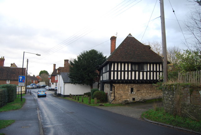
The area is primarily residential, with a mix of housing options ranging from Victorian and Edwardian terraces to modern apartment complexes. It has a diverse population and is known for its close-knit community atmosphere. Abbey Wood offers a range of amenities, including local shops, supermarkets, cafes, and restaurants, providing residents with convenient access to everyday essentials.

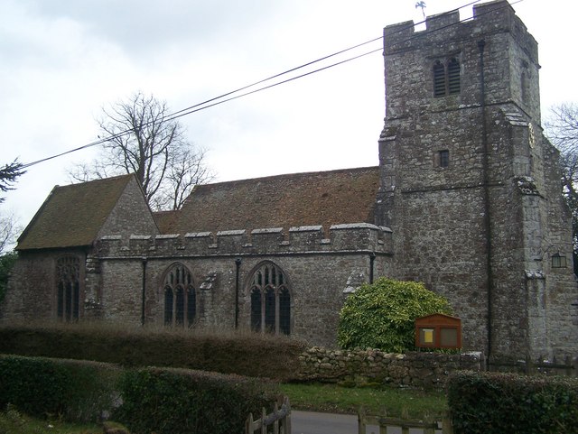
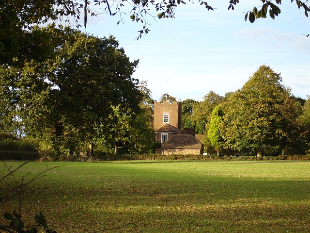
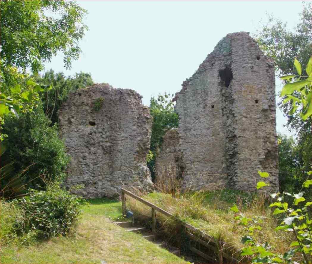
One of the notable landmarks in Abbey Wood is the Lesnes Abbey Woods, a nature reserve that covers approximately 88 hectares of ancient woodland. This beautiful green space offers opportunities for leisurely walks, picnics, and wildlife spotting. It is also home to the ruins of Lesnes Abbey, a former medieval monastery, which adds historical significance to the area.

Transportation in Abbey Wood is well-served by the Abbey Wood railway station, which provides regular train services to central London, making it a popular choice for commuters. Additionally, the forthcoming Crossrail service will further enhance the connectivity of Abbey Wood, providing faster and more convenient access to other parts of London.

Overall, Abbey Wood offers a peaceful suburban lifestyle with a touch of natural beauty. Its proximity to London and excellent transport links make it an attractive location for those seeking a balance between urban convenience and a tranquil environment.

If you have any feedback on the listing, please let us know in the comments section below.

Abbey Wood Images

Images are sourced within 2km of 51.229534/0.6008914 or Grid Reference TQ8151. Thanks to Geograph Open Source API. All images are credited.

A274 crossroads with Warmlake Road At this point the 'A' road is also called North Street.
A274 crossroads with Warmlake Road
At this point the 'A' road is also called North Street.
A274 north of Five Wents
Crown & Horseshoes This pub is on the corner of the junction between the A274, Sutton Road, and Horseshoes Lane.
Crown & Horseshoes
This pub is on the corner of the junction between the A274, Sutton Road, and Horseshoes Lane.
Sheep near Kingswood A public footpath runs along the hedgerow on the left.
Sheep near Kingswood
A public footpath runs along the hedgerow on the left.
Broomfield Road Looking towards Kingswood.
Broomfield Road
Looking towards Kingswood.
Broomfield Road With Scrub Wood in the background.
Broomfield Road
With Scrub Wood in the background.
Scrub Wood Scrub Wood, with Park Barn Road in the foreground.
Scrub Wood
Scrub Wood, with Park Barn Road in the foreground.
Park Barn Farm Late 18th/early 19th century grade II listed farmhouse - see <span class="nowrap"><a title="www.historicengland.org.uk/listing/the-list/list-entry/1060934" rel="nofollow ugc noopener" href="http://www.historicengland.org.uk/listing/the-list/list-entry/1060934">Link</a><img style="margin-left:2px;" alt="External link" title="External link - shift click to open in new window" src="https://s1.geograph.org.uk/img/external.png" width="10" height="10"/></span>.
Park Barn Farm
Late 18th/early 19th century grade II listed farmhouse - see LinkExternal link.
Park Barn Farm An outbuilding on Park Barn Farm.  Beyond is the farmhouse - see <a href="https://www.geograph.org.uk/photo/3013853">TQ8352 : Park Barn Farm</a>.
Park Barn Farm
An outbuilding on Park Barn Farm. Beyond is the farmhouse - see TQ8352 : Park Barn Farm.
Junction of Park Barn Road with Burberry Lane Park Barn Road is on the right.  In the distance are the North Downs.
Junction of Park Barn Road with Burberry Lane
Park Barn Road is on the right. In the distance are the North Downs.
Field off Burberry Lane An oilseed rape crop in seed.
Field off Burberry Lane
An oilseed rape crop in seed.
Burberry Lane A sharp bend on Burberry Lane.
Burberry Lane
A sharp bend on Burberry Lane.
A274 at Langley The lorry is partly parked in the Pear Tree Row bus stop pull-in.
A274 at Langley
The lorry is partly parked in the Pear Tree Row bus stop pull-in.
Plough Wents Road by Fir Tree Farm The B2163 passes the inevitable converted oast house.
Plough Wents Road by Fir Tree Farm
The B2163 passes the inevitable converted oast house.
Langley Heath, Skinner's Way bus stop Skinner's Way is the turning on the right just past the near hedge.
Langley Heath, Skinner's Way bus stop
Skinner's Way is the turning on the right just past the near hedge.
Horseshoes Lane leaves Langley Heath The 40 signs have 30 on their reverse.
Horseshoes Lane leaves Langley Heath
The 40 signs have 30 on their reverse.
Footpath off Church Rd
Church Rd
Church Rd
Show me another place!

Abbey Wood is located at Grid Ref: TQ8151 (Lat: 51.229534, Lng: 0.6008914)

Administrative County: Kent

District: Maidstone

Police Authority: Kent

What 3 Words

///clouds.munch.slope. Near Harrietsham, Kent

Nearby Locations

Langley Heath Abbey Wood

Related Wikis

Nearby Amenities

Located within 500m of 51.229534,0.6008914
Generator Method: photovoltaic
Generator Output Electricity: yes
Generator Source: solar
Generator Type: solar_photovoltaic_panel
Location: roof
Power: generator
Lat/Long: 51.2333166/0.5972461
The data included in this document is from www.openstreetmap.org. The data is made available under ODbL.

Have you been to Abbey Wood?

Leave your review of Abbey Wood below (or comments, questions and feedback).