The Wilderness

Wood, Forest in Essex Maldon

England

The Wilderness

Stream in Woodham Walter Common The Essex Wildlife Trust manages a block of nearly 250 acres of nature reserves on Danbury Ridge.

There are a range of habitats including woodland, heathland, marsh, pools, streams and bogs.

The reserves comprise: Scrubs Wood SSSI, Little Baddow Heath (mostly SSSI), Poors Piece SSSI, Pheasanthouse Wood SSSI, Birch Wood  SSSI and Woodham Walter Common SSSI.

A signposted nature trail starts at Runsell Lane, Danbury, see: <a href="https://www.geograph.org.uk/photo/2443548">TL7806 : Nature Trail Map</a>

External links:
<span class="nowrap"><a title="https://www.essexwt.org.uk/nature-reserves/danbury-ridge" rel="nofollow ugc noopener" href="https://www.essexwt.org.uk/nature-reserves/danbury-ridge">Link</a><img style="margin-left:2px;" alt="External link" title="External link - shift click to open in new window" src="https://s1.geograph.org.uk/img/external.png" width="10" height="10"/></span>
<span class="nowrap"><a title="http://www.wildessex.net/sites/Danbury%20Ridge.htm" rel="nofollow ugc noopener" href="http://www.wildessex.net/sites/Danbury%20Ridge.htm">Link</a><img style="margin-left:2px;" alt="External link" title="External link - shift click to open in new window" src="https://s1.geograph.org.uk/img/external.png" width="10" height="10"/></span>
Stream in Woodham Walter Common Credit: Roger Jones

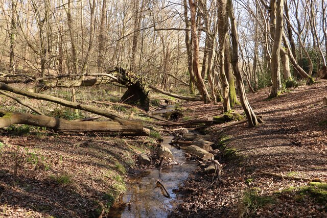
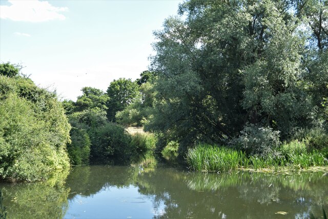
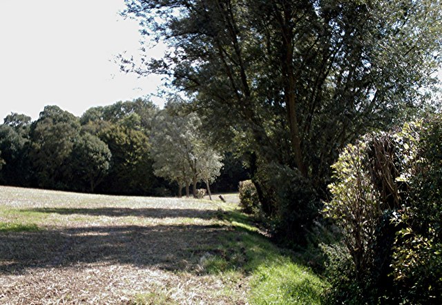
The Wilderness is a large expanse of woodland located in Essex, England. It spans an area of approximately 1,000 acres, making it one of the largest forests in the region. The forest is known for its diverse range of native trees, including oak, beech, and birch, which create a rich and vibrant ecosystem.

The Wilderness is a popular destination for nature enthusiasts and outdoor enthusiasts alike. It offers a variety of walking trails and pathways, allowing visitors to explore the forest at their own pace. These trails provide opportunities to observe the local wildlife, such as deer, foxes, and various bird species.

The forest is also home to several picturesque ponds and streams, which add to the natural beauty of the area. These water bodies attract a wide array of aquatic life and provide a tranquil setting for visitors to relax and enjoy the peaceful surroundings.

In addition to its natural beauty, The Wilderness has a rich cultural history. It has been a significant site for centuries, with evidence of human activity dating back to the Iron Age. The forest has also been subject to various management practices over the years, including timber harvesting and conservation efforts.

Overall, The Wilderness offers a unique and diverse experience for visitors. Its vast woodland, diverse wildlife, and cultural history make it an ideal destination for those seeking to connect with nature and explore the beauty of Essex's countryside.

If you have any feedback on the listing, please let us know in the comments section below.

The Wilderness Images

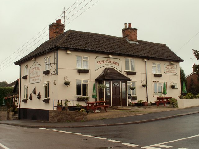
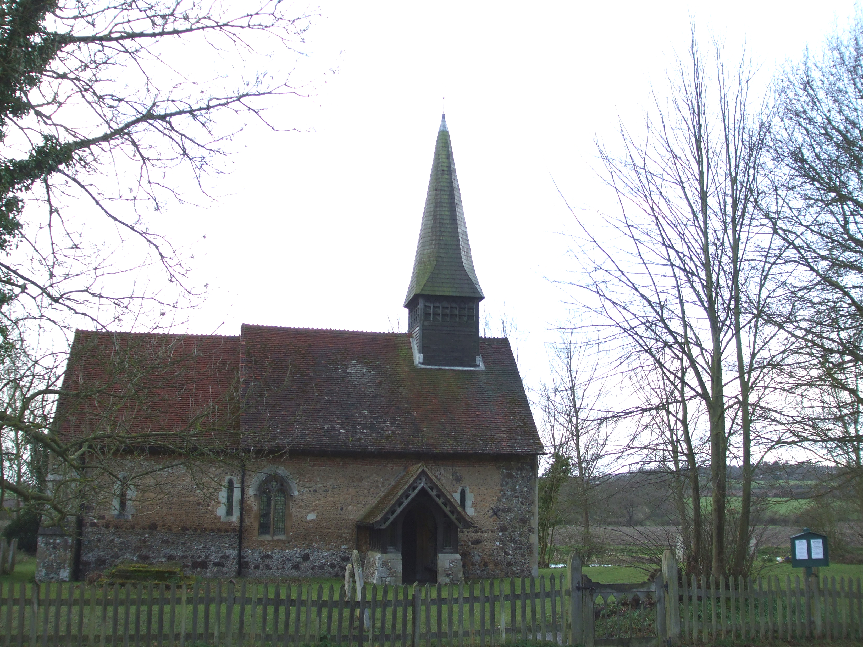
Images are sourced within 2km of 51.731208/0.62337315 or Grid Reference TL8106. Thanks to Geograph Open Source API. All images are credited.

Stream in Woodham Walter Common The Essex Wildlife Trust manages a block of nearly 250 acres of nature reserves on Danbury Ridge.

There are a range of habitats including woodland, heathland, marsh, pools, streams and bogs.

The reserves comprise: Scrubs Wood SSSI, Little Baddow Heath (mostly SSSI), Poors Piece SSSI, Pheasanthouse Wood SSSI, Birch Wood  SSSI and Woodham Walter Common SSSI.

A signposted nature trail starts at Runsell Lane, Danbury, see: <a href="https://www.geograph.org.uk/photo/2443548">TL7806 : Nature Trail Map</a>

External links:
<span class="nowrap"><a title="https://www.essexwt.org.uk/nature-reserves/danbury-ridge" rel="nofollow ugc noopener" href="https://www.essexwt.org.uk/nature-reserves/danbury-ridge">Link</a><img style="margin-left:2px;" alt="External link" title="External link - shift click to open in new window" src="https://s1.geograph.org.uk/img/external.png" width="10" height="10"/></span>
<span class="nowrap"><a title="http://www.wildessex.net/sites/Danbury%20Ridge.htm" rel="nofollow ugc noopener" href="http://www.wildessex.net/sites/Danbury%20Ridge.htm">Link</a><img style="margin-left:2px;" alt="External link" title="External link - shift click to open in new window" src="https://s1.geograph.org.uk/img/external.png" width="10" height="10"/></span>
Stream in Woodham Walter Common
The Essex Wildlife Trust manages a block of nearly 250 acres of nature reserves on Danbury Ridge. There are a range of habitats including woodland, heathland, marsh, pools, streams and bogs. The reserves comprise: Scrubs Wood SSSI, Little Baddow Heath (mostly SSSI), Poors Piece SSSI, Pheasanthouse Wood SSSI, Birch Wood SSSI and Woodham Walter Common SSSI. A signposted nature trail starts at Runsell Lane, Danbury, see: TL7806 : Nature Trail Map External links: LinkExternal link LinkExternal link
The River Chelmer The river proper re-joins the Chelmer and Blackwater Navigation below Hoe Mill Lock having passed a weir and sluice a little further upstream
The River Chelmer
The river proper re-joins the Chelmer and Blackwater Navigation below Hoe Mill Lock having passed a weir and sluice a little further upstream
Parish church and signpost at Woodham Walter A pleasant view marred by the tangle of overhead cables.  The signpost was a product of Maldon Iron Works and dates back to the 1920s.
Parish church and signpost at Woodham Walter
A pleasant view marred by the tangle of overhead cables. The signpost was a product of Maldon Iron Works and dates back to the 1920s.
Bell Inn, Woodham Walter, Essex This inn dates from the late 16th to early 17th century.
Bell Inn, Woodham Walter, Essex
This inn dates from the late 16th to early 17th century.
Blue plaque, Woodham Mortimer Hall At the Gates Of the Hall.
Blue plaque, Woodham Mortimer Hall
At the Gates Of the Hall.
Thrift Wood, Woodham Mortimer View south-east along the small brook that forms the field boundary.
Thrift Wood, Woodham Mortimer
View south-east along the small brook that forms the field boundary.
The Queen Victoria, Woodham Walter One of three pubs in Woodham Walter.
The Queen Victoria, Woodham Walter
One of three pubs in Woodham Walter.
The Cats, Woodham Walter Rather unusual pub hidden away to the north of the village.
The Cats, Woodham Walter
Rather unusual pub hidden away to the north of the village.
Curling Tye Green Three very minor roads converge at this very minor green.
Curling Tye Green
Three very minor roads converge at this very minor green.
Bog Wood, Maldon View north-west along wood edge.
Bog Wood, Maldon
View north-west along wood edge.
Beeleigh Lodge, Maldon Large house on London Road neighbouring Brook Farm.
Beeleigh Lodge, Maldon
Large house on London Road neighbouring Brook Farm.
The Gates of Woodham Mortimer Place Try as I might, I couldn't get a decent shot of the house from anywhere on the perimeter roads. The house looks very photogenic but is superbly screened by vegetation.
The Gates of Woodham Mortimer Place
Try as I might, I couldn't get a decent shot of the house from anywhere on the perimeter roads. The house looks very photogenic but is superbly screened by vegetation.
Farmland opposite Hoe Mill Barns
'The Queen Victoria' public house at Woodham Walter, Essex
Lane leading to Lodge Farm
Chelmer & Blackwater Navigation This is the Chelmer & Blackwater Navigation as seen from the Bridge near Hoe Mill Lock, looking downstream. The natural course is to the right the lock stands on a canalised cut. For info on the Chelmer see <span class="nowrap"><a title="http://www.chelmercanaltrust.co.uk/cct.htm" rel="nofollow ugc noopener" href="http://www.chelmercanaltrust.co.uk/cct.htm">Link</a><img style="margin-left:2px;" alt="External link" title="External link - shift click to open in new window" src="https://s1.geograph.org.uk/img/external.png" width="10" height="10"/></span>
Chelmer & Blackwater Navigation
This is the Chelmer & Blackwater Navigation as seen from the Bridge near Hoe Mill Lock, looking downstream. The natural course is to the right the lock stands on a canalised cut. For info on the Chelmer see LinkExternal link
Ulting WQMS The building in this picture is Ulting Water Quality Measurement Station on the River Chelmer. It used to simply be a gauging station but its upgrading seems to have got the Environment Agency <a href="https://www.geograph.org.uk/photo/291819">TL8108 : Confused?</a>.
Ulting WQMS
The building in this picture is Ulting Water Quality Measurement Station on the River Chelmer. It used to simply be a gauging station but its upgrading seems to have got the Environment Agency TL8108 : Confused?.
Confused? The G.R on the old gauging station sign is good enough even if it indicates a location about 250m downstream. The new <a href="https://www.geograph.org.uk/photo/291801">TL8108 : Ulting WQMS</a> sign however shows a location the best part of a km west in the middle of a fishing lake in Ulting, at least the northing is correct. The GPS reading is inset (ignore the direction indicator it only works when moving)
Confused?
The G.R on the old gauging station sign is good enough even if it indicates a location about 250m downstream. The new TL8108 : Ulting WQMS sign however shows a location the best part of a km west in the middle of a fishing lake in Ulting, at least the northing is correct. The GPS reading is inset (ignore the direction indicator it only works when moving)
Show me another place!

The Wilderness is located at Grid Ref: TL8106 (Lat: 51.731208, Lng: 0.62337315)

Administrative County: Essex

District: Maldon

Police Authority: Essex

What 3 Words

///enrolling.palace.goodbyes. Near Danbury, Essex

Nearby Locations

The Wilderness

Related Wikis

Woodham Walter

Woodham Walter is a village about three miles west of Maldon in the English county of Essex. The village is part of the Wickham Bishops and Woodham ward...

Ulting Wick

Ulting Wick is a 11-acre (4.5 ha) garden, situated at Ulting near Maldon in Essex. It is centred around three listed black Essex barns and a 16th-century...

Ulting

Ulting is a small village and civil parish in the Maldon district, in the county of Essex, England. It shares its borders with Langford and Nounsley. It...

Danbury Ridge Nature Reserves

Danbury Ridge Nature Reserves are a group of nature reserves totalling 101 hectares near Danbury in Essex, England. They are managed by the Essex Wildlife...

Nearby Amenities

Located within 500m of 51.731208,0.62337315
Church Corner
Lat/Long: 51.7295376/0.61761
The Bell
Naptan AtcoCode: 1500IM1020
Naptan Bearing: E
Naptan BusStopType: CUS
Naptan CommonName: The Bell
Naptan Indicator: o/s
Naptan Landmark: The Bell
Naptan NaptanCode: esxadjam
Naptan Street: The Street
Naptan Verified: no
Public Transport: platform
Source: naptan_import
Lat/Long: 51.7311351/0.6170661
The Bell
Naptan AtcoCode: 1500IM1020AA
Naptan Bearing: W
Naptan BusStopType: CUS
Naptan CommonName: The Bell
Naptan Indicator: Opp
Naptan Landmark: The Bell
Naptan NaptanCode: esxgtpaj
Naptan Street: The Street
Naptan Verified: no
Public Transport: platform
Source: naptan_import
Lat/Long: 51.7310831/0.6169762
Defibrillator
Booth: K6
Covered: booth
Defibrillator Location: Within an old red phone box opposite Queen Victoria pub
Emergency: defibrillator
Indoor: no
Man Made: telephone_box
Operator: Village committee
Operator Type: community
Lat/Long: 51.732899/0.6182863
Post Box
Post Box Type: lamp
Lat/Long: 51.7328647/0.6182892
Woodham Walter
Place: village
Lat/Long: 51.7341483/0.6191023
Post Box
Lat/Long: 51.7299132/0.6175968
Barrier: kissing_gate
Lat/Long: 51.7302041/0.6187066
The data included in this document is from www.openstreetmap.org. The data is made available under ODbL.

Have you been to The Wilderness?

Leave your review of The Wilderness below (or comments, questions and feedback).