Pump-hewl

Settlement in Carmarthenshire

Wales

Pump-hewl

Swiss Valley Cycle route near Horeb Looking southbound along the former railway line.
Swiss Valley Cycle route near Horeb Credit: Gareth James

Pump-hewl, Carmarthenshire is a picturesque village located in the southwest of Wales, UK. Situated in the rolling countryside, it is surrounded by lush green fields and is known for its natural beauty. The village is part of the larger community of Llanddarog and is located about 8 miles northwest of the county town of Carmarthen.

Pump-hewl boasts a rich history, with evidence of human settlement dating back to the Iron Age. The area is dotted with several ancient monuments and burial sites, providing a glimpse into the village's past. The village itself is quaint and charming, with traditional Welsh stone cottages lining its narrow streets.

Despite its small size, Pump-hewl offers a range of amenities to its residents and visitors. The village has a local pub, providing a welcoming atmosphere for socializing and dining. Additionally, there are a few small businesses, including a convenience store and a post office, catering to the needs of the community.

The surrounding countryside offers ample opportunities for outdoor activities, such as hiking, cycling, and birdwatching. The nearby River Towy is a popular spot for fishing enthusiasts, attracting anglers from far and wide.

Pump-hewl is also within close proximity to several attractions in Carmarthenshire. The historic town of Carmarthen, with its shops, restaurants, and castle, is just a short drive away. The Brecon Beacons National Park, renowned for its stunning landscapes and hiking trails, is also within easy reach.

In summary, Pump-hewl, Carmarthenshire is a charming village in rural Wales, offering a peaceful and scenic retreat for residents and visitors alike.

If you have any feedback on the listing, please let us know in the comments section below.
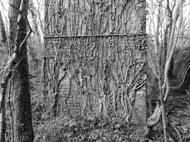
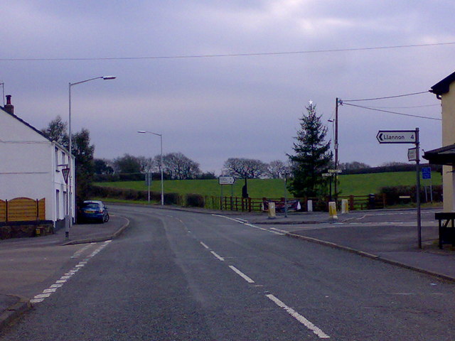
Pump-hewl Images

Images are sourced within 2km of 51.726666/-4.189948 or Grid Reference SN4805. Thanks to Geograph Open Source API. All images are credited.

Swiss Valley Cycle route near Horeb Looking southbound along the former railway line.
Swiss Valley Cycle route near Horeb
Looking southbound along the former railway line.
Remains of a building near Horeb
Horeb Brickworks' chimney glimpsed through the trees
Southern entrance to the Hoffman kiln at Horeb Brickworks
Inside the Hoffman kiln at Horeb Brickworks
The ivy-covered base of Horeb Brickworks' chimney
Horeb Brickworks' chimney
A western-side entrance to the Hoffman kiln at Horeb Brickworks
Northern-side base of Horeb Brickworks' Chimney
Derelict building at Horeb Brickworks This wall was once part of a likely boiler or engine house at the site.
Derelict building at Horeb Brickworks
This wall was once part of a likely boiler or engine house at the site.
Horeb Brickworks' chimney The Hoffman kiln is on the left.
Horeb Brickworks' chimney
The Hoffman kiln is on the left.
Horeb Brickworks' kiln wall and chimney
Horeb Brickworks: siding and loading bank Looking towards the location of the sidings that served Horeb Brickworks and the wall of the loading bank beyond.
Horeb Brickworks: siding and loading bank
Looking towards the location of the sidings that served Horeb Brickworks and the wall of the loading bank beyond.
Swiss Valley Cycle route south of Horeb
Former railway equipment box beside the Swiss Valley Cycle Trail
Farm crossing on the Swiss Valley Cycle Trail
Cycle track through woodland The old railway from Cross Hands to Llanelli - now cycle track 47, more than 12 miles long.
Cycle track through woodland
The old railway from Cross Hands to Llanelli - now cycle track 47, more than 12 miles long.
Cycle track 47 Alongside Afon Lliedi. See also <a href="https://www.geograph.org.uk/photo/7584684">SN5005 : Cycle track through woodland</a>.
Cycle track 47
Alongside Afon Lliedi. See also SN5005 : Cycle track through woodland.
Show me another place!

Pump-hewl is located at Grid Ref: SN4805 (Lat: 51.726666, Lng: -4.189948)

Unitary Authority: Carmarthenshire

Police Authority: Dyfed Powys

Also known as: Five Roads

What 3 Words

///delay.tycoons.commander. Near Pontyates, Carmarthenshire

Related Wikis

Five Roads

Five Roads (Welsh: Pum Heol) is a village on the B4309 road in Carmarthenshire, Wales, 5 miles (8.0 km) from Llanelli and 10 miles (16 km) from Carmarthen...

Horeb, Carmarthenshire

Horeb is a hamlet in Carmarthenshire, Wales, near the town of Llanelli. It is situated east of the village of Five Roads (Welsh: Pum Heol) about five miles...

River Lliedi

The River Lliedi (Welsh: Afon Lliedi) has its source near Mynydd Sylen Llanelli and Llannon in Carmarthenshire, Wales. The river fills the Cwm-Lliedi Reservoirs...

Llanelli and Mynydd Mawr Railway

This article describes the current heritage railway. For the historical railway see Llanelly and Mynydd Mawr Railway.The Llanelli and Mynydd Mawr Railway...

Llanelli (UK Parliament constituency)

Llanelli is a constituency of the House of Commons of the Parliament of the United Kingdom. From 1918 to 1970 the official spelling of the constituency...

Llanelli (Senedd constituency)

Llanelli is a constituency of the Senedd. It elects one Member of the Senedd by the first past the post method of election. Also, however, it is one of...

Carway

Carway (Welsh: Carwe) is a village situated to the north-west of the town of Llanelli in the county of Carmarthenshire, Wales, in the Gwendraeth Valley...

Cynheidre Colliery

Cynheidre Colliery was a coal mine located in the Gwendraeth valley, in Carmarthenshire, South Wales. Opened in 1954, it closed in 1989. Cynheidre was...

Nearby Amenities

Located within 500m of 51.726666,-4.189948
Pum Heol / Five Roads
Name Cy: Pum Heol
Name En: Five Roads
Place: village
Wikidata: Q5456119
Wikipedia: en:Five Roads
Lat/Long: 51.7272261/-4.1883849
Turning Circle
Lat/Long: 51.7286812/-4.1905466
Turning Circle
Lat/Long: 51.7275787/-4.1877992
Power: pole
Lat/Long: 51.7269418/-4.1935104
Power: pole
Lat/Long: 51.7260679/-4.1928238
Power: pole
Lat/Long: 51.7243167/-4.1915041
Power: pole
Lat/Long: 51.7275232/-4.1939691
Power: pole
Lat/Long: 51.728241/-4.1946209
Power: pole
Lat/Long: 51.7290384/-4.1953719
Natural: spring
Lat/Long: 51.7261114/-4.1967045
Direction: WSW
Generator Method: photovoltaic
Generator Output Electricity: yes
Generator Solar Modules: 4
Generator Source: solar
Generator Type: solar_photovoltaic_panel
Location: roof
Power: generator
Lat/Long: 51.7276898/-4.1867519
Direction: SW
Generator Method: photovoltaic
Generator Output Electricity: yes
Generator Solar Modules: 1
Generator Source: solar
Generator Type: solar_photovoltaic_panel
Location: roof
Power: generator
Lat/Long: 51.7287813/-4.192524
Direction: 165
Generator Method: photovoltaic
Generator Output Electricity: yes
Generator Solar Modules: 14
Generator Source: solar
Generator Type: solar_photovoltaic_panel
Location: roof
Power: generator
Lat/Long: 51.7282767/-4.1882265
Direction: SSE
Generator Method: photovoltaic
Generator Output Electricity: yes
Generator Solar Modules: 22
Generator Source: solar
Generator Type: solar_photovoltaic_panel
Location: roof
Power: generator
Lat/Long: 51.727711/-4.1865367
Direction: 170
Generator Method: photovoltaic
Generator Output Electricity: yes
Generator Solar Modules: 3
Generator Source: solar
Generator Type: solar_photovoltaic_panel
Location: roof
Power: generator
Lat/Long: 51.726386/-4.1877363
Direction: 260
Generator Method: photovoltaic
Generator Output Electricity: yes
Generator Solar Modules: 11
Generator Source: solar
Generator Type: solar_photovoltaic_panel
Location: roof
Power: generator
Lat/Long: 51.7263582/-4.187682
Direction: SW
Generator Method: photovoltaic
Generator Output Electricity: yes
Generator Solar Modules: 12
Generator Source: solar
Generator Type: solar_photovoltaic_panel
Location: roof
Power: generator
Lat/Long: 51.7267341/-4.189528
Direction: SW
Generator Method: photovoltaic
Generator Output Electricity: yes
Generator Solar Modules: 18
Generator Source: solar
Generator Type: solar_photovoltaic_panel
Location: roof
Power: generator
Lat/Long: 51.7267482/-4.1895065
Direction: SW
Generator Method: photovoltaic
Generator Output Electricity: yes
Generator Solar Modules: 16
Generator Source: solar
Generator Type: solar_photovoltaic_panel
Location: roof
Power: generator
Lat/Long: 51.7265663/-4.1891465
Direction: 145
Generator Method: photovoltaic
Generator Output Electricity: yes
Generator Solar Modules: 8
Generator Source: solar
Generator Type: solar_photovoltaic_panel
Location: roof
Power: generator
Lat/Long: 51.7294928/-4.1913962
Direction: 145
Generator Method: photovoltaic
Generator Output Electricity: yes
Generator Solar Modules: 8
Generator Source: solar
Generator Type: solar_photovoltaic_panel
Location: roof
Power: generator
Lat/Long: 51.7295235/-4.1913224
Direction: 170
Generator Method: photovoltaic
Generator Output Electricity: yes
Generator Solar Modules: 12
Generator Source: solar
Generator Type: solar_photovoltaic_panel
Location: roof
Power: generator
Lat/Long: 51.729647/-4.1907504
Direction: SE
Generator Method: photovoltaic
Generator Output Electricity: yes
Generator Solar Modules: 8
Generator Source: solar
Generator Type: solar_photovoltaic_panel
Location: roof
Power: generator
Lat/Long: 51.7287609/-4.1924161
Direction: SW
Generator Method: photovoltaic
Generator Output Electricity: yes
Generator Solar Modules: 4
Generator Source: solar
Generator Type: solar_photovoltaic_panel
Location: roof
Power: generator
Lat/Long: 51.7287489/-4.1924761
Generator Method: photovoltaic
Generator Output Electricity: yes
Generator Source: solar
Generator Type: solar_photovoltaic_panel
Location: roof
Power: generator
Lat/Long: 51.7284627/-4.1845431
Generator Method: photovoltaic
Generator Output Electricity: yes
Generator Source: solar
Generator Type: solar_photovoltaic_panel
Location: roof
Power: generator
Lat/Long: 51.7284078/-4.1846096
The data included in this document is from www.openstreetmap.org. The data is made available under ODbL.

Have you been to Pump-hewl?

Leave your review of Pump-hewl below (or comments, questions and feedback).