Five Ash Down

Settlement in Sussex Wealdon

England

Five Ash Down

World War Two Pillbox just to the west of Buxted
World War Two Pillbox just to the west of Buxted Credit: tristan forward

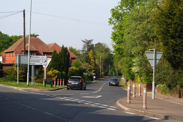
Five Ash Down is a small village located in the Wealden district of East Sussex, England. Situated approximately 10 miles north of the county town of Lewes, it falls within the civil parish of Buxted. The village is nestled amidst picturesque landscapes, surrounded by lush green fields and woodlands, offering a tranquil and peaceful environment for its residents.

The name "Five Ash Down" originates from the five ash trees that once stood at the village crossroads. Today, the village maintains its rural charm with a mix of traditional and modern properties, including a number of historic houses and cottages.

The community in Five Ash Down is close-knit, with a population of around 500 residents. The village boasts a strong local spirit, with various social events and activities organized throughout the year, fostering a sense of unity among its inhabitants.

Despite its small size, Five Ash Down offers several amenities to cater to the needs of its residents. These include a village hall, a pub, and a primary school, providing educational and recreational facilities within easy reach. The village is also well-connected, with good transport links to nearby towns and cities, making it an attractive location for those seeking a quieter lifestyle while still having access to urban amenities.

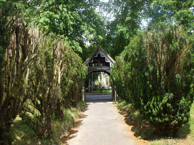
Surrounded by the natural beauty of the High Weald Area of Outstanding Natural Beauty, Five Ash Down provides ample opportunities for outdoor activities such as hiking, cycling, and exploring the nearby Ashdown Forest, which inspired A.A. Milne's famous Winnie-the-Pooh stories.

In summary, Five Ash Down is a charming village in Sussex, known for its idyllic countryside setting, strong community spirit, and access to natural beauty.

If you have any feedback on the listing, please let us know in the comments section below.

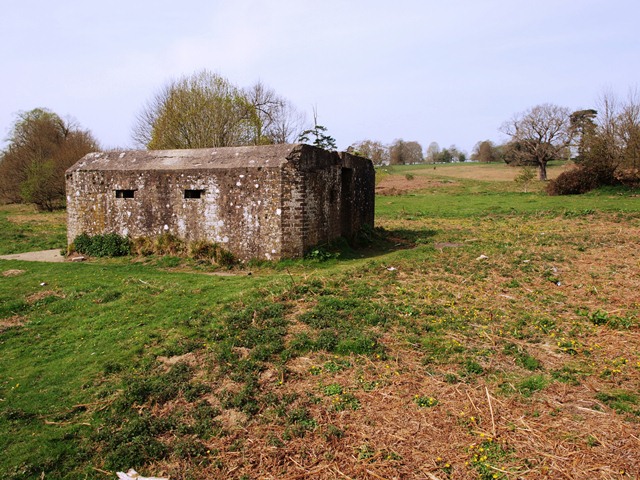
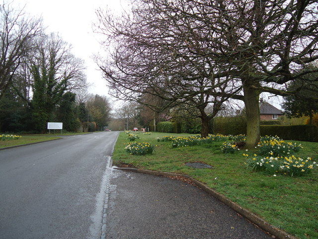
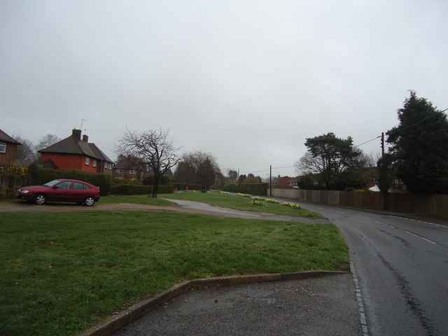
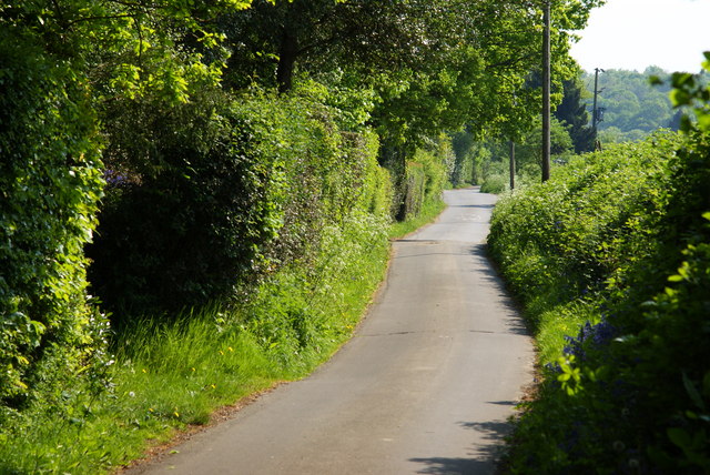
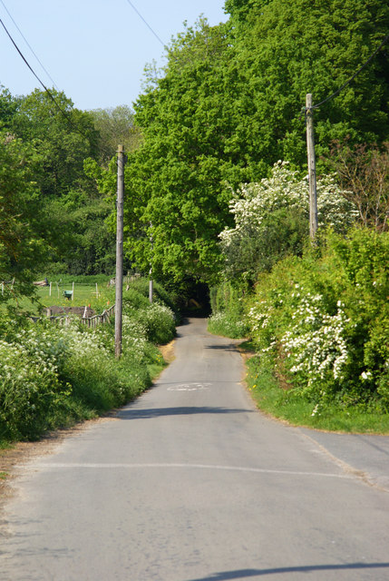
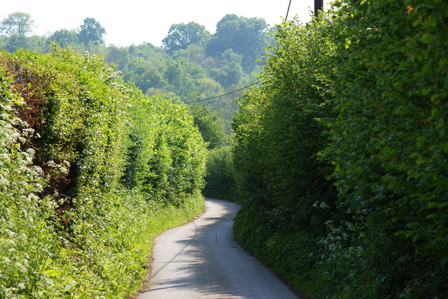
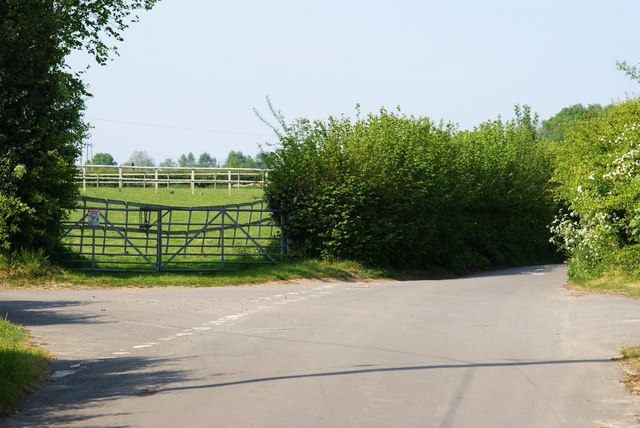
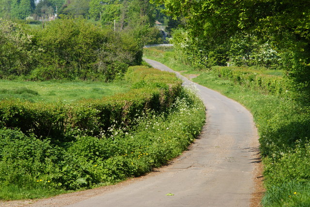
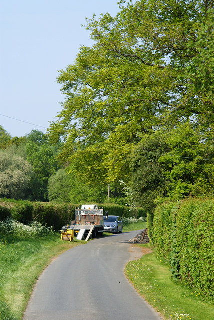
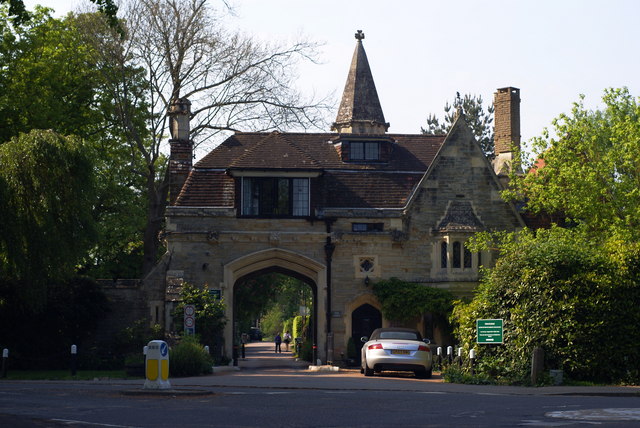
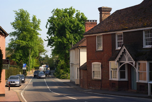
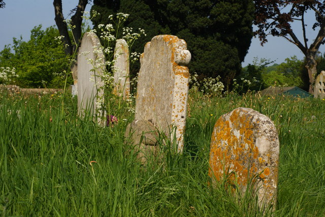
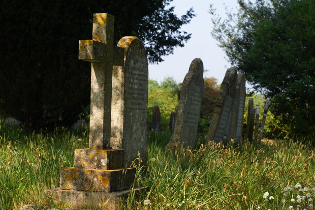
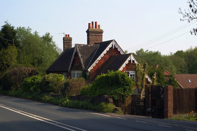
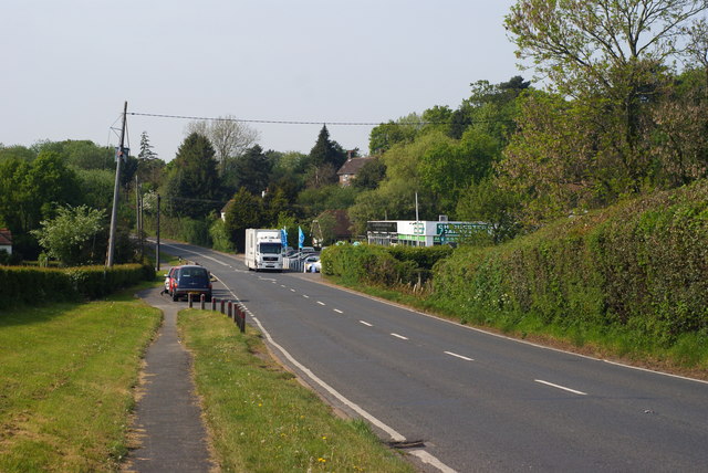
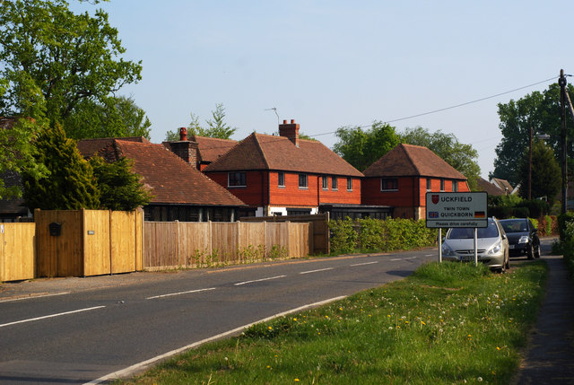
Five Ash Down Images

Images are sourced within 2km of 50.997132/0.10428755 or Grid Reference TQ4724. Thanks to Geograph Open Source API. All images are credited.

World War Two Pillbox just to the west of Buxted
Batts Bridge Road, Maresfield
Nursery Lane, Fairwarp, Sussex A quiet country lane. Out of picture, to the left, a row of houses is hidden by the high hedge.
Nursery Lane, Fairwarp, Sussex
A quiet country lane. Out of picture, to the left, a row of houses is hidden by the high hedge.
Nursery Lane, Fairwarp, Sussex Looking in the direction of Fairwarp village. A row of houses is out of picture, to the right.
Nursery Lane, Fairwarp, Sussex
Looking in the direction of Fairwarp village. A row of houses is out of picture, to the right.
Nursery Lane, Fairwarp, Sussex Looking in the direction of Maresfield. Note the high hedges, either side of this narrow lane.
Nursery Lane, Fairwarp, Sussex
Looking in the direction of Maresfield. Note the high hedges, either side of this narrow lane.
Junction of Nursery Lane and Burrells Lane, Sussex The location is just north of the Maresfield Park estate.
Junction of Nursery Lane and Burrells Lane, Sussex
The location is just north of the Maresfield Park estate.
Nursery Lane, Maresfield, Sussex Photograph taken from beside Nightingale Wood, looking north.
Nursery Lane, Maresfield, Sussex
Photograph taken from beside Nightingale Wood, looking north.
Nursery Lane, Maresfield, Sussex The large tree, to the right of picture, marks the position of Oak Tree Cottage.
Nursery Lane, Maresfield, Sussex
The large tree, to the right of picture, marks the position of Oak Tree Cottage.
Entrance to Maresfield Park, Sussex Formerly a large private estate, the road beyond the gatehouse is still marked as 'private'. Judging from the gatehouse, it must have been an impressive estate in its heyday.
Entrance to Maresfield Park, Sussex
Formerly a large private estate, the road beyond the gatehouse is still marked as 'private'. Judging from the gatehouse, it must have been an impressive estate in its heyday.
High Street, Maresfield, Sussex Photographed from close to Maresfield church.
High Street, Maresfield, Sussex
Photographed from close to Maresfield church.
Graves in Maresfield Cemetery, Sussex Photographed from the footpath in High Street.
Graves in Maresfield Cemetery, Sussex
Photographed from the footpath in High Street.
Graves in Maresfield Cemetery, Sussex Photographed from the footpath on High Street.
Graves in Maresfield Cemetery, Sussex
Photographed from the footpath on High Street.
The Mill House, Maresfield, Sussex The former mill house lies just within this grid square. The pond, serving this house, lies to the west; an aerial view suggests that the pond may have been truncated by the construction of the A22 Maresfield bypass, some years ago.
The Mill House, Maresfield, Sussex
The former mill house lies just within this grid square. The pond, serving this house, lies to the west; an aerial view suggests that the pond may have been truncated by the construction of the A22 Maresfield bypass, some years ago.
London Road, Budlett's Common, Sussex Chichester Caravans can be seen, in the centre of picture.
London Road, Budlett's Common, Sussex
Chichester Caravans can be seen, in the centre of picture.
London Road, Ringles Cross, Sussex Looking in the direction of Uckfield. The town sign can be seen, to the right of picture.
London Road, Ringles Cross, Sussex
Looking in the direction of Uckfield. The town sign can be seen, to the right of picture.
Road Junction at Ringles Cross, Sussex The junction of London Road with Coopers Green Road.
Road Junction at Ringles Cross, Sussex
The junction of London Road with Coopers Green Road.
Church path, Maresfield Parish Church
Show me another place!

Five Ash Down is located at Grid Ref: TQ4724 (Lat: 50.997132, Lng: 0.10428755)

Administrative County: East Sussex

District: Wealdon

Police Authority: Sussex

What 3 Words

///solves.fittingly.conducted. Near Buxted, East Sussex

Related Wikis

Five Ash Down

Five Ash Down is a small village within the civil parish of Buxted, in the Wealden district of East Sussex, England. Its nearest town is Uckfield, which...

Cooper's Green

Cooper's Green is a village in the civil parish of Buxted in the Wealden district of East Sussex, England. Its nearest town is Uckfield, which lies approximately...

Buxted Park

Buxted Park is an 84.7 hectare (206.16 acre) biological Site of Special Scientific Interest, located near the village of Buxted, East Sussex, England....

Maresfield

Maresfield is a village and civil parish in the Wealden District of East Sussex, England. The village itself lies 1.5 miles (2.4 km) north from Uckfield...

A.F.C. Uckfield Town

A.F.C. Uckfield Town is a community football club based in Uckfield, East Sussex, England. They are currently members of the Southern Combination Premier...

A.F.C. Uckfield

Association Football Club Uckfield was a football club based in Uckfield, East Sussex, England. == History == The club was formed in 1988 as Wealden Football...

St Margaret the Queen, Buxted

The Church of St Margaret the Queen is a grade I listed building in Buxted Park, East Sussex, England. It is dedicated to Saint Margaret of Scotland, an...

Buxted

Buxted is a village and civil parish in the Wealden district of East Sussex in England. The parish is situated on the Weald, north of Uckfield; the settlements...

Nearby Amenities

Located within 500m of 50.997132,0.10428755
Turning Circle
Lat/Long: 50.9934663/0.1014437
Five Ash Down
Is In: East Sussex, England, UK
Place: village
Source: OS OpenData StreetView
Wikidata: Q5455832
Lat/Long: 50.9944871/0.103983
Post Box
Operator: Royal Mail
Operator Wikidata: Q638098
Post Box Type: wall
Ref: TN22 61
Royal Cypher: EIIR
Royal Cypher Wikidata: Q33102113
Lat/Long: 50.994206/0.1029652
Post Box
Operator: Royal Mail
Operator Wikidata: Q638098
Post Box Type: lamp
Ref: TN22 100D
Royal Cypher: EIIR
Royal Cypher Wikidata: Q33102113
Lat/Long: 50.9973102/0.1046466
Public Footpath
Information: guidepost
Tourism: information
Lat/Long: 50.9998225/0.1058762
Public Footpath
Information: guidepost
Tourism: information
Lat/Long: 50.9974015/0.1039919
Public Footpath
Information: guidepost
Tourism: information
Lat/Long: 50.9961063/0.1017711
Bus Stop
The Pig and Butcher
Bus: yes
Naptan AtcoCode: 1400WE10055
Naptan NaptanCode: esudgptw
Public Transport: platform
Shelter: no
Tactile Paving: no
Lat/Long: 50.9949722/0.1034655
Addr City: Five Ash Down
Addr Housename: West Riding
Addr Postcode: TN22 3AP
Addr Street: Five Ash Down
Building: house
Lat/Long: 50.9989745/0.1067832
Bus Stop
Cobdown Lane
Bench: yes
Bin: yes
Bus: yes
Public Transport: platform
Shelter: yes
Tactile Paving: no
Lat/Long: 50.9989764/0.1053864
WW
Information: guidepost
Tourism: information
Lat/Long: 50.9968703/0.1042284
Addr Housename: Greenshutters
Building: house
Lat/Long: 50.9991328/0.107391
Addr City: Five Ash Down
Addr Housename: Diamond Cottage
Building: house
Lat/Long: 50.9936942/0.1045609
Defibrillator
Booth: K6
Covered: booth
Defibrillator Location: In old red phone box
Disused Amenity: telephone
Emergency: defibrillator
Man Made: telephone_box
Lat/Long: 50.9949591/0.1035483
Bus Stop
The Pig and Butcher
Bus: yes
Naptan AtcoCode: 1400WE10054
Naptan NaptanCode: esudgptp
Public Transport: platform
Lat/Long: 50.9944087/0.1030411
Addr City: Five Ash Down
Addr Housename: Culverley
Addr Postcode: TN22 3AP
Addr Street: Five Ash Down
Building: house
Lat/Long: 50.9988763/0.1065774
Addr City: Five Ash Down
Addr Housename: Cucumber Cottage
Building: house
Lat/Long: 50.9937816/0.1047918
Bus Stop
Cobdown Lane
Bench: yes
Bus: yes
Naptan AtcoCode: 1400WE0468
Naptan NaptanCode: esudagmj
Public Transport: platform
Shelter: yes
Lat/Long: 50.9993907/0.1058105
Addr City: Five Ash Down
Addr Housename: Gwynant
Addr Postcode: TN22 3AH
Addr Street: Five Ash Down
Building: house
Lat/Long: 50.9938053/0.1023544
Addr City: Five Ash Down
Addr Housename: Spindleberry
Addr Postcode: TN22 3AH
Addr Street: Five Ash Down
Building: house
Lat/Long: 50.9938771/0.1023316
Addr City: Five Ash Down
Addr Housename: Cinders
Addr Postcode: TN22 3AH
Addr Street: Five Ash Down
Building: house
Lat/Long: 50.9938045/0.1022243
Addr City: Five Ash Down
Addr Housename: St Anton
Addr Postcode: TN22 3AH
Addr Street: Five Ash Down
Building: house
Lat/Long: 50.9939581/0.1022458
Oast Farm Shop
Addr Postcode: TN22 4AU
Addr Street: Buxted Road
Fhrs Id: 182699
Opening Hours: Mo-Sa 09:00-17:00
Shop: deli
Source Addr: fhrs
Wheelchair: yes
Lat/Long: 50.9940366/0.1086201
Cafe
Oast Farm Cafe
Addr Postcode: TN22 4AU
Addr Street: Buxted Road
Fhrs Id: 182699
Opening Hours: Mo-Sa 10:00-16:00
Lat/Long: 50.9939843/0.1084605
The data included in this document is from www.openstreetmap.org. The data is made available under ODbL.

Have you been to Five Ash Down?

Leave your review of Five Ash Down below (or comments, questions and feedback).