Armiger's Carr

Wood, Forest in Norfolk Breckland

England

Armiger's Carr

Paddock at Lynford Arboretum The best place to see Hawfinch in the Brecks, see <a href="https://www.geograph.org.uk/photo/1036176">TL8293 : Hawfinch (Coccothraustes coccothraustes)</a>
Paddock at Lynford Arboretum Credit: Hugh Venables

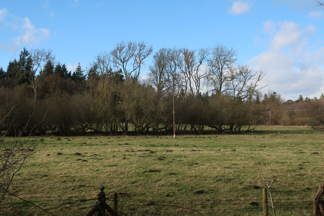
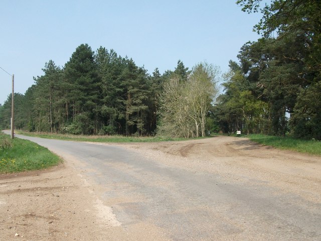
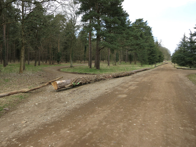
Armiger's Carr is a picturesque woodland area located in Norfolk, England. Covering an expansive area, it is known for its dense forest and diverse range of flora and fauna. The name "Carr" refers to a wetland or marshy area, indicating the presence of water bodies within the woodland.

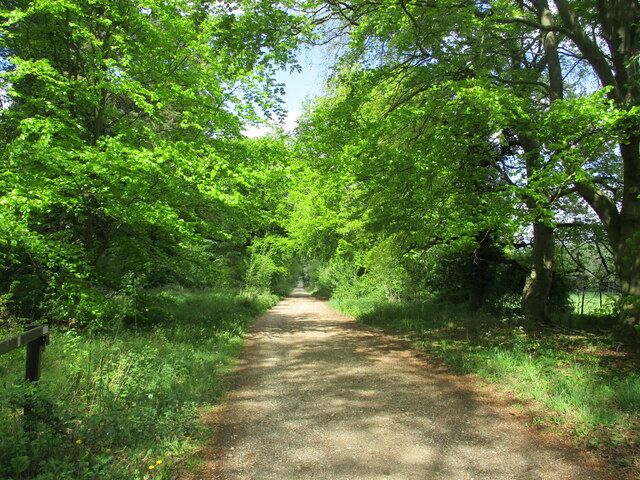
The forest of Armiger's Carr is primarily composed of native deciduous trees such as oak, beech, and birch. The dense canopy provides ample shade, creating a cool and tranquil atmosphere within the woodland. The forest floor is carpeted with a variety of plants, including bluebells, wood anemones, and wild garlic, which burst into a riot of colors during the spring.

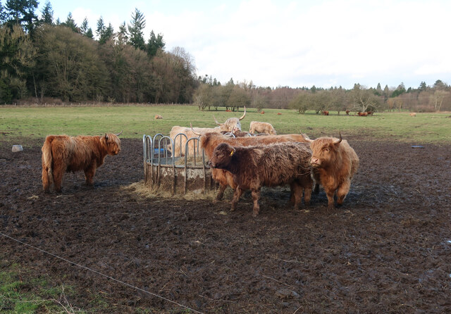
The wetland areas within Armiger's Carr are an important habitat for numerous species of birds and other wildlife. The presence of water bodies attracts a variety of waterfowl, including ducks, swans, and herons. The woodland is also home to various mammals, such as deer, foxes, and rabbits, which can often be spotted roaming among the trees.

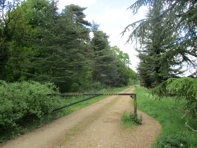
This enchanting woodland offers a haven for nature enthusiasts and provides ample opportunities for outdoor activities such as hiking, birdwatching, and photography. Several well-maintained trails wind through the forest, allowing visitors to explore its beauty at their own pace.

Armiger's Carr is a cherished natural gem within Norfolk, attracting visitors from near and far who seek solace in the tranquility of its ancient woodland and the abundant wildlife it supports.

If you have any feedback on the listing, please let us know in the comments section below.

Armiger's Carr Images

Images are sourced within 2km of 52.519586/0.65819709 or Grid Reference TL8094. Thanks to Geograph Open Source API. All images are credited.

Paddock at Lynford Arboretum The best place to see Hawfinch in the Brecks, see <a href="https://www.geograph.org.uk/photo/1036176">TL8293 : Hawfinch (Coccothraustes coccothraustes)</a>
Paddock at Lynford Arboretum
The best place to see Hawfinch in the Brecks, see TL8293 : Hawfinch (Coccothraustes coccothraustes)
Paddock at Lynford Arboretum
Forest track at Lynford
Restoration at the Church of Our Lady of Consolation and St Stephen, Lynford The church was built in 1879 and designed by Henry Clutton <span class="nowrap"><a title="https://historicengland.org.uk/listing/the-list/list-entry/1077247?section=official-list-entry" rel="nofollow ugc noopener" href="https://historicengland.org.uk/listing/the-list/list-entry/1077247?section=official-list-entry">Link</a><img style="margin-left:2px;" alt="External link" title="External link - shift click to open in new window" src="https://s1.geograph.org.uk/img/external.png" width="10" height="10"/></span>
Restoration at the Church of Our Lady of Consolation and St Stephen, Lynford
The church was built in 1879 and designed by Henry Clutton LinkExternal link
Study of a Gasoline Station Gulf, Ickburgh.

 This photograph is part of a series taken in homage to the American artist Ed Ruscha's 1963 publication of 'Twentysix Gasoline Stations'.
 More properly known as filling stations in the UK, I am attempting to photograph as many as possible to mark the sixty year anniversary.
Study of a Gasoline Station
Gulf, Ickburgh. This photograph is part of a series taken in homage to the American artist Ed Ruscha's 1963 publication of 'Twentysix Gasoline Stations'. More properly known as filling stations in the UK, I am attempting to photograph as many as possible to mark the sixty year anniversary.
Crown Hotel, Mundford <span class="nowrap"><a title="https://historicengland.org.uk/listing/the-list/list-entry/1077250?section=official-list-entry" rel="nofollow ugc noopener" href="https://historicengland.org.uk/listing/the-list/list-entry/1077250?section=official-list-entry">Link</a><img style="margin-left:2px;" alt="External link" title="External link - shift click to open in new window" src="https://s1.geograph.org.uk/img/external.png" width="10" height="10"/></span>
Crown Hotel, Mundford
St Peter Ickburgh The church of St Peter Ickburgh, Norfolk for more info see <span class="nowrap"><a title="http://www.norfolkchurches.co.uk/ickburgh/ickburgh.htm" rel="nofollow ugc noopener" href="http://www.norfolkchurches.co.uk/ickburgh/ickburgh.htm">Link</a><img style="margin-left:2px;" alt="External link" title="External link - shift click to open in new window" src="https://s1.geograph.org.uk/img/external.png" width="10" height="10"/></span>
St Peter Ickburgh
The church of St Peter Ickburgh, Norfolk for more info see LinkExternal link
Foulden Road Foulden road near to Ickburgh, Norfolk.
Foulden Road
Foulden road near to Ickburgh, Norfolk.
Lynford Hall, Mundford Full of standard Victorian motifs such as shaped gables, mullioned and transomed windows, and an exotically-roofed and asymmetrically-placed tower. By William Burn, 1856-61, for Mr and Mrs Lyne-Stephens (he was a banker, "reputedly the richest commoner in England ...[who] made his first fortune by inventing opening eyes for dolls"). Grade II listed.
The house is now a hotel.
Burn (1789-1870), a pupil of Robert Smirke, established himself in his Scottish homeland before doing the same in England. He was a phenomenally prolific designer of country houses, sought after by the wealthy largely because he was very adroit at planning homes to accommodate the increasing complexity of Victorian country house living - vast numbers of very specialised servants requiring specialist rooms and more segregation of the sexes (e.g. billiard rooms). In his Biographical Dictionary of British Architects, Howard Colvin states that by 1840 Burn "had already designed or altered ninety country houses, besides thirty churches and twenty-five public buildings", and he was to be in practice for almost another thirty years. He was competent across the gamut of architectural styles, but the results were rarely very exciting.
Lynford Hall, Mundford
Full of standard Victorian motifs such as shaped gables, mullioned and transomed windows, and an exotically-roofed and asymmetrically-placed tower. By William Burn, 1856-61, for Mr and Mrs Lyne-Stephens (he was a banker, "reputedly the richest commoner in England ...[who] made his first fortune by inventing opening eyes for dolls"). Grade II listed. The house is now a hotel. Burn (1789-1870), a pupil of Robert Smirke, established himself in his Scottish homeland before doing the same in England. He was a phenomenally prolific designer of country houses, sought after by the wealthy largely because he was very adroit at planning homes to accommodate the increasing complexity of Victorian country house living - vast numbers of very specialised servants requiring specialist rooms and more segregation of the sexes (e.g. billiard rooms). In his Biographical Dictionary of British Architects, Howard Colvin states that by 1840 Burn "had already designed or altered ninety country houses, besides thirty churches and twenty-five public buildings", and he was to be in practice for almost another thirty years. He was competent across the gamut of architectural styles, but the results were rarely very exciting.
Former car park, Lynford Arboretum The car park has been blocked off. This was a convenient place to park, but it is also very isolated, leading to unwanted activities (the litter left behind left little to the imagination). See <a href="https://www.geograph.org.uk/photo/1456879">TL8193 : Lynford lakes</a>.
Former car park, Lynford Arboretum
The car park has been blocked off. This was a convenient place to park, but it is also very isolated, leading to unwanted activities (the litter left behind left little to the imagination). See TL8193 : Lynford lakes.
Plantation thinning The stack along the track is young thinned trees, at a guess going for biomass burning.
Plantation thinning
The stack along the track is young thinned trees, at a guess going for biomass burning.
Roundabout at Mundford Junction between A134 and A1065, viewed from West Tofts Road.
Roundabout at Mundford
Junction between A134 and A1065, viewed from West Tofts Road.
A1065, northbound
A1065, northbound
A1065 approaching Mundford The A1065 is an important route through the centre of Norfolk. It starts on the infamous Five Ways roundabout at Barton Mills, leaving the A11, and heads up through countryside for nearly 40 miles, crossing the A47 at Swaffham en route, until it ends on the A148 just outside Fakenham.
A1065 approaching Mundford
The A1065 is an important route through the centre of Norfolk. It starts on the infamous Five Ways roundabout at Barton Mills, leaving the A11, and heads up through countryside for nearly 40 miles, crossing the A47 at Swaffham en route, until it ends on the A148 just outside Fakenham.
Roundabout, Mundford The A1065 is an important route through the centre of Norfolk. It starts on the infamous Five Ways roundabout at Barton Mills, leaving the A11, and heads up through countryside for nearly 40 miles, crossing the A47 at Swaffham en route, until it ends on the A148 just outside Fakenham.
Roundabout, Mundford
The A1065 is an important route through the centre of Norfolk. It starts on the infamous Five Ways roundabout at Barton Mills, leaving the A11, and heads up through countryside for nearly 40 miles, crossing the A47 at Swaffham en route, until it ends on the A148 just outside Fakenham.
A1065, Mundford The A1065 is an important route through the centre of Norfolk. It starts on the infamous Five Ways roundabout at Barton Mills, leaving the A11, and heads up through countryside for nearly 40 miles, crossing the A47 at Swaffham en route, until it ends on the A148 just outside Fakenham.
A1065, Mundford
The A1065 is an important route through the centre of Norfolk. It starts on the infamous Five Ways roundabout at Barton Mills, leaving the A11, and heads up through countryside for nearly 40 miles, crossing the A47 at Swaffham en route, until it ends on the A148 just outside Fakenham.
Show me another place!

Armiger's Carr is located at Grid Ref: TL8094 (Lat: 52.519586, Lng: 0.65819709)

Administrative County: Norfolk

District: Breckland

Police Authority: Norfolk

What 3 Words

///nappy.ranges.reclined. Near Mundford, Norfolk

Related Wikis

Ickburgh

Ickburgh is a village and civil parish in the English county of Norfolk. The villages name means 'Ic(c)a's fortification'. == Location == It is situated...

Mundford

Mundford is a village and civil parish in the English county of Norfolk. It is situated at the intersection of two major routes, the A134 Colchester to...

Lynford Hall

Lynford Hall is a neo-Jacobean country house at Mundford, near Thetford in the English county of Norfolk. It is now a hotel. == Location == The Lynford...

Cranwich

Cranwich is a village and civil parish in the English county of Norfolk, about 2 miles (3.2 km) northwest of Mundford. For the purposes of local government...

Nearby Amenities

Located within 500m of 52.519586,0.65819709
Foulden Turn, adj
Naptan AtcoCode: 2900I018
Naptan Bearing: NE
Naptan BusStopType: CUS
Naptan CommonName: Foulden Turn
Naptan Indicator: adj
Naptan Landmark: Cockley Cley Road
Naptan Locality: Ickburgh
Naptan NaptanCode: nfodagat
Naptan Street: Swaffham Road
Naptan Verified: no
Source: naptan_import
Lat/Long: 52.5191482/0.6631702
Foulden Turn, opp
Naptan AtcoCode: 2900I019
Naptan Bearing: SW
Naptan BusStopType: CUS
Naptan CommonName: Foulden Turn
Naptan Indicator: opp
Naptan Landmark: Cockley Cley Road
Naptan Locality: Ickburgh
Naptan NaptanCode: nfodagaw
Naptan Street: Swaffham Road
Naptan Verified: no
Source: naptan_import
Lat/Long: 52.5191891/0.6633496
Fixme: check for oil pipeline marker posts around here
Lat/Long: 52.5161271/0.660529
Pipeline: marker
Substance: oil
Lat/Long: 52.5201862/0.6616878
Fixme: check exact location
Pipeline: marker
Substance: oil
Lat/Long: 52.5156634/0.6602902
Post Box
Collection Times: Mo-Fr 16:00; Sa 10:15
Post Box Type: lamp
Ref: IP26 3398
Royal Cypher: EIIR
Royal Cypher Wikidata: Q33102113
Lat/Long: 52.5171019/0.6623912
Pipeline: marker
Substance: oil
Lat/Long: 52.5201306/0.6616491
Addr Housenumber: 36
Addr Street: Swaffham Road
Addr Village: Mundford
Lat/Long: 52.5175544/0.6629482
Addr Housenumber: 33
Addr Street: Swaffham Road
Addr Village: Mundford
Lat/Long: 52.5160887/0.6614006
Addr Housename: Ickburgh Lodge
Addr Street: Swaffham Road
Addr Village: Mundford
Lat/Long: 52.5186912/0.662806
Addr Housenumber: 31
Addr Street: Swaffham Road
Addr Village: Mundford
Lat/Long: 52.5157965/0.6610438
Addr Housenumber: 34
Addr Street: Swaffham Road
Addr Village: Mundford
Lat/Long: 52.5173063/0.6631198
Communication Mobile Phone: yes
Man Made: mast
Material: metal
Operator: O2-UK;Vodafone UK
Tower Construction: freestanding
Tower Type: communication
Lat/Long: 52.5160299/0.658493
The data included in this document is from www.openstreetmap.org. The data is made available under ODbL.

Have you been to Armiger's Carr?

Leave your review of Armiger's Carr below (or comments, questions and feedback).