Shirke Shaw

Wood, Forest in Sussex Rother

England

Shirke Shaw

Farm
Farm Credit: Oast House Archive

Shirke Shaw is a picturesque woodland area located in Sussex, England. Nestled amidst the rolling hills and lush greenery, this forest is a haven for nature enthusiasts and those seeking tranquility in a serene environment.

Covering an expansive area, Shirke Shaw is known for its diverse range of tree species, including oak, beech, and pine. The dense canopy formed by these trees creates a captivating atmosphere, with sunlight filtering through the leaves and casting dancing shadows on the forest floor. The undergrowth is adorned with an array of wildflowers and ferns, adding bursts of color to the landscape.

The forest is crisscrossed by numerous walking trails, inviting visitors to explore its natural beauty. These well-maintained paths wind through the woods, offering glimpses of wildlife such as deer, rabbits, and various bird species. Nature lovers will also find a wealth of plant life, from delicate mushrooms to vibrant mosses, making Shirke Shaw a haven for botany enthusiasts as well.

In addition to its natural wonders, Shirke Shaw boasts several amenities for visitors. There are picnic areas scattered throughout the forest, providing the perfect spot for a leisurely lunch or a family gathering. Furthermore, the forest is equipped with well-marked parking areas and facilities, ensuring a hassle-free experience for all.

Overall, Shirke Shaw in Sussex is a captivating woodland retreat that offers a respite from the hustle and bustle of everyday life. With its stunning scenery, abundant wildlife, and convenient amenities, it is a must-visit destination for anyone seeking solace in the beauty of nature.

If you have any feedback on the listing, please let us know in the comments section below.

Shirke Shaw Images

Images are sourced within 2km of 50.926043/0.56617605 or Grid Reference TQ8017. Thanks to Geograph Open Source API. All images are credited.

Park View Road, off Cottage Lane, Westfield
Sign for Westfield Community Fibre Project, Westfield A parish council sign by Cottage Lane, Westfield, encouraging people to pledge to subscribe to ultra fast broadband fibre connection.
Sign for Westfield Community Fibre Project, Westfield
A parish council sign by Cottage Lane, Westfield, encouraging people to pledge to subscribe to ultra fast broadband fibre connection.
Sign at entrance to path leading to Parish Field, Westfield This is situated where the footpath to the sports facility joins Cottage lane, Westfield
Sign at entrance to path leading to Parish Field, Westfield
This is situated where the footpath to the sports facility joins Cottage lane, Westfield
Entrance to path to Westfield Parish Field A public footpath from Cottage Lane to the Parish Field
Entrance to path to Westfield Parish Field
A public footpath from Cottage Lane to the Parish Field
Footpath to Westfield Parish Field This runs from Cottage Lane in Westfield to the Parish Field recreation ground.
Footpath to Westfield Parish Field
This runs from Cottage Lane in Westfield to the Parish Field recreation ground.
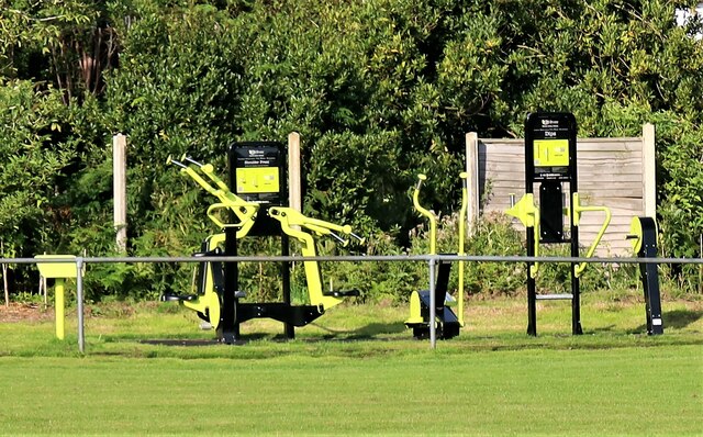
Exercise apparatus in Westfield Parish Field This set of exercise apparatus is for public use in the Parish Field.
Exercise apparatus in Westfield Parish Field
This set of exercise apparatus is for public use in the Parish Field.
House in Westfield village This house by the A28, seen from across the Village Field sports facility, has the unusual name of "Further Down".
House in Westfield village
This house by the A28, seen from across the Village Field sports facility, has the unusual name of "Further Down".
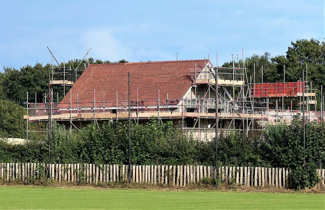
House construction in Westfield village A newly developed site beside the A28 seen from the Westfield Sports Field.
House construction in Westfield village
A newly developed site beside the A28 seen from the Westfield Sports Field.
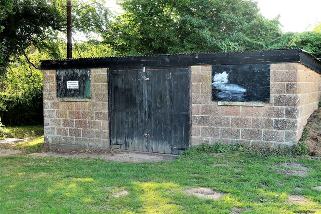
Building in western corner of Parish Field, Westfield
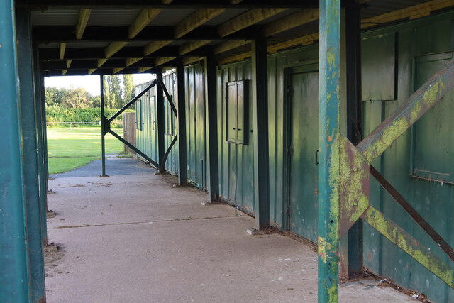
Sports pavilion at Westfield Sports Field
Covid-19 precautionary sign on Sports Field railing, Westfield An injunction to sports spectators to keep one metre apart during the Covid-19 Coronavirus pandemic.
Covid-19 precautionary sign on Sports Field railing, Westfield
An injunction to sports spectators to keep one metre apart during the Covid-19 Coronavirus pandemic.
Westfield Football Club facilities at Westfield Parish Field Westfield Football Club was established before World War I. They joined the Sussex County Football League Division Three in 1997. They are currently members of the Mid-Sussex League Premier Division
Westfield Football Club facilities at Westfield Parish Field
Westfield Football Club was established before World War I. They joined the Sussex County Football League Division Three in 1997. They are currently members of the Mid-Sussex League Premier Division
House frontages in Cottage Lane, Westfield The door on the left bears the figure 2.  However it is some way north of the start of Cottage Lane which has many houses bordering it.  The number may refer to Fernlea Close which runs from Cottage Lane immediately north of these houses
House frontages in Cottage Lane, Westfield
The door on the left bears the figure 2. However it is some way north of the start of Cottage Lane which has many houses bordering it. The number may refer to Fernlea Close which runs from Cottage Lane immediately north of these houses
Fernlea Close, Westfield A cul-de-sac off Cottage Lane.
Fernlea Close, Westfield
A cul-de-sac off Cottage Lane.
Sign at eentrance to New Cut off Cottage Lane, Westfield The New Cut, a kind of suburban estate and with many modern houses, is not, in fact, new.  Houses (the Blue Barracks) were there in 1813 and the name appeared on maps a few years later.
Sign at eentrance to New Cut off Cottage Lane, Westfield
The New Cut, a kind of suburban estate and with many modern houses, is not, in fact, new. Houses (the Blue Barracks) were there in 1813 and the name appeared on maps a few years later.
Front garden of Trefel, New Cut, Westfield The tree towards the left of the picture is a weeping willow.  The name 'Trefel' might be a Welsh, Cornish of Breton place name or family name.
Front garden of Trefel, New Cut, Westfield
The tree towards the left of the picture is a weeping willow. The name 'Trefel' might be a Welsh, Cornish of Breton place name or family name.
Show me another place!

Shirke Shaw is located at Grid Ref: TQ8017 (Lat: 50.926043, Lng: 0.56617605)

Administrative County: East Sussex

District: Rother

Police Authority: Sussex

What 3 Words

///curious.hotel.wired. Near Battle, East Sussex

Related Wikis

Nearby Amenities

Located within 500m of 50.926043,0.56617605
Power: tower
Source: Bing
Lat/Long: 50.9263426/0.5680141
Power: tower
Lat/Long: 50.9284111/0.5693305
Power: tower
Lat/Long: 50.9251659/0.565286
The data included in this document is from www.openstreetmap.org. The data is made available under ODbL.

Have you been to Shirke Shaw?

Leave your review of Shirke Shaw below (or comments, questions and feedback).