Downter's Wood
Wood, Forest in Suffolk West Suffolk
England
Downter's Wood

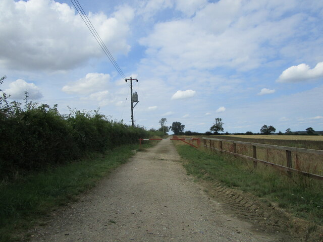
Downter's Wood is a picturesque woodland located in Suffolk, England. Covering an area of approximately 100 acres, this enchanting forest is a haven for nature enthusiasts and a popular destination for outdoor activities. The wood is situated near the village of Downter, hence its name, and is easily accessible from nearby towns and cities.
The wood is predominantly made up of native broadleaf trees, such as oak, beech, and ash, creating a diverse and vibrant ecosystem. The canopy of the trees provides a cool and shaded environment, perfect for a leisurely stroll or a peaceful picnic. The forest floor is adorned with a carpet of bluebells in the spring, while wildflowers and ferns flourish in the summer months.
Downter's Wood is home to a wide variety of wildlife, making it a favorite spot for birdwatchers and nature photographers. Visitors may catch a glimpse of woodpeckers, owls, and even deer roaming through the forest. The tranquil atmosphere and natural beauty of the wood also attract artists and writers seeking inspiration.
For those seeking more active pursuits, the wood offers numerous walking trails and cycling paths, allowing visitors to explore its hidden corners and take in the breathtaking scenery. There are also designated areas for camping and picnicking, making it an ideal location for a family day out or a weekend getaway.
Overall, Downter's Wood in Suffolk is a captivating destination that combines natural beauty, tranquility, and recreational opportunities, making it a must-visit for nature lovers and outdoor enthusiasts alike.
If you have any feedback on the listing, please let us know in the comments section below.
Downter's Wood Images
Images are sourced within 2km of 52.217174/0.63779701 or Grid Reference TL8060. Thanks to Geograph Open Source API. All images are credited.


Downter's Wood is located at Grid Ref: TL8060 (Lat: 52.217174, Lng: 0.63779701)
Administrative County: Suffolk
District: West Suffolk
Police Authority: Suffolk
What 3 Words
///tickles.mows.womb. Near Bury St Edmunds, Suffolk
Nearby Locations
Related Wikis

Thingoe Rural District
Thingoe Rural District was a rural district in the county of West Suffolk, England between 1894 and 1974. It was named after the ancient Hundred of Thingoe...

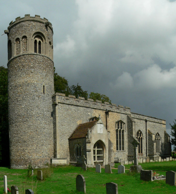
St Mary's Church, Ickworth
Ickworth Church (more formally known as St Mary's Church, Ickworth) is a former parish church in Ickworth Park near Bury St Edmunds in Suffolk, England...

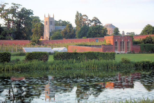
Ickworth House
Ickworth House is a country house at Ickworth, near Bury St Edmunds, Suffolk, England. It is a neoclassical building set in parkland. The house was the...
Little Saxham
Little Saxham is a village and former civil parish, now in the parish of The Saxhams, in the West Suffolk district, in the county of Suffolk, England....

Chevington, Suffolk
Chevington is a village and civil parish in the West Suffolk district of Suffolk in East Anglia, England. Located around 10 km south-west of Bury St Edmunds...
Ickworth
Ickworth is a small civil parish, almost coextensive with the estate of the National Trust's Ickworth House, in the West Suffolk district of Suffolk, eastern...

Great Saxham
Great Saxham is a village and former civil parish, now in the parish of The Saxhams, in the West Suffolk district, in the county of Suffolk, England. The...

Saxham Hall
Great Saxham Hall is a two-storey Palladian house situated at Great Saxham, just outside Bury St Edmunds in Suffolk, England. It is a Grade II* listed...
Nearby Amenities
Located within 500m of 52.217174,0.63779701Have you been to Downter's Wood?
Leave your review of Downter's Wood below (or comments, questions and feedback).