Chevington Field Plantation
Wood, Forest in Suffolk West Suffolk
England
Chevington Field Plantation

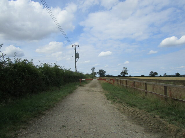
Chevington Field Plantation is a picturesque woodland area located in Suffolk, England. Spanning over vast acres, this enchanting forest is a haven for nature enthusiasts and outdoor adventurers. The plantation is situated in the rural village of Chevington, surrounded by rolling hills and idyllic countryside.
The woodland of Chevington Field Plantation is characterized by a diverse range of trees, including oak, beech, and ash, which create a lush canopy overhead. The vibrant flora is complemented by an assortment of wildflowers, adding bursts of color to the forest floor during spring and summer. The plantation is meticulously maintained by a team of dedicated conservationists, ensuring the preservation of its natural beauty.
Visitors to Chevington Field Plantation can enjoy a variety of recreational activities. There are well-maintained walking trails that wind through the woodland, allowing visitors to explore the plantation at their own pace. These trails offer opportunities for birdwatching, with species such as woodpeckers, owls, and finches commonly spotted in the area. Nature photography is also popular, as the plantation provides numerous scenic spots with breathtaking views.
For those seeking a tranquil retreat, Chevington Field Plantation offers several picnic areas and benches where visitors can relax and immerse themselves in the peaceful ambiance. The plantation is also home to a small pond, providing a serene setting for contemplation or a spot of fishing.
Overall, Chevington Field Plantation is a captivating woodland retreat, inviting visitors to escape the hustle and bustle of daily life and reconnect with nature in its purest form.
If you have any feedback on the listing, please let us know in the comments section below.
Chevington Field Plantation Images
Images are sourced within 2km of 52.211857/0.63549096 or Grid Reference TL8060. Thanks to Geograph Open Source API. All images are credited.


Chevington Field Plantation is located at Grid Ref: TL8060 (Lat: 52.211857, Lng: 0.63549096)
Administrative County: Suffolk
District: West Suffolk
Police Authority: Suffolk
What 3 Words
///nightlife.decimal.wreck. Near Bury St Edmunds, Suffolk
Nearby Locations
Related Wikis

Thingoe Rural District
Thingoe Rural District was a rural district in the county of West Suffolk, England between 1894 and 1974. It was named after the ancient Hundred of Thingoe...

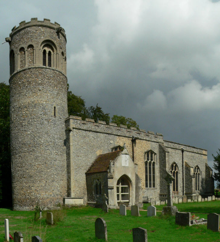
St Mary's Church, Ickworth
Ickworth Church (more formally known as St Mary's Church, Ickworth) is a former parish church in Ickworth Park near Bury St Edmunds in Suffolk, England...

Chevington, Suffolk
Chevington is a village and civil parish in the West Suffolk district of Suffolk in East Anglia, England. Located around 10 km south-west of Bury St Edmunds...

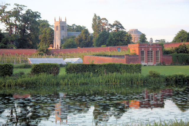
Ickworth House
Ickworth House is a country house at Ickworth, near Bury St Edmunds, Suffolk, England. It is a neoclassical building set in parkland. The house was the...
Little Saxham
Little Saxham is a village and former civil parish, now in the parish of The Saxhams, in the West Suffolk district, in the county of Suffolk, England....
Ickworth
Ickworth is a small civil parish, almost coextensive with the estate of the National Trust's Ickworth House, in the West Suffolk district of Suffolk, eastern...

Hay Wood, Whepstead
Hay Wood, Whepstead is a 10.4-hectare (26-acre) biological Site of Special Scientific Interest west of Whepstead in Suffolk.This ancient wood on poorly...

Great Saxham
Great Saxham is a village and former civil parish, now in the parish of The Saxhams, in the West Suffolk district, in the county of Suffolk, England. The...
Nearby Amenities
Located within 500m of 52.211857,0.63549096Have you been to Chevington Field Plantation?
Leave your review of Chevington Field Plantation below (or comments, questions and feedback).