Abergwynfi

Settlement in Glamorgan

Wales

Abergwynfi

Ordnance Survey Cut Mark This OS cut mark can be found on No41 Gwynfi Street. It marks a point 264.880m above mean sea level.
Ordnance Survey Cut Mark Credit: Adrian Dust

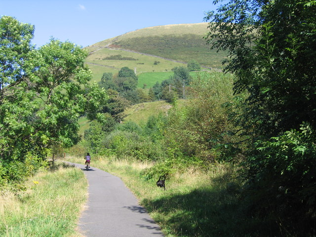
Abergwynfi is a small village located in the county of Glamorgan, Wales. Situated in the Afan Valley, it is surrounded by picturesque mountains and lush green valleys. The village lies approximately 10 miles northeast of Port Talbot and 20 miles northwest of Swansea.

Abergwynfi has a rich history dating back to the 19th century when it was a thriving coal mining community. The village was once home to several coal mines, which played a significant role in the local economy. However, with the decline of the coal industry in the late 20th century, Abergwynfi has undergone a transformation and has adapted to new economic opportunities.

Today, Abergwynfi is a close-knit community with a population of around 1,500 residents. The village offers a peaceful and rural lifestyle, attracting those seeking a quieter way of life. The stunning natural surroundings provide ample opportunities for outdoor activities such as hiking, mountain biking, and fishing.

Abergwynfi is also home to a few amenities, including a local primary school, a post office, and a convenience store. The village has a strong sense of community, with various events and activities organized throughout the year, such as festivals, fairs, and sports competitions.

Overall, Abergwynfi is a charming village with a rich heritage and a strong community spirit. Its beautiful natural surroundings and peaceful atmosphere make it an appealing place to live or visit for those seeking a tranquil retreat in the heart of Glamorgan.

If you have any feedback on the listing, please let us know in the comments section below.

Abergwynfi Images

Images are sourced within 2km of 51.653816/-3.606419 or Grid Reference SS8896. Thanks to Geograph Open Source API. All images are credited.

Ordnance Survey Cut Mark This OS cut mark can be found on No41 Gwynfi Street. It marks a point 264.880m above mean sea level.
Ordnance Survey Cut Mark
This OS cut mark can be found on No41 Gwynfi Street. It marks a point 264.880m above mean sea level.
Gelli Tunnel near Croeserw Western portal of the 169yd, single track Gelli tunnel on the former Rhondda and Swansea Bay Railway between Caerau and Cymmer, photographed in 1980.  The site was relatively unchanged apart from the growth of a lot of undergrowth and saplings when I revisited it in 2005.
Gelli Tunnel near Croeserw
Western portal of the 169yd, single track Gelli tunnel on the former Rhondda and Swansea Bay Railway between Caerau and Cymmer, photographed in 1980. The site was relatively unchanged apart from the growth of a lot of undergrowth and saplings when I revisited it in 2005.
Blaengwynfi village A typical South Wales valley scene.  The larger building to the right of the picture is named the Great Western - almost certainly a hotel dating back to the era when the Great Western railway ran up this valley.  These days the railway has been repurposed into a cycle track.
Blaengwynfi village
A typical South Wales valley scene. The larger building to the right of the picture is named the Great Western - almost certainly a hotel dating back to the era when the Great Western railway ran up this valley. These days the railway has been repurposed into a cycle track.
Toward Gelli Farm Walking along the former railway between the Gelli Mill and Gelli Farm bridges.
Toward Gelli Farm
Walking along the former railway between the Gelli Mill and Gelli Farm bridges.
In the Afan Right by the Gelli Farm bridge.

Good paddling for children and dogs.

And photographers ...
In the Afan
Right by the Gelli Farm bridge. Good paddling for children and dogs. And photographers ...
Road to a village The road to Blaengwynfi comes off the A4107.
Road to a village
The road to Blaengwynfi comes off the A4107.
Stream under the road The rather sombre Nant Dyrys runs under the A4107 on the corner.
Stream under the road
The rather sombre Nant Dyrys runs under the A4107 on the corner.
Moorland road The A4107 cuts along on the lower slopes of Werfa, the summit of which is in the next square south.
Moorland road
The A4107 cuts along on the lower slopes of Werfa, the summit of which is in the next square south.
Road junction, Croeserw
Who was here last? Perched on the highest point (528m) in the middle of a clearing in the forestry is an OS trig point.
Who was here last?
Perched on the highest point (528m) in the middle of a clearing in the forestry is an OS trig point.
Needs some maintenance This trig point has character: peeling paint, mosses and lichens - it looks as if no one's been here for many years. It was a good place to put our sandwich boxes while we ate our lunch on a very dank day.
Needs some maintenance
This trig point has character: peeling paint, mosses and lichens - it looks as if no one's been here for many years. It was a good place to put our sandwich boxes while we ate our lunch on a very dank day.
Gloomy gorge This is the small gorge of the Nant Lluest - not easy to photograph on a really gloomy day (ISO 400, 1/40th, f2.8).
Gloomy gorge
This is the small gorge of the Nant Lluest - not easy to photograph on a really gloomy day (ISO 400, 1/40th, f2.8).
There is a path On the 1:25000 map, both tracks have equal weight, but on the ground the track going downhill (not shown on the 1:50000) to cross Nant Lluest is overgrown. Despite that, it is well laid with sandstone blocks, so was probably important at some time in the past.
There is a path
On the 1:25000 map, both tracks have equal weight, but on the ground the track going downhill (not shown on the 1:50000) to cross Nant Lluest is overgrown. Despite that, it is well laid with sandstone blocks, so was probably important at some time in the past.
Forest road Yet another of the many forest roads in South Wales used by hikers and cyclists - though this one did not have any formal signposts on it.
Forest road
Yet another of the many forest roads in South Wales used by hikers and cyclists - though this one did not have any formal signposts on it.
Calling all listeners! A radio transmitter overlooks the valley of the Afon Afan (River Avan).
Calling all listeners!
A radio transmitter overlooks the valley of the Afon Afan (River Avan).
Use the 1:25000 This square looks more interesting from the Glyncorrwg approach (from the north), but we walked in having parked in Blaengwynfi. None of the tracks is marked on the 1:50000.
Use the 1:25000
This square looks more interesting from the Glyncorrwg approach (from the north), but we walked in having parked in Blaengwynfi. None of the tracks is marked on the 1:50000.
Forest edge to the north of Blaengarw A view of a small part of Blaengarw Forest and some of the mountainside at the head of the Garw Valley.
Forest edge to the north of Blaengarw
A view of a small part of Blaengarw Forest and some of the mountainside at the head of the Garw Valley.
Hillside at the head of the Garw Valley Some of the hillside at the northern, closed end of the valley, and the location of several small streams and springs providing some of the northernmost stretches of the Afon Garw with water.

A good deal of the terrain in the photograph - including the high outcrops in, perhaps, the right two-thirds of the picture - lies in grid square SS9094.
Hillside at the head of the Garw Valley
Some of the hillside at the northern, closed end of the valley, and the location of several small streams and springs providing some of the northernmost stretches of the Afon Garw with water. A good deal of the terrain in the photograph - including the high outcrops in, perhaps, the right two-thirds of the picture - lies in grid square SS9094.
Show me another place!

Abergwynfi is located at Grid Ref: SS8896 (Lat: 51.653816, Lng: -3.606419)

Unitary Authority: Neath Port Talbot

Police Authority: South Wales

What 3 Words

///unsightly.golden.spectacle. Near Blaengwynfi, Neath Port Talbot

Nearby Locations

Coetgae Isaf Abergwynfi

Related Wikis

Abergwynfi

Abergwynfi is a village in the Welsh county borough of Neath Port Talbot, in the community of Gwynfi and Croeserw. Abergwynfi is the first half of a village...

Blaengwynfi

Blaengwynfi is a village in the Afan Valley, in the Neath Port Talbot area of South Wales. It is in the community of Gwynfi and Croeserw, == Location... ==

Abergwynfi railway station

Abergwynfi railway station served the villages of Abergwynfi and Blaengwynfi in Neath Port Talbot, Wales. The station was the terminus of the line from...

Gwynfi

Gwynfi is an electoral ward of Neath Port Talbot county borough, Wales. Gwynfi includes the villages if Abergwynfi and Blaengwynfi. Gwynfi is part of...

Blaengwynfi railway station

Blaengwynfi railway station served the village of Blaengwynfi, Neath Port Talbot, Wales, from 1890 to 1968 on the Rhondda and Swansea Bay Railway. ��2...

A4107 road

The A4107 road is an A road in Neath Port Talbot County Borough, Wales. It begins in Port Talbot and heads up the Afan Valley in a north easterly direction...

Rhondda Tunnel

The Rhondda Tunnel is an abandoned railway tunnel that runs between the Rhondda and the Afan Valleys in South Wales. It is 3,443 yards (3,148 m) long,...

Croeserw

Croeserw is a village of approximately 1,380 inhabitants in Gwynfi and Croeserw, Neath Port Talbot county borough, Wales. == Location == It stands on a...

Nearby Amenities

Located within 500m of 51.653816,-3.606419
Turning Circle
Lat/Long: 51.6560149/-3.6043992
Abergwynfi
Place: village
Wikidata: Q4667111
Lat/Long: 51.6539494/-3.6020753
Blaengwynfi
Place: village
Wikidata: Q4923812
Lat/Long: 51.6557507/-3.6013316
Abergwynfi
Abandoned Railway: station
Railway: site
Wikidata: Q4667108
Wikipedia: en:Abergwynfi railway station
Lat/Long: 51.6547565/-3.6011933
Post Box
Collection Times: Mo-Fr 09:00; Sa 07:00
Operator: Royal Mail
Post Box Mounting: rendered_wall
Post Box Type: wall
Ref: SA13 21D
Royal Cypher: GVIR
Royal Cypher Wikidata: Q33102169
Lat/Long: 51.6537117/-3.6024441
Post Box
Collection Times: Mo-Fr 09:00; Sa 07:00
Operator: Royal Mail
Post Box Mounting: pier
Post Box Type: lamp
Ref: SA13 87D
Royal Cypher: GR
Royal Cypher Wikidata: Q33102273
Lat/Long: 51.6582232/-3.6070347
Pub
Lat/Long: 51.6555717/-3.6011794
Post Box
Collection Times: Mo-Fr 09:00; Sa 07:00
Operator: Royal Mail
Post Box Mounting: stone_wall
Post Box Type: wall
Ref: SA13 1D
Royal Cypher: GR
Royal Cypher Wikidata: Q33102273
Lat/Long: 51.655657/-3.6011063
Post Box
Collection Times: Mo-Fr 16:30; Sa 11:00
Operator: Royal Mail
Post Box Mounting: stone_wall
Post Box Type: wall
Ref: SA13 39
Royal Cypher: GVIR
Royal Cypher Wikidata: Q33102169
Lat/Long: 51.6564174/-3.6036377
Direction: 125
Generator Method: photovoltaic
Generator Output Electricity: yes
Generator Solar Modules: 8
Generator Source: solar
Generator Type: solar_photovoltaic_panel
Location: roof
Power: generator
Lat/Long: 51.6567948/-3.6039762
Direction: 215
Generator Method: photovoltaic
Generator Output Electricity: yes
Generator Solar Modules: 8
Generator Source: solar
Generator Type: solar_photovoltaic_panel
Location: roof
Power: generator
Lat/Long: 51.6567876/-3.6040559
Direction: SSW
Generator Method: photovoltaic
Generator Output Electricity: yes
Generator Solar Modules: 5
Generator Source: solar
Generator Type: solar_photovoltaic_panel
Location: roof
Power: generator
Lat/Long: 51.6534313/-3.6016542
Direction: ESE
Generator Method: photovoltaic
Generator Output Electricity: yes
Generator Solar Modules: 5
Generator Source: solar
Generator Type: solar_photovoltaic_panel
Location: roof
Power: generator
Lat/Long: 51.653414/-3.6017045
The data included in this document is from www.openstreetmap.org. The data is made available under ODbL.

Have you been to Abergwynfi?

Leave your review of Abergwynfi below (or comments, questions and feedback).