Amber Wood

Wood, Forest in Kent Maidstone

England

Amber Wood

Hermitage Lane, Detling A steep track leading to part of the North Downs Way to the west of the village.
Hermitage Lane, Detling Credit: pam fray

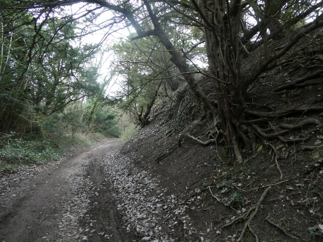
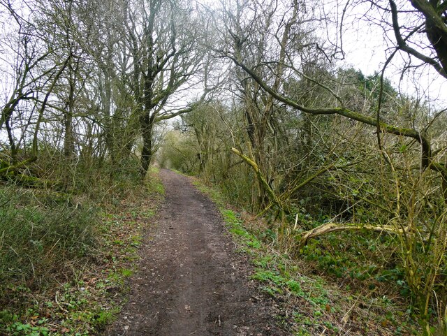
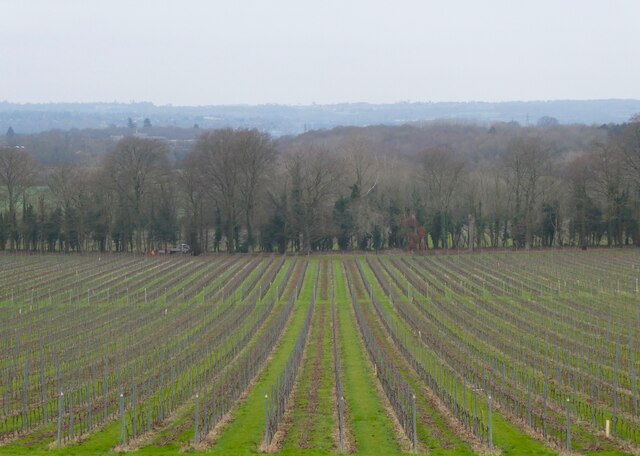
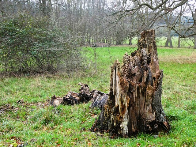
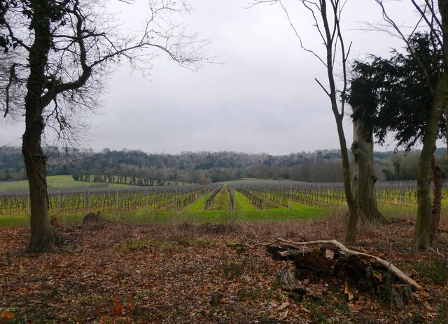
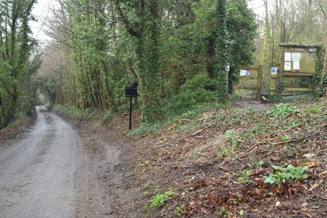
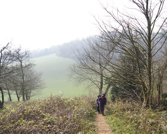
Amber Wood, located in Kent, England, is a picturesque woodland area renowned for its natural beauty and diverse wildlife. Stretching over an area of approximately 200 acres, the wood is primarily composed of ancient oak trees, interspersed with patches of beech and birch trees. The forest floor is covered in a rich carpet of ferns, mosses, and wildflowers, creating a tranquil and enchanting atmosphere.

Amber Wood is home to a wide variety of wildlife, making it a popular destination for nature enthusiasts and birdwatchers. Visitors can spot a range of bird species, including woodpeckers, owls, and warblers. The wood is also inhabited by mammals such as deer, foxes, and rabbits, which can occasionally be observed from the well-maintained footpaths that wind through the forest.

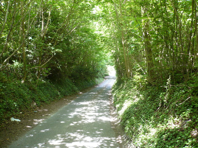
The wood offers visitors the opportunity to explore its natural wonders through a network of walking trails, each varying in length and difficulty. These paths lead visitors through the heart of the woodland, allowing them to immerse themselves in the serene surroundings and appreciate the ancient trees that have stood the test of time.

Amber Wood, with its tranquil ambience and breathtaking scenery, is not only a haven for nature lovers but also a valuable ecological site. Its preservation and protection are of utmost importance to maintain the delicate balance of its ecosystem. The wood is managed by the local authorities, who work tirelessly to ensure its long-term sustainability and accessibility for visitors.

Overall, Amber Wood in Kent is a natural gem that offers a sanctuary for wildlife and a peaceful retreat for those seeking solace in nature's embrace.

If you have any feedback on the listing, please let us know in the comments section below.

Amber Wood Images

Images are sourced within 2km of 51.304826/0.57751269 or Grid Reference TQ7959. Thanks to Geograph Open Source API. All images are credited.

Hermitage Lane, Detling A steep track leading to part of the North Downs Way to the west of the village.
Hermitage Lane, Detling
A steep track leading to part of the North Downs Way to the west of the village.
North Downs Way, near Detling
Farmland near Detling North west of the village by Pilgrims Way.
Farmland near Detling
North west of the village by Pilgrims Way.
Horse and pony, Boxley Riding School On Pilgrims Way.
Horse and pony, Boxley Riding School
On Pilgrims Way.
Dead tree near Harple Lane, Detling By the footpath running between Boxley Church and Harple Lane.
Dead tree near Harple Lane, Detling
By the footpath running between Boxley Church and Harple Lane.
Farmland near Detling Looking across to Pilgrims Way from the footpath running between Boxley Church and Harple Lane.
Farmland near Detling
Looking across to Pilgrims Way from the footpath running between Boxley Church and Harple Lane.
Timber-framed houses in The Street, Detling
A249 at Detling Hill Seen from the footbridge at <a href="https://www.geograph.org.uk/photo/3043084">TQ7958 : Jade's Crossing, Detling</a>
A249 at Detling Hill
Seen from the footbridge at TQ7958 : Jade's Crossing, Detling
Pilgrims Way, northwest of Detling On the right is an entrance to The Larches, an area of woodland managed by Kent Wildlife Trust.
Pilgrims Way, northwest of Detling
On the right is an entrance to The Larches, an area of woodland managed by Kent Wildlife Trust.
Eastbound Javelin train on the HS1 route at Detling
Detling Village from the south With the line of Detling Hill beyond.
Detling Village from the south
With the line of Detling Hill beyond.
Path into The Larches Area of woodland managed by Kent Wildlife Trust, seen on a very wet and misty morning.
Path into The Larches
Area of woodland managed by Kent Wildlife Trust, seen on a very wet and misty morning.
Steps on the North Downs Way A nice Spring day on the North Downs Way
Steps on the North Downs Way
A nice Spring day on the North Downs Way
Fuel Station, A249 The A249 is a road running from Maidstone to Sheerness on the Isle of Sheppey. It mainly functions as a link between the M2 and M20 motorways,up Detling Hill and for goods vehicle traffic to the port at Sheerness.
In 2006, an upgraded dual carriageway section opened between Iwade and Queenborough, including a new fixed crossing over the Swale. The existing lifting Kingsferry Bridge has been retained as an alternative route.
The old Sheppey way runs parallel to the new road.
Wikipedia: <span class="nowrap"><a title="http://en.wikipedia.org/wiki/A249_road" rel="nofollow ugc noopener" href="http://en.wikipedia.org/wiki/A249_road">Link</a><img style="margin-left:2px;" alt="External link" title="External link - shift click to open in new window" src="https://s1.geograph.org.uk/img/external.png" width="10" height="10"/></span>
Fuel Station, A249
The A249 is a road running from Maidstone to Sheerness on the Isle of Sheppey. It mainly functions as a link between the M2 and M20 motorways,up Detling Hill and for goods vehicle traffic to the port at Sheerness. In 2006, an upgraded dual carriageway section opened between Iwade and Queenborough, including a new fixed crossing over the Swale. The existing lifting Kingsferry Bridge has been retained as an alternative route. The old Sheppey way runs parallel to the new road. Wikipedia: LinkExternal link
The top of Detling Hill (A249) The A249 is a road running from Maidstone to Sheerness on the Isle of Sheppey. It mainly functions as a link between the M2 and M20 motorways,up Detling Hill and for goods vehicle traffic to the port at Sheerness.
In 2006, an upgraded dual carriageway section opened between Iwade and Queenborough, including a new fixed crossing over the Swale. The existing lifting Kingsferry Bridge has been retained as an alternative route.
The old Sheppey way runs parallel to the new road.
Wikipedia: <span class="nowrap"><a title="http://en.wikipedia.org/wiki/A249_road" rel="nofollow ugc noopener" href="http://en.wikipedia.org/wiki/A249_road">Link</a><img style="margin-left:2px;" alt="External link" title="External link - shift click to open in new window" src="https://s1.geograph.org.uk/img/external.png" width="10" height="10"/></span>
The top of Detling Hill (A249)
The A249 is a road running from Maidstone to Sheerness on the Isle of Sheppey. It mainly functions as a link between the M2 and M20 motorways,up Detling Hill and for goods vehicle traffic to the port at Sheerness. In 2006, an upgraded dual carriageway section opened between Iwade and Queenborough, including a new fixed crossing over the Swale. The existing lifting Kingsferry Bridge has been retained as an alternative route. The old Sheppey way runs parallel to the new road. Wikipedia: LinkExternal link
A259, Detling Hill
A259, Detling Hill
Highland Garage on the A249 Highland Garage on the A249 consists of a Shell petrol station and a Little Chef (out of view).
Highland Garage on the A249
Highland Garage on the A249 consists of a Shell petrol station and a Little Chef (out of view).
Sheep grazing in a field Sheep grazing in a field behind Highland Garage on the A249 and next to the Kent County Showground.
Sheep grazing in a field
Sheep grazing in a field behind Highland Garage on the A249 and next to the Kent County Showground.
Show me another place!

Amber Wood is located at Grid Ref: TQ7959 (Lat: 51.304826, Lng: 0.57751269)

Administrative County: Kent

District: Maidstone

Police Authority: Kent

What 3 Words

///approve.incurring.files. Near Maidstone, Kent

Related Wikis

Kent County Show

The Kent County Show is an event hosted annually by the Kent County Agricultural Society at their Kent Showground headquarters at Detling near Maidstone...

Kent Showground

The Kent Showground, formerly (and still colloquially) known as the Kent County Showground is an area of land in Detling, Kent, England, north of the county...

Jade's Crossing

Jade's Crossing is a footbridge in Detling, Kent, England. The footbridge crosses the A249, a major road which runs between Maidstone and Sheerness. The...

Detling Hill

Detling Hill is a hill forming part of the North Downs in Kent, north-east of Maidstone, and is situated in the Kent Downs Area of Outstanding Natural...
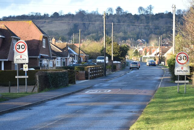
Detling

Detling is a village and civil parish in the Borough of Maidstone in Kent, England. The parish is located on the slope of the North Downs, 4 miles (6...

RAF Detling

Royal Air Force Detling, or more simply RAF Detling, is a former Royal Air Force station situated 600 feet (180 m) above sea level, located near Detling...
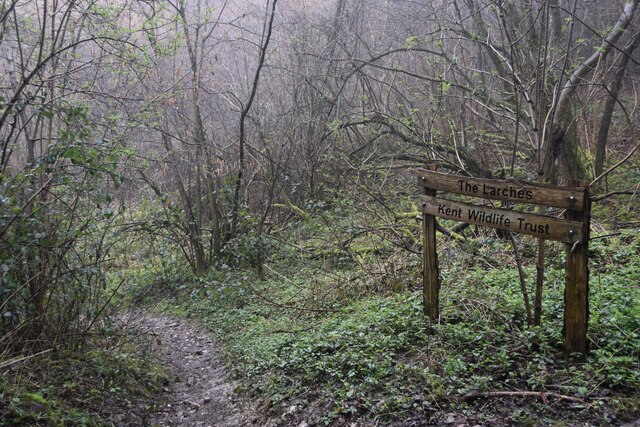
The Larches, Kent

The Larches is a 25-hectare (62-acre) nature reserve north of Detling, which is north of Maidstone in Kent. It is managed by Kent Wildlife Trust. It is...

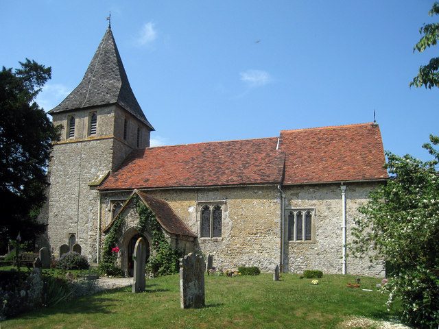
St Martin of Tours Church, Detling

St Martin of Tours is a parish church in Detling, Kent. Dedicated to Martin of Tours, the building was constructed in the 12th century with 13th and 15th...

Nearby Amenities

Located within 500m of 51.304826,0.57751269
Hillfield
Building: yes
Source: npe
Lat/Long: 51.3022172/0.5801377
Barrier: kissing_gate
Lat/Long: 51.3074627/0.5775921
The Hernitage and High Noon Farm
Place: hamlet
Lat/Long: 51.3065325/0.5756234
Barrier: stile
Lat/Long: 51.3008987/0.5764098
Addr City: Detling
Addr Postcode: ME14 3HB
Addr Street: Scragged Oak Road
Operator: Detling Coach House
Tourism: guest_house
Website: http://www.detlingcoachhouse.co.uk/
Lat/Long: 51.302163/0.5801884
Turning Circle
Lat/Long: 51.3073026/0.5827664
Generator Method: photovoltaic
Generator Output Electricity: yes
Generator Source: solar
Generator Type: solar_photovoltaic_panel
Location: roof
Power: generator
Lat/Long: 51.3089168/0.5783084
The data included in this document is from www.openstreetmap.org. The data is made available under ODbL.

Have you been to Amber Wood?

Leave your review of Amber Wood below (or comments, questions and feedback).