Fishwick

Settlement in Lancashire Preston

England

Fishwick

M6 approaching crossing of River Ribble
M6 approaching crossing of River Ribble Credit: Alpin Stewart

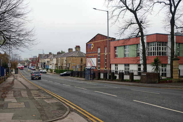
Fishwick is a small village located in the county of Lancashire, England. Situated just 3 miles southeast of the city of Preston, Fishwick is a predominantly residential area with a rich history and a close-knit community.

The village is known for its quiet and peaceful atmosphere, offering a pleasant escape from the bustling city life. It is surrounded by picturesque countryside, making it an ideal location for those who enjoy outdoor activities such as hiking, cycling, and fishing.

Fishwick has a small but well-established primary school, providing education for the local children. In terms of amenities, the village boasts a local convenience store, a post office, and a community center, which serves as a hub for various social events and activities.

Historically, Fishwick was an agricultural area, with farming being a significant part of the local economy. However, with the growth of nearby Preston, the village has evolved into a more residential area. Many of the older farm buildings have been converted into residential properties, giving the village a unique blend of old and new architecture.

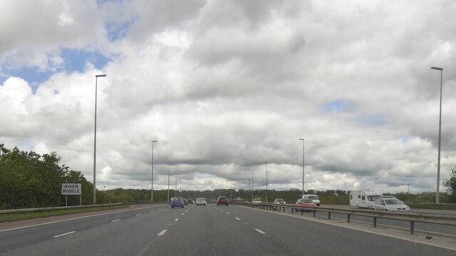
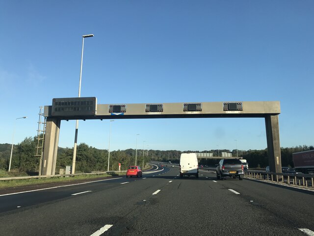
Transport links in Fishwick are excellent, with regular bus services connecting the village to Preston city center and surrounding areas. The M6 motorway is also easily accessible, providing convenient connections to major cities like Manchester and Liverpool.

Overall, Fishwick offers a peaceful and picturesque place to live, with its close proximity to Preston providing access to the amenities and opportunities of a larger city.

If you have any feedback on the listing, please let us know in the comments section below.

Fishwick Images

Images are sourced within 2km of 53.761354/-2.665126 or Grid Reference SD5629. Thanks to Geograph Open Source API. All images are credited.

M6 approaching crossing of River Ribble
Workings at Lower Brockholes
Matrix board - northbound M6
Deepdale Road, Preston Looking towards the city centre from outside Deepdale Stadium. On the right is Moor Park High School.
Deepdale Road, Preston
Looking towards the city centre from outside Deepdale Stadium. On the right is Moor Park High School.
Turf zone "PigeonRoad" Park on Dove Street, Preston.
Turf zone "PigeonRoad"
Park on Dove Street, Preston.
Exit from the Tickled Trout Services Although not signed on the M6 as services, due to its small nature, it dates back to 1958 when the motorway was built. The first building here was built in the 1930s on Preston New Road, called the Riverside Café. The eastbound A59 access road is on the original alignment of the road. As a result, it was initially known as Riverside services. The Tickled Trout Hotel was owned by Carton Holdings, with Riverside Restaurants providing the catering. It joined the MacDonald Hotels chain in the mid-1990s.
Exit from the Tickled Trout Services
Although not signed on the M6 as services, due to its small nature, it dates back to 1958 when the motorway was built. The first building here was built in the 1930s on Preston New Road, called the Riverside Café. The eastbound A59 access road is on the original alignment of the road. As a result, it was initially known as Riverside services. The Tickled Trout Hotel was owned by Carton Holdings, with Riverside Restaurants providing the catering. It joined the MacDonald Hotels chain in the mid-1990s.
Tickled Trout Services Although not signed on the M6 as services, due to its small nature, it dates back to 1958 when the motorway was built. The first building here was built in the 1930s on Preston New Road, called the Riverside Café. The eastbound A59 access road is on the original alignment of the road. As a result, it was initially known as Riverside services. The Tickled Trout Hotel was owned by Carton Holdings, with Riverside Restaurants providing the catering. It joined the MacDonald Hotels chain in the mid-1990s.
Tickled Trout Services
Although not signed on the M6 as services, due to its small nature, it dates back to 1958 when the motorway was built. The first building here was built in the 1930s on Preston New Road, called the Riverside Café. The eastbound A59 access road is on the original alignment of the road. As a result, it was initially known as Riverside services. The Tickled Trout Hotel was owned by Carton Holdings, with Riverside Restaurants providing the catering. It joined the MacDonald Hotels chain in the mid-1990s.
Exit from the Tickled Trout Services Tickled Trout Services

Although not signed on the M6 as services, due to its small nature, it dates back to 1958 when the motorway was built. The first building here was built in the 1930s on Preston New Road, called the Riverside Café. The eastbound A59 access road is on the original alignment of the road. As a result, it was initially known as Riverside services. The Tickled Trout Hotel was owned by Carton Holdings, with Riverside Restaurants providing the catering. It joined the MacDonald Hotels chain in the mid-1990s.
Exit from the Tickled Trout Services
Tickled Trout Services Although not signed on the M6 as services, due to its small nature, it dates back to 1958 when the motorway was built. The first building here was built in the 1930s on Preston New Road, called the Riverside Café. The eastbound A59 access road is on the original alignment of the road. As a result, it was initially known as Riverside services. The Tickled Trout Hotel was owned by Carton Holdings, with Riverside Restaurants providing the catering. It joined the MacDonald Hotels chain in the mid-1990s.
Preston North End Football Ground, Deepdale With "The Splash" in the foreground (by Peter Hodgkinson) based on a photograph of Tom Finney at Stamford Bridge in 1956
Preston North End Football Ground, Deepdale
With "The Splash" in the foreground (by Peter Hodgkinson) based on a photograph of Tom Finney at Stamford Bridge in 1956
Ribbleton, Preston
Ribbleton, Preston
Welcome to Grange Park No....not that one....
Welcome to Grange Park
No....not that one....
Moor Nook Youth Centre
West View Leisure Centre West View sports a very good climbing wall
West View Leisure Centre
West View sports a very good climbing wall
Hesketh Arms This pub stands at the junction of New Hall Lane and Blackpool Road, opposite the gates of Preston Cemetery.
Hesketh Arms
This pub stands at the junction of New Hall Lane and Blackpool Road, opposite the gates of Preston Cemetery.
Preston fire station Preston fire station, Blackpool Road, Preston, Lancashire.
Preston fire station
Preston fire station, Blackpool Road, Preston, Lancashire.
The Tickled Trout Hotel This is a view of the rear of the hotel, from the north bank of the Ribble
The Tickled Trout Hotel
This is a view of the rear of the hotel, from the north bank of the Ribble
The Parish Church of St Mary Magdalene, Ribbleton
Show me another place!

Fishwick is located at Grid Ref: SD5629 (Lat: 53.761354, Lng: -2.665126)

Administrative County: Lancashire

District: Preston

Police Authority: Lancashire

What 3 Words

///sorry.dock.local. Near Preston, Lancashire

Related Wikis

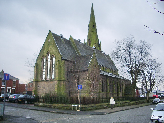
St Matthew's Church, Preston

St Matthew's Church, is in New Hall Lane, Preston, Lancashire, England. It is an active Anglican parish church in the deanery of Preston, the archdeaconry...

Madina Mosque (Preston)

Madina Mosque is a mosque in Preston, Lancashire, England.

St Joseph's Church, Preston

St Joseph's Church is in Skeffington Road, Preston, Lancashire, England. It is an active Roman Catholic church in the Diocese of Lancaster. The church...
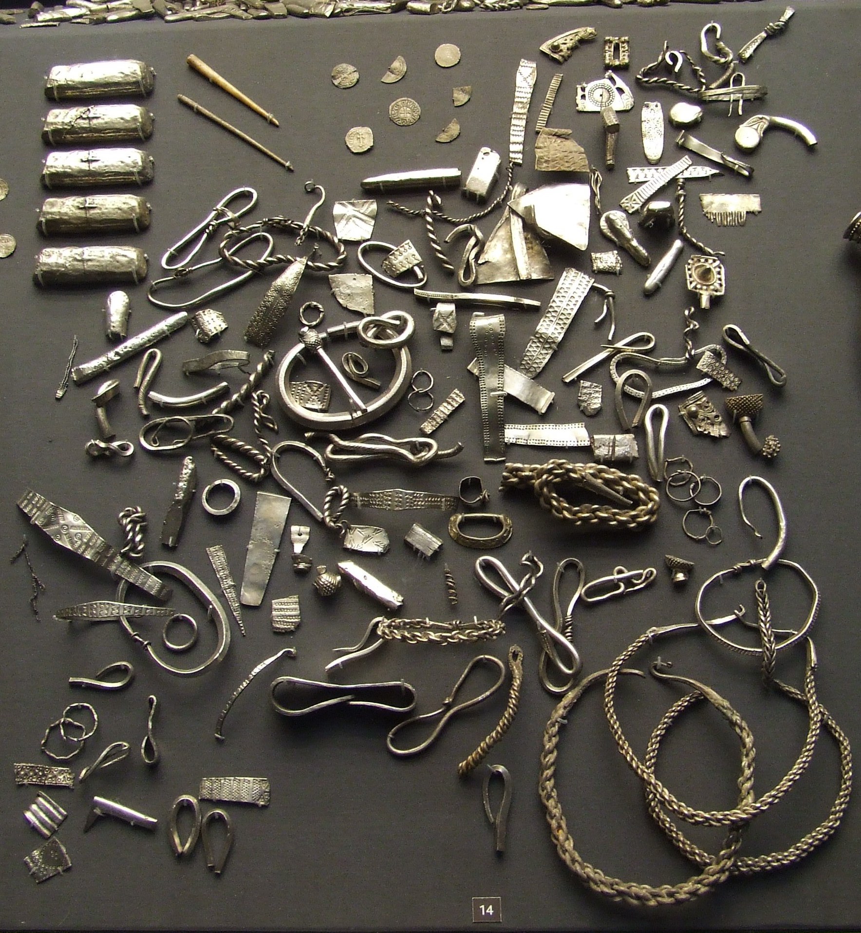
Cuerdale Hoard

The Cuerdale Hoard is a hoard of more than 8,600 items, including silver coins, English and Carolingian jewellery, hacksilver and ingots. It was discovered...

St Matthew's, Preston

St Matthew's is an electoral ward in Preston, Lancashire, England. The ward is adjacent to the larger Ribbleton to the east but is considered to be an...

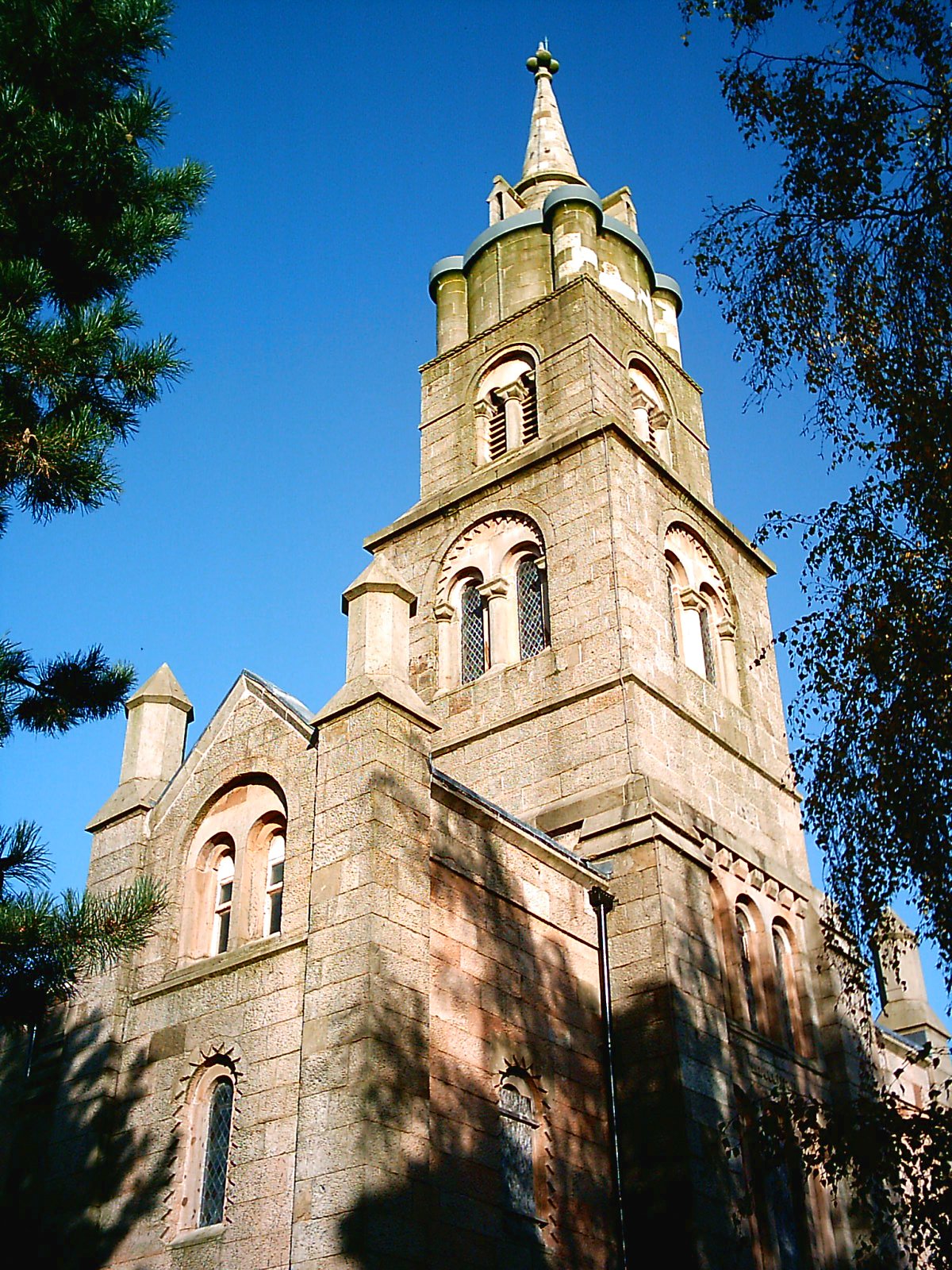
St Luke's Church, Preston

St Luke's Church is a redundant Anglican parish church in St Luke's Place, Preston, Lancashire, England. The church is recorded in the National Heritage...

Lancaster University School of Mathematics

Lancaster University School of Mathematics, also known as LUSoM, is a maths school located in Preston, Lancashire, England. As a maths school, it is a...

St Mary's Church, Preston

St Mary's Church is in St Mary's Street, Preston, Lancashire, England. It is a redundant Anglican parish church, and was converted into a conservation...

Nearby Amenities

Located within 500m of 53.761354,-2.665126
Fishwick
Place: suburb
Lat/Long: 53.7618422/-2.6713224
Callon
Place: neighbourhood
Lat/Long: 53.7631644/-2.6675793
Devonshire Garage
Addr Street: Devonshire Place
Shop: car_repair
Lat/Long: 53.7651123/-2.6625137
Turning Circle
Lat/Long: 53.7629128/-2.659535
Barrier: bollard
Bicycle: yes
Foot: yes
Horse: yes
Motor Vehicle: no
Lat/Long: 53.7633162/-2.667602
Crossing
Crossing: uncontrolled
Crossing Ref: zebra
Lat/Long: 53.7656174/-2.6674839
Bus Stop
Bus: yes
Naptan AtcoCode: 250020161
Naptan NaptanCode: lanatwgp
Public Transport: platform
Lat/Long: 53.7656775/-2.663824
Bus Stop
Bus: yes
Naptan AtcoCode: 25001197
Naptan NaptanCode: lanagtgd
Public Transport: platform
Lat/Long: 53.7657992/-2.6640214
Veterinary
New Hall Veterinary Centre
Created By: Potlatch 0.10f
Lat/Long: 53.7656089/-2.6631948
Post Box
Collection Times: Mo-Fr 17:00; Sa 11:15
Mapillary: 502904954088671
Operator: Royal Mail
Post Box Type: pillar
Ref: PR1 124
Source: survey
Lat/Long: 53.765779/-2.6643549
Post Office
Cemetery Post Office
Addr City: Preston
Addr Housenumber: 379
Addr Postcode: PR1 4SY
Addr Street: New Hall Lane
Note: in convenience store
Opening Hours: Mo-Sa 07:00-21:00; Su 08:00-21:00
Ref Pol Id: 143980
Source: pol_branch_list_2018-02
Lat/Long: 53.765794/-2.6657888
Premier: Rams Convenience
Addr City: Preston
Addr Housenumber: 379-381
Addr Postcode: PR1 4SY
Addr Street: New Hall Lane
Fhrs Id: 116447
Shop: supermarket
Lat/Long: 53.7658083/-2.6657344
Source: PGS
Lat/Long: 53.7595865/-2.6588173
Source: PGS
Lat/Long: 53.7595687/-2.6581683
Crossing
Crossing: uncontrolled
Lat/Long: 53.7657175/-2.6636612
Barrier: bollard
Bicycle: yes
Motor Vehicle: no
Lat/Long: 53.7656658/-2.6629829
Fishwick Bottoms
Place: hamlet
Lat/Long: 53.7580472/-2.6675972
Barrier: bollard
Foot: yes
Lat/Long: 53.765431/-2.6623163
Barrier: bollard
Foot: yes
Lat/Long: 53.7654276/-2.6619764
Barrier: bollard
Bicycle: yes
Foot: yes
Horse: yes
Motor Vehicle: no
Lat/Long: 53.7633658/-2.66738
Barrier: bollard
Bicycle: yes
Foot: yes
Horse: yes
Motor Vehicle: no
Lat/Long: 53.763944/-2.6677767
Barrier: bollard
Bicycle: yes
Foot: yes
Horse: yes
Motor Vehicle: no
Lat/Long: 53.763861/-2.6681152
Heavenly Hair & Beauty
Shop: hairdresser
Lat/Long: 53.7656458/-2.6642777
Crossing
Crossing: uncontrolled
Crossing Ref: zebra
Tactile Paving: yes
Lat/Long: 53.7657198/-2.6643726
Crossing
Crossing: zebra
Lat/Long: 53.7657757/-2.6643591
Crossing
Crossing: zebra
Lat/Long: 53.7656749/-2.6643552
School
Fishwick Primary School
Addr City: Preston
Addr Postcode: PR1 4RH
Addr Street: Downing Street
Capacity: 140
Fhrs Id: 129414
Fixme: Survey needed to map which ground belongs to which school
Isced Level: 0;1
Max Age: 11
Min Age: 2
Phone: +44 1772 491402
Ref GB Uprn: 10007603216
Ref Edubase: 119333
Religion: none
School Boarding: no
School Gender: mixed
School Selective: no
School Trust: no
School Type: community
Website: https://www.fishwick.lancs.sch.uk/
Wikidata: Q66137539
Lat/Long: 53.7648012/-2.6646394
School
St Teresa's Catholic Primary School
Addr City: Preston
Addr Postcode: PR1 4RH
Addr Street: Downing Street
Capacity: 175
Denomination: roman_catholic
Diocese: Diocese of Lancaster
Fixme: Survey needed to map which ground belongs to which school
Isced Level: 1
Max Age: 11
Min Age: 4
Phone: +44 1772 797397
Ref GB Uprn: 10007603220
Ref Edubase: 119700
Religion: christian
School Boarding: no
School Gender: mixed
School Selective: no
School Trust: no
School Type: voluntary_aided
Website: https://www.st-teresas-pri.lancs.sch.uk/
Wikidata: Q66137937
Lat/Long: 53.7644904/-2.664595
Barrier: block
Bicycle: yes
Foot: yes
Motor Vehicle: no
Note: Road closure during pandemic
Lat/Long: 53.764241/-2.6693518
Give Way
Direction: backward
Lat/Long: 53.7645136/-2.668393
Give Way
Direction: forward
Lat/Long: 53.7644886/-2.6684842
Give Way
Direction: forward
Lat/Long: 53.7642443/-2.6694614
Give Way
Direction: forward
Lat/Long: 53.7639649/-2.6704828
Give Way
Direction: forward
Lat/Long: 53.7638081/-2.6709942
Give Way
Direction: forward
Lat/Long: 53.7637546/-2.6709451
Give Way
Direction: forward
Lat/Long: 53.7636867/-2.6714665
Fishwick Bottoms PMT
Material: wood
Operator: Electricity North West
Power: pole
Ref: 410811
Source: survey
Transformer: minor_distribution
Voltage: 6600
Lat/Long: 53.7589294/-2.6658636
Callon Stores
Addr City: Preston
Addr Country: GB
Addr Housenumber: 40,42
Addr Postcode: PR1 4RR
Addr Street: Waldon Street
Fhrs Id: 456300
Shop: yes
Survey Date: 2019-02-18
Lat/Long: 53.7633635/-2.6678632
Social Facility
Ribble View Health Care
Addr City: Preston
Addr Country: GB
Addr Housenumber: 39
Addr Postcode: PR1 4UD
Addr Street: Church Avenue
Fhrs Id: 1194094
Operator: Ribble View Health Care Ltd
Social Facility: nursing_home
Survey Date: 2020-01-24
Lat/Long: 53.7642117/-2.6626477
Fast Food
Warburton's Traditional Fish & Chips
Addr City: Preston
Addr Country: GB
Addr Housenumber: 456
Addr Postcode: PR1 4TA
Addr Street: New Hall Lane
Cuisine: fish_and_chips
Fhrs Id: 140179
Survey Date: 2019-01-24
Lat/Long: 53.7655926/-2.6634235
Magazin Romanesc 3
Addr City: Preston
Addr Country: GB
Addr Housenumber: 442
Addr Postcode: PR1 4TA
Addr Street: New Hall Lane
Fhrs Id: 1401963
Shop: yes
Lat/Long: 53.765599/-2.6642905
Fast Food
Papa Norio's
Addr City: Preston
Addr Country: GB
Addr Housenumber: 412
Addr Postcode: PR1 4SX
Addr Street: New Hall Lane
Fhrs Id: 479664
Survey Date: 2019-02-14
Lat/Long: 53.7655673/-2.6657885
The data included in this document is from www.openstreetmap.org. The data is made available under ODbL.

Have you been to Fishwick?

Leave your review of Fishwick below (or comments, questions and feedback).