Broon Covert
Wood, Forest in Suffolk West Suffolk
England
Broon Covert

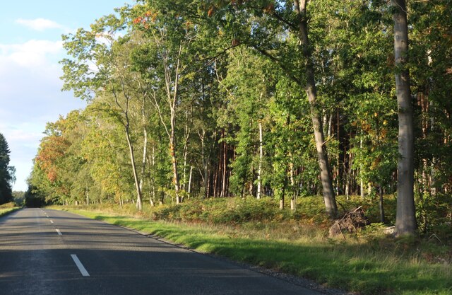
Broon Covert is a picturesque woodland area located in Suffolk, England. Situated in the heart of the county, it is surrounded by the stunning Suffolk countryside and is known for its dense forest and natural beauty. The name "Covert" refers to a small sheltered place or a hiding spot, which perfectly encapsulates the peaceful and secluded atmosphere of this tranquil woodland.
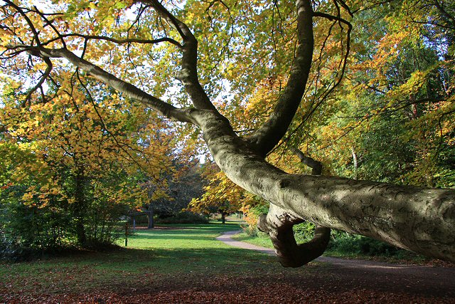
Covering an area of approximately 200 acres, Broon Covert boasts a diverse range of tree species, including oak, beech, and pine, which create a rich and vibrant tapestry of colors throughout the year. It is a haven for wildlife, providing a sanctuary for various bird species, small mammals, and insects. Visitors can often spot deer roaming freely within the woodland, adding to its enchanting allure.
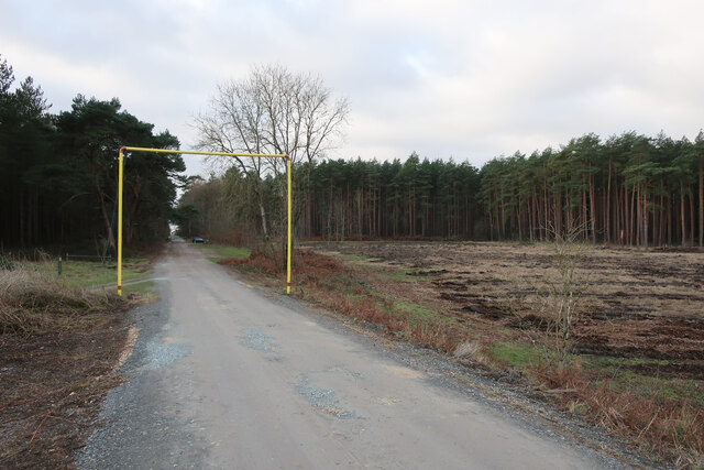
The woodland is crisscrossed by a network of well-maintained footpaths and trails, allowing visitors to explore its wonders at their own pace. These paths lead to hidden ponds and streams, providing opportunities for peaceful reflection and connecting with nature. In spring, the woodland floor is adorned with a carpet of bluebells, creating a breathtaking spectacle that attracts nature enthusiasts and photographers alike.
Broon Covert is open to the public year-round and offers a range of recreational activities, including walking, hiking, birdwatching, and nature photography. It provides an ideal escape from the hustle and bustle of everyday life, offering a serene and tranquil retreat for those seeking solace in nature.
If you have any feedback on the listing, please let us know in the comments section below.
Broon Covert Images
Images are sourced within 2km of 52.414833/0.63855166 or Grid Reference TL7982. Thanks to Geograph Open Source API. All images are credited.


Broon Covert is located at Grid Ref: TL7982 (Lat: 52.414833, Lng: 0.63855166)
Administrative County: Suffolk
District: West Suffolk
Police Authority: Suffolk
What 3 Words
///expiring.hiked.thighs. Near Weeting, Norfolk
Nearby Locations
Related Wikis
Brandon Country Park
Brandon Country Park is a country park in Brandon, Suffolk, England. == History == In 1820 Edward Bliss bought Brandon Park house and grounds using wealth...

Breckland Farmland
Breckland Farmland is a 13,392.4 hectare biological Site of Special Scientific Interest (SSSI) in many separate areas between Swaffham in Norfolk and Bury...
London Road Industrial Estate, Brandon
London Road Industrial Estate, Brandon is a 0.1-hectare (0.25-acre) biological Site of Special Scientific Interest (SSSI) in Brandon in Suffolk.This very...

Brandon, Suffolk
Brandon is a town and civil parish in the English county of Suffolk. Brandon is located in the Breckland area of Suffolk, close to the adjoining county...

Elveden
Elveden is a village and civil parish in the West Suffolk district of Suffolk in eastern England. In 2005 it had a population of 270. The village is bypassed...

Wangford Warren and Carr
Wangford Warren and Carr is a 67.8-hectare (168-acre) biological Site of Special Scientific Interest between Brandon and Lakenheath in Suffolk. It is...

Lakenheath Warren
Lakenheath Warren is a 588.3-hectare (1,454-acre) biological Site of Special Scientific Interest south-east of Lakenheath in Suffolk, England. It is a...

Elveden Hall
Elveden Hall is a large stately home on the Elveden Estate in Elveden, Suffolk, England. The seat of the Earls of Iveagh, it is a Grade II* listed building...
Nearby Amenities
Located within 500m of 52.414833,0.63855166Have you been to Broon Covert?
Leave your review of Broon Covert below (or comments, questions and feedback).